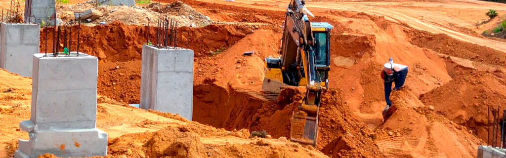
For property owners across Cherokee County, Ball Ground, and Canton planning any outdoor improvement project, understanding what a thorough site evaluation covers, why each element of that evaluation affects the project decisions that follow it, and what the cost of skipping evaluation typically looks like compared to the cost of conducting it gives the practical case for treating site evaluation as the first and most consequential step in every project rather than as an optional preliminary that experienced intuition or general regional knowledge can adequately substitute for. North Georgia’s specific terrain, soil, vegetation, and regulatory conditions make site evaluation more important than it would be in simpler improvement environments, and the consequences of skipping it more expensive than they would be on sites where fewer site-specific variables affect project outcomes.
What Site Evaluation Actually Is and What It Is Not
Site evaluation for an outdoor improvement project is the deliberate, systematic assessment of the specific conditions at the project location that will affect how the project should be designed, what it will cost, what methods should be used to execute it, and what the finished result will need to do to perform correctly in its specific setting. It is not a casual walk around the property before the contractor visit. It is not a review of aerial imagery that shows canopy surface and general lot outline rather than ground-level terrain, soil conditions, and drainage behavior. And it is not a general knowledge assessment of what North Georgia properties typically present, because the site-specific conditions that create project complications are almost always the ways that the specific property differs from what typical properties in the region present rather than the ways it conforms to regional averages.
Effective site evaluation requires physical presence at the specific project location, under conditions that reveal the characteristics most relevant to the planned project. It requires walking the terrain rather than observing it from the property edge. It requires observing drainage behavior during or after significant rain rather than only during the dry season when the conditions that most affect drainage project design are inactive. It requires probing the soil at the specific location where excavation or compaction work will occur rather than assuming soil conditions from regional generalizations. And it requires identifying any regulatory features including stream buffers and potential wetland areas that restrict where improvements can be placed before the project design commits improvements to positions that may not be compliant.
How Terrain Understanding Prevents Earthwork Budget Surprises
The terrain at any North Georgia project site determines the earthwork scope that creating the intended improvement condition requires. This is the site condition that the widest gap consistently exists between what generic planning assumes and what evaluation of the specific site reveals, because Cherokee County’s rolling terrain creates ground-level slope variation that aerial observation and property-edge observation consistently underestimate on wooded and partially vegetated sites where the canopy surface visible from above does not accurately represent the ground surface conditions that excavation and grading work will encounter.
A building pad that must be established at a specific elevation across a defined footprint on a site with actual ground-level slope variation will require cut-and-fill earthwork volumes proportional to that slope variation. Those volumes translate directly into project cost through the equipment time, fuel, and material handling the earthwork requires. A project budget built from an assumed terrain condition that turned out to be flatter than the actual terrain is a project budget that will need to be revised upward when actual earthwork volumes are determined during execution, at a point when the project is committed and revision is reactive rather than planned.
Site evaluation that walks the specific terrain of the project area, estimating the elevation change across the planned improvement footprint from high corner to low corner and observing the topographic relationships between the project area and the surrounding terrain that will affect drainage, provides the terrain information that allows earthwork volumes to be estimated before budget commitment rather than discovered during execution. On Cherokee County rural properties where meaningful elevation change across a building footprint or driveway alignment is common, this terrain evaluation consistently produces budget estimates that are more accurate than terrain assumptions and therefore more reliable as the basis for project financial decisions.
How Soil Assessment Determines Method Selection and Cost
The soil conditions at the project location affect every phase of improvement work from initial excavation through final grading and compaction, and several soil condition variables on Cherokee County properties have large enough effects on project method and cost to justify specific assessment before project planning is finalized.
Organic Topsoil Depth
Organic topsoil must be stripped from any area where structural fill will be placed or where foundations will bear, because organic material continues decomposing after burial and creates the settlement voids that produce surface depression and structural movement in the improvements placed above it. The depth of the organic topsoil layer at the specific project location determines the volume of stripping excavation that must precede structural work and the volume of fill required to replace the stripped material and reach design grade. Wooded sites that have accumulated decades of leaf litter and root turnover can have organic layers of a foot or more that would not be apparent from surface observation and that represent significant additional excavation scope compared to sites with shallower organic profiles. Site evaluation that probes the soil at the specific project location to determine the organic layer depth before the earthwork scope and budget are established prevents this from becoming an unplanned discovery during active excavation.
Clay Moisture Conditions and Seasonal Scheduling Implications
Cherokee County’s red piedmont clay performs very differently under grading and compaction equipment depending on its moisture content at the time of work. Clay at appropriate moisture content can be worked efficiently and compacted to the structural density that foundation systems and pavement bases require. Clay significantly above optimum moisture content cannot be compacted to adequate density regardless of effort applied, deforms rather than being cut cleanly during excavation, and creates equipment tracking conditions that damage the subgrade that subsequent work will depend on. Site evaluation conducted during or after a wet period provides information about how the specific site’s clay responds to saturation and what the access and workability limitations are when the clay is at its wet-season moisture level, which allows realistic scheduling decisions to account for the seasonal windows when the clay conditions support the quality of work the project requires.
Subsurface Rock Probability
Subsurface rock is the single most common source of significant unplanned cost on Cherokee County excavation projects because its removal requires specialized equipment and substantially more time than clay excavation, but its presence cannot be confirmed without physical investigation at the specific excavation location. Site evaluation can assess rock probability from the indicators available at the surface, including topographic position relative to the surrounding terrain, visible rock outcrops on or near the property, and any available site history information from prior construction or well drilling, and can build appropriate budget contingency based on that probability assessment rather than assuming the cost-neutral outcome that no rock will be encountered and discovering during active excavation that the assumption was incorrect.
How Vegetation Assessment Shapes Clearing Scope and Method
The vegetation conditions at the project site affect the clearing scope that the project requires, the clearing method appropriate for what the cleared area will become, the debris management approach needed after clearing, and the ongoing management requirements that invasive species resprout from established root systems will create after the initial clearing is done. Each of these vegetation-related project factors is most accurately assessable through site evaluation that walks the vegetated areas with attention to species identification, stem size, and site coverage, rather than from edge observation that consistently underestimates the density and species composition of interior vegetation on larger properties.
Summer is the most productive season for vegetation assessment because all species are at their characteristic leaf, stem, and growth stage expression, making invasive species distinguishable from native plants by the specific identifying features that dormant-season observation obscures. A summer vegetation assessment that identifies the dominant invasive species, estimates their stem size distribution, and notes the extent of their coverage across the project area provides the information that clearing method selection and post-clearing management planning require. A clearing scope developed from this vegetation assessment is calibrated to what the site actually presents rather than what the project boundary looks like from the edge, and the post-clearing management plan built from the invasive species identification is positioned to address the specific resprout behavior of those species rather than applying a generic management approach that may not match what the specific invasive populations will actually do after mechanical clearing treats them.
How Equipment Access Assessment Prevents Mobilization Day Complications
Every piece of equipment that will be used in an outdoor project must reach the work area from the public road, and the approach route’s characteristics, including width, height clearance, grade, and ground bearing capacity, determine whether the planned equipment can access the work area safely and at what point preparation is needed to establish that access. Site evaluation that physically measures or estimates the critical dimensions along the full approach route from the road to the work area, and that assesses the ground bearing condition along any sections that appear soft or wet, produces the access information that allows appropriate equipment to be selected and any necessary access preparation to be included in the project scope before equipment is scheduled.
Discovering access limitations on the day that equipment arrives produces delays while access problems are resolved, equipment substitutions that may reduce project capability, and in some cases an inability to begin the project at all until the access issue is addressed as an additional unplanned project phase. All of these outcomes could have been prevented by evaluation that identified the same limitations before equipment was scheduled. On Cherokee County rural properties where long driveways, wooded approach routes, seasonal ground softness, and varied terrain are common, access evaluation prevents a significant proportion of the project day complications that access problems create when they are first discovered during equipment mobilization.
How Post-Rain Drainage Observation Reveals Conditions That Dry Evaluation Misses
Drainage conditions at a project site are most accurately observable during or immediately after significant rain events when they are actively expressing themselves. Dry-season site observation, which is when most pre-project evaluations conveniently occur, conceals the drainage behavior that wet-season conditions reveal clearly and that most significantly affects how drainage-related improvement projects should be designed.
A building site that appears well-drained during August evaluation may show standing water accumulating against the planned foundation location from uphill drainage during March after construction has placed the structure in a position that evaluation revealed would need drainage management but that design did not adequately address because the drainage problem was invisible during the dry-season evaluation. A driveway drainage design developed from dry-season observation may miss the drainage crossing at a low point that becomes a significant flow concentration during storms because the intermittent drainage channel it crosses was dry and invisible during evaluation. A food plot planned at a location that appeared flat and well-suited during summer may reveal seasonal saturation conditions in spring that make establishment difficult in the specific soil conditions that the drainage behavior creates.
Site evaluation that includes at least one post-rain observation of the project area, noting where water collects, how long it persists, what flow paths it follows, and whether any seasonal drainage features are active during the rain event, captures drainage behavior information that no amount of dry-condition observation can substitute for. This post-rain observation investment is particularly important for grading and excavation projects where drainage design is the central engineering challenge, for building site selection where foundation drainage determines long-term structural moisture conditions, and for any project where the land’s drainage behavior under wet conditions will significantly affect how the finished improvement performs.
How Regulatory Feature Identification Protects Against Compliance Complications
Cherokee County outdoor improvement projects must comply with applicable regulatory requirements including Georgia’s land disturbance permit requirements for projects disturbing one acre or more, stream buffer protection requirements that restrict disturbance within defined setbacks from regulated drainage features, and federal wetland protection requirements for sites where wetland conditions may be present. Site evaluation that identifies whether any of these regulatory conditions apply to the specific project location before project design or scheduling is committed allows compliance to be incorporated into the project approach from the beginning rather than discovered as a constraint after work has already proceeded into areas that turn out to require permits or review that were not obtained.
Regulatory features on Cherokee County properties are not always obviously identifiable from the property edge or from aerial imagery. Seasonal streams that qualify for buffer protection flow through wooded lots without surface expression during dry periods, making post-rain evaluation the most reliable identification method for these features. Low-lying areas with potential wetland characteristics require walking the specific areas under wet conditions when the hydric soil and wetland vegetation indicators that define regulatory wetland conditions are most observable. And the land disturbance permit threshold of one acre is easily exceeded by clearing and grading projects that feel modest in scope but that disturb more area than their immediate footprint suggests when access routes and material staging areas are included in the disturbed area calculation. Each of these regulatory conditions is most efficiently identified during site evaluation before project design rather than during project execution when compliance issues create stop-work situations that are significantly more disruptive and more expensive than front-end evaluation would have been.
How Site Evaluation Changes the Contractor Conversation
A property owner who arrives at a contractor conversation having completed site evaluation that covers terrain, soil conditions, vegetation, equipment access, drainage behavior, and regulatory feature identification brings specific, documented information to the conversation that allows the contractor to develop a more accurate scope and estimate than they could from a general description of the planned improvement alone. The contractor who visits a site after the property owner’s prior evaluation can focus the site visit on confirming and expanding the property owner’s observations rather than developing the entire site picture from scratch during a single visit, making the site visit and subsequent scope development more efficient and more complete than a contractor-only evaluation without prior property owner assessment would be.
Contractors who conduct thorough site evaluation themselves and produce estimates that reflect the specific conditions the site presents typically produce higher initial estimates than those who estimate from regional averages without detailed site-specific assessment. These higher estimates are more accurate rather than less competitive because they account for the actual scope the project requires at the actual site conditions it presents rather than the scope a simpler project on more favorable conditions would require. Selecting the lowest estimate from a contractor who produced it without site evaluation creates a high probability of discovering during project execution that the estimate was based on assumptions the site’s actual conditions do not support, producing cost growth that erodes the initial price advantage and leaves the property owner with a partially complete project, a budget overrun, and a contractor working through conditions their estimate was not designed for.
Frequently Asked Questions
How extensive does site evaluation need to be for a smaller outdoor project versus a large development?
Evaluation scope should be proportional to both the project’s complexity and its consequence if site conditions are misunderstood. A small trail clearing project through low-risk terrain away from structures and regulatory features requires a modest evaluation that confirms access conditions, identifies preservation targets, and checks for any obvious drainage features in the trail corridor. A building foundation project requires comprehensive evaluation covering terrain, soil bearing, organic depth, drainage, rock probability, access, regulatory compliance, and utility positions because the consequences of getting any of these wrong are substantial and some are not correctable without major demolition and rework after the structure is placed. The appropriate evaluation depth for any specific project is determined by which site conditions could change the project design, cost, or approach significantly if they turn out to differ from what a generic assumption would predict, and how consequential that change would be if it occurred during active project execution rather than during pre-project evaluation.
Can I rely on a prior survey or soil test from when the property was purchased to substitute for current site evaluation?
Prior surveys and soil tests provide useful baseline information but cannot substitute for current site evaluation for several reasons. Property conditions change over time as vegetation establishes, drainage patterns shift, erosion develops, and land use activities alter soil conditions and access routes. A survey conducted at purchase may not cover the specific location of a planned improvement project with the detail needed for design decisions. And prior soil tests conducted at different locations or at different seasonal moisture conditions than current evaluation would encounter may not accurately represent the conditions at the specific project location under current seasonal conditions. Prior documentation is valuable context that supplements current evaluation rather than a substitute for it.
What is the most common site condition that property owners fail to evaluate before outdoor projects in Cherokee County?
Drainage behavior under wet conditions is the most consistently omitted element of pre-project site evaluation on Cherokee County properties because most site evaluations are conducted during dry seasonal conditions when the drainage problems that will affect the finished improvement are inactive and invisible. Property owners who evaluate their project sites only during dry conditions see the site in its most favorable drainage presentation and design their improvements for that favorable condition rather than for the wet-season conditions that Cherokee County’s climate routinely produces and that the finished improvement must perform through across all seasons. The specific investment of visiting the project site during or within twenty-four hours of a significant rain event, one time during the pre-project evaluation period, produces the most consequential single piece of site-specific information available for any project where drainage affects the improvement’s performance.
How do I document site evaluation findings in a way that is useful for contractor conversations and project planning?
Smartphone photographs taken at representative locations during the evaluation walk, with date metadata preserved in the image file, provide the most immediately useful documentation format for most site evaluation findings. Photographs of terrain conditions at proposed improvement locations, vegetation density in clearing areas, access route dimensions at critical constraint points, and drainage behavior during or after rain events capture conditions in a shareable format that can be provided to contractors before or during site visits to give them context they would not have from the current-day site condition alone. Brief written notes describing the location, nature, and apparent significance of each photographed condition complete the documentation set. This photograph-plus-notes approach is maintainable by any property owner during a site walk without technical expertise and produces documentation that is genuinely useful for contractor planning conversations rather than documentation so elaborate that it discourages consistent use.
Does site evaluation need to be repeated if project planning is delayed significantly after the initial evaluation?
Yes. Site conditions change over time as vegetation grows, drainage patterns evolve, erosion develops, and seasonal moisture cycles alter soil conditions in ways that may affect project approach decisions. An evaluation conducted during one season may not accurately represent the conditions that a project executing in a different season will encounter. And a project delayed more than one growing season after initial evaluation will encounter vegetation conditions that have continued developing during the delay and access conditions that may have changed if the approach route has seen vegetation growth or drainage changes in the intervening period. Refreshing the key elements of site evaluation before finalizing the project plan and schedule, particularly the drainage behavior observation, access route assessment, and vegetation density evaluation, costs modest additional time and ensures that the project scope and budget reflect current conditions rather than conditions that existed at the original evaluation date and may have changed significantly during the planning and delay period.
Ready to Start Your Next Outdoor Project on the Right Foundation?
Every outdoor project on a North Georgia property proceeds better when it begins with accurate knowledge of the terrain, soil, vegetation, access, drainage, and regulatory conditions it will encounter. That knowledge does not require technical expertise to gather. It requires deliberate physical presence at the specific project location under the conditions that reveal its actual characteristics, systematic attention to the evaluation categories that most affect outdoor project design and cost in this region, and honest documentation of what the evaluation reveals rather than what generic planning assumptions would predict. Site evaluation conducted with this approach converts the site conditions that create expensive mid-project surprises into planned project parameters that the scope, method, and budget were designed to address from the beginning.
Bardin Outdoors works with homeowners and landowners across Ball Ground, Canton, Cherokee County, and North Georgia on outdoor improvement projects that begin with thorough site evaluation and proceed on plans designed for the specific terrain, soil, drainage, and vegetation conditions each property presents. To learn more about how Bardin Outdoors approaches pre-project site evaluation for North Georgia outdoor improvement projects, contact us.