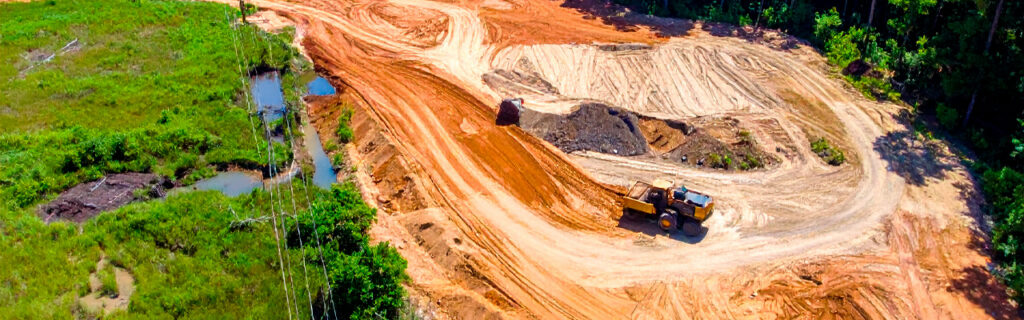
For property owners across Cherokee County, Ball Ground, and Canton planning to clear land on their residential and rural properties, whether for building development, hunting habitat improvement, access restoration, agricultural production, or the range of other intended uses that clearing serves as the improvement that enables them, understanding what the thorough pre-clearing evaluation of terrain, vegetation, access, drainage, and future property use specifically involves, why each evaluation component matters for the clearing decisions it informs, and what the practical assessment activities that adequate pre-clearing evaluation requires look like in specific terms gives the complete guide for approaching land clearing as the outcome-determined practice that pre-clearing evaluation specifically makes it rather than the outcome-discovered practice that clearing without pre-clearing evaluation allows to produce whatever the equipment and operator happen to create from the unguided treatment of the site that inadequate evaluation leaves unspecified in the dimensions that the evaluation would have established as the clearing’s specific requirements.
Evaluating Terrain Before Clearing
Terrain evaluation before clearing serves two distinct planning functions that the clearing’s execution and the subsequent improvements that clearing enables each specifically depend on: characterizing the earthwork scope that achieving the post-clearing site conditions the intended use requires involves, and identifying the equipment operation challenges that the terrain’s slopes, irregularities, and drainage features create for the clearing equipment that the site’s terrain-specific conditions require the clearing approach to specifically address.
Interior Terrain Walking for Accurate Elevation Assessment
The terrain beneath North Georgia’s wooded canopy is consistently more variable at the ground level than aerial imagery and perimeter-edge observation suggest from the accessible positions that most pre-clearing site assessment conveniently uses. Trees of varying heights growing on rolling terrain produce a canopy surface that aerial observation captures as substantially flatter than the ground surface beneath because the taller trees in lower terrain positions and the shorter trees in higher terrain positions partially cancel the terrain variation’s visual expression in the canopy that rises above it. Physically walking the proposed clearing area from its highest terrain corner to its lowest terrain corner at the ground surface level where clearing and subsequent earthwork must operate reveals the actual corner-to-corner elevation differential that post-clearing earthwork scope estimation requires rather than the systematically lower apparent differential that accessible perimeter observation provides without the interior terrain walk that reveals what the canopy conceals.
This interior terrain walk should note the slope direction and estimated elevation change at each section of the walk, producing the terrain profile that identifies where the major cut and fill areas will be in any subsequent grading, which direction slopes face relative to drainage outlets, and where terrain irregularities including rock outcrops, drainage channels, and abrupt grade changes exist within the clearing area that the post-clearing site development plan should specifically account for in improvement location selection and drainage infrastructure design. Many building sites and food plot locations are selected or rejected based on the terrain walk’s findings rather than the pre-walk accessible observation that the terrain walk consistently reveals as inadequate for the grade-informed decisions that building site selection and food plot location identification require.
Slope Assessment for Equipment Operation and Erosion Risk
Slope conditions within the proposed clearing area affect clearing equipment operation through the grade limitations that the specific equipment’s safe operating threshold creates for the slopes the equipment must traverse during the clearing, and they affect post-clearing site management through the erosion risk that disturbed bare clay on slopes presents to the rainfall impact energy and surface flow velocity that Cherokee County’s high-intensity storm season produces on cleared surfaces without the vegetative protection that established ground cover provides. The terrain walk’s slope assessment should specifically estimate the maximum slopes within the clearing area that the clearing equipment must traverse, comparing those estimates to the safe operating gradient that the specific equipment is designed for rather than assuming that any slope within the clearing area is within the equipment’s safe operating range without the slope-specific evaluation that the terrain walk’s slope assessment provides. Slopes that exceed the safe operating gradient for the specific clearing equipment require the operator to adapt the processing approach or restrict the treatment in the steepest sections to the operational positions that stability allows, which the clearing approach planning should account for before the clearing operator encounters them during active operation rather than discovering the slope constraint at the operational stage when approach adjustment during active processing is less efficient than pre-clearing slope assessment and approach planning would have been.
Evaluating Vegetation Before Clearing
Vegetation evaluation before clearing determines the clearing equipment type and approach that the specific vegetation conditions require, identifies the preservation targets that the clearing should specifically navigate around rather than process with the surrounding vegetation, and establishes the realistic expectations for the post-clearing management program that the vegetation’s root energy accumulation level requires to prevent resprout from returning the cleared area to its pre-clearing condition.
Invasive Species Assessment and Root Energy Evaluation
Physically entering the proposed clearing area at multiple interior points to assess the dominant invasive species present, their average stem diameters at the base, and the canopy heights that the established populations have developed provides the vegetation development stage information that clearing equipment selection and per-acre treatment cost estimation require rather than the edge-condition assessment that perimeter observation provides without the interior density and stem development characterization that the interior assessment adds. Dominant stem diameters below half an inch indicate early-establishment vegetation addressable with owner-operated brush mowing equipment for the property owner who wants to address it before professional clearing becomes necessary. Dominant stem diameters in the half-inch to two-inch range indicate middle-establishment vegetation that may be within heavy owner-operated equipment’s capacity or at the threshold requiring professional forestry mulching equipment depending on the density and the specific owner-operated equipment available. Dominant stem diameters above two inches at high density indicate established vegetation requiring professional forestry mulching equipment for efficient treatment.
The establishment duration that the vegetation’s development stage indicates also informs the realistic expectation for post-clearing resprout vigor and the combined mechanical and chemical treatment program that root energy depletion requires across successive growing seasons. Vegetation at the established stage, with multi-inch diameter stems at high density and multiple growing seasons of root energy accumulation, will produce vigorous resprout from intact root systems within four to eight weeks of mechanical clearing without herbicide follow-up treatment. Property owners who expect mechanical clearing alone to permanently resolve established invasive vegetation are expecting the outcome that the combined mechanical and chemical program produces rather than what mechanical clearing alone consistently produces, and the pre-clearing vegetation assessment that establishes realistic expectations about the post-clearing management program prevents the disappointment that inadequate expectations create when vigorous resprout appears on schedule after the mechanical clearing that the unrealistic expectation had treated as the final resolution rather than the first step of the combined treatment program that lasting improvement from established invasive populations requires.
Native Tree and Preservation Target Identification
Native trees, native understory species, and natural features within the proposed clearing area that the clearing should specifically preserve rather than process with the surrounding invasive vegetation require physical identification and field marking before clearing equipment arrives. The preservation walk that physically enters the proposed clearing area before the clearing operator’s first site visit, identifies each preservation target at its specific location within the clearing area, and marks each target with bright flagging tape at approximately five to six feet of height translates the property owner’s preservation intent into the specific field instructions that the clearing operator needs to navigate around each marked preservation target during active processing rather than the general preservation preference that verbal instruction alone cannot reliably translate into the specific equipment navigation decisions that each preservation target’s position during active processing requires. This preservation walk must be conducted by the person with the specific knowledge of which trees and native species within the clearing area are worth preserving, which is the property owner or their specific designee rather than the clearing contractor who has not been given the property owner’s specific preservation priorities about individual plants within the treatment area.
The preservation walk should specifically prioritize late-summer growing-season timing when full leaf development makes native species identification most accurate, because the specific leaf characteristics that distinguish native species from the invasive species surrounding them are most clearly expressed during the growing season rather than during dormancy when leafless conditions make species identification rely on bark and twig characteristics that require more botanical knowledge than leaf-based identification for most property owners conducting preservation walks without professional botanical assistance. Native species worth specifically identifying and marking during the preservation walk include mature oaks and hickories that the overstory contains above the invasive understory, flowering dogwood in suppressed condition beneath the invasive competition, native viburnums, serviceberry, native azaleas, and any other native understory species whose recovery from invasive competition release will contribute to the ecological diversity and seasonal character that the cleared area will express from the native populations that selective clearing reveals and releases rather than eliminates with the surrounding invasive vegetation that they were competing against within the clearing area.
Evaluating Access Before Clearing
Access evaluation before clearing determines whether the clearing equipment can reach the proposed clearing area through the existing access conditions, what preliminary access preparation the existing conditions require before the clearing equipment can navigate to the treatment area, and what the clearing itself should include for access corridor development that the subsequent improvement phases’ equipment will need to reach the cleared site after the primary clearing’s completion.
Equipment Route Assessment From Road to Treatment Area
Physically walking the full equipment route from the public road or primary driveway to the proposed clearing area before clearing is scheduled identifies each access constraint the clearing equipment will encounter between the road and the treatment area. The route walk should specifically assess corridor width at every narrowing position including gate openings and vegetation-narrowed sections, overhead clearance at every canopy overhang position where equipment transport height may approach or contact the canopy, ground bearing conditions at any soft soil or poorly drained positions that wet-season bearing capacity failure risk creates for the equipment transport, and turning radius adequacy at any junction or destination approach where the equipment must maneuver into position from the available approach geometry. Each access constraint identified during this route assessment corresponds to a preliminary access preparation response that should be addressed before the clearing equipment’s scheduled mobilization date rather than on it, ensuring that the equipment can navigate to the treatment area at the mobilization date’s schedule without the access discovery complications that clearing equipment mobilizations encounter when route assessments were not conducted before the mobilization commitment.
Access Corridor Scope Within the Clearing Plan
The clearing plan should specifically identify any access corridors to destinations beyond the primary clearing area that the clearing should establish in addition to the primary treatment area, allowing the clearing equipment’s current mobilization to establish the access corridors that subsequent improvement phases will require to reach their treatment areas rather than requiring separate mobilization events for access corridor establishment that the current clearing scope could efficiently include while the equipment is already on site and the mobilization cost has already been incurred. Building site access, food plot access, fence line access, and other post-clearing management routes that the property improvement program will eventually require should be specifically identified in the clearing plan so that the clearing establishes these corridors during the primary clearing event rather than requiring additional mobilization at later dates to establish the access that the clearing plan’s inclusion would have created at the primary event’s mobilization cost.
Evaluating Drainage Before Clearing
Drainage evaluation before clearing serves two specific purposes that both require post-rain observation rather than dry-condition assessment to accomplish at the accuracy that clearing plan decisions require: identifying regulated drainage features that clearing boundaries must route around and characterizing the post-clearing drainage conditions at the proposed clearing area that subsequent improvement drainage design should account for.
Regulated Drainage Feature Identification
Georgia’s stream buffer protection requirements establish minimum setback distances from regulated watercourses within which land-disturbing activities are restricted, and the wooded properties that most North Georgia clearing projects address commonly contain drainage features whose regulated status is concealed by the dense vegetation that covers them from accessible observation but that reveals itself during post-rain observation as the surface flow, defined channel, and drainage continuity that regulated watercourse status is based on. Walking the proposed clearing area and its surroundings within twenty-four hours of a significant rain event to specifically observe whether any positions within or adjacent to the clearing area show surface flow, defined drainage channels, or standing water patterns that indicate the presence of drainage features whose regulated status should be evaluated before clearing boundaries are committed to positions that may fall within the buffer zone that regulated features require to be avoided identifies these potential regulatory features at the post-rain timing when drainage flow specifically reveals them rather than dry-condition assessment when the absence of surface flow expression at these features’ positions conceals their drainage character from the observation that dry conditions do not require drainage flow to express. Clearing that inadvertently proceeds within regulated stream buffer zones creates the compliance problem whose avoidance after the fact is significantly more disruptive and costly than the pre-clearing regulatory feature identification that routes the clearing boundaries around the buffer zone before the clearing scope is committed to the boundary that the buffer protection restricts.
Post-Clearing Drainage Infrastructure Planning
The post-rain drainage observation that identifies regulated drainage features also characterizes the drainage flow patterns across the proposed clearing area that post-clearing drainage infrastructure design must manage when the clearing removes the vegetative roughness that slows surface flow and exposes the bare clay surface that accelerates runoff during rain events relative to the vegetated condition’s slower and more distributed drainage behavior. Identifying where water flows across the clearing area during rain events before the clearing that will change the drainage behavior reveals the drainage watershed and flow concentration patterns that post-clearing drainage infrastructure must manage, allowing the drainage infrastructure requirements for culverts at drainage crossings, drainage swales at concentrated flow positions, and sediment control measures at flow outlets to be planned before the clearing creates the bare surface and accelerated runoff that those infrastructure requirements exist to manage.
Evaluating Future Property Use Before Clearing
Future property use evaluation before clearing is the planning activity that connects every other evaluation component to the intended outcome that the clearing serves rather than leaving the clearing as an improvement without specific intended outcome that the equipment will produce without the outcome-specific guidance that future use evaluation provides as the specific requirements that the clearing’s approach, scope, and boundaries must serve.
How Intended Use Determines Clearing Approach
The clearing approach that most efficiently produces the conditions a building site requires is specifically different from the clearing approach that most efficiently produces the conditions a hunting habitat improvement requires, which is different from the clearing approach that most efficiently produces the conditions an agricultural production area requires, and each of these is determined by the intended use that the clearing is intended to enable rather than by the clearing equipment’s capabilities or the contractor’s default approach in the absence of the intended use guidance that future use evaluation provides as the outcome specification that clearing approach selection requires. Building site clearing that requires organic-free structural subgrade for building pad preparation cannot be adequately served by the in-place organic preservation that selective forestry mulching provides, requiring instead the comprehensive clearing with stump grinding and root raking that structural subgrade preparation demands. Hunting habitat improvement clearing that requires preserved native canopy above cleared invasive understory cannot be adequately served by comprehensive clearing that removes the native canopy along with the invasive understory, requiring instead the selective forestry mulching approach that specifically preserves the canopy the hunting habitat requires while addressing the invasive understory that reduces the habitat’s quality.
Defining the intended future use of the clearing area before clearing approach selection ensures that the approach chosen serves the use rather than the default approach that clearing without use guidance applies without the use-specific requirements that adequate clearing approach selection demands. The property owner who communicates the intended future use to the clearing contractor before approach discussion receives the contractor’s advice informed by the use-specific requirements that the approach must serve, producing the recommendation that serves the intended outcome rather than the recommendation that serves a generic clearing context without the outcome specification that use-specific clearing guidance provides.
How Intended Use Determines Clearing Boundaries
Clearing boundaries that specifically serve the intended future use require the future use knowledge that identifies which areas the clearing should include to serve the use and which areas adjacent to the use area should be preserved rather than cleared for the character, habitat diversity, or buffer function that preserved adjacent areas provide to the cleared use area. A food plot clearing boundary that specifically serves food plot productivity includes the full intended food plot productive area plus adequate additional margin that provides the sunlight access the productive area requires, while excluding the woodland edge that provides the cover and habitat diversity adjacent to the food plot that wildlife management specifically values as the transition habitat between the open food plot and the adjacent cover woodland. A building site clearing boundary that specifically serves building development includes the building footprint, the construction operating zone that equipment must maneuver within during construction, and the utility corridors from the building site to the road and utility connection points, while preserving the native trees adjacent to the building site that the residential setting’s character depends on retaining at the positions outside the construction requirements that the clearing boundaries can specifically navigate around.
How the Pre-Clearing Evaluation Components Connect to a Complete Clearing Plan
The terrain, vegetation, access, drainage, and future use evaluation components together produce the complete clearing plan that specifies the clearing approach, clearing boundaries, preservation targets, access corridor scope, preliminary access preparation requirements, post-clearing drainage infrastructure requirements, post-clearing management program requirements, and realistic performance expectations that together constitute the outcome-specific clearing plan that the equipment operator can execute to produce the outcome the property owner intended rather than the undirected treatment that equipment without a complete clearing plan tends to produce as the default outcome of clearing without the specific requirements that the complete plan provides.
Conducting the evaluation components in the sequence that each component’s findings inform the subsequent components’ planning produces the most efficient pre-clearing evaluation process: the terrain walk and drainage observation that physically enter the clearing area before any other component reveal the site conditions that preservation target identification, access constraint identification, and future use evaluation each need to know about the actual clearing area’s terrain and drainage before the preservation, access, and use evaluation can be conducted at full accuracy. The preservation walk that follows the terrain walk has the terrain information needed to identify preservation targets at the positions the terrain walk found them to occupy relative to the terrain features that preservation planning should account for. The access route assessment that follows identifies the equipment route requirements for the terrain access that the terrain walk characterized. The future use evaluation that follows these physical assessments connects the use-specific requirements to the terrain, preservation, access, and drainage findings that the physical assessments produced, generating the complete clearing plan from the full evaluation component findings rather than from any single component in isolation from the others that the complete plan requires.
Frequently Asked Questions
How much time should I plan for the pre-clearing evaluation before scheduling the clearing contractor?
The pre-clearing evaluation for a typical Cherokee County residential or rural clearing project should be planned to require two to four weeks between the evaluation initiation and the clearing contractor’s scheduling commitment, because the evaluation components include the post-rain drainage observation that cannot be conducted on a schedule that does not depend on when the next significant rain event occurs relative to the evaluation timing, and that missing the first post-rain observation opportunity after the evaluation begins may require waiting for the subsequent rain event before the drainage evaluation can be completed. Initiating the evaluation with the components that do not require post-rain timing, specifically the terrain walk, preservation target identification, and access route assessment, allows those components to be completed immediately while the post-rain drainage observation component waits for the next significant rain event to provide the observation opportunity. The full evaluation including the post-rain component is typically completable within two weeks on most Cherokee County properties, with the two-to-four-week window accounting for the variability in when the next significant rain event occurs after the evaluation begins and the time required for the contractor scheduling conversation that follows the complete evaluation rather than preceding it before the evaluation has produced the specific site knowledge that the contractor conversation requires to be specific about the clearing scope, approach, and preliminary work that the evaluation’s findings have characterized.
Should the pre-clearing evaluation be conducted jointly with the clearing contractor or independently by the property owner?
The pre-clearing evaluation is most productively structured as an initial independent property owner assessment followed by a shared walkthrough with the clearing contractor that applies the contractor’s professional expertise to the specific site conditions that the property owner’s assessment documented. The independent property owner assessment covers the evaluation components that require the property owner’s specific knowledge of the intended future use, the preservation priorities that the property owner alone can establish for the specific plants within the clearing area, and the multi-season context that the property owner’s prior observation history provides for the current-condition findings. The shared walkthrough with the contractor after the independent assessment shares the documentation that the property owner’s assessment produced, applies the contractor’s professional expertise to the specific site conditions the documentation characterizes, and confirms the clearing approach, clearing boundaries, preservation marking adequacy, and preliminary work requirements that the contractor’s professional assessment of the documented conditions specifically informs. This two-stage approach produces the most complete clearing plan because the property owner’s knowledge and the contractor’s expertise are both specifically applied to the same documented site conditions, with each contribution adding the knowledge that the other does not provide from the specific expertise and site familiarity that each party brings to the complete clearing plan that both contributions together produce more accurately than either provides alone without the complementary knowledge that the two-stage approach specifically combines.
What should I do if the pre-clearing evaluation reveals conditions that change the clearing scope I had initially planned?
When the pre-clearing evaluation reveals conditions that change the initially planned clearing scope, the appropriate response is to revise the clearing scope before the clearing commitment rather than proceeding with the initial scope and managing the discovered conditions reactively during or after clearing. Scope revisions that the evaluation reveals as necessary before commitment are planning updates that improve the clearing outcome at no cost beyond the evaluation time that discovered them before commitment. The same scope revisions discovered during clearing execution are mid-project changes that disrupting active equipment operation, revising contractor scheduling, and potentially additional equipment mobilization make significantly more costly and more disruptive than the pre-commitment revision that the evaluation discovery would have enabled at planning stage. Common scope revisions that pre-clearing evaluation produces include expanded clearing boundaries where the terrain walk reveals that the initial boundary was located at a position that the intended use requires to extend beyond, contracted clearing boundaries where the post-rain drainage observation reveals a regulated drainage feature that the initial boundary would have cleared into without the drainage evaluation that identified the buffer zone requirement, revised clearing approach where the vegetation assessment reveals that the soil conditions or intended use requires a different clearing method than the initial approach assumed without the evaluation that reveals the method-determining conditions, and additional access corridor scope where the clearing plan identified the access that the primary clearing area and subsequent improvement phases require to be established during the current clearing event rather than at separate future events.
How does the pre-clearing evaluation differ for a first clearing on a newly acquired property versus a subsequent clearing on a property that has been managed for several seasons?
Pre-clearing evaluation on a newly acquired property requires the most comprehensive assessment scope of any clearing evaluation context because the property owner has no prior site knowledge from previous clearings or management seasons that supplements the evaluation’s findings, meaning the evaluation must produce the complete site knowledge base that clearing planning requires from scratch without the prior observation history that previous management seasons would have accumulated. Every evaluation component applies to the full property extent that clearing may affect, and the evaluation must specifically establish the baseline condition at each relevant area without the prior-condition reference that prior ownership and management history provides for properties under existing management. Pre-clearing evaluation on a property that has been managed for several seasons benefits from the prior site knowledge that previous clearings and management activities have accumulated, allowing the evaluation to update and confirm the prior knowledge at the specific areas the current clearing will affect rather than establishing it from scratch. Terrain conditions characterized by prior clearing phases, drainage features identified during prior post-rain observations, native species mapped during prior preservation walks, and vegetation development stages tracked across prior management seasons all provide the prior-condition reference that the current evaluation updates and confirms from the current season’s conditions rather than establishing from initial observation without any prior reference context. The current-season evaluation for managed properties therefore focuses on what has changed since the prior season’s evaluation rather than what the full site condition is without any prior reference, producing a more efficient evaluation that achieves equivalent planning accuracy from the confirmed-and-updated prior knowledge rather than the fully established baseline that newly acquired property evaluation must produce from the initial assessment without any prior management season reference.
Ready to Conduct the Pre-Clearing Evaluation Your North Georgia Property Deserves?
The pre-clearing evaluation that thoroughly assesses terrain, vegetation, access, drainage, and future property use before the clearing commitment produces the complete clearing plan that specifically guides the clearing’s approach, boundaries, preservation targets, access corridor scope, preliminary preparation requirements, post-clearing management program, and realistic performance expectations. Each evaluation component informs a specific dimension of the clearing plan that the evaluation’s absence leaves unspecified, and the unspecified dimension is the dimension that the clearing execution determines by default rather than by the intended-outcome guidance that the complete evaluation provides. The terrain conditions that the terrain walk reveals, the invasive density and preservation targets that the vegetation assessment identifies, the access constraints that the route assessment finds, the drainage features and patterns that the post-rain observation characterizes, and the future use requirements that the use evaluation specifies together produce the complete clearing plan that the clearing’s execution can specifically follow to produce the outcome the property owner intended rather than the outcome that default execution without complete planning produces from the unguided treatment of the site conditions that adequate evaluation would have converted from undiscovered challenges into specifically planned-for requirements.
Bardin Outdoors works with property owners across Ball Ground, Canton, Cherokee County, and North Georgia on land clearing and forestry mulching projects planned from thorough pre-clearing evaluation of the terrain, vegetation, access, drainage, and future use conditions that each specific clearing area presents, producing the evaluation-informed clearing plans that execute with the outcome specificity that the property owner’s intended use for the cleared area specifically requires. To learn more about how Bardin Outdoors approaches pre-clearing evaluation for North Georgia property clearing projects, contact us.