For landowners across Cherokee County, Ball Ground, and Canton managing residential and rural properties on the rolling piedmont terrain that characterizes the region, understanding specifically how sloped terrain affects the drainage, earthwork, access, and usable space considerations that property improvement planning must account for, why each of these considerations requires slope-specific planning attention that flat-terrain planning assumptions inadequately substitute for, and how to evaluate the actual slope conditions at proposed improvement locations before committing to improvement designs that the slope’s actual conditions will either support or challenge gives the foundational knowledge for approaching sloped property improvement with the terrain-informed accuracy that Cherokee County’s rolling landscape specifically requires rather than with the flat-terrain planning assumptions that the region’s topography consistently and expensively contradicts.
How Cherokee County’s Terrain Creates Slope-Specific Planning Requirements
Cherokee County’s position at the transition between the Georgia piedmont and the Blue Ridge foothills produces the rolling terrain that gives the region its distinctive landscape character and that gives every improvement project on local properties the slope-specific planning requirements that this terrain character creates. The elevation changes that make Cherokee County’s countryside visually striking from every road and viewpoint are the same elevation changes that create the drainage concentration, earthwork scope, access route complexity, and usable space limitations that sloped property planning must specifically address rather than assume away from the favorable observation positions that accessible road and boundary edges provide.
The rolling terrain that Cherokee County presents is distinguished from both the flat piedmont terrain farther south and the dramatic mountain terrain farther north by the specific combination of slope magnitudes, drainage pattern complexity, and terrain position variety that the piedmont-foothills transition zone produces. Individual properties in this terrain zone present slope gradients ranging from nearly level at ridge shoulders and valley bottoms to moderately steep on hillside mid-slopes, with the terrain transitions between these gradient zones creating the cut-and-fill relationships that earthwork must address and the drainage convergence patterns that infrastructure must manage. This terrain variety within individual properties is what makes Cherokee County property improvement planning specifically demanding relative to either the uniformly flat terrain that flat-region planning handles well or the uniformly steep terrain that mountain-region planning addresses with its own specific techniques, because the variety itself requires the site-specific terrain assessment that neither uniform terrain type demands at the same level of location-specific detail.
How Slope Affects Drainage and Why This Requires Pre-Improvement Planning Attention
Slope is the primary terrain factor determining drainage behavior on Cherokee County properties, because the direction and magnitude of surface slope determines where water flows when it falls as rainfall on the terrain surface, how fast it flows, how much additional watershed area it collects drainage from above each improvement position, and what concentrated drainage volumes reach each improvement location during the storm events that test drainage infrastructure against the loads the watershed delivers rather than only the direct rainfall that the improvement footprint receives.
Contributing Watershed and Its Impact on Drainage Infrastructure Sizing
Every improvement location on sloped Cherokee County terrain occupies a specific position within a larger drainage watershed that delivers its collected rainfall to the improvement position as concentrated surface flow rather than as the distributed direct rainfall that the improvement footprint alone receives. The size of this contributing watershed above any specific improvement location determines the drainage volume that infrastructure at that location must manage during storm events, and the infrastructure that is sized for the direct footprint rainfall alone without accounting for the contributing watershed that slopes deliver to the improvement position will be systematically inadequate for the actual drainage loads the installation receives during the storm events that test it.
A building pad at the base of a hillside that receives drainage from five acres of surrounding higher terrain during significant rain events faces a drainage challenge many times larger than the direct rainfall on the building footprint would create if the terrain slope did not concentrate the watershed’s drainage toward the pad perimeter. Foundation drainage infrastructure designed only for the footprint’s direct rainfall at this location will be overwhelmed by the first significant storm event that delivers the full watershed’s runoff to the unprepared foundation perimeter, creating the chronic moisture accumulation and foundation drainage failure that adequate watershed-based drainage design would have prevented. Identifying the contributing watershed above any proposed improvement location before drainage infrastructure is designed, which requires the topographic assessment and post-rain observation that reveals actual watershed boundaries rather than the dry-condition observation that conceals them, is the pre-improvement planning activity that most directly prevents drainage infrastructure failure at sloped improvement locations.
Slope-Driven Erosion and Its Infrastructure Consequences
Slope accelerates the surface flow velocity that rainfall produces as it moves downhill from its landing position toward the drainage channels and improvement perimeters that receive it, and higher surface flow velocity produces correspondingly higher erosion energy that the disturbed soil surfaces at improvement sites expose to the concentrated flow that slope-driven acceleration creates. Cherokee County clay that is exposed during grading and site preparation on sloped terrain experiences the erosion that this velocity-accelerated flow initiates at rates significantly higher than equivalent exposed clay on flat terrain, because the gravitational energy component that slope adds to surface flow velocity is absent from flat terrain flow that lacks the gradient that slope provides. Erosion control on sloped improvement sites requires the erosion control mat installation, seeding timing, and surface protection measures that slope-specific erosion risk justifies and that flat-terrain improvement sites may not require at the same level, making erosion control planning a specific component of sloped site improvement design that flat-terrain planning assumptions inadequately substitute for.
How Slope Affects Earthwork Requirements and Why Planning Must Account for It
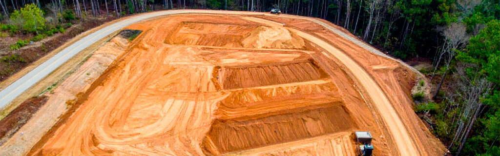
Slope is the primary terrain factor determining the earthwork scope and cost that creating level or gently sloped surfaces for improvements on Cherokee County properties requires. The elevation differential that slope creates across proposed improvement footprints directly determines the volume of soil that must be cut from the high side and filled on the low side to achieve the design grade that the improvement requires, and the earthwork cost is directly proportional to this volume regardless of how efficiently the grading is executed or how favorable the site’s access and soil conditions are for the grading operation.
Earthwork Volume Underestimation on Cherokee County Slopes
The earthwork volume underestimation that Cherokee County sloped terrain consistently produces for improvement projects planned without physical interior terrain walking is the most common and most expensive single planning error on local improvement projects, because the elevation differential that creates the earthwork requirement is consistently underestimated from the accessible observation positions that road-edge, boundary-edge, and aerial imagery provide relative to the actual ground-level differential that physically walking the interior terrain reveals. A building pad candidate that appears from the road to occupy terrain with modest elevation variation may reveal ten to fifteen feet of corner-to-corner elevation differential when the full proposed footprint is physically walked from highest to lowest corner at ground level through the interior terrain that aerial and road-position observation could not accurately characterize. This ten to fifteen foot underestimation of the average cut depth across a building pad footprint represents earthwork volume that the budget based on the external observation estimate did not include, and discovering it during active grading when the actual terrain requires substantially more earthwork than the estimate anticipated produces the budget overrun that pre-commitment interior terrain walking would have prevented by revealing the actual elevation differential before the scope and budget were committed to the underestimate.
Cut-Fill Balance and Its Impact on Material Management
Sloped site earthwork that cuts material from the high side of the improvement footprint and places it as fill on the low side may be approximately cut-fill balanced, in excess cut that requires disposing of additional material beyond what the fill side can accept, or in fill deficit that requires importing additional material beyond what the cut side produces to complete the fill side to design grade. The cut-fill balance at any specific sloped site is determined by the terrain’s specific geometry and the design grade that the improvement requires, and significant departure from cut-fill balance in either direction adds earthwork cost that a balanced site would not incur: excess cut requires material hauling and disposal at cost beyond the cut and fill operations, while fill deficit requires material importing and additional hauling cost to source and deliver the fill that the cut side cannot produce in adequate volume for the fill side’s requirement. Assessing the approximate cut-fill balance before improvement design is committed at a specific sloped site location allows cut-fill balance to influence site location selection among candidate locations where some may offer more favorable balance than others at equivalent improvement design requirements.
Slope Stability Requirements for Cut and Fill Faces
Grading that creates cut and fill faces on sloped Cherokee County terrain must account for the slope stability requirements that prevent the cut and fill faces from failing through the erosion, sliding, and sloughing that unsupported steep slopes in Cherokee County clay experience under the saturating rainfall and freeze-thaw cycling that local climate delivers to exposed slope faces. Cut and fill slopes that are established steeper than the stable slope gradient for Cherokee County clay under saturated conditions will fail progressively through the soil movements that gravity and moisture pressure produce on unstable slopes, creating the safety hazard and improvement damage that adequate slope design for stable gradient would have prevented. Incorporating slope stability requirements into graded slope design before grading begins rather than addressing the stability failures that inadequate gradient produces after grading creates the conditions for those failures is the planning approach that prevents the most expensive and most disruptive earthwork consequences of slope-inadequate graded face design on Cherokee County sloped improvement sites.
How Slope Affects Access Route Development and What Planning Must Address
Access route development on sloped Cherokee County terrain requires planning for the specific slope-related challenges that grade management, drainage crossing frequency, and year-round bearing capacity on sloped clay routes create for the management and improvement equipment that the routes must serve through all seasonal conditions rather than only under the favorable dry-season conditions that most initial access routes can support regardless of their design quality.
Maximum Safe Grade and Its Route Design Implications
Access routes on sloped terrain must maintain the maximum safe operating grade for the vehicles and equipment that will navigate them, which on Cherokee County rural properties with the clay surfaces that become slippery under wet conditions constrains route grade more severely than paved or graveled surface routes where traction is more reliably maintained at steeper grades under equivalent moisture conditions. Tractor-mounted equipment navigating clay access routes on sustained grades steeper than the equipment’s stable operating gradient on slippery wet clay faces the traction loss and potential equipment tipping risk that grade management should specifically prevent through route alignment choices that limit sustained grades to the safe operating range for the specific equipment that will use the route. Route alignments that must traverse significant slope must route around the steepest terrain sections or include grade-reducing switchback turns that keep sustained grades within safe equipment operation limits, adding route length and potentially drainage crossing requirements that the most direct alignment would have avoided on flatter terrain.
Drainage Crossing Frequency on Sloped Terrain
Sloped terrain creates more frequent drainage crossing requirements for access routes navigating from high to low terrain positions because the route alignment crosses more drainage channels as it traverses the slope than an equivalent-length route on flat terrain would encounter. Each drainage channel crossing requires culvert installation sized for the contributing watershed above the crossing point, and the cumulative culvert infrastructure cost for a sloped access route that crosses multiple drainage channels is substantially higher than the infrastructure cost for an equivalent-length flat terrain route that crosses fewer channels. Drainage crossing identification during access route planning through physical terrain walking and post-rain observation that reveals where water flows and concentrates allows route alignment to minimize crossing requirements where alternative alignments can avoid channel crossings without creating unacceptable grade or distance penalties, reducing the culvert infrastructure cost that drainage crossing frequency produces.
How Slope Affects Usable Space and What Planning Can Do About It
Sloped terrain limits the usable space available on Cherokee County properties for the specific land uses that require level or gently sloped ground, because the areas where terrain slope exceeds the gradient limits of specific uses are areas that cannot serve those uses without the earthwork that creates usable ground from the sloped conditions the terrain presents. Understanding which land uses require level or near-level ground and where the terrain’s actual gradients fall within or outside those limits allows property owners to accurately assess the usable space that the terrain actually provides for each intended use before improvement investment is directed at creating additional usable space through earthwork where existing terrain gradients already approach adequacy, or before improvement planning assumes usable space availability that the actual terrain gradients do not provide without earthwork investment that adequate terrain assessment would have identified as a requirement.
Agricultural uses including hay production, row crop cultivation, and orchard establishment require terrain gradients below the threshold that equipment operation, erosion risk, and irrigation uniformity establish as the maximum acceptable slope for productive agricultural use. Slopes exceeding these gradients are not suitable for the agricultural uses that the property owner may have intended for those sections without the terracing or grade correction that brings the slope within the acceptable range for the intended use. Identifying the specific areas of a sloped property where terrain gradients fall within acceptable agricultural use range and where they do not, before agricultural improvement investment is planned for sections where the terrain’s actual gradients exceed the acceptable range, allows agricultural improvement planning to focus on the sections where terrain gradients support the intended use rather than investing in sections where the gradients do not.
Building site development requires the level pad that adequate structural foundation performance and comfortable residential use demand, and the earthwork required to create this level pad from sloped terrain is the primary site development cost driver on Cherokee County sloped building sites. Identifying the candidate building locations where terrain gradients are most favorable for level pad creation with the least earthwork, rather than selecting sites based on views, road proximity, or other site selection factors that do not account for the earthwork cost that slope creates, consistently produces building site development at lower earthwork cost than site selection without terrain-based cost comparison among available candidates on a sloped property. The site that is most visually appealing from the road may not be the site where the terrain’s actual grade requires the least earthwork for the level pad that building requires, and evaluating the earthwork cost implications of each candidate site’s actual terrain gradient before site selection is committed produces better development cost outcomes than selecting sites without this terrain-informed comparison.
How to Assess Slope Conditions Before Committing to Improvement Plans
Assessing the actual slope conditions at proposed improvement locations on Cherokee County properties before committing to improvement plans that the slope’s actual conditions will determine the earthwork, drainage, and access requirements for requires the physical terrain assessment that accessible observation positions cannot provide at the accuracy that improvement planning requires to be genuinely informed rather than genuinely assumed.
Physical terrain walking of each proposed improvement location’s full extent, specifically entering the interior of the proposed footprint rather than assessing from accessible adjacent positions, is the single most consequential slope assessment activity because it reveals the actual corner-to-corner elevation differential that the improvement’s earthwork must address, which accessible observation consistently underestimates on Cherokee County wooded terrain where the canopy surface is substantially flatter than the ground surface beneath it. Walking from the highest to the lowest corner of the proposed footprint while noting the slope direction and estimating the elevation change between these extreme corners produces the earthwork volume context that improvement planning requires for realistic scope and cost estimation rather than the systematically low estimate that accessible observation produces on local wooded terrain.
Post-rain site observation at each proposed improvement location within twenty-four hours of a significant rain event reveals the actual drainage behavior that slope creates at the specific location, specifically showing where water flows toward the proposed improvement from surrounding higher terrain, where it concentrates at lower terrain positions within the proposed footprint, and whether the contributing watershed above the proposed location is larger than the immediately visible surrounding terrain might suggest from dry-condition observation. This post-rain observation is the drainage assessment activity that most effectively reveals the watershed-based drainage loads that slope delivers to each proposed improvement location and that drainage infrastructure design must manage rather than only the direct footprint rainfall that dry-condition planning inadequately substitutes for the actual slope-delivered watershed drainage.
Topographic maps that show contour lines across the property and its surrounding area provide the watershed boundary information that identifies the drainage area above each proposed improvement location from the contour pattern that reveals watershed divides, drainage channel directions, and terrain position relationships that ground-level observation alone cannot convey as comprehensively as the topographic map’s overhead perspective provides. Using topographic maps to supplement physical terrain walking and post-rain observation produces the most complete slope assessment available before improvement commitment, combining the ground-level detail that terrain walking provides with the watershed-scale context that topographic maps show and the actual drainage behavior that post-rain observation reveals.
Frequently Asked Questions
At what slope gradient do Cherokee County residential improvement projects become significantly more complex and expensive than flat-terrain equivalents?
Residential improvement complexity and cost on Cherokee County properties begins increasing significantly above flat-terrain equivalents when the terrain slope across the proposed improvement footprint exceeds approximately five to eight percent, which is the gradient range where earthwork volume for level pad creation begins requiring meaningful cut-and-fill operations rather than modest grading corrections, where drainage from surrounding terrain begins delivering meaningful contributing watershed volumes to the improvement perimeter beyond direct footprint rainfall, and where access route grade management begins requiring design attention to maintain grades within safe equipment and vehicle operation limits. Below this gradient range, sloped terrain creates modest incremental requirements relative to flat-terrain equivalents that careful planning can address without fundamentally changing the improvement approach. Above this gradient range, each additional increment of slope adds proportionally to the earthwork volume, drainage infrastructure requirement, and access route complexity that the improvement requires, and improvements on terrain significantly steeper than fifteen to twenty percent slope may require the engineering assessment and specialized earthwork approach that DIY planning from general improvement guidance cannot adequately substitute for on Cherokee County clay without slope stability and erosion risk experience that local contractor expertise with sloped terrain specifically provides.
How do sloped terrain drainage requirements on Cherokee County properties differ from what standard residential lot drainage guidance recommends?
Standard residential lot drainage guidance developed for typical suburban flat-terrain lots addresses direct rainfall on the improvement footprint as the primary drainage load that infrastructure must manage, with modest allowance for adjacent terrain drainage contributions that flat suburban lots generate at relatively low volumes. Cherokee County sloped terrain delivers contributing watershed drainage volumes that can exceed direct footprint rainfall by five to fifteen times or more at lower-slope improvement positions where significant uphill watershed area concentrates drainage toward the improvement site, which is a drainage load magnitude that standard suburban drainage guidance developed for flat lots cannot adequately address through the infrastructure sizing it recommends for the substantially lower drainage loads that flat-terrain improvements experience. Applying standard flat-terrain drainage guidance to Cherokee County sloped improvement sites produces systematically undersized drainage infrastructure that fails at the first significant storm event that delivers the actual watershed-based drainage load to the improvement perimeter rather than the direct footprint rainfall load that the standard guidance sized the infrastructure for. Site-specific drainage assessment that identifies the contributing watershed and sizes infrastructure for the watershed-based drainage load is the drainage design approach that sloped Cherokee County improvement sites specifically require rather than the standard flat-terrain guidance that the site’s slope conditions make specifically inadequate.
Can slope be an asset for some Cherokee County property improvements rather than only a challenge?
Yes, slope is an asset rather than only a challenge for specific improvement types and intended uses that benefit from the terrain variation that slope creates rather than requiring the level ground that slope makes more expensive to achieve. Pond construction benefits from slope because the terrain’s elevation differential creates the natural dam opportunity at drainage channel positions where a relatively modest earthen embankment can impound the drainage from a significant contributing watershed above the dam position, producing water storage volume that flat terrain cannot create without the extensive basin excavation that must substitute for the natural storage that sloped terrain’s elevation differential provides. Gravity-fed water systems that use terrain elevation differential to deliver water from elevated storage to lower use points eliminate the pumping equipment and energy cost that flat terrain requires for equivalent delivery pressure. And the visual character and natural setting quality that slope creates on residential and recreational properties is an asset that contributes to the land’s distinctive appeal and long-term value relative to flat alternatives at equivalent acreage, making the planning investment that slope requires to accommodate effectively the cost of a terrain characteristic whose positive contributions to property character and specific use capabilities justify the careful planning that its challenges specifically require.
How should slope considerations influence the sequencing of multiple improvement phases on a Cherokee County property?
Slope considerations on multi-phase improvement programs on Cherokee County properties should specifically elevate access route development and drainage infrastructure to the earliest improvement phases because slope amplifies the consequences of inadequate access and drainage for every subsequent phase that depends on those foundational systems. On a sloped property, the access route that must navigate grade transitions and drainage crossings to reach interior improvement locations serves every subsequent phase’s equipment access requirements, and inadequate access route grade management or drainage crossing infrastructure creates barriers that each subsequent phase must either work around at cost or invest in correcting before the primary scope can proceed. Similarly, sloped terrain’s drainage concentration toward improvement locations means that drainage infrastructure established during early phases must be correctly positioned and correctly sized for the watershed loads that slope delivers or subsequent improvement phases will build on a drainage infrastructure that the watershed drainage overwhelms. Planning the access route and drainage infrastructure for the full anticipated improvement program before the first phase executes, rather than only for the immediate first phase’s requirements, produces the early-phase foundational work that serves every subsequent phase efficiently rather than requiring revision before each subsequent phase that needs more capable access or drainage than the prior phase’s planning provided for the immediate phase alone.
Planning Improvements on Your Sloped Cherokee County Property?
Sloped Cherokee County properties reward the landowners who plan their improvements from accurate knowledge of what the terrain’s actual slope conditions require from earthwork, drainage, and access design with improvements that perform reliably through the full seasonal range that local climate delivers and that advance the property toward its intended destination without the repeated replanning that discovering slope-imposed requirements during execution consistently generates when slope conditions are inadequately assessed before improvement commitment. The physical terrain walking that reveals actual elevation differentials, the post-rain drainage observation that reveals watershed-based drainage loads, and the topographic assessment that reveals watershed boundaries are each pre-commitment assessment activities whose investment is modest relative to the earthwork overruns, drainage infrastructure failures, and access route revision costs that planning without them consistently produces when Cherokee County’s sloped terrain conditions contradict the flat-terrain assumptions that accessible observation inadequately substitutes for the slope-specific knowledge that accurate improvement planning on local terrain specifically requires.
Bardin Outdoors works with landowners across Ball Ground, Canton, Cherokee County, and North Georgia on grading and excavation, clearing, and forestry mulching projects on sloped properties planned from site-specific slope assessment that accurately characterizes the terrain, drainage, and access conditions each project must account for rather than generic assumptions that local slope conditions consistently contradict. To learn more about how Bardin Outdoors approaches sloped property improvement planning in Cherokee County, contact us.