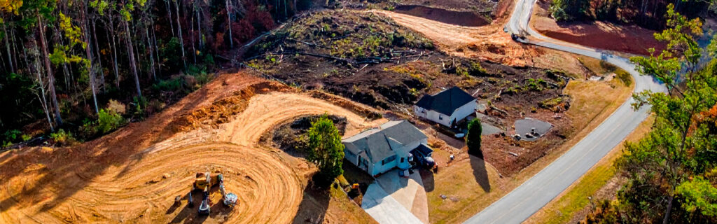
For property owners across Cherokee County, Ball Ground, and Canton managing residential and rural lots where the natural character of the land is a primary ownership value, understanding how selective land clearing specifically creates more functional outdoor spaces by addressing what limits function without eliminating what defines character, what the functional outcomes of selective clearing look like across the specific property use categories that Cherokee County landowners most commonly pursue, and how to plan a selective clearing project that maximizes the functional improvement while specifically protecting the natural features that the property owner most values gives the practical foundation for approaching clearing as the precision management activity that creates the property condition the owner intended rather than the blunt removal of everything in the treatment area that comprehensive clearing produces regardless of each element’s contribution to the property’s long-term character and value.
What Selective Clearing Removes and What It Preserves
Selective clearing is defined by the specific identification of what should be removed and what should be preserved rather than by the treatment of all vegetation within the clearing area as removal candidates regardless of each element’s contribution to the property’s functional and character value. This identification is the planning activity that distinguishes selective clearing from comprehensive clearing, and it is what makes the outcome of selective clearing more satisfying and more durable as a property improvement than comprehensive clearing that achieves functional improvement at the cost of the natural features that preservation planning would have specifically protected.
What selective clearing removes is the vegetation that limits the property’s function without contributing to its character and ecological value. Chinese privet that has dominated the understory to the point of making wooded sections impenetrable is removed because it limits function and provides no native ecological value that its removal compromises. Kudzu that has smothered a slope is removed because it limits access and function while the native vegetation it was suppressing provides more ecological value than the kudzu monoculture it replaced. Multiflora rose that has converted a trail corridor to an impassable barrier is removed because it limits the trail’s function while providing no character value that its removal would eliminate. In each case the removal is specifically targeted at vegetation whose functional limitation justifies the clearing decision and whose absence from the property after clearing improves both the function and the ecological character of the treated area.
What selective clearing preserves is the vegetation that contributes to the property’s character, ecological value, and long-term identity in ways that would be permanently lost if clearing removed it along with the invasive vegetation the clearing was intended to address. Mature native canopy trees that have been growing above the invasive understory are preserved because they define the property’s woodland character and cannot be replaced within any practical timeframe. Native understory trees including flowering dogwood, serviceberry, and native viburnums that have survived in suppressed condition beneath invasive dominance are preserved because their release from invasive competition allows them to recover and contribute to the ecological diversity and seasonal character of the cleared property. Distinctive natural features including rock outcrops, terrain formations, and natural drainage features are preserved because they are site-specific character elements that the clearing’s improvement of the surrounding area makes more accessible and more appreciable rather than elements that the clearing should eliminate for the convenience of a simpler treatment boundary.
How Selective Clearing Improves Visibility
Visibility within and across a wooded property is among the most immediate and most dramatically improved outcomes that selective clearing produces, because the dense invasive understory that selective clearing specifically removes is the primary obstacle to visibility at ground level in most Cherokee County unmanaged woodland. The transition from the ten-foot visibility of a privet-dominated understory to the forty or sixty foot visibility that the same woodland presents after selective clearing has removed the privet while preserving the canopy above is one of the most striking functional improvements available from any single management action, and it requires no construction, no infrastructure, and no change to the native canopy that was already defining the property’s character above the invasive understory that was blocking visibility below.
Hunting Sight Lines and Stand Visibility
The visibility improvement from selective understory clearing on hunting properties translates directly into stand productivity because deer observation from stand positions depends on sight lines that extend far enough through the woodland to provide the reaction time that stand hunting requires. A stand position in privet-dominated woodland with ten-foot visibility in all directions provides essentially no functional hunting value because deer movement through the area cannot be observed until they are within the distance that already compromises the hunting opportunity. The same stand position after selective clearing that opens the understory to forty or sixty feet of sight line in multiple directions provides the observation window that makes hunting from the position productive, converting land that was physically present within the hunting property boundary but functionally absent from hunting use into productive hunting habitat that the sight line improvement creates without requiring any addition to the land or removal from the canopy.
Property Monitoring and Boundary Visibility
Property owners managing rural land who cannot observe conditions, wildlife, or activities within wooded sections from accessible positions cannot manage those sections proactively because they cannot see what is developing within them without physically entering the vegetation mass that limits their view. Selective clearing that improves visibility within and across wooded sections converts previously invisible interior conditions into observable ones that property owners can monitor from trail and road positions rather than requiring physical entry into every section to assess its current condition. This visibility improvement in management access translates directly into management efficiency, because the property owner who can observe food plot margins, fence lines, and interior conditions from trail positions without requiring specific access to each monitored location reduces the inspection travel time and effort that property management requires while increasing the observation coverage that routine inspection provides.
How Selective Clearing Improves Accessibility
Accessibility improvement from selective clearing converts property sections that are physically present within the property boundary but functionally inaccessible due to vegetation density into sections that can be physically entered, traversed, and used for the intended purposes that their terrain, soil, and ecological conditions support. The functional area of a rural property is not simply its total acreage. It is the acreage that can be physically reached and used for intended purposes, and selective clearing that expands this functional area by removing the vegetation that was preventing access to sections with unrealized use potential creates value from land that the property owner was already paying for but could not productively use.
Trail Network Access and Interior Connectivity
Selective clearing of trail corridors through wooded sections connects the property’s accessible areas to its interior sections that invasive density had isolated from the trail network, creating the connectivity that allows people, equipment, and wildlife to move through the property’s full extent rather than only through the sections that prior accessibility allowed. Trail corridor selective clearing that removes the invasive growth within corridor width while preserving the wooded character on both sides of the corridor produces trail access that feels like movement through native woodland rather than through a utility corridor cleared for access efficiency alone, because the preserved woodland character on either side of the corridor is part of the trail experience that makes trail walking on wooded rural property enjoyable rather than simply utilitarian.
Equipment and Vehicle Access to Management Areas
Food plots, fence lines, water features, and stand locations that require periodic equipment or vehicle access for maintenance, monitoring, and management cannot be effectively maintained when invasive vegetation density prevents equipment from reaching them. Selective clearing of access corridors to these management areas converts the periodic management activities from efforts that must work around access limitations into straightforward operations that proceed directly to the management location without the vegetation navigation that inadequate access imposed. The maintenance efficiency improvement from adequate selective clearing of access corridors to management areas compounds across every subsequent maintenance event at each management location rather than being realized only at the clearing event that established the access, making access corridor selective clearing one of the highest recurring return investments available from any property management expenditure.
How Selective Clearing Creates More Usable Space
Usable space creation from selective clearing results from converting areas that were physically present within the property boundary but functionally unusable due to vegetation density into areas that can support the intended uses their terrain, soil, and ecological conditions make them suitable for. This usable space creation occurs differently in different property use contexts, and understanding how selective clearing specifically creates usable space in each context helps property owners identify which areas of their specific property would benefit most from selective clearing investment relative to the usable space it would create.
Open Woodland for Hunting and Recreation
Selective understory clearing that removes invasive dominance while preserving native canopy creates the open woodland character that supports hunting, recreational walking, and wildlife observation across property sections that the invasive understory had made functionally inaccessible for these uses. The open woodland that selective clearing creates is a specific habitat type, distinct from both the closed invasive-dominated understory it replaces and the fully cleared open ground that comprehensive clearing would produce, and it is the habitat type that most wildlife species in North Georgia use for foraging, movement, and seasonal activity more productively than either alternative. Creating this specific habitat type through selective clearing rather than comprehensive clearing preserves the native canopy overhead that is the essential structural element of the habitat, producing a functional outdoor space that is simultaneously more accessible for human use and more productive for wildlife habitat than either the pre-clearing invasive-dominated condition or the post-comprehensive-clearing open condition would have been.
Food Plot Productivity and Effective Area
Food plot usable space creation from selective clearing addresses both the physical area that invasive margin encroachment has reduced from the intended plot size and the sunlight access at the plot interior that canopy from advancing woodland edge has reduced from the full-sun condition that productive food plot planting requires. Selective clearing that restores intended food plot boundaries by removing advancing invasive vegetation from the plot margins while preserving the woodland edge trees and native species at the woodland boundary creates usable productive plot area from the ground that advancing vegetation had converted to functionally unproductive plot margin. The usable space created by food plot margin selective clearing is measured in the restored productive area that the clearing returns to the effective plot size, the restored sunlight access that the clearing returns to the productive planting zone, and the restored wildlife attraction that the functional plot size and sunlight access together restore to the management objective that the plot was established to serve.
Outdoor Living and Gathering Areas Near Structures
Residential rural properties where invasive vegetation has advanced to the edges of outdoor living areas, driveway corridors, and structure surroundings benefit from selective clearing that creates functional outdoor living space from the areas immediately adjacent to the structures that the property’s intended residential use requires to be comfortable, accessible, and visually connected to the natural landscape beyond them. Selective clearing near residential structures that removes invasive encroachment while preserving the significant native trees and natural features in the immediate vicinity creates the outdoor living space that feels naturally integrated into the surrounding landscape rather than carved from it, because the selective approach preserves the mature native canopy and native plantings that give the outdoor living space its natural setting character while removing the invasive growth that was encroaching on the space and eliminating the accessible, comfortable outdoor living area that the structures were positioned to provide.
How Selective Clearing Preserves Natural Character While Improving Function
The defining characteristic of selective clearing relative to comprehensive clearing is not what it removes but what it preserves, and how the combination of targeted removal and deliberate preservation produces a post-clearing property condition that is simultaneously more functional and more characterful than either the pre-clearing overgrown condition or the post-comprehensive-clearing fully cleared condition would have been. This combined improvement in function and character is what makes selective clearing the approach that property owners who value their land’s natural character most consistently describe as producing the property they wanted rather than the traded property that comprehensive clearing sometimes produces, where the functional improvement came at the cost of the natural character that made the land worth improving.
The natural character preservation that selective clearing achieves operates through the specific preservation of the elements that define the property’s natural identity: the mature native canopy that took decades to develop and that cannot be replaced within any practical ownership period, the native understory species that provide the seasonal flowering, fruiting, and ecological diversity that defines productive native woodland, the distinctive terrain features and rock outcrops that the clearing exposes and makes accessible rather than eliminates, and the natural drainage features that the clearing’s preservation boundaries protect rather than disturb. Each of these preserved elements contributes to the post-clearing property condition in ways that comprehensive clearing would have eliminated, and their presence in the cleared landscape defines the natural character that selective clearing specifically produces rather than the cleared character that comprehensive clearing substitutes for it.
Planning Selective Clearing for Specific Property Outcomes
Effective selective clearing planning requires defining the specific functional outcomes the clearing should produce, identifying the preservation targets that must be protected to achieve both the functional outcomes and the character preservation objectives, and communicating both the functional outcomes and the preservation targets to the clearing contractor before work begins in the form that translates planning decisions into execution guidance that the contractor and operator can specifically follow during active treatment.
The functional outcome definition should specifically describe what the cleared area will be used for after clearing is complete, because different intended uses require different cleared area conditions that selective clearing should specifically achieve. A hunting land understory clearing that requires navigable sight lines and accessible wildlife observation positions defines a different functional outcome than a food plot margin clearing that requires restored productive area and full sunlight access, which defines a different functional outcome than a residential property boundary clearing that requires visual screening from adjacent roads while restoring accessible outdoor living space adjacent to the structure. Each of these functional outcome definitions determines the treatment extent, the treatment intensity, and the preservation boundaries that selective clearing should specifically achieve to serve the intended use rather than clearing to a generic standard that may over-treat areas that benefit from retained vegetation or under-treat areas that require more thorough clearing for the specific functional outcome the clearing is intended to produce.
The preservation target identification requires physically walking the treatment area before clearing equipment arrives and marking every tree, shrub, and natural feature that should be preserved with bright flagging tape at approximately five to six feet of height on every trunk and stem that the treatment should navigate around. This physical marking converts the preservation planning decision from a mental intention that the clearing operator cannot access during active treatment into an unambiguous field instruction at each preservation target’s specific location that the operator can observe from the equipment cab during the active, efficient treatment pace that equipment operation requires. Without this physical marking, the clearing operator’s preservation decisions during active treatment are based on general instructions and personal judgment rather than the specific property owner identification of each preservation target that physical marking provides, and the preservation accuracy that physical marking produces consistently exceeds the preservation accuracy that instruction-only communication achieves during active equipment operation.
Frequently Asked Questions
How does selective clearing compare to comprehensive clearing in terms of cost per acre on North Georgia properties?
Selective clearing through forestry mulching on Cherokee County rural properties typically costs less per acre than comprehensive clearing that includes stump removal and debris hauling, because selective clearing’s in-place processing of above-ground vegetation eliminates the debris hauling and stump removal costs that comprehensive clearing adds to the base clearing treatment cost. Selective clearing’s primary cost component is the forestry mulching equipment time to process the above-ground vegetation within the treatment boundaries, without the additional scope of stump grinding, debris piling, and debris removal that comprehensive clearing requires. The cost comparison shifts when the vegetation density and stem sizes within the selective clearing area require more machine time per acre due to the density of the invasive vegetation being processed, because dense established privet at large stem diameters requires more machine time per acre than lighter vegetation at smaller diameters regardless of clearing method. For typical Cherokee County invasive understory clearing on wooded properties, selective forestry mulching consistently provides the more cost-effective outcome per acre when the total scope comparison accounts for the debris management costs that comprehensive clearing requires and that selective mulching eliminates through in-place processing.
What percentage of a wooded property’s area typically needs selective clearing to achieve functional improvement?
The percentage of a property’s wooded area that selective clearing should address to achieve meaningful functional improvement depends on the property’s intended use, the current invasive species distribution across the wooded area, and the specific functional objectives the clearing is intended to achieve. For hunting land understory management, treating approximately thirty to fifty percent of the wooded area with selective understory clearing while leaving the remaining area in less managed condition typically produces the habitat structural diversity that supports the broadest wildlife use while maintaining the cover character that wildlife movement and bedding require. For properties with specific functional objectives including trail network connectivity and food plot margin management, the treatment area is determined by the trail network and food plot system extent rather than by a percentage of total wooded area. For properties primarily seeking visibility and accessibility improvement, selective clearing should address the specific sections where visibility and accessibility limitations most constrain the property’s intended use rather than treating the full wooded area to a uniform standard that may over-treat sections where current conditions are already adequate for the intended use.
How does selective clearing affect the invasive species seed pressure on cleared areas from adjacent uncleared sections?
Selective clearing that treats specific sections of a property while leaving adjacent sections uncleared does not eliminate the invasive seed rain from the uncleared adjacent sections onto the cleared treatment area, because the bird-dispersed and wind-dispersed seeds that privet, autumn olive, and other invasive species produce travel from uncleared populations into cleared areas where the reduced competitive environment from clearing creates favorable establishment conditions for new seedling populations. This seed pressure from adjacent uncleared sections is the management reality that makes recurring herbicide follow-up treatment in cleared areas necessary regardless of how thorough the initial mechanical clearing was, because new invasive seedlings establishing from seed rain must be addressed by herbicide treatment of seedlings at early establishment stage before they develop the root systems that make them resistant to the herbicide applications that early-stage treatment controls effectively. Cleared areas with adjacent uncleared invasive populations will require more consistent ongoing management than cleared areas surrounded by managed or invasive-free sections, and the management program for selective clearing projects should specifically plan for this ongoing management rather than treating the initial clearing as an event that eliminates the management need rather than converts it from intensive restoration work to ongoing monitoring and early-stage seedling management.
Can selective clearing be done in sections over multiple seasons or does the full planned treatment need to be completed at once?
Selective clearing can be effectively executed in sections over multiple seasons, and this phased approach is often the most practical and most cost-efficient way to address larger treatment areas on properties where the full intended treatment scope exceeds any single season’s available budget or where the property owner wants to evaluate the outcomes of initial sections before committing to the full treatment scope. Phased selective clearing that treats the highest-priority sections first, specifically the sections where functional limitations most constrain the property’s use or where the management efficiency gains from improved access most directly enable other management activities, produces early-phase functional improvements that are available for use during the subsequent phases that extend the treatment to additional areas. The sequencing of phased selective clearing should be organized by the priority that each section’s functional improvement produces for the property’s intended use rather than by the convenience of treatment sequence, ensuring that each phase’s investment produces the highest functional improvement relative to its cost within the available budget constraint.
Ready to Create More Functional Outdoor Spaces on Your North Georgia Property?
Selective land clearing that removes what limits function without eliminating what defines character produces the outdoor spaces that North Georgia rural and residential property owners describe when they articulate the property they want rather than the property they currently have. The open native woodland that hunting and recreation require, the functional food plot system that wildlife management needs, the accessible trail network that connects interior sections to the property’s full extent, and the comfortable outdoor living environment that residential rural property provides all result from the specific management decision to remove the invasive vegetation that was limiting these outcomes while preserving the native canopy, native understory, and natural features that make achieving these outcomes satisfying rather than simply functional. Planning that decision deliberately, marking it physically in the treatment area before equipment arrives, and communicating it clearly to the contractor who executes it converts the property improvement potential of selective clearing from an idea into the specific property condition that the deliberate combination of targeted removal and thoughtful preservation produces.
Bardin Outdoors works with property owners across Ball Ground, Canton, Cherokee County, and North Georgia on selective land clearing and forestry mulching projects designed to create the specific functional outdoor spaces each property’s intended use requires while preserving the natural character that makes North Georgia rural and residential land distinctive and valuable. To learn more about how Bardin Outdoors approaches selective clearing for functional outdoor space creation, contact us.