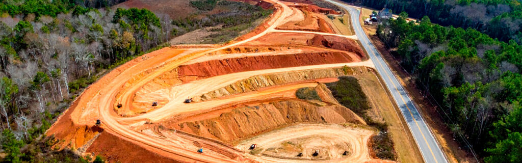
For landowners across Cherokee County, Ball Ground, and Canton planning property improvements across the range of residential and rural project types that local properties most commonly require, understanding specifically how the hills, wooded areas, clay soil, and elevation changes that characterize North Georgia’s terrain affect each category of improvement planning gives the terrain-informed foundation that separates improvement plans that account for what local terrain actually presents from those that assume conditions the terrain will contradict when execution reveals the site-specific reality that adequate planning should have incorporated before commitment rather than after discovery.
How Hills and Elevation Changes Affect Every Improvement Category
The rolling hills that define Cherokee County’s landscape create improvement planning implications across every project category that local landowners commonly pursue, from building site development where hill slopes determine earthwork scope to access route development where hill grades determine drainage crossing frequency and safe equipment operation constraints to vegetation management where hillside terrain affects equipment operation safety and post-clearing erosion risk.
Earthwork Scope Underestimation From Accessible Observation
The most consistently consequential effect of North Georgia’s hills on improvement planning is the earthwork scope underestimation that planning from accessible observation positions produces relative to the actual earthwork scope that ground-level interior terrain assessment reveals. The canopy surface that aerial imagery captures and the perimeter-level view that road and boundary edge observation provides are both substantially flatter than the ground surface within the wooded interior where most Cherokee County improvement projects are located, because the canopy of trees of varying heights produces a relatively uniform overhead surface while the ground beneath it follows the hill’s actual slope profile that the canopy appearance conceals from external observation. The building pad candidate that looks level from the aerial image or from the road may reveal ten to fifteen feet of corner-to-corner elevation differential when the full proposed footprint is physically walked with attention to the ground surface rather than the canopy above it. This elevation differential translates directly into earthwork volume at the rate that the cut-and-fill geometry the level pad requires from that differential produces, and every foot of underestimated elevation differential represents additional earthwork volume that the project budget must accommodate when active grading reveals what terrain walking would have revealed before commitment at no additional earthwork cost.
The prevention for this consistently recurring earthwork underestimation is specifically and only the physical interior terrain walking that reveals actual ground-level elevation differentials by placing the observer within the proposed improvement footprint at the ground surface level where the earthwork must create the design grade rather than at the canopy level that aerial observation captures or the perimeter level that road and boundary observation provides. No amount of aerial imagery interpretation, topographic map reading, or general experience with similar-appearing properties substitutes for the specific terrain walk of the specific proposed improvement location that produces the actual elevation differential at the actual ground surface of the specific site rather than the estimated differential from the observation positions that systematically underestimate what the ground-level interior reveals.
Drainage Watershed Concentration at Lower-Slope Positions
Hills concentrate drainage from their upper slopes toward their lower slopes and into the channels that form at the base of hill sections and across the lower terrain that receives the accumulated drainage from all the higher terrain above it. Every improvement located at a lower-slope position on Cherokee County hills receives not only the direct rainfall that falls on its footprint but the accumulated drainage from the watershed above it that the hill’s slope directs toward the lower position, and the drainage infrastructure serving the improvement must be designed for the full watershed’s drainage delivery rather than the footprint’s direct rainfall that the drainage load would consist of on flat terrain without the hill watershed contribution. Improvement designs that size drainage infrastructure for direct footprint rainfall at lower-slope positions on North Georgia hills are drainage designs that will fail at the first significant storm event that delivers the watershed’s full drainage to the infrastructure, producing the foundation drainage failure, driveway overtop, and surface flooding that adequate watershed-based drainage design would have prevented by sizing the infrastructure for the actual drainage load the hill delivers rather than the direct-rainfall-only load that flat terrain designs would correctly apply to positions without the hill watershed contribution.
How Wooded Areas Affect Improvement Planning
The wooded areas that cover most Cherokee County rural properties create improvement planning implications through what they conceal, what they contain that should be preserved during improvement, and what they require from the clearing and site preparation that improvements in wooded sections need before earthwork, construction, or management activities can proceed on the terrain the woodland occupies.
Concealment of Terrain, Drainage, and Site Conditions
Wooded areas conceal the terrain surface conditions that improvement planning requires to be accurately characterized before improvement designs are committed to those conditions. The terrain variation that hills create within wooded sections is concealed from aerial and perimeter observation by the canopy surface that appears flatter than the ground beneath it, as described above. The drainage channels, wet areas, and soil conditions that influence improvement site selection and drainage design are concealed from dry-condition observation by the vegetation that occupies and grows adjacent to them, making post-rain observation within the wooded section the assessment activity that reveals drainage behavior at proposed improvement locations rather than the dry-condition observations that leave drainage behavior to assumption from terrain position estimation without the behavioral evidence that rainfall events specifically provide. Rock outcrops and shallow subsurface rock at ridge and upper slope positions within wooded sections are concealed from aerial observation but may be indicated by the tree species composition at those positions, where certain species assemblages that are adapted to shallower soil conditions reveal the shallow rock depth that explains their presence rather than the deeper-rooted species that deeper soil positions support.
Native Canopy as a Planning Asset to Preserve
The native canopy trees that wooded Cherokee County properties contain are irreplaceable natural assets whose preservation during improvement planning requires the same deliberate attention that improvement designs give to creating the improvements the plans envision. A mature white oak removed during site preparation because the improvement design did not specifically identify it as a preservation priority cannot be restored within any practical ownership period at any cost, and the character, shade, mast production, and natural setting contribution the tree provided to the property’s value and enjoyment are permanently eliminated by its removal. Improvement plans for wooded North Georgia properties that do not specifically identify significant native trees at proposed improvement locations and specifically design improvements to preserve those trees where preservation does not prevent the improvement from achieving its functional objectives consistently eliminate some of the property’s most valuable natural assets for the convenience of simpler clearing boundaries, smaller equipment-maneuvering constraints, or minimally better construction site access that the tree’s presence near the improvement represents.
Planning that specifically identifies significant native trees at proposed improvement locations, evaluates whether the improvement can be designed to preserve those trees through footprint adjustments, route modifications, and equipment staging area positions that keep the improvement’s disturbance zone outside the trees’ root protection areas, and specifically marks preservation targets in the field before clearing and site preparation equipment arrives converts tree preservation from the aspirational intention that generic clearing instructions inconsistently translate into the specifically achieved outcome that physical marking and design accommodation reliably produce. The improvement plan that incorporates tree preservation as a specific design objective alongside the improvement’s functional objectives consistently produces better post-improvement property outcomes than the plan that treats tree preservation as a constraint to be accommodated if convenient rather than an objective to be specifically achieved through deliberate design.
Organic Soil Depth on Long-Wooded Sites
Wooded Cherokee County properties that have been continuously forested for decades accumulate organic topsoil layers significantly deeper than the four to six inch generic assumption that improvement planning without site-specific soil probing commonly applies. The organic layer on long-wooded North Georgia sites frequently ranges from eight to twenty-four inches depending on the specific site’s forest history, drainage conditions, and soil biology, and every inch of organic depth above the generic assumption represents additional stripping scope that improvement projects requiring organic-free structural subgrade must address before fill can be placed. Building site preparation, driveway subgrade development, and any structural improvement that places load on compacted fill discovers the organic depth discrepancy as a mid-project scope addition when active stripping reveals what soil probing before project commitment would have revealed at no additional earthwork cost. Probing the soil at multiple points across any proposed structural improvement footprint on a wooded Cherokee County site before the improvement scope and budget are committed is the site assessment practice that most directly prevents the organic stripping scope surprise that long-wooded site improvement projects most consistently encounter when planned without this simple pre-commitment assessment.
How Clay Soil Affects Every Improvement Category
Cherokee County’s red piedmont clay is the soil characteristic whose specific behavior most pervasively affects improvement planning across every project category because the clay’s drainage impermeability, moisture-dependent bearing capacity, volume change with moisture cycling, and compaction sensitivity to moisture content create specific design and scheduling requirements for drainage, foundation, earthwork, and access route improvements that more permeable and more stable soil types do not impose at the same frequency or severity.
Near-Zero Permeability and Its Drainage Design Implications
Cherokee County clay becomes effectively impermeable when saturated, converting essentially all rainfall during wet conditions into surface runoff rather than the infiltration that more permeable soils allow. This total surface runoff conversion at saturation produces drainage volumes at improvement sites that drainage infrastructure must manage at the full watershed-based load rather than the reduced load that partial infiltration on more permeable soils would deliver to the same infrastructure. Drainage designs for Cherokee County improvements that assume significant infiltration in the contributing watershed are drainage designs that consistently undersize infrastructure for the actual drainage loads that local clay’s impermeability produces when the watershed is saturated, which occurs multiple times each year during Cherokee County’s wet seasons. Improvement drainage designs that account for the clay’s impermeability by sizing infrastructure for the full watershed’s runoff at saturation rather than for the partial runoff that permeable soil assumptions would allow produce the drainage infrastructure adequacy that local conditions specifically require.
Compaction Moisture Sensitivity and Earthwork Scheduling
Cherokee County clay’s compaction quality is highly sensitive to the soil’s moisture content at the time of compaction, because the water filling the soil’s pore spaces at moisture content above the optimum range prevents the particle consolidation that compaction is intended to achieve, producing a soil surface that appears compacted but that has not achieved the structural density the compaction specification requires. Earthwork that places and compacts fill on Cherokee County clay during wet seasonal conditions consistently produces compaction quality below specification regardless of the effort applied, and the progressive settlement that below-specification compaction produces as the fill consolidates under load and seasonal drying reveals the density that wet-condition compaction could not achieve becomes apparent in the graded surfaces, building foundations, and access route subgrades that were compacted at moisture conditions above the optimum range. Improvement planning that accounts for this compaction moisture sensitivity by scheduling earthwork requiring structural compaction quality during the late summer through fall dry-season window when Cherokee County clay is most consistently near optimum moisture content produces earthwork quality that the improvement’s performance depends on, rather than accepting the wet-season compaction quality that scheduling without moisture consideration consistently produces at below-specification density.
Volume Change and Foundation Drainage Requirements
Cherokee County clay expands as it absorbs moisture and contracts as it dries, applying mechanical forces to foundations, pavements, and buried infrastructure through the volume change that seasonal moisture cycling drives. The foundation cracking, pavement heaving, and infrastructure displacement that these volume change forces produce are endemic on North Georgia residential properties where foundation drainage design is inadequate to limit the clay’s seasonal moisture cycling amplitude at the foundation zone. Improvement planning for buildings, paved areas, and buried infrastructure on Cherokee County clay must specifically include the perimeter drainage that limits clay moisture cycling adjacent to foundations and infrastructure rather than designing only for surface drainage management without the subsurface perimeter drainage that clay volume change management requires. Drainage designs that address clay volume change at foundation and infrastructure positions, rather than treating drainage as only a surface management concern, produce the foundation and infrastructure performance durability that the clay’s volume change would otherwise systematically undermine across the improvement’s service life.
How Invasive Vegetation Pressure Affects Improvement Planning
The invasive species pressure that Cherokee County’s climate sustains across every unmanaged and transitional area of the landscape creates improvement planning implications that property owners from regions with lower invasive pressure or different invasive species assemblages consistently underestimate when approaching North Georgia land improvements for the first time.
Chinese privet, kudzu, wisteria, and multiflora rose established on Cherokee County properties have accumulated root energy reserves proportional to the years of unchecked establishment that most local invasive populations represent, and these root energy reserves drive vigorous resprout growth following mechanical clearing that returns cleared areas toward pre-clearing density within one to two growing seasons without the herbicide follow-up treatment that root energy depletion requires to prevent this reversion. Improvement plans that include clearing of invasive-dominated sections but that do not specifically plan and budget for the herbicide follow-up treatment that prevents the mechanical clearing investment from being consumed by vigorous resprout consistently require the same-intensity clearing investment again within two seasons, converting what should have been a one-time mechanical clearing initiation into a recurring restoration investment at full intensity each time the resprout recovers to restoration-requiring density without the combined treatment program that progressively depletes root energy and reduces the management intensity that each subsequent season requires.
Planning for invasive species management on Cherokee County properties requires accounting for this multi-season combined treatment program rather than single-season mechanical clearing in the improvement investment that the property owner commits to when clearing overgrown sections. The total investment that produces lasting improvement from North Georgia invasive vegetation is the combined cost of initial mechanical clearing plus successive seasons of herbicide follow-up treatment, not the mechanical clearing cost alone, and improvement plans that account for the full program investment consistently produce the progressive improvement toward sustainable management that the realistic total investment can achieve rather than the recurring restoration challenge that mechanical clearing without herbicide follow-up consistently produces at the same total investment but with none of the progressive root energy depletion that makes each successive season’s management less intensive than the prior one.
How Terrain-Informed Planning Changes Specific Improvement Decisions
The terrain-informed understanding of how North Georgia’s hills, wooded areas, clay soil, and invasive species pressure affect improvement planning changes specific improvement decisions in concrete ways that benefit from illustration through the specific improvement categories that local landowners most commonly pursue.
Building site selection on a Cherokee County property that uses terrain-informed assessment specifically walks each candidate site’s interior footprint to determine the actual elevation differential before committing to the earthwork scope that the specific candidate will require, evaluates each candidate’s topographic position for the contributing watershed that will deliver drainage to the site’s foundation perimeter, and probes the soil at multiple points across each candidate footprint to determine the organic depth that stripping must address before structural fill can be placed. This terrain-informed assessment produces a building site selection based on the actual earthwork, drainage, and organic stripping scope that each candidate presents, allowing the selection to consider total site preparation cost alongside the visual appeal, view, and access factors that non-terrain-informed selection accounts for without the site-preparation cost implications that specific terrain conditions create among available candidates.
Driveway development on a Cherokee County property that uses terrain-informed planning specifically walks the full proposed alignment to identify drainage crossings at each position where a natural drainage channel crosses beneath the proposed route, uses topographic maps or post-rain observation to estimate the contributing watershed above each crossing position for culvert sizing, and evaluates the bearing capacity of clay soils along the alignment at the moisture conditions that the wet seasons will produce rather than at the dry-condition bearing that favorable observation timing suggests. This terrain-informed driveway planning produces an alignment design and drainage infrastructure specification based on the actual drainage crossings and bearing capacity conditions along the proposed route, preventing the mid-project culvert additions and wet-season bearing failures that planning without terrain-informed assessment consistently encounters when the actual drainage crossings and clay moisture conditions at the route positions that dry-condition assessment under-characterized during planning are revealed during construction execution.
The Pre-Project Assessment Activities That Terrain-Informed Planning Requires
Terrain-informed improvement planning for North Georgia properties requires three pre-project assessment activities that together produce the site-specific knowledge base that accurate improvement design requires to account for local terrain conditions rather than generic planning assumptions that those conditions consistently contradict.
Physical terrain walking of all proposed improvement locations, conducted specifically to assess ground-level elevation differentials and slope conditions across each proposed improvement footprint from interior positions rather than from accessible perimeter observation, is the assessment activity that most directly prevents the earthwork scope underestimation that planning from external observation consistently produces on North Georgia wooded terrain. This walking is most productively conducted with a specific focus on noting the elevation change from the highest to the lowest ground-surface point within the proposed improvement footprint, the slope direction across each footprint section, and any abrupt grade changes or terrain irregularities that would create specific earthwork challenges for the grading scope the improvement requires.
Post-rain site observation conducted within twenty-four hours of a significant rain event at all proposed improvement locations reveals the drainage behavior that defines the actual drainage challenge each location presents, specifically showing the contributing watershed flow paths that deliver drainage to each proposed improvement location and the drainage collection patterns within each location that drainage infrastructure must address. This post-rain observation is the assessment activity that most directly prevents the drainage infrastructure undersizing that planning from dry-condition site visits consistently produces when drainage infrastructure is sized for the direct footprint rainfall that dry-condition assessment assumes rather than the watershed-based drainage load that post-rain observation reveals as the actual drainage challenge at lower-slope Cherokee County improvement positions.
Soil probing at multiple points across all proposed structural improvement footprints, using a metal rod or soil probe pushed to the depth where mineral subsoil resistance clearly exceeds organic layer resistance at each probing point, reveals the organic soil depth that stripping scope must address at each footprint position before structural fill can be placed. This probing is the assessment activity that most directly prevents the organic stripping scope underestimation that planning without site-specific organic depth knowledge consistently produces on long-wooded Cherokee County sites where generic four to six inch organic depth assumptions significantly understate the actual organic depth that active stripping reveals as the condition the project must address regardless of whether planning accounted for it.
Frequently Asked Questions
How is North Georgia terrain specifically different from other Georgia regions in ways that require different improvement planning approaches?
North Georgia’s piedmont-foothills transition terrain presents a combination of elevation change, clay soil behavior, rainfall intensity, and invasive species pressure that is more demanding of site-specific improvement planning than the coastal plain, middle Georgia farmland, and suburban Atlanta flatlands that represent other common Georgia property improvement contexts. The coastal plain’s sandy soils drain rapidly and do not produce the bearing capacity failures, volume change forces, and compaction moisture sensitivity that Cherokee County clay creates, making drainage designs, compaction practices, and foundation approaches calibrated to coastal plain conditions specifically inappropriate for North Georgia clay. Middle Georgia farmland improvements on relatively flat terrain with productive soil do not require the earthwork scope, drainage watershed analysis, and slope-specific erosion management that Cherokee County’s rolling terrain and steep hills demand from every improvement in the region. And the invasive species assemblages that dominate Cherokee County’s unmanaged sections, specifically Chinese privet and kudzu with their deep root energy reserves and vigorous resprout characteristics, are more demanding of the combined mechanical and chemical management program that lasting improvement requires than invasive species assemblages in other Georgia regions that may be more responsive to mechanical control alone without the herbicide follow-up that Cherokee County’s dominant invasive species specifically require for root energy depletion.
Can general improvement planning resources be adapted for North Georgia conditions or should they be replaced with North Georgia-specific planning?
General improvement planning resources provide useful conceptual frameworks and general principles that are applicable to North Georgia conditions with site-specific adjustments for the local terrain, soil, and vegetation characteristics that the general resources were not calibrated to. The earthwork volume estimation methods that general resources provide are applicable to North Georgia improvements when the input values, specifically the elevation differentials that the estimation method multiplies into volume, come from the physical interior terrain walking that North Georgia wooded terrain specifically requires rather than from the aerial observation that underestimates local terrain variation. The drainage design methods that general resources provide are applicable to North Georgia improvements when the contributing watershed areas and runoff coefficients that the methods use reflect the watershed-based drainage loads and clay impermeability that local conditions create rather than the direct-footprint rainfall and partial infiltration that general resources may assume as their default design conditions. The distinction is not that general improvement planning resources are wrong for North Georgia but that applying their methods to the actual North Georgia site conditions, rather than to the generic site conditions the resources assume, produces accurate North Georgia improvement designs rather than generic designs that the specific local conditions require to be specifically adjusted to serve the improvements that North Georgia terrain actually presents.
How much of a North Georgia improvement project’s cost is typically attributable to the terrain conditions that adequate planning should specifically account for?
The fraction of a North Georgia improvement project’s cost attributable to the specific terrain conditions that adequate planning should account for varies significantly with the improvement type, the specific site’s terrain characteristics, and whether the planning that developed the project’s scope and budget specifically accounted for local terrain conditions or applied generic planning assumptions. For building site preparation projects on long-wooded ridge sites with significant slope and deep organic soil, the terrain-attributable cost components including organic stripping above generic depth assumptions, rock contingency for the elevated rock probability that ridge position creates, and watershed-based drainage infrastructure for the contributing watershed that the slope delivers to the foundation perimeter can collectively represent thirty to sixty percent of the total site preparation cost above what the same project on a flat, previously cleared site with typical organic depth and no contributing watershed would require. For driveway development projects with multiple drainage crossings on significant terrain, the terrain-attributable cost of culvert infrastructure for the watershed-sized crossings that the terrain requires can represent twenty to forty percent of the total driveway cost above what a flat-terrain equivalent-length driveway without drainage crossings would cost. These terrain-attributable cost fractions are not added costs that adequate planning creates, they are inherent site development costs that the terrain conditions require regardless of whether planning accounts for them, with the distinction that adequate planning incorporates them into the project budget before commitment and inadequate planning discovers them as budget overruns during execution.
What is the most important single terrain factor that North Georgia landowners should understand before planning any significant property improvement?
The most important single terrain factor that North Georgia landowners should understand before planning any significant property improvement is that every improvement decision’s quality and cost depends on what the specific site’s terrain actually presents at ground level, not on what accessible observation positions suggest it presents from aerial, road-edge, or property-boundary perspectives. This distinction between actual ground-level conditions and accessible-observation assumptions is the root cause of essentially every significant planning failure on North Georgia property improvement projects, because the improvement that was budgeted from road-edge observation and encounters dramatically more earthwork than estimated during active grading, the drainage infrastructure that was sized from dry-condition assessment and is overwhelmed by the first significant rain event’s watershed delivery, and the organic stripping that was budgeted for generic depth and encounters twice the actual depth during active stripping are all the same type of failure: planning from observation that did not reach the actual conditions that the improvement must address. The universal terrain awareness that prevents this consistently recurring failure type is the understanding that North Georgia’s hills and woodlands systematically conceal the actual ground-level conditions from the accessible observation positions that planning convenience defaults to, and that the physical terrain assessment that specifically reaches those concealed conditions before project commitment is the investment that converts planning assumptions into planning knowledge for every improvement category that North Georgia terrain affects.
Planning a Property Improvement on Your North Georgia Land?
North Georgia’s terrain, from its rolling hills and wooded interiors to its clay soil and invasive species pressure, creates improvement planning requirements that are specific to the local conditions and that planning from generic resources, from accessible observation positions, or from experience calibrated to other regions consistently underestimates until active project execution reveals what adequate terrain-informed pre-project assessment would have accounted for before commitment. The physical terrain walking, post-rain drainage observation, and soil probing that terrain-informed planning requires are investments in the site-specific knowledge that accurate improvement design depends on for every improvement category across every project type that local landowners commonly pursue. Properties planned from this terrain-informed knowledge base consistently produce improvements that perform as designed, execute within budget, and serve the property owner’s intended uses reliably across the improvement’s full service life because they were designed for the actual terrain conditions they build in rather than for the assumed conditions that accessible observation inadequately substitutes for the site-specific knowledge that North Georgia’s distinctive terrain specifically requires from every improvement plan it influences.
Bardin Outdoors works with landowners across Ball Ground, Canton, Cherokee County, and North Georgia on clearing, forestry mulching, and grading and excavation projects planned from terrain-informed site assessment that specifically accounts for the hills, wooded conditions, clay soil, and elevation changes that local properties present, producing improvements designed for North Georgia’s actual conditions rather than generic planning assumptions the terrain consistently contradicts. To learn more about how Bardin Outdoors approaches terrain-informed improvement planning for North Georgia properties, contact us.