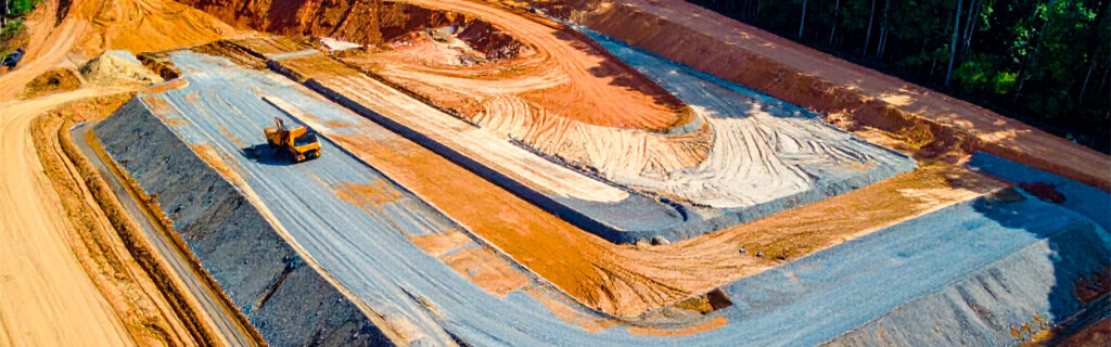
For property owners across Cherokee County, Ball Ground, and Canton planning grading projects for building sites, food plots, access routes, drainage corrections, and the range of other improvement types that grading serves on residential and rural North Georgia properties, understanding the specific factors that determine how much soil a grading project must move, how each factor is assessed at the specific site to produce accurate scope information rather than regional average assumptions, and how the factors combine to produce the total soil movement that the project requires gives the practical foundation for evaluating whether proposed grading scopes are accurately sized for the specific site’s conditions or whether they reflect regional average assumptions that the specific site’s actual conditions may significantly exceed.
Factor One: The Elevation Differential Across the Improvement Footprint
The elevation differential between the highest and lowest points across the proposed improvement footprint is the primary driver of earthwork volume for most grading projects because it determines the cut-and-fill magnitude that creating the design grade from the existing terrain requires. Every foot of average cut on the uphill side of a building pad or level surface corresponds directly to an equivalent foot of average fill on the downhill side if the project is cut-fill balanced, and both the cut volume and the fill volume are direct functions of the elevation differential that the existing terrain presents across the improvement footprint.
Why Elevation Differential Is Consistently Underestimated on Cherokee County Properties
The elevation differential across proposed improvement footprints on Cherokee County wooded properties is the factor most consistently underestimated from accessible observation positions, because the canopy surface that aerial imagery and perimeter-edge observation captures is substantially flatter than the ground surface beneath it. Trees of varying heights growing on rolling terrain produce a canopy surface whose height variation reflects the combination of tree height variation and terrain variation in a way that partially cancels out the terrain variation’s visual expression, making the canopy appear flatter than the ground it grows on. A terrain surface with ten feet of corner-to-corner elevation differential across a proposed building footprint will appear significantly flatter from aerial imagery and from the road than the actual ground-level differential because the taller trees in the low areas and the shorter trees in the high areas partially equalize the apparent canopy height above the terrain variation that the canopy conceals.
The only assessment approach that reveals the actual ground-level elevation differential rather than the canopy-concealed estimate is physically walking the proposed improvement footprint from its highest corner to its lowest corner at ground level through the interior terrain that aerial and perimeter observation cannot reach at the ground surface where the earthwork must create the design grade. This terrain walking, conducted specifically to note the elevation change from the highest to the lowest ground surface point within the proposed footprint, produces the actual elevation differential that earthwork volume calculation requires rather than the systematically underestimated differential that accessible observation provides. The difference between the walking-revealed and observation-estimated differentials on Cherokee County wooded terrain is consistently significant, routinely ranging from five to fifteen feet of additional elevation differential that the walking reveals relative to the observation-estimated differential that regional average grading cost estimates would apply to the project budget before the walking reveals what the site actually requires.
How Elevation Differential Translates Into Earthwork Volume
The earthwork volume that an elevation differential creates for a specific improvement footprint is a function of the differential magnitude, the footprint’s area, and the grading geometry that the cross-slope direction and magnitude create across the footprint’s extent. A simple cross-slope that drops uniformly from one side of the footprint to the other in a single direction creates earthwork volume proportional to the differential divided by two (representing the average cut on the uphill half and the average fill on the downhill half) multiplied by the footprint area. More complex terrain with the elevation varying in multiple directions across the footprint, or with abrupt grade changes at specific positions within the footprint, creates earthwork volumes that require the section-by-section analysis that the terrain walk produces rather than the simple calculation that uniform cross-slope geometry allows. Understanding that earthwork volume is directly proportional to elevation differential helps property owners recognize why the elevation differential that the terrain walk reveals is the single most important site-specific input to accurate grading scope and cost estimation, and why the accessible-observation underestimate of that differential produces the proportionally underestimated earthwork scope and cost that the walking-revealed actual differential then exceeds.
Factor Two: The Organic Soil Depth That Stripping Must Address
The organic topsoil depth that must be completely stripped from any zone where structural fill will be placed is the second primary factor determining grading soil movement scope, specifically for projects that place structural fill over the existing terrain rather than only reshaping the existing terrain through cut-and-fill without placing fill over organic material. This factor is specific to Cherokee County’s long-wooded residential and rural lots where the organic layer accumulates to depths that significantly exceed the generic four to six inch assumption that grading scope estimates without site-specific soil assessment routinely apply to the stripping scope component.
What Organic Depth Means for Stripping Scope
Organic stripping that must reach mineral subsoil below the organic layer before structural fill can be placed removes the full organic depth volume from the improvement footprint plus a buffer zone around it adequate for the grading equipment’s operation adjacent to the fill zone. A building footprint of five thousand square feet with twelve inches of actual organic depth rather than the estimated six requires twice the stripping volume that the estimate assumed, representing an additional five hundred cubic yards of stripped organic material that the project must remove from the footprint before fill placement can begin. This additional stripping volume requires additional equipment time, additional off-site disposal or on-site stockpiling management, and additional delay before fill placement can begin on the stripped footprint, all of which translate directly into additional project cost that the accurate stripping scope would have incorporated into the budget before commitment and that the inaccurate scope discovers as a mid-project cost addition when active stripping reveals what probing before commitment would have shown.
How to Determine Actual Organic Depth Before Grading Commitment
Soil probing at multiple points distributed across the proposed improvement footprint using a metal rod, soil probe, or hand auger that can be pushed or driven to the depth where mineral subsoil resistance clearly exceeds organic layer resistance reveals the organic depth at each probing point without the excavation that direct visual confirmation would require. Multiple probing points across the footprint rather than a single central probe account for the organic depth variation that even a single improvement footprint may present depending on the site’s land use history, drainage conditions, and soil biology across the footprint’s extent. Probing points at the footprint corners, midpoints along each edge, and the center produce the multi-point depth profile that represents the full footprint’s organic depth variation rather than the single-point estimate that a central probe alone would provide without the edge condition characterization that corner and edge probing adds. The probing investment before grading commitment is modest in time and entirely free of equipment cost when conducted with a hand probe, making it the most cost-efficient grading scope input available relative to the cost overrun it prevents when actual stripping depth significantly exceeds the assumed depth that commitment without probing consistently risks applying.
Factor Three: The Drainage Design Requirements
Drainage design requirements for the graded surface create soil movement scope that the elevation differential and organic stripping factors do not fully account for, specifically through the requirement that the graded surface’s drainage slopes achieve the minimum grades that adequate surface drainage requires at every point on the graded surface rather than only at the points where the terrain’s natural configuration would produce adequate drainage grades without specific grading to establish them.
Minimum Drainage Grades and Their Soil Movement Implications
A building pad that is leveled to within a few inches of flat requires additional grading to establish the minimum two percent drainage slopes away from the foundation perimeter in all directions that adequate perimeter drainage demands, because a truly flat surface provides no drainage direction preference and allows water to pool at any low point that random surface irregularity creates rather than flowing away from the foundation at the minimum grade that adequate drainage requires. The soil movement that establishing these minimum drainage grades on a near-flat building pad requires is modest per linear foot of perimeter but cumulative across the full foundation perimeter, and it must be accomplished at grading accuracy that actually achieves the minimum grade at every perimeter position rather than at the average minimum grade that allows some perimeter sections to fall below minimum while others exceed it.
Drainage grade requirements create more significant soil movement implications for the side ditch development that access route grading requires, because adequate side ditches on Cherokee County clay access routes must have sufficient longitudinal grade to convey drainage away from the route corridor at flow velocities that prevent sediment deposition from progressively filling the ditch and reducing its conveyance capacity over time. Side ditches on routes with inadequate natural longitudinal grade to convey drainage by gravity at adequate velocity require the route profile grading that creates the longitudinal grade the drainage design needs, which may require soil movement beyond the route surface grading that establishes the crown profile for surface water management, specifically to create the profile grade that the side ditch drainage design requires for year-round drainage conveyance at the velocity that prevents the progressive sediment accumulation that inadequate ditch grade consistently produces on Cherokee County clay routes over successive wet seasons.
Watershed-Based Drainage Infrastructure and Its Soil Movement Requirements
Drainage infrastructure development that installs culverts at drainage crossings and drainage swales at concentrated flow positions requires the soil movement that positioning this infrastructure at the elevations the hydraulic design requires creates, specifically the excavation for culvert bedding and barrel installation that must achieve the invert elevation the drainage design specifies for hydraulic continuity through the crossing and the fill compaction above the culvert that achieves adequate cover depth for the surface loading the culvert must support. Culvert installation that does not achieve the designed invert elevation at the crossing position creates the backwater or the inadequate cover condition that incorrect elevation produces, making the soil movement accuracy at culvert installation positions as important as the soil movement volume in determining the drainage infrastructure’s functional performance across its service life.
Factor Four: The Planned Use of the Improved Area
The planned use of the area being graded determines the performance standards that the graded surface must meet and therefore the soil movement scope required to achieve those standards, because different intended uses require different design grades, surface quality standards, and compaction specifications that each have distinct soil movement implications for the grading scope that achieves them.
Building Sites and Structural Subgrade Requirements
Building sites require the most demanding grading standards of any common improvement type, because the structural performance that buildings impose on their foundation subgrade over their service life demands organic-free subgrade throughout the fill zone, compaction to structural density specifications across the full fill depth, and drainage grades that maintain the foundation zone at stable moisture content rather than the seasonal saturation that inadequate drainage allows to cycle the clay through the volume change forces that structural loads and moisture cycling combine to create. Each of these building pad grading requirements creates soil movement scope beyond the terrain reconfiguration that simply leveling the site involves, specifically the stripping scope that organic removal requires, the compaction lift management that structural density demands, and the precision grading that accurate drainage slope achievement at every foundation perimeter position creates. Building site grading therefore consistently requires more soil movement per square foot of improved area than the same area graded for lower-performance-standard uses, because the building use’s structural requirements add the organic removal, compaction management, and drainage accuracy scopes that lower-performance uses do not impose on the same grading footprint.
Agricultural and Food Plot Uses
Agricultural and food plot grading that corrects drainage collection in chronically wet areas, establishes the gentle positive drainage that keeps productive areas from saturating after rain events, and smooths the surface irregularities that equipment operation efficiency requires does not need the organic removal and structural compaction that building uses demand because the soil’s natural structure rather than engineered fill provides the bearing that agricultural equipment imposes on the graded surface. Food plot grading therefore involves smaller soil movement scope per improved acre than building site grading for equivalent terrain improvement, creating a lower cost per acre of graded area that reflects the lower performance standard the use requires rather than a grading quality deficiency. Understanding that the planned use determines the appropriate performance standard, and that the appropriate performance standard determines the soil movement scope that achieves it, helps property owners avoid both the over-specification that applies building site grading standards to food plot grading and the under-specification that applies food plot grading standards to building site preparation, each of which produces either unnecessary soil movement cost or inadequate structural performance depending on the direction of the mismatch.
Access Route Grading and Its Use-Specific Requirements
Access route grading scope varies with the intended traffic type the route will serve, because routes intended to support only foot and ATV traffic require the basic crown profile and minimal side ditch development that light traffic management demands, while routes intended to support heavy equipment including concrete trucks, excavators on transport trailers, and agricultural equipment require the subbase preparation, crown profile accuracy, and drainage infrastructure capacity that heavy traffic loading and repeated wet-season access impose on route bearing capacity. The soil movement that access route grading requires per linear foot of route increases with the performance standard the intended traffic type demands, making the planned use’s traffic type the critical variable that the grading scope per route linear foot specifically reflects. Routes planned for future heavy equipment access that are graded to light traffic standards require the upgrade investment before heavy equipment can use them that adequate original planning would have incorporated into the initial grading scope at lower cost than the post-construction upgrade generates.
Factor Five: Cut-Fill Balance and Material Management
The relationship between the volume of material cut from the high areas of a grading project and the volume required as fill for the low areas, known as cut-fill balance, affects the total soil movement scope through the material management requirements that imbalance creates beyond the primary cut-and-fill operations that terrain reconfiguration involves.
A grading project that generates more cut volume from the uphill terrain reduction than the fill volume that the downhill area requires must dispose of the excess cut material either on-site in an area that accepts the additional fill without creating the drainage or structural problems that unplanned fill deposit creates, or off-site through the hauling that excess cut removal requires and that adds the hauling cost to the project scope beyond the grading operations that produced the excess. A project that requires more fill volume than the on-site cut produces must import fill material from an off-site source and pay the material and hauling cost that imported fill generates in addition to the grading operations that place and compact the imported material. Both cut-excess and fill-deficit conditions add soil movement cost to the project scope beyond the primary cut-and-fill operations that the terrain reconfiguration involves, and the pre-project terrain assessment that estimates the approximate cut-fill balance for the proposed grading design allows these additional costs to be anticipated in the project budget rather than discovered as scope additions when active grading reveals the imbalance that the terrain’s actual conditions create relative to the design’s volume requirements.
How the Factors Combine on Typical Cherokee County Grading Projects
On a typical Cherokee County building site preparation project, all five factors combine to produce a total soil movement scope that commonly exceeds the scope that regional average assumptions without site-specific assessment would estimate by a margin that pre-project terrain walking, soil probing, and drainage assessment reveals before commitment rather than active grading reveals after it. The elevation differential that the terrain walk reveals typically exceeds the perimeter-observation estimate by five to fifteen feet, adding proportionally to the primary cut-and-fill volume. The organic depth that probing reveals typically exceeds the generic assumption by four to eighteen inches on long-wooded sites, adding proportionally to the stripping scope. The drainage grades that the building use requires add the precision grading that adequate perimeter drainage demands at every foundation perimeter position. The building site’s structural subgrade requirements add the compaction management that structural density demands across the full fill depth. And the cut-fill balance that the terrain’s actual cross-slope geometry produces may create excess cut that the site cannot absorb or fill deficit that imported material must address.
Each of these factors is quantifiable through the pre-project assessment activities that terrain walking, soil probing, and post-rain drainage observation specifically address, and the total soil movement scope that the factor combination produces is accurately estimable from the assessment findings rather than from the regional averages that the assessments correct toward the actual site-specific values that each factor presents at the specific project location rather than the regional average that the assessment confirms or corrects depending on how closely the site’s actual conditions align with the regional average’s assumed values.
Frequently Asked Questions
How accurate can a grading scope estimate be before excavation reveals the actual site conditions?
Grading scope estimates based on thorough pre-project site assessment including interior terrain walking, multi-point soil probing, and post-rain drainage observation can achieve accuracy within ten to twenty percent of the actual grading scope on most Cherokee County residential and rural improvement projects, which is sufficient accuracy for realistic budget development and contractor scheduling while preserving the contingency allowance that the remaining uncertainty justifies. This accuracy level is significantly better than the accuracy achievable from regional average assumptions without site-specific assessment, which can underestimate actual scope by thirty to sixty percent or more on sites where the actual elevation differential, organic depth, and drainage requirements significantly exceed regional average values. The accuracy achievable through thorough pre-project assessment is not perfect because some conditions, specifically subsurface rock probability and precise organic depth variation across large footprints, cannot be fully characterized without the excavation that project execution provides, but it is sufficient to establish realistic budgets that include appropriate contingency for the remaining uncertainty rather than budgets built on assumptions that the site’s actual conditions may double or triple.
Does the time of year affect how much soil movement a grading project requires?
The time of year does not change the soil movement that the terrain configuration and intended use require, but it significantly affects the practical achievability of compaction quality within that soil movement and therefore the effective scope that adequately completed grading represents at different seasonal timing. A building pad grading project that requires compacted fill to structural density specification requires the same fill volume regardless of whether the grading occurs in August or March, but the August grading occurs when Cherokee County clay is most likely to be within the optimum moisture range for compaction while the March grading occurs when the clay is typically at elevated moisture from winter and spring rainfall that places it above compaction optimum, requiring either a moisture drying interval before fill placement can achieve specification density or accepting below-specification compaction that the wet-season moisture content makes unavoidable with the settlement consequences that below-specification compaction consistently produces. The time of year therefore affects the effective completeness of the soil movement, specifically whether the moved soil achieves the compaction standard that the intended use requires, rather than the volume of soil that the terrain and use requirements determine must be moved regardless of seasonal timing.
How does the presence of rock affect the soil movement requirements for Cherokee County grading projects?
Subsurface rock encountered during grading on Cherokee County ridge and upper slope positions where shallow rock probability is elevated by the geological erosion that has removed more soil depth over time requires breaking before it can be moved, which adds the rock breaking equipment time and the more difficult material handling that broken rock creates to the grading scope beyond what equivalent volume clay excavation would require. Rock breaking equipment costs substantially more per operating hour than clay excavation equipment and processes substantially less volume per hour, making the cost per cubic yard of excavated rock significantly higher than the cost per cubic yard of clay excavation. When rock volume is significant relative to the total grading scope, the rock breaking cost can represent a disproportionate fraction of the total grading project cost because the rock’s processing rate and equipment cost are both substantially higher than clay’s equivalents at the same volume. Pre-project rock probability assessment based on topographic position, surface outcrop observation, and probe resistance during soil probing informs a risk-appropriate contingency allocation for rock breaking scope that the project budget should include before commitment at ridge and upper slope positions where rock probability is elevated, rather than treating rock as an excluded scope item that the property owner discovers as an unexpected cost when active excavation encounters what pre-project assessment should have characterized as a probable condition worth contingency planning for.
What should a property owner provide to a grading contractor to enable the most accurate scope and cost estimate?
Property owners who provide the following information to grading contractors enable significantly more accurate scope and cost estimates than contractors can develop from general site observation alone without the specific site condition data that the property owner’s pre-project assessment activities can produce. The terrain walk findings, specifically the estimated elevation differential between the highest and lowest corners of the proposed improvement footprint and the direction and approximate magnitude of the slopes across each footprint section, give the contractor the primary earthwork volume input that the footprint’s area and the elevation differential together produce. The soil probing results, specifically the organic depth at each probing point across the proposed improvement footprint and the probe resistance pattern that reveals any rock indicators at shallow depth, give the contractor the stripping scope input and rock contingency assessment input that the project budget’s organic removal and contingency allowances require. The post-rain drainage observation findings, specifically where water flows toward or accumulates within the proposed improvement area from surrounding higher terrain, give the contractor the watershed characterization input that drainage infrastructure sizing requires for culvert selection and swale design. And the intended use description in enough detail to establish the appropriate performance standard for the graded surface, specifically including whether the use requires structural subgrade compaction, the traffic type and weight that access routes must support, and the drainage grade requirements that the use’s drainage performance standard demands, give the contractor the design standard inputs that translate terrain and soil conditions into the specific grading scope that achieves the performance the intended use requires.
Planning a Grading Project on Your North Georgia Property?
The soil movement that a grading project requires on a North Georgia property is determined by the five factors described in this article: the elevation differential that the existing terrain presents, the organic soil depth that stripping must address, the drainage design requirements that adequate surface and perimeter drainage demands, the planned use’s performance standards, and the cut-fill balance that the terrain geometry and design create between cut volume and fill requirement. Each of these factors is site-specific, each is accurately characterizable through the pre-project assessment activities that reveal actual site conditions rather than regional average conditions, and each contributes to the total soil movement scope in ways that generic regional average assumptions consistently underestimate for the specific combination of conditions that Cherokee County’s wooded terrain, deep organic soil, significant slopes, and high drainage demands present at improvement locations that accessible observation cannot adequately characterize at the accuracy that realistic grading scope and cost estimation specifically requires.
Bardin Outdoors works with homeowners, landowners, and builders across Ball Ground, Canton, Cherokee County, and North Georgia on grading and excavation projects whose scope is determined from thorough site-specific assessment of the elevation differential, organic depth, drainage requirements, and intended use performance standards that each project at each specific site requires, producing accurate scope and cost estimates that reflect what the site actually needs rather than what regional averages assume it typically presents. To learn more about how Bardin Outdoors approaches grading scope determination for North Georgia property projects, contact us.