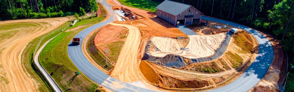
For property owners across Cherokee County, Ball Ground, and Canton managing rural and residential properties where dense vegetation, inadequate trail infrastructure, or terrain conditions have limited the practical usable space to a fraction of the owned acreage, understanding specifically how access improvements convert previously inaccessible acreage into genuinely usable space, what types of access improvements produce the most significant usable space expansion relative to their development cost, and how to evaluate which access improvements would most expand the practical usable space of the specific property gives the framework for approaching access development as the usable space investment it represents rather than the infrastructure cost without direct land value return that treating access improvements as overhead rather than improvement consistently leads property owners to underinvest in and undersatisfaction with the usable space their properties actually provide.
Why Usable Space and Total Acreage Diverge on North Georgia Rural Properties
The divergence between usable space and total acreage on Cherokee County rural properties is larger than the same divergence on properties in regions with less invasive species pressure, simpler terrain, and more consistent management history, because each of the specific characteristics that makes North Georgia rural land distinctive also makes the access conditions that connect owned acreage to its practical usable space more demanding to establish and more costly to maintain without the specific management investment that adequate access requires in this specific environment.
Chinese privet that has been accumulating in unmanaged wooded sections for multiple seasons without mechanical or chemical management creates the physical barrier that makes foot and vehicle navigation through those sections require the extraordinary effort that routine navigation cannot sustain as a management practice. The property owner who could theoretically reach the interior sections by pushing through the established privet density cannot realistically manage those sections through the effort that pushing through them requires for every management visit, making the theoretical reach a practical impossibility at the management frequency that adequate land stewardship requires. This gap between theoretical and practical reach is specifically the gap that access improvement closes by converting the push-through navigation that the density demands into the comfortable, efficient navigation that cleared corridors make possible at the effort level that routine management visits can actually sustain across a full management season without the physical demand that dense vegetation navigation creates as the barrier that makes interior sections practically inaccessible regardless of the owner’s theoretical ownership claim to them.
Cherokee County’s rolling terrain creates the access challenges that the gradient changes between terrain positions impose on vehicles and equipment that must navigate those changes to reach interior sections. Access routes that must traverse significant grades on Cherokee County clay need the drainage design that maintains bearing capacity through wet seasonal conditions rather than becoming the impassable mud that inadequate drainage consistently produces at elevated clay moisture content, and the access route grade management that keeps grades within the safe operating limits of the equipment that the interior sections’ management requires. These terrain-specific access demands are the characteristics that make the access infrastructure investment on North Georgia rural properties specifically consequential for the usable space that those properties provide, because terrain that limits access to interior sections removes those sections from the practical usable space as effectively as invasive density does, just through a different mechanism that access route design and maintenance specifically addresses.
How Different Access Improvements Expand Usable Space in Different Ways
Access improvements expand usable space through mechanisms that are specific to the improvement type and the access limitation the improvement addresses, producing usable space additions that differ in character, duration, and the management program that sustaining them requires depending on which access limitation the specific improvement converts from inaccessible to accessible condition.
Trail Corridor Development Through Dense Vegetation
Trail corridors developed through dense invasive vegetation sections by forestry mulching expand usable space in the specific form of the interior sections the trails connect to the accessible starting points they originate from, converting those interior sections from the practically inaccessible condition that vegetation density created into the routinely reachable condition that navigable trail corridors make them. A single trail corridor extending three hundred yards through dense privet from the primary trail network into a previously isolated interior section adds the full extent of that interior section to the practical usable space, because the navigation to and from it at the effort level that trail walking requires is the navigation that routine management visits can sustain repeatedly across a full management season rather than the extraordinary effort that push-through navigation demands and that cannot be sustained as the management approach for sections that require multiple management visits per season.
The usable space addition that trail corridor development produces is sustainable rather than temporary only when the trail maintenance program that prevents the invasive resprout from closing the cleared corridor is specifically planned and executed at the frequency that the dominant invasive species’ resprout rate requires. Invasive root systems with intact root energy reserves produce resprout growth that can close trail corridors to below functional width within two growing seasons without the mowing or herbicide management that corridor maintenance requires. Trail corridor development that is not followed by the maintenance program that keeps corridors open produces a temporary usable space addition rather than a durable one, which is the gap between the trail development investment and the management program it should initiate that understanding the connection between the two prevents from producing the temporary access that the development investment deserved to produce as durable access.
Primary Driveway Drainage Improvement
Primary driveway drainage improvement that restores year-round reliable bearing capacity to a driveway that currently becomes impassable during wet seasonal conditions expands usable space in the specific form of the management scheduling access that year-round driveway reliability provides compared to the seasonally limited access that wet-season impassability restricts. A property whose primary driveway becomes impassable for weeks during the wet spring and fall seasons is a property whose management activities, contractor mobilizations, and material deliveries can only be scheduled during the dry-season windows that the impassable wet-season driveway prohibits access through, effectively reducing the management calendar from the full year to the dry-season fraction of it that driveway impassability does not compromise. Drainage improvement that maintains year-round driveway bearing capacity expands the management calendar back to the full year, increasing the scheduling flexibility that management activities, contractor projects, and material deliveries have for accessing the property through the full annual cycle rather than through the compressed dry-season windows that wet-season impassability restricts them to.
Interior Access Route Extension to Remote Management Areas
Interior access route extension that reaches food plots, fence lines, timber sections, and other management areas currently accessible only by the impractical push-through navigation that dense vegetation or difficult terrain requires expands usable space by enabling the equipment-supported management that those sections’ productive function requires but that current access conditions prevent from reaching them. A food plot that can only be reached by pushing equipment through dense vegetation at the labor cost and equipment stress that push-through navigation imposes on each management visit is a food plot that cannot realistically be managed at the frequency that productive food plot maintenance requires, making the theoretical food plot area practically less productive than the access-supported food plot maintenance schedule would make it if equipment could reach it at the efficiency that adequate access provides. Interior access route extension that makes equipment-supported management reach previously difficult areas converts those areas from the under-managed condition that access difficulty creates into the adequately managed condition that equipment-supported maintenance at appropriate frequency produces, adding the productivity difference between under-managed and adequately managed condition to the value that the improved access generates for the interior sections it connects to the accessible management program.
Calculating the Usable Space Value That Access Improvements Add
The usable space value that access improvements add to North Georgia rural properties can be calculated in terms that allow the access improvement investment to be compared to alternative investments for expanding usable space or property value, specifically comparing the cost of access improvement that converts owned but inaccessible acreage to usable space against the cost of acquiring additional usable acreage that would be needed to add equivalent usable space to the property without the access improvement that converts currently owned but inaccessible acreage to the usable status that adequate access provides.
Rural acreage in Cherokee County that is accessible, managed, and in productive use for hunting, recreation, or agricultural purposes has a per-acre value that reflects its usable status. The same acreage that is owned but inaccessible and unmanaged has a lower per-acre value that reflects its potential rather than its current usable status. Access improvements that convert inaccessible acreage to usable status capture the value difference between the inaccessible and usable per-acre values across the acreage that the access improvement converts, which for the ten or twenty acres of inaccessible land on a typical Cherokee County rural property can represent a total property value improvement that significantly exceeds the access improvement investment that produced the conversion. This value calculation is not guaranteed to produce any specific outcome because property values are determined by market conditions that individual improvements influence without controlling, but the general principle that accessible, managed, productive acreage has higher per-acre value than inaccessible, unmanaged acreage of equivalent terrain and soil quality is consistent with the straightforward logic that usable space is worth more than equivalent space that cannot be used.
Which Access Improvements Produce the Most Usable Space Per Dollar Invested
Access improvements vary significantly in the usable space they add per dollar invested, depending on the acreage they open to practical use, the management efficiency they create for areas already accessible but inefficiently managed, and the duration for which the improved access persists without reinvestment at the maintenance level that sustaining the improved access requires.
Trail corridors that connect isolated interior sections to the existing accessible trail network through minimal clearing investment add the full extent of the connected interior sections to practical usable space at the modest trail development cost that short corridors through invasive vegetation require when the interior sections themselves require only connection to the existing trail network rather than the full interior opening that the sections themselves would require for their full extent to become accessible rather than just their connection to the trail network reaching them. These connecting corridors have the highest usable space addition per dollar invested of any access improvement type because they leverage the existing trail network’s extent by connecting sections to it rather than building new trail network to reach sections that the existing network does not approach.
Primary driveway drainage improvements that restore year-round reliability produce usable space additions in the form of management scheduling flexibility that is difficult to quantify in acreage terms but that has substantial practical value for properties whose management activities are most productively executed during the wet seasons when driveway impassability currently prevents scheduling them. The management calendar expansion that year-round driveway reliability enables is particularly valuable for fall improvement project scheduling, winter timber operations, and spring management activities that would benefit from early-season execution if the driveway’s wet-season impassability did not restrict scheduling to the dry-season windows that bypass these optimal timing periods.
How to Evaluate Which Access Improvements Would Most Expand Your Property’s Usable Space
Evaluating which access improvements would most expand a specific property’s usable space requires a systematic assessment of the currently inaccessible sections, the access limitations preventing their routine use, and the access improvement types that would address those specific limitations most efficiently relative to the usable space the improvements would add.
Begin by identifying every section of the property that is currently practically inaccessible for routine management and use, specifically noting why each section is inaccessible and what the access limitation preventing routine access is. Dense invasive vegetation between the accessible areas and the inaccessible section requires trail corridor development through the vegetation. Terrain conditions including steep grades or wet sections that prevent vehicle or equipment navigation require drainage improvement or grade correction along the route. Complete absence of any route between accessible areas and remote sections requires new route development from the accessible network to the isolated section. Each identified section’s inaccessibility has a specific cause that a specific access improvement type addresses, and mapping these causes across all inaccessible sections produces the access improvement program that prioritizes the improvements addressing the most significant inaccessibility causes with the highest usable space addition per investment dollar.
Prioritize the access improvement opportunities by the product of the acreage that each improvement would add to practical usable space and the intensity of the intended use of those sections, because improvements that add high-use-intensity sections to practical usable space produce more value per dollar than improvements that add low-use-intensity sections of equal acreage. A trail corridor that connects a high-priority food plot in a productive game movement corridor to the accessible trail network produces more practical value per dollar than a trail corridor of equivalent development cost that connects a remote low-productivity section without intended use. The prioritization that maximizes the practical value per dollar invested, rather than simply the acreage per dollar invested, produces the access improvement sequence that the available budget creates the most meaningful usable space expansion from rather than the sequence that simply adds the most acreage regardless of that acreage’s intended use intensity.
Frequently Asked Questions
How much of a typical Cherokee County rural property’s acreage is practically inaccessible without specific access improvements?
The fraction of a Cherokee County rural property’s acreage that is practically inaccessible without specific access improvements varies significantly with the property’s management history, terrain character, and the invasive species accumulation that years of unmanaged or under-managed sections have produced. Properties that have received consistent management with maintained trail networks, managed vegetation, and adequate driveway drainage typically have small fractions of their acreage that current access conditions make practically inaccessible. Properties that have been recently acquired with limited prior management history, or that have experienced management gaps of multiple seasons that allowed invasive vegetation to advance in previously accessible sections, can have substantial fractions of their acreage in conditions that current access infrastructure does not practically support routine management and use of. The most commonly encountered situation on Cherokee County rural properties that have had some management history but not comprehensive management across all sections is that approximately twenty to forty percent of the total acreage is in sections that current access conditions limit from routine management at the frequency and equipment access level that adequate management of those sections specifically requires, with the specific fraction depending on the property’s specific trail network coverage relative to its full extent and the invasive accumulation in the sections between and beyond the existing trail network.
Can access improvements be phased over multiple seasons to spread the investment while progressively expanding usable space?
Access improvements can effectively be phased over multiple seasons in a sequence that progressively expands usable space while distributing the investment across the seasons that the expansion program requires to reach its full intended extent. The most productive phasing sequence specifically establishes the connecting corridors from the existing accessible network outward toward the most remote intended destinations in the order that each season’s corridors create the accessible starting points from which the subsequent season’s corridors can extend further rather than requiring each season’s corridors to begin from the same fixed starting points that the existing network provides without the extension that each prior season’s improvement added to the accessible starting positions. This network-building sequence means that each season’s investment produces immediate usable space addition for the current season while simultaneously creating the infrastructure from which the subsequent season’s investment extends the network further, compounding the usable space addition across successive seasons in ways that a sequence without this network-building logic does not achieve because its individual segments do not create the starting point extensions that allow subsequent segments to reach the most remote destinations without the full network development that the sequential building approach accomplishes season by season rather than requiring the full network investment in a single season.
How does improving access affect property insurance and liability relative to the expanded usable space?
Property insurance and liability implications of improved access and expanded usable space are property-owner-specific considerations that depend on the property’s insurance policy terms, the intended uses that the improved access enables, and the property owner’s specific circumstances that an insurance professional familiar with rural property policies in Cherokee County is most qualified to advise on. The general principle that the specific insurance and liability implications of rural property improvements should be discussed with the property owner’s insurance provider before significant access improvements that substantially change the property’s use pattern are executed is the appropriate guidance for this article to provide, because the specific implications vary with policy terms, intended use types, and property characteristics that no general article can accurately characterize for the range of specific situations that individual property owners present. Property owners who are significantly expanding the usable space of their rural properties through access improvements that will enable recreational, hunting, or agricultural uses in previously inaccessible sections should specifically confirm with their insurance provider that the expanded use pattern is covered under their current policy and what if any coverage adjustments the expanded use pattern warrants before those uses begin in the newly accessible sections.
What is the relationship between improved property access and the property’s appeal to potential future buyers?
Improved property access consistently affects rural property appeal to potential buyers positively because buyers evaluating rural properties assess the practical usable space the property presents rather than the theoretical acreage the deed describes, and properties that can demonstrate the practical usable space of the full acreage through the accessible trail network, manageable vegetation, and functional driveway that allow a buyer to physically experience the property’s interior sections during evaluation consistently present more appealingly than equivalent acreage properties that cannot be practically explored because access limitations prevent buyers from reaching the interior sections that the deed includes but current access conditions isolate from the accessible edges. The buyer who can walk a connected trail network through the property’s managed interior sections, evaluate the food plots, timber sections, and natural features that the accessible trail reveals, and confirm the terrain, drainage, and soil conditions that the accessible interior tour provides forms a more complete and more favorable assessment of the property’s value than the buyer who can only evaluate the property from the accessible perimeter and the limited sections that the existing access conditions allow the evaluation to reach. Properties with developed access infrastructure that makes the full acreage experientially available to buyers during evaluation consistently attract buyer interest and achieve pricing that reflects the full acreage’s value rather than the accessible fraction’s value that limited access conditions make the practical basis for buyer evaluation.
Ready to Expand the Usable Space on Your North Georgia Property?
The usable space on North Georgia rural properties is limited not by the acreage the deed describes but by the access conditions that determine what fraction of that acreage can be practically reached, regularly managed, and actively used for the intended purposes that the property was acquired to serve. Access improvements that convert the inaccessible fraction into accessible, manageable, usable space expand the property’s practical usable area without acquiring additional land, at development costs that typically represent a fraction of what acquiring equivalent additional usable acreage would cost on today’s Cherokee County rural land market. The trail corridors that connect isolated sections to the existing trail network, the driveway drainage improvements that restore year-round access reliability, and the interior route extensions that bring management equipment to remote sections are each investments in converting owned but unusable acreage into the usable space that adequate access makes it, adding practical value to the property that each subsequent season of management and use through the improved access compounds rather than consuming.
Bardin Outdoors works with property owners across Ball Ground, Canton, Cherokee County, and North Georgia on access development projects including forestry mulching trail corridor development, grading and excavation for access route drainage improvement, and land clearing for interior section opening that convert currently inaccessible owned acreage into the practically usable space that improved access makes it for the first time or restores it to after the vegetation and terrain limitations that prior management did not address had isolated it from the accessible property management and use that adequate access specifically enables. To learn more about how Bardin Outdoors can help expand the usable space on your North Georgia property through improved access, contact us.