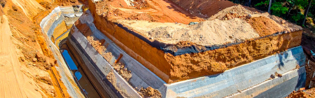
For property owners across Cherokee County, Ball Ground, and Canton planning excavation projects across the range of common residential and rural improvement types, understanding how excavation depth is determined for each project type through the specific interaction of functional requirements, soil conditions, and applicable standards gives the practical knowledge for evaluating whether proposed excavation scopes are appropriately designed for what the specific project at the specific site requires rather than applying generic depth assumptions that may be inadequate for the site’s specific conditions or excessive for the project’s actual functional requirements.
The Three Factors That Determine Appropriate Excavation Depth
Appropriate excavation depth for any specific project at any specific site results from three interacting factors that must each be evaluated and reconciled to produce the depth that serves the project’s functional requirements at the site’s actual conditions without unnecessary over- or under-excavation. These factors are the project’s functional depth requirement, the site’s soil condition depth requirement, and the applicable regulatory or structural standard depth requirement. The appropriate excavation depth for any specific project is the greatest depth that any of these three factors requires, because falling below the greatest requirement fails the factor that requires the greatest depth while exceeding it for the other factors is simply the necessary consequence of meeting the binding requirement.
The Project’s Functional Depth Requirement
Every excavation project has a functional depth requirement determined by what the project must accomplish below the existing ground surface to fulfill its intended purpose. A foundation requires excavation to the depth that places the foundation system at the bearing elevation where adequate structural support exists, which is below the organic topsoil that cannot bear structural load, below any fill that was not compacted to structural density standards, and to the depth that the foundation design specifies as adequate for the structural loads the building will apply. A pond excavation requires depth to the water storage volume the pond design specifies and to the clay or less permeable soil layer that the pond’s water retention requires when the surface soils are more permeable than adequate water retention allows. A utility trench requires depth to the burial elevation that provides the protection from frost, traffic loading, and physical damage that the utility type’s installation standards specify. The functional depth requirement is the minimum depth at which the project accomplishes what it was designed to do, and excavation to a lesser depth fails to accomplish the project’s purpose regardless of how well the shallower excavation was executed.
The Site’s Soil Condition Depth Requirement
The site’s actual soil conditions create a depth requirement that is independent of the project’s functional requirements and that may be shallower or deeper than those functional requirements at any specific site. On Cherokee County properties, the soil condition depth requirements most commonly affecting excavation depth are the organic topsoil depth that must be removed before structural fill can be placed, the seasonal high water table depth that foundations and drainage systems must respect in their positioning, and the bedrock depth at ridge and hilltop positions where shallow rock constrains the excavation depth that is practically achievable at reasonable cost. The organic topsoil depth on long-wooded Cherokee County properties can range from four to twenty-four inches depending on the site’s history, and the deeper end of this range requires proportionally more stripping depth before structural fill placement than the shallower end. The seasonal high water table depth affects foundation system type selection and drainage infrastructure positioning in ways that require excavation to accommodate the constraint rather than placing infrastructure at depths the seasonal water table will compromise. And subsurface bedrock at depths shallower than the project’s functional depth requirement limits excavation to the depth achievable through rock breaking rather than the depth that soil excavation would accomplish at equivalent cost.
The Applicable Regulatory or Structural Standard Depth Requirement
Regulatory and structural standards applicable to specific project types establish minimum depth requirements that the project must meet regardless of whether the functional and soil condition requirements would indicate a lesser depth as adequate. Building codes establish minimum foundation depth requirements that reflect the regional frost depth, soil bearing capacity standards, and structural performance expectations that the code’s authority has determined adequate for the building type in the local climate and soil context. Septic system installation standards establish minimum drain field depth and separation requirements from seasonal high water tables that protect water quality and system function regardless of what site-specific conditions might suggest as adequate from the property owner’s practical perspective. Underground utility installation standards establish minimum burial depths for each utility type that protect the utility from the frost, traffic, and physical damage risks that the standard’s depth requirement is specifically designed to prevent. Each of these regulatory and structural standards creates a depth requirement floor that the excavation design must meet at minimum, and may exceed if the project’s functional requirements or site soil conditions require greater depth than the applicable standard specifies.
How Excavation Depth Is Determined for Building Foundations
Building foundation excavation depth on Cherokee County properties results from the intersection of the building code’s minimum foundation depth requirement, the organic topsoil stripping depth that the specific site’s organic layer requires before structural fill can be placed, and the foundation design’s bearing elevation specification that places the foundation at adequate bearing depth on the mineral subsoil or engineered fill that the structural loads will bear on rather than on the organic material that adequate stripping must remove before bearing can occur.
The organic topsoil stripping requirement is the soil condition factor most consistently affecting building foundation excavation depth beyond the minimum building code requirement on Cherokee County’s long-wooded residential and rural lots. A building code that specifies eighteen inches of minimum foundation depth below grade on a site with twelve inches of organic topsoil above the mineral subsoil requires stripping the twelve inches of organic material plus an additional six inches of mineral subsoil excavation to reach the eighteen-inch code minimum depth at the mineral soil level where the structural standard is measured. The same code requirement on a site with twenty inches of organic topsoil above the mineral subsoil requires stripping the twenty inches of organic material plus the code minimum below that point, producing total excavation from grade significantly exceeding the building code’s minimum specification because the site’s organic depth requires the stripping that the code minimum does not account for at the surface elevation where the organic material begins.
Pre-project soil probing at multiple points across the proposed building footprint that reveals the actual organic depth before excavation scope is budgeted is the site assessment practice that most directly prevents the organic stripping depth discovery that produces mid-project scope additions when the actual organic depth significantly exceeds what the generic stripping depth assumption in the project budget anticipated. The probing investment before budget commitment is modest relative to the earthwork cost overrun that discovering the actual versus assumed organic depth during active stripping generates when the discrepancy is significant on long-wooded Cherokee County building sites.
How Excavation Depth Is Determined for Ponds and Water Features
Pond excavation depth on Cherokee County rural properties is determined by the water storage volume the pond design specifies, the water retention characteristics of the soil at the pond basin location, and the safety considerations that adequate bank slopes and minimum water depth across the pond’s full surface area require for the intended use and safety standards applicable to the planned pond.
The design depth required to achieve the pond’s intended water storage volume at the specific pond basin location depends on the basin’s surface area at the proposed water surface elevation and the depth-area relationship that the terrain profile creates within the proposed pond footprint. A basin with a large surface area may achieve the intended water volume at a relatively shallow average depth. A narrower, more confined basin may require greater depth to achieve the same volume in a smaller surface area. The terrain assessment that physically characterizes the depth to which the pond basin extends at the proposed pond location, combined with the surface area that the pond’s water surface elevation will create at that location, allows the depth-volume relationship to be established before pond design commits to a specific depth that the terrain may or may not support at the intended volume without excessive or insufficient excavation relative to the intended storage.
Water retention at the pond basin location requires that the excavated basin reach a soil horizon with adequate impermeability to retain water without excessive seepage loss, which on Cherokee County properties with their clay subsoil is typically achievable at depths within the clay profile before more permeable saprolite or rock is encountered, but which requires specific assessment at ridge and hilltop basin positions where shallow rock depth may limit excavation to depths above the clay layer that water retention requires. Pond basins excavated into permeable material without reaching the clay layer that retention requires can be made functional through bentonite or synthetic liner installation that creates the impermeability the soil profile cannot provide, but the depth-to-clay-layer assessment that reveals this requirement before pond construction begins is the information that allows the liner option to be planned and budgeted before construction rather than discovered as a pond performance failure after construction invested in the excavation that did not achieve the depth the retention required.
How Excavation Depth Is Determined for Drainage Infrastructure
Drainage infrastructure excavation depth on Cherokee County properties is determined by the hydraulic grade that the drainage system must establish between the collection points where water enters the system and the outlet points where it exits, the cover depth that protection from traffic, frost, and physical damage requires above the installed infrastructure, and the invert elevation requirements at drainage crossings where culverts must be positioned to convey flow beneath the crossing surface without creating backwater conditions that reduce the drainage system’s conveyance efficiency.
Drainage system hydraulic grade requirements establish the slope at which drainage pipes and culverts must be installed to convey flow by gravity from collection to outlet without the flat or adverse slope sections that allow sediment deposition, reduce flow velocity below the self-cleaning threshold, and create the hydraulic restrictions that reduce the system’s capacity below what the design intended. Achieving the hydraulic grade from the collection point’s required depth to the outlet point’s available elevation across the horizontal distance between them determines the profile elevation at every intermediate point along the drainage system, and the excavation depth at each intermediate point must place the pipe at the elevation that the hydraulic grade requires rather than at a convenient depth that the terrain’s existing surface might suggest as adequate.
Culvert invert elevation at driveway drainage crossings must be established at the elevation that provides the minimum cover depth above the culvert that the driveway’s traffic loading and the culvert material’s structural capacity require, while also achieving the drainage channel’s natural invert elevation at the crossing point so that the culvert does not create a backwater condition that reduces the channel’s approach flow velocity and promotes the sedimentation at the culvert inlet that backwater conditions systematically cause. This dual requirement, adequate cover above and hydraulic continuity through the crossing, establishes the culvert invert elevation at the crossing point from which the excavation depth is directly determined as the distance from the crossing’s existing grade to the culvert invert elevation that the dual requirements establish.
How Excavation Depth Is Determined for Utility Installations
Utility trench excavation depth on Cherokee County residential and rural properties is primarily determined by the applicable installation standard for each utility type that specifies the minimum burial depth that provides adequate protection from the frost, traffic loading, and physical damage risks that each utility’s burial depth requirement is specifically designed to prevent in the regional climate and use context.
Electrical service underground burial depth requirements in Georgia reflect the regional frost depth, which is relatively shallow compared to northern climates but not negligible at locations where rare but significant frost events can reach depths that inadequately buried electrical conduit would be affected by. The Georgia frost depth consideration affects electrical burial depth less than traffic loading protection does on properties where vehicle access routes cross the electrical service path, and the deeper burial depth required for adequate traffic loading protection at route crossings compared to the frost protection minimum in off-route sections produces the depth variation along the service path that the burial depth requirement’s different applicable standards at different locations along the trench create.
Water service burial depth requirements reflect the frost depth protection needed to prevent service line freezing during the infrequent but significant cold events that North Georgia’s climate delivers, which on most Cherokee County properties requires burial in the twelve to eighteen inch range as a practical minimum that provides adequate frost protection while not requiring the deeper burial that northern climates’ more severe frost penetration necessitates. Properties in low-lying terrain positions where cold air drainage concentrates and frost events are more severe than on surrounding higher terrain may warrant burial depths at the upper end or above the standard minimum range to protect against the frost penetration that the property’s specific thermal environment produces rather than the regional average that the standard minimum reflects.
How Subsurface Conditions Affect Achievable Excavation Depth on Cherokee County Properties
The subsurface conditions that Cherokee County’s specific geology creates at various depths beneath the soil surface affect the achievable excavation depth and the excavation approach required to reach specific depths at specific topographic positions in ways that significantly influence excavation project scope and cost beyond what the project’s functional depth requirements alone would establish.
Subsurface rock at ridge and hilltop topographic positions where geological erosion has removed more soil depth over time creates the excavation depth limitation that rock breaking rather than soil excavation is required to exceed and that project budgets must specifically account for rather than assuming that the functional depth requirement is achievable through soil excavation at all topographic positions regardless of the rock probability that the specific position’s geological context presents. Rock encountered during excavation at depths shallower than the project’s functional depth requirement creates the choice between rock breaking that is substantially more expensive per unit volume than soil excavation but that reaches the functional depth the project requires, redesigning the project to accommodate the shallower achievable depth through alternative approaches such as pier extensions for building foundations or alternative utility routing around the rock obstruction, or abandoning the proposed improvement location in favor of an alternative location where rock probability is lower and adequate depth may be achievable through soil excavation at reasonable cost.
The seasonal high water table depth at low terrain positions where drainage converges creates a subsurface condition that limits the practical excavation depth for open excavation to depths above the water table, because open excavation that reaches the water table produces water inflow that must be continuously managed through pumping or other dewatering measures before and during construction at the excavated elevation. Projects that require excavation below the seasonal high water table at these locations must specifically plan and budget for the dewatering that allows construction to proceed at the required depth, which adds cost and complexity relative to excavation at equivalent depths above the seasonal high water table that does not encounter the groundwater management requirement that below-water-table excavation imposes.
Why Pre-Project Soil Assessment Is Essential for Accurate Excavation Depth Determination
The soil condition factor that affects excavation depth at any specific site can only be accurately characterized through physical soil assessment at the proposed excavation location rather than from generic soil type descriptions, regional averages, or surface observation that does not reveal what exists at the depths that the excavation must reach. Pre-project soil assessment through probing, test pit excavation, or soil borings at the proposed excavation location provides the organic depth, rock depth, and water table depth information that allows excavation depth to be determined from the actual site conditions rather than assumed from the regional averages that may significantly differ from any specific site’s actual subsurface conditions.
The investment in pre-project soil assessment at proposed excavation locations is consistently modest relative to the excavation cost overruns that discovering actual versus assumed soil conditions during active excavation generates when the actual conditions require significantly more excavation depth, rock breaking, or dewatering than the generic depth assumptions in the project budget anticipated. A soil probe inserted at multiple points across a building pad footprint before foundation design is finalized produces the organic depth profile that stripping scope calculation requires at a fraction of the cost of the mid-project scope addition that discovering twelve inches more organic depth than the generic six-inch assumption anticipated generates during active stripping. A test pit at a proposed pond location before pond design commits to excavation depth reveals whether clay retention layers exist at accessible depths or whether liner installation should be planned and budgeted before the excavation investment in a basin that retention requires artificial lining for is made without this advance knowledge.
Frequently Asked Questions
How do contractors estimate the appropriate excavation depth during a site evaluation before the project begins?
Experienced local contractors estimate appropriate excavation depth during site evaluations through a combination of physical soil probing that estimates organic depth and rock resistance at multiple points across the proposed excavation footprint, topographic position assessment that indicates rock probability and seasonal high water table likelihood at the specific site, project type familiarity that provides the functional depth requirements and applicable regulatory standards for the specific project being evaluated, and the regional calibration from prior similar projects at similar sites in the same area that allows the specific site’s observable indicators to be interpreted through the lens of what those indicators have meant for excavation depth requirements on comparable prior projects. Contractors who combine thorough site assessment with regional project experience produce excavation depth estimates that are reliably accurate for budget development purposes on most Cherokee County improvement projects. Contractors who estimate excavation depth from general project type norms without site-specific assessment produce estimates that may be significantly inaccurate when the specific site’s organic depth, rock probability, or water table depth differs from the regional average that unadjusted norms reflect.
What happens when excavation reveals conditions that require greater depth than the original scope anticipated?
When excavation reveals conditions requiring greater depth than the original scope anticipated, the project faces the choice between proceeding to the greater depth that the revealed conditions require, which generates the scope addition and cost increase that the original budget did not include, or accepting an inadequately shallow result that the revealed conditions prevent from performing as the project intended. The appropriate response depends on why the greater depth is required and whether the greater depth is achievable through the original excavation approach or whether it requires additional equipment or techniques that the original scope did not anticipate. Organic material at greater depth than anticipated requires additional stripping scope that is achievable through the same equipment already on site and that should proceed before structural fill placement regardless of the cost addition it generates, because placing structural fill on inadequately stripped organic material creates the settlement that the additional stripping cost would have prevented. Rock at shallower depth than anticipated requires the rock breaking decision that the original scope did not budget for, and the options of breaking through the rock to the required depth, redesigning the project to accommodate the shallower achievable depth, or relocating the improvement to a lower-rock-probability alternative site should each be evaluated against the functional requirements and the cost implications of each option before proceeding with the most expensive option by default.
Does excavation depth affect the permit requirements for a project in Cherokee County?
Excavation depth can affect permit requirements for certain project types in Cherokee County when the depth and scope of excavation combined with the surface area of land disturbance cross the thresholds that trigger specific permit requirements. Building permits that cover foundation excavation are required for structural improvements and include foundation depth requirements that the permit’s inspection process confirms before foundation placement is approved. Septic system permits that specify the installation depth and elevation requirements for drain field components are required for septic installations and include depth-related requirements that soil evaluation and permit conditions establish for the specific site. Land disturbance permits under Georgia’s Erosion and Sedimentation Act are triggered by total land disturbance area of one acre or more rather than by excavation depth specifically, but deep excavation projects that involve significant surface area disturbance from spoil management and site preparation commonly reach the disturbance area threshold that the permit requirement triggers regardless of the excavation depth that the project requires. Pre-project inquiry with Cherokee County Building Permits and the applicable regulatory agencies before significant excavation project scope is committed is the regulatory compliance approach that confirms applicable permit requirements before work begins rather than discovering them during execution when addressing them retrospectively is significantly more disruptive and costly than the pre-project inquiry that would have identified and incorporated them into the project plan before commitment.
How does excavation depth relate to the fill requirements when creating a level surface from sloping terrain?
Excavation depth and fill depth are the complementary quantities that together create the level surface from sloping terrain that building pads, food plots, and other improvements requiring uniform grade across an existing slope require. On a cross-slope building site where the terrain slopes from one side of the improvement footprint to the other, excavation on the uphill side removes material from the terrain above the design grade while fill placement on the downhill side adds material below the design grade to raise the downhill section to the design grade elevation. The excavation depth on the uphill side and the fill depth on the downhill side are each determined by the distance between the existing terrain surface at each point and the design grade elevation that the improvement requires at that point, and the relationship between the cut volume from the uphill side and the fill volume required on the downhill side determines whether the project is cut-fill balanced, in excess cut that must be managed elsewhere on the property or removed from site, or in fill deficit that requires importing additional fill material to complete the downhill fill section. This cut-fill balance assessment that terrain assessment makes possible before excavation scope is committed allows the earthwork volume, cut-fill balance, and any import or export material management to be incorporated into the project scope and budget rather than being discovered as reactive additions when active excavation reveals the actual earthwork volumes that the terrain assessment would have characterized before commitment.
Planning an Excavation Project on Your North Georgia Property?
Excavation depth on North Georgia residential and rural property projects is a design outcome determined by the specific intersection of what each project type functionally requires, what the specific site’s soil conditions require to achieve that functional outcome, and what the applicable regulatory and structural standards specify as the minimum that structural adequacy demands. Understanding this intersection and the factors that each site’s specific conditions contribute to it is the knowledge that allows excavation project scope and cost to be accurately estimated before commitment rather than discovered through the scope additions that actual site conditions generate when those conditions differ from the generic assumptions that project planning without site-specific assessment substitutes for actual knowledge. The site assessment that reveals what the specific site’s organic depth, rock probability, and water table depth require from the excavation depth is the most valuable pre-project investment available for any excavation scope that those site-specific factors significantly affect, which on Cherokee County’s organic-deep, potentially rocky, seasonally wet terrain is most significant excavation projects planned without that assessment.
Bardin Outdoors works with homeowners, landowners, and builders across Ball Ground, Canton, Cherokee County, and North Georgia on grading and excavation projects whose excavation depth is determined from thorough site-specific assessment of the organic depth, rock conditions, water table, and regulatory requirements that each project type at each specific site requires, producing accurate excavation scope and cost estimates that reflect actual site conditions rather than generic assumptions. To learn more about how Bardin Outdoors approaches excavation depth determination for North Georgia property projects, contact us.