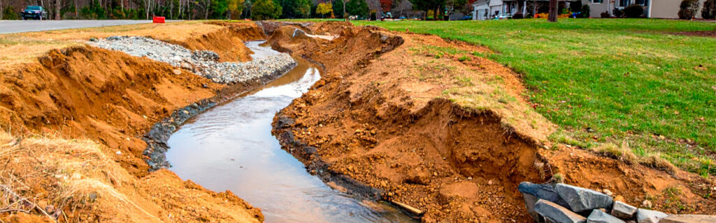
For property owners across Cherokee County, Ball Ground, and Canton planning any excavation project from a building foundation to a pond to a driveway, understanding how existing drainage patterns affect what the project must accomplish, why those patterns are often more complex and more consequential than initial site observation suggests, and what the evaluation process that accurately characterizes them requires in terms of observation timing and assessment method gives the practical foundation for approaching excavation projects with the drainage awareness that North Georgia’s specific soil, terrain, and rainfall conditions make essential rather than optional. The drainage design that serves the finished improvement across its service life cannot be better than the drainage understanding that informed it, which is why drainage pattern evaluation before design is the investment that most directly determines whether an excavation project produces a finished improvement that works through every season or one that reveals its drainage design’s inadequacy the first time North Georgia’s weather delivers what the design was not prepared to manage.
What Existing Drainage Patterns Are and Why They Matter
Existing drainage patterns are the routes that water follows when it moves across and through a property in response to rainfall and gravity. These patterns are established by the property’s terrain, expressed in the contour relationships that direct surface flow toward lower elevations, and by the soil’s permeability, which on Cherokee County properties is dominated by the red piedmont clay that becomes essentially impermeable when saturated and converts almost all rainfall to surface runoff under wet seasonal conditions. The patterns include both the obvious drainage features that any site observation would identify, such as streams and defined drainage channels, and the less obvious drainage concentrations that rolling terrain creates at specific slope positions without producing the physical channel that makes a drainage feature easy to notice and describe.
These patterns matter for excavation project planning because every excavation site is not a hydrologically isolated area that only receives the rainfall falling directly on its footprint. It is a site embedded within a larger drainage context that delivers water from the surrounding terrain to the site through the existing drainage patterns, and the volume of water that the site must manage comes from the full contributing drainage area that the existing patterns collect rather than only from the direct rainfall that the site’s footprint intercepts. A building site at the base of a slope in Cherokee County that receives drainage from a contributing area of one acre above it must manage the runoff from that full acre under the saturated soil conditions that the region’s frequent rain events produce on its impermeable clay subsoil, not simply the rainfall on the building site’s own quarter-acre footprint. The difference between these two drainage volumes is the difference between adequate drainage infrastructure and flooding of the first significant rain event.
Why Existing Drainage Patterns Are Harder to Observe Than They Appear
The practical challenge of accounting for existing drainage patterns in excavation project planning is that those patterns are most accurately observable under conditions that most pre-project site evaluations never encounter. Drainage patterns exist and matter under wet conditions when the terrain’s drainage is active. They are largely invisible under dry conditions when no surface flow is occurring and when the terrain features that concentrate drainage are not expressing their drainage functions. Most pre-project site evaluations occur under dry or moderately moist conditions because property owners find site visits more comfortable and contractors find assessment easier under those conditions. The result is that the drainage patterns that most significantly affect project design are evaluated from conditions that do not represent them accurately.
This observation timing problem is compounded on wooded North Georgia properties by the canopy and vegetation that conceal ground-level drainage features from aerial observation and limit what edge-position observation can assess about interior drainage behavior. A drainage swale that concentrates flow from a significant uphill watershed and delivers it to the exact location of a proposed building site may not be visible from any external observation position, particularly when the swale is a vegetated concavity rather than an incised channel that would be apparent even from above. Walking the interior of the property during or immediately following a significant rain event is the only observation method that reveals these less obvious drainage concentration features with the accuracy that project design decisions require, because the water that makes them visible is only present when drainage is actively occurring rather than when the site appears quiet and manageable under dry conditions.
How Cherokee County’s Terrain Creates Specific Drainage Pattern Complexities
Cherokee County’s rolling terrain, position at the transition between the southern Piedmont and the Appalachian foothills, and red clay soil together create drainage pattern complexities that generic excavation planning approaches developed for flatter terrain or more permeable soil conditions consistently fail to anticipate at the scale they actually occur on North Georgia properties.
Slope Position and Uphill Contributing Areas
The most consequential drainage pattern complexity on Cherokee County properties is the relationship between slope position and the uphill contributing area that delivers drainage to any lower-elevation site. Because Cherokee County’s clay soil becomes nearly impermeable under saturated conditions that the region’s rainfall pattern produces multiple times each growing season, the effective contributing area for any site is essentially the full uphill watershed above it rather than a fraction of that watershed that less saturated conditions would make the effective contributing area in regions with more permeable soils. This means that a site positioned at the base of a slope may receive drainage volumes during significant rain events that a project designer unaware of the contributing area’s extent would not anticipate from the site’s immediate vicinity, because the designer’s intuitive estimate of drainage volume was calibrated to rainfall on the visible immediate area rather than to the full watershed above the site that Cherokee County’s terrain and soil conditions deliver to lower slope positions during wet events.
Terrain Concavities That Concentrate Flow
Rolling terrain creates concavities where multiple slope faces direct their drainage toward a common lower point, concentrating flow volumes that no single slope face would generate individually. These concavities are frequently not apparent as defined drainage channels because their flow frequency is too low to produce the channel incision that more permanent streams create, but their drainage concentration during significant rain events is real and substantial regardless of the absence of a defined channel. Excavation projects located at or adjacent to these terrain concavities encounter drainage volumes during significant rain events that the site’s surface appearance during dry conditions would not suggest, and drainage infrastructure designed without knowledge of the concavity’s contributing drainage area will be systematically undersized for the events it must manage.
Seasonal High Water Table in Low-Lying Positions
Low-lying terrain positions on Cherokee County properties frequently have seasonal high water table conditions that bring groundwater close to the surface during the wet season months from November through April. These conditions are not visible during dry-season site evaluation because the water table has declined below the depth of normal soil observation by the time summer visits occur, but they are deeply consequential for foundation design, drainage infrastructure performance, and the bearing capacity of subgrades that excavation establishes at these positions. Building foundations placed at low-lying positions without assessment of the seasonal high water table encounter the moisture conditions during their first wet season of service that the design should have accounted for before the foundation was committed to a position and depth that the seasonal water table now challenges.
How Existing Drainage Patterns Should Influence Building Site Selection
Building site selection on Cherokee County residential and rural properties that accounts for existing drainage patterns produces sites where the drainage infrastructure required to protect the foundation from chronic moisture exposure is modest and directly achievable, because the site’s topographic position naturally sheds water away from the building footprint in most directions. Building site selection that ignores existing drainage patterns produces sites where the building is positioned at a drainage collection point that the existing patterns have always directed water toward, requiring extensive drainage intervention to redirect the water that will always arrive at that position regardless of how much infrastructure is installed to manage it.
The specific drainage pattern characteristics that most favor building site positions are natural positive drainage away from the proposed building footprint in most or all directions, minimal uphill contributing area delivering drainage to the site from surrounding higher terrain, terrain position on a shoulder or gently sloping area rather than in a concavity or at a slope base where multiple drainage paths converge, and no evidence of seasonal saturation or high water table from the soil color indicators that grayish or mottled subsoil reveals when examined in any nearby soil exposure. Sites that present these favorable drainage characteristics require the least drainage infrastructure to protect their foundations from chronic moisture exposure and produce the most reliable long-term foundation performance for any given investment in drainage design.
How Existing Drainage Patterns Affect Driveway and Road Design
Driveways and roads that cross Cherokee County’s rolling terrain must cross the drainage patterns that terrain creates rather than avoiding them, making the identification of those crossing points and the sizing of the culvert infrastructure that each crossing requires a fundamental drainage design activity for every driveway and road project on rolling North Georgia land. The existing drainage patterns establish where water concentrates during storm events, and the driveway or road that crosses those concentration points without culverts of adequate size for the concentrated flow will experience the overtop events that undersized crossings consistently produce when significant rain tests the infrastructure beyond the capacity it was designed for.
Identifying the existing drainage patterns that a proposed driveway or road alignment will cross requires walking the full proposed alignment during or following a rain event to observe where surface water flow crosses the alignment path, where terrain concavities direct drainage toward the alignment, and where the alignment’s position relative to the surrounding slope will make it the collection point for uphill drainage that the road’s shoulder drainage system must convey to the drainage outlets and culverts that remove it from the road corridor. This alignment drainage assessment, conducted under wet conditions that reveal what the driveway will actually encounter rather than what the dry terrain suggests, provides the drainage crossing location and contributing area information that culvert sizing requires for the driveway to perform reliably through the storms that will test it throughout its service life.
How Excavation Changes Existing Drainage Patterns and Creates New Ones
Every excavation project changes the existing drainage patterns at the project site to some degree, because earthmoving that creates new surface elevations and surface materials changes the drainage relationships that the pre-excavation terrain established. These changes can improve drainage conditions at the project site if the excavation design specifically accounts for how the earthmoving will change drainage and ensures that the changed patterns work better than the original ones. They can create drainage problems at the project site and adjacent areas if the excavation design does not account for the drainage pattern changes the earthmoving will create and those changed patterns collect water in positions where the design assumed water would not go.
The most common drainage pattern change from excavation projects that creates problems at adjacent unexcavated areas is the concentration of drainage from the excavated site to positions that the existing drainage patterns would have distributed across a broader area. A building pad created on a slope by cutting into the hillside and filling the downslope area creates a cross-slope berm that intercepts the natural slope drainage flowing across the hillside and concentrates it at the ends of the berm where the cut and fill meet the undisturbed slope. If the drainage design does not provide outlets for this concentrated end-berm drainage, the concentration erodes the slope at the berm ends and delivers concentrated flow to the areas adjacent to the building site that the berm ends discharge to. The adjacent areas that receive this concentrated drainage may experience erosion, wet conditions, and drainage infrastructure impacts that did not exist before the excavation project changed the drainage pattern that previously distributed flow across the full slope face rather than concentrating it at specific points.
How to Evaluate Existing Drainage Patterns Before Excavation Planning
Evaluating existing drainage patterns with the accuracy that excavation project planning requires involves a specific combination of observation timing, evaluation coverage, and assessment documentation that casual site visits under comfortable conditions do not provide. The following evaluation approach produces the drainage pattern understanding that adequate project design requires and that the time and effort invested in proper evaluation consistently demonstrates is more valuable than the preparation cost it requires.
Post-Rain Site Observation as the Primary Evaluation Method
Walking the proposed excavation site and the surrounding terrain within twenty-four hours of a significant rain event is the single most productive evaluation activity for understanding existing drainage patterns, because it reveals the actual drainage behavior that the site and surrounding terrain produce during the conditions that the excavation’s drainage design must manage rather than the quiet, apparently well-drained conditions that dry-season observation presents regardless of what the site’s drainage behavior actually is under wet conditions. During this post-rain walk, specific attention should be given to where surface water is actively flowing or has recently flowed based on wet soil and debris patterns, where water is pooling rather than flowing indicating collection points and low drainage gradient areas, where the terrain shows evidence of concentrated flow in channels or rills indicating drainage concentration under significant events, and whether any areas show the persistent saturation that seasonal high water table conditions produce independently of recent surface drainage activity.
Contributing Area Assessment From Topographic Context
Using a topographic map or digital elevation model of the property to identify the uphill contributing area that drains toward the proposed excavation site gives the drainage volume context that post-rain observation of the immediate site area alone cannot provide. The contributing area, meaning the total area of terrain that drains through or toward the proposed improvement site, determines the drainage volume the site must manage during significant events and therefore the size of the drainage infrastructure required to convey that volume. Topographic maps available through USGS or through land management applications that overlay topographic information on satellite imagery allow the drainage watershed above any proposed site to be traced and estimated before the project is designed, providing the contributing area information that drainage infrastructure sizing requires without physical measurement of the watershed area.
Contractor Assessment With Regional Drainage Experience
An experienced contractor with consistent project history on Cherokee County properties brings accumulated knowledge about how local terrain positions, soil types, and seasonal conditions interact to create the specific drainage behaviors that regularly challenge excavation projects in the region. This regional knowledge translates the general drainage evaluation principles described in this article into site-specific assessments that account for the local conditions that generic evaluation guidance cannot fully calibrate to. A contractor who has executed multiple projects on similar terrain in the immediate area has already encountered the drainage conditions that the proposed site’s terrain position and soil type will create, and their assessment of the specific drainage challenges the project will need to address draws on that accumulated experience rather than only on the general principles that the immediate site observation provides.
Frequently Asked Questions
How significantly do existing drainage patterns affect the cost of excavation projects in Cherokee County?
Existing drainage patterns affect excavation project costs through two mechanisms that each can produce significant cost differences between projects at favorable drainage positions and projects at challenging drainage positions. The first mechanism is the drainage infrastructure scope required to manage the water that the existing patterns deliver to the project site during significant events. Sites with large uphill contributing areas, concentrated drainage flows, or seasonal high water table conditions require more extensive drainage infrastructure than sites with minimal uphill drainage and natural positive drainage away from the improvement footprint. The second mechanism is the influence of existing drainage patterns on site selection and building pad positioning, where sites at drainage collection points require more earthwork to achieve the raised pad elevations that keep the foundation above seasonal water conditions than sites at natural drainage shedding positions where the terrain itself provides the drainage advantage. Evaluating drainage conditions before project scope is committed allows these cost drivers to be identified and incorporated in the budget rather than discovered during construction when they become reactive scope additions.
Can an existing drainage pattern that delivers water to a proposed excavation site be redirected away from the site?
Existing drainage patterns can sometimes be redirected through drainage infrastructure installation that intercepts uphill flow before it reaches the project site and conveys it to an alternative outlet that bypasses the site. The feasibility of this interception approach depends on the topographic context, specifically whether an interception point at adequate distance above the proposed site exists that allows a diversion channel or pipe to route the intercepted flow to an outlet that is topographically accessible without the diverted flow creating problems at its new outlet location. Diverting drainage that was previously flowing to a natural outlet at one location to an alternative outlet at a different location can create drainage concentration problems at the new outlet if the natural outlet at the original location provided adequate dissipation and the alternative outlet does not. The feasibility and appropriate design of drainage pattern interception should be evaluated by an experienced contractor or drainage designer who can assess whether the specific existing patterns at the proposed site are divertable to alternative outlets that can accept the diverted flow without creating new problems at the diversion destination.
How do existing drainage patterns affect the selection between a slab-on-grade and a raised foundation system?
Existing drainage patterns at the building site position affect foundation system selection through the moisture conditions they create at the foundation bearing depth and at the foundation perimeter across the seasonal cycle. Sites at favorable drainage positions that shed water naturally away from the building footprint in all directions can typically support slab-on-grade construction with standard perimeter drainage because the drainage patterns deliver minimal additional moisture to the foundation zone beyond what falls directly on the immediate site. Sites at unfavorable drainage positions that receive concentrated uphill drainage or that have seasonal high water table conditions may require raised foundation systems that elevate the building floor above the seasonal moisture level, deeper foundation systems that reach below the seasonal high water table to bearing at adequate depth, or extensive drainage intervention that manages the moisture the existing patterns deliver before it reaches the foundation zone. Understanding the existing drainage patterns at the proposed building site before foundation system selection allows the selection to be based on the actual moisture conditions the site presents rather than on the assumed conditions that dry-season observation suggests regardless of what the wet-season reality is.
What happens when existing drainage patterns are not accounted for in an excavation project and the project is completed?
When existing drainage patterns are not adequately accounted for in excavation project design and the project is completed without addressing those patterns, the drainage that was always going to arrive at the project site from the existing patterns arrives at the completed improvement rather than at the drainage infrastructure that would have managed it if the project had been designed with those patterns in mind. The specific consequences depend on the improvement type and the drainage pattern characteristics, but they consistently include some combination of chronic wet conditions at the building foundation or driveway subgrade from drainage accumulation that the project’s drainage infrastructure was not sized to manage, erosion at the building site margins or driveway edges where concentrated drainage arrives without adequate outlet infrastructure, premature deterioration of the improvement’s structural elements from the moisture cycling that chronic drainage exposure creates in clay soil, and in severe cases structural failure of the driveway, foundation, or other improvements when the saturated subgrade bearing capacity failure under load produces the deformation and damage that adequate drainage would have prevented. Correcting these consequences after completion requires retrofitting drainage infrastructure into a completed project at substantially higher cost and with substantially more disruption to the completed improvements than designing adequate drainage into the original project would have required.
Planning an Excavation Project on Your North Georgia Property?
Existing drainage patterns on North Georgia residential and rural properties are the governing physical reality that every excavation project must work with rather than discover reactively during or after project execution. The clay soil that makes most of the region’s rainfall into surface runoff during saturated seasonal conditions, the rolling terrain that concentrates that runoff at specific slope positions, and the contributing drainage areas that deliver that concentrated runoff to any lower-elevation project site all combine to make drainage pattern evaluation before excavation design the most consequential single pre-project activity available for ensuring that the finished improvement performs across the full seasonal range rather than revealing its drainage design’s inadequacy the first significant time that North Georgia’s weather delivers what the design was not prepared to manage. Conducting that evaluation under wet conditions that reveal what the drainage patterns actually produce, using topographic context to assess the contributing areas that the project site receives drainage from, and engaging an experienced local contractor whose regional knowledge calibrates generic drainage principles to Cherokee County’s specific conditions gives the excavation project the drainage design foundation that long-term performance requires.
Bardin Outdoors works with homeowners, landowners, and builders across Ball Ground, Canton, Cherokee County, and North Georgia on grading and excavation projects designed from thorough evaluation of the existing drainage patterns at each project site, producing improvements whose drainage infrastructure is sized and positioned for the actual drainage conditions the site presents rather than for the conditions that dry-season observation suggests. To learn more about how Bardin Outdoors approaches drainage-informed excavation planning for North Georgia properties, contact us.