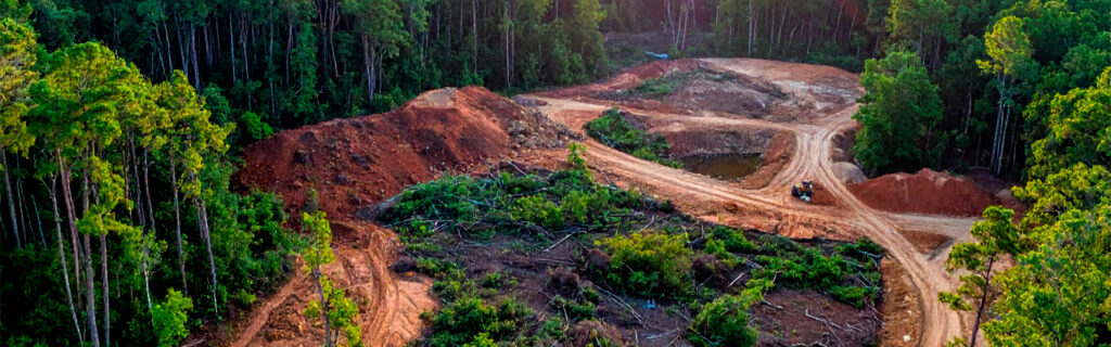
For landowners across Cherokee County, Ball Ground, and Canton planning clearing projects on wooded residential and rural lots where the dense vegetation, tree roots, uneven terrain, and limited equipment access that characterize local wooded properties create clearing challenges that simpler clearing contexts do not present at the same scale or with the same consequences for inadequate planning, understanding what each of these challenges specifically involves, how each affects the clearing project’s scope, timing, and approach, and what the planning that adequately addresses each challenge looks like in practical terms gives the foundational knowledge for approaching wooded North Georgia lot clearing with the terrain-specific planning accuracy that local conditions require rather than the generic clearing assumptions that local conditions consistently and expensively challenge.
Challenge One: Dense Invasive Vegetation and Its Root Energy Persistence
The dense invasive vegetation that characterizes unmanaged wooded North Georgia lots is not the vegetation that simpler clearing contexts address. It is specifically the vegetation that Cherokee County’s warm, wet climate, its native canopy structure that creates the partially shaded conditions that invasive understory species are specifically adapted to dominate, and its abundant seed and root dispersal networks have produced across essentially every unmanaged wooded property in the region at the density and biological persistence that make it the primary clearing challenge that distinguishes local wooded lot clearing from clearing in other contexts.
What Established Privet Density Means for Clearing Equipment
Chinese privet that has been establishing without management for three to five or more seasons develops stem diameters in the one to four inch range at densities that can exceed thousands of stems per acre, creating a combined stem mass that exceeds the processing capacity of owner-operated brush mowing equipment designed for lighter vegetation while presenting a processing challenge for professional forestry mulching equipment that is calibrated to this stem size and density range but that requires more operating time per acre to process than lighter vegetation at smaller stem diameters would require. The clearing equipment time required to process established privet at multi-inch stem diameters and high density is substantially more per acre than the time required to process lighter vegetation at equivalent acreage, and the acreage estimates that property owners develop from their visual assessment of the vegetation from accessible positions consistently underestimate both the density and the stem development of the established populations within the dense section because the edge observation that is the most accessible assessment position provides a partial view of the vegetation’s outer edge rather than the full interior density that equipment encounters throughout the section rather than only at its accessible perimeter.
The Root Energy Reserve Challenge That Mechanical Clearing Alone Cannot Resolve
The most significant clearing challenge that established invasive vegetation on North Georgia wooded lots presents is not the above-ground density that mechanical clearing equipment addresses during the clearing event but the root energy reserves that decades of unmanaged establishment have accumulated in the root systems that mechanical clearing does not remove from the soil. These root energy reserves drive vigorous resprout growth from the intact root systems within four to eight weeks of mechanical clearing under active growing season conditions, producing resprout at vigor and density that reflects the full root energy reserves available rather than the diminished reserve that combined mechanical and chemical treatment produces progressively across successive treatment seasons. Property owners who expect mechanical clearing alone to permanently resolve the established invasive vegetation on their wooded lots are expecting the outcome that the combined mechanical and chemical treatment program produces rather than the outcome that mechanical clearing alone consistently produces, which is vigorous resprout that returns cleared areas toward pre-clearing density within two growing seasons without the herbicide follow-up that root energy depletion requires to prevent this reversion.
Understanding this root energy persistence challenge before the clearing commitment is the planning knowledge that most consistently determines whether the clearing investment produces the lasting improvement the property owner intended or the temporary clearing followed by recurring reversion that mechanical clearing without combined treatment consistently generates. The clearing plan that includes herbicide follow-up treatment of resprout at six to twelve inch stem height as a specifically scheduled component of the clearing program rather than as a possible future addition when resprout appears converts the mechanical clearing investment from the first event of recurring temporary clearances into the first step of the combined treatment program that progressively depletes root energy and produces the lasting improvement that the property owner’s clearing investment deserves to produce.
Challenge Two: Tree Roots and Their Implications for Site Preparation
The root systems that decades of wooded development has created in the soil beneath North Georgia wooded lots create clearing challenges that extend beyond the above-ground clearing that mechanical equipment addresses to include the below-grade organic material that structural site preparation must specifically address for any subsequent improvement that places loads on the cleared site.
Organic Soil Depth on Long-Wooded Sites
The organic topsoil layer that must be completely removed from any zone where structural fill will be placed before that fill can be compacted to structural density standards ranges from four to six inches on previously disturbed or cultivated sites to eight to twenty-four inches on the long-wooded North Georgia sites where decades of leaf litter accumulation, root turnover, and soil biology have produced the deep organic horizon that distinguishes these sites from previously managed or agriculturally used properties. Every inch of actual organic depth above the generic four to six inch assumption that clearing and site preparation budgets without site-specific soil probing commonly apply represents additional stripping scope and cost that the project must address before the structural subgrade that subsequent improvements require can be established. The difference between a six-inch and an eighteen-inch organic layer across a five-thousand square foot building footprint represents approximately five hundred cubic yards of additional stripping that the deep organic site requires relative to the shallow organic assumption, which translates directly into additional equipment time, additional organic material management, and additional project cost that probing before commitment would have incorporated into the budget while active stripping after commitment discovers it as an unexpected addition.
Root Mass Settlement Risk in Structural Fill Zones
Root masses from cleared trees that remain in the soil within zones where structural fill will be placed above them create settlement voids as the buried root material decomposes after the clearing that killed it but did not remove it from the structural zone. The settlement that buried root decomposition produces in the fill above it is progressive, becoming apparent in the surface above the decomposing root mass months to years after the fill was placed, and appearing as the surface depression, slab cracking, and structural movement that the property owner experiences as a construction quality failure when the actual cause is the site preparation quality failure that allowed organic material to remain in the structural zone where the decomposition that creates the settlement was always going to occur. Addressing root mass settlement risk in structural fill zones requires specifically removing the larger root masses and stumps from within the structural fill zone during the clearing and stripping phase, and probing the cleared and stripped subgrade for buried root material before fill placement begins rather than placing fill over the stripped subgrade and discovering the root material presence through the settlement its decomposition produces after the fill and the improvements above it are in place.
Challenge Three: Uneven Terrain Beneath the Wooded Canopy
The terrain beneath wooded North Georgia canopy is consistently more variable at the ground level than the canopy surface that aerial imagery and accessible perimeter observation makes visible from accessible positions outside the wooded section, and this terrain variability creates clearing challenges in the form of equipment operation complexity on irregular ground and earthwork scope surprises when the terrain that clearing reveals requires more substantial grading than the accessible observation assessment estimated before clearing exposed what was actually beneath the canopy.
Equipment Operation on Sloped and Irregular Wooded Terrain
Forestry mulching and clearing equipment operating on the sloped, irregular terrain that wooded North Georgia lots present encounters the equipment stability and operating efficiency challenges that flat terrain operations do not generate at the same frequency or severity. Slopes within the clearing area that approach the safe operating gradient for the specific equipment model require the operator to adapt the processing approach to maintain equipment stability across the terrain variation that the clearing area presents, sometimes requiring processing from the downhill side rather than the uphill side at specific steep terrain positions, or requiring the operator to establish the processing pattern from the most accessible terrain positions toward the steeper sections that the accessible positions provide stable approach angles to rather than the uniform processing pattern that flat terrain allows without the slope-specific approach adaptation that steep terrain demands. These terrain-adaptation requirements reduce the processing rate per operating hour on significantly sloped wooded terrain relative to the flat terrain processing rate, making the per-acre processing time on typical North Georgia wooded lots higher than the flat terrain processing rate that regional average estimates often apply to clearing scope and cost estimates without specifically accounting for the terrain-driven processing rate reduction that sloped, irregular terrain consistently creates.
Terrain Revelation as a Post-Clearing Site Assessment Opportunity
Clearing of wooded North Georgia lots reveals the actual terrain conditions beneath the vegetation for the first time since the vegetation covered it, providing the post-clearing terrain assessment opportunity that should be specifically planned as a step between clearing completion and the subsequent improvement planning that the revealed terrain conditions should inform rather than allowing subsequent improvements to proceed on the pre-clearing terrain assumptions that clearing’s revelation may have significantly revised. The building site that the pre-clearing aerial assessment suggested was positioned on relatively level terrain may reveal eight to twelve feet of corner-to-corner elevation differential when clearing exposes the actual ground surface, requiring the post-clearing site assessment that specifically walks the revealed terrain and characterizes what clearing has revealed before the earthwork scope and budget for the building site development are committed to the conditions the assessment has now made specifically characterizable rather than requiring estimation from the pre-clearing assessment that the actual terrain substantially exceeded. Planning specifically for the post-clearing terrain assessment as the information-gathering step that informs subsequent improvement planning captures the full value that clearing’s terrain revelation provides rather than treating the clearing as only the vegetation removal event and missing the site knowledge opportunity that the revealed terrain specifically creates for the subsequent improvements that need accurate terrain information to be planned accurately.
Challenge Four: Limited Equipment Access on Wooded Lots
Equipment access to the clearing area on wooded North Georgia lots creates challenges that open, previously cleared properties do not present to the same degree because the vegetation density, terrain conditions, and route limitations that wooded lots impose on equipment navigation to the clearing area add preliminary clearing scope, access route development, and equipment selection constraints that clearing projects on properties with established equipment access do not require.
Corridor Clearing Before Primary Clearing Can Begin
Wooded lots where the primary clearing area is interior to the property and separated from the public road or primary access point by dense vegetation or terrain conditions that prevent the primary clearing equipment from navigating directly to the clearing area require preliminary corridor clearing that establishes the access route before the primary clearing equipment can reach the treatment area. This preliminary corridor clearing is not part of the primary clearing scope that the treatment area’s vegetation requires to be addressed. It is the prerequisite preparation that the primary clearing equipment’s access to the treatment area requires before the primary clearing can begin, and its cost and time requirements must be specifically incorporated into the clearing project scope rather than assumed to be included in the primary clearing scope that the treatment area’s acreage and vegetation density determine without the access corridor component that the equipment’s route to the treatment area also requires.
Identifying the equipment access corridor requirements before the clearing project scope is committed requires physically walking the proposed equipment route from the public road or primary access point to the clearing area, specifically assessing the route width, overhead clearance, ground bearing capacity, and any terrain features that the clearing equipment must navigate. Each access limitation identified during this assessment represents a preliminary clearing or access preparation scope item that the project must address before primary clearing can begin, and the aggregate of these preliminary requirements determines whether the project’s access preparation scope is modest and straightforward or substantial and potentially access-route-development-scale in cost and complexity.
Equipment Selection Constraints From Access Limitations
Access limitations along the equipment route to the clearing area may constrain the equipment options available for the primary clearing to the equipment sizes and types that the access limitations allow to pass through rather than the equipment that the primary clearing area’s vegetation and terrain conditions would most efficiently employ without the access limitation constraint. A clearing area that would be most efficiently treated with large-format forestry mulching equipment that the access route’s width or gate dimensions prevent from reaching the treatment area must be treated with the smaller equipment that the access route accommodates, which processes the same vegetation at a lower production rate per operating hour that the larger equipment would have achieved, increasing the operating time and cost for the same treatment area. Identifying the access constraints that limit equipment selection before the clearing project scope is committed allows the clearing approach to be designed for the equipment that the access allows rather than the equipment that the treatment area alone would most efficiently employ, producing the realistic scope, cost, and timeline estimate that equipment selection constrained by access limitations requires rather than the optimistic estimate that assumes the most efficient equipment can reach the treatment area without the access limitation assessment that reveals whether it actually can.
Challenge Five: Native Tree and Ecological Feature Preservation
Wooded North Georgia lots contain native trees and ecological features whose preservation during clearing requires planning and communication that clearing projects on properties without these preservation priorities do not require at the same level of specificity. The mature oaks, hickories, native understory species, and natural features that give wooded North Georgia properties their distinctive character and long-term value are the elements that clearing must specifically navigate around rather than process with the surrounding invasive vegetation that is the actual clearing target, and preserving them requires the specific identification and physical marking that translates the preservation intent into the field instruction that clearing operators can follow during active equipment operation.
The preservation challenge that wooded North Georgia lot clearing specifically creates is that the native trees and ecological features worth preserving are often within or adjacent to the invasive vegetation that the clearing is intended to address, making the clearing operation a selective activity that removes the invasive surrounding while navigating around the preserved elements rather than the uniform clearing that removing everything within the clearing boundaries would be. This selectivity requires the preservation walk that physically enters the clearing area before equipment arrival, identifies each preservation target, and marks it with bright flagging tape at approximately five to six feet of height before the clearing equipment begins operating. Without this physical marking, the clearing operator’s preservation decisions during active operation are based on general instructions and personal judgment for each encountered element rather than the specific property owner identification at each preservation target that physical marking provides, producing inconsistent preservation outcomes that specific marking specifically prevents by removing the judgment uncertainty at each preservation target position during the active clearing operation.
Challenge Six: Regulatory Considerations Specific to Wooded North Georgia Properties
Wooded North Georgia lots present regulatory considerations that open properties without wooded drainage features rarely encounter at the same frequency or with the same consequence for clearing projects that inadvertently proceed within regulated zones without the pre-clearing regulatory assessment that identifies and avoids those zones before clearing creates the regulatory compliance problem that adequate pre-clearing assessment specifically prevents.
Georgia’s stream buffer requirements establish minimum setback distances from regulated watercourses within which land-disturbing activities are restricted, and wooded North Georgia lots commonly contain seasonal drainage features including intermittent streams and drainage channels that may qualify for stream buffer protection but that the dense vegetation covering them prevents from being clearly identified from accessible positions before clearing exposes their character and position. Clearing that proceeds without pre-clearing identification of potential regulated drainage features may inadvertently disturb stream buffer zones when the clearing equipment encounters and processes vegetation within the buffer zone of a drainage feature that the clearing’s pre-planning did not specifically identify and route around. Post-rain site observation before clearing begins, conducted specifically to identify any drainage features on or adjacent to the clearing area that show flowing water or defined channels during rain events, provides the drainage feature identification that allows clearing boundaries to route around potential regulated buffer zones rather than discovering the drainage feature within the clearing area after the clearing has already created the buffer zone disturbance that adequate pre-clearing assessment would have prevented.
How to Plan Wooded Lot Clearing to Address These Challenges
Addressing the challenges that wooded North Georgia lot clearing presents requires pre-clearing planning activities that each specifically address the challenge category they inform, together producing the comprehensive clearing plan that can execute successfully rather than discovering what adequate planning would have addressed during the clearing execution that post-discovery corrections are significantly more expensive and more disruptive to incorporate than pre-commitment planning would have been.
Physical entry into the clearing area for the preservation walk that identifies and marks native trees and ecological features before equipment arrives addresses the preservation challenge that the clearing operation requires selectivity to navigate rather than uniform processing. Post-rain drainage observation before clearing commitment addresses the regulatory challenge that wooded drainage features create for clearing boundary planning. Soil probing at multiple points across any zones that will receive structural fill addresses the organic depth challenge that site preparation scope requires to be accurately characterized before commitment. Equipment route walking from the road to the clearing area addresses the access limitation challenge that equipment selection and preliminary clearing scope depends on knowing before the clearing project scope is committed. And specifically incorporating herbicide follow-up treatment of resprout as a planned component of the clearing program rather than a possible future addition addresses the root energy persistence challenge that mechanical clearing alone consistently fails to resolve permanently. Together these planning activities address the challenges that wooded North Georgia lot clearing specifically presents with the pre-commitment preparation that each challenge requires rather than the reactive responses that discovering each challenge during clearing execution consistently makes more expensive and more disruptive than the planning that would have addressed them before commitment.
Frequently Asked Questions
How does the age of the invasive vegetation affect how challenging it is to clear on North Georgia wooded lots?
The age and establishment duration of invasive vegetation on North Georgia wooded lots affects clearing challenge in two distinct ways that each independently increase the clearing difficulty and the post-clearing management program intensity that older, more established invasive populations require relative to recently established populations at lower density and smaller stem size. Above-ground clearing challenge increases with establishment age through the stem diameter development and density accumulation that each additional unmanaged growing season adds to the population, increasing both the processing time per acre that the forestry mulching equipment requires to process the larger stems at higher density and the proportion of stems that exceed the size threshold where the equipment’s processing rate is most efficient and begins declining toward the lower rate that the largest-diameter stems at the density that established populations present require from equipment that is processing at the upper end of its designed capacity. Post-clearing management challenge increases with establishment age through the root energy accumulation that each additional unmanaged growing season adds to the root systems that drive resprout vigor, making the resprout from older, longer-established populations more vigorous and more persistent per treatment event than the resprout from recently established populations whose root energy reserves have not had the same accumulation period to develop the vigor and density that older establishment’s fuller root energy reserves produce in the growing seasons following mechanical clearing.
Does the time of year affect which clearing challenges are most significant for wooded North Georgia lot clearing?
Time of year affects the relative significance of different clearing challenges in ways that make some challenges more manageable at specific seasonal timing and some challenges more consequential at others. Dormant season clearing from November through February reduces the above-ground biomass challenge by clearing deciduous invasive vegetation at its minimum annual biomass, when leafless conditions create lower volume per stem and lower processing resistance per unit of cleared area than the same vegetation at peak growing-season biomass would present to the same equipment. Dormant season clearing also provides the most favorable conditions for preservation target identification because leafless canopy allows native trees and preserved species to be seen through the understory that growing-season foliage would obscure at positions within the clearing area. Growing-season clearing from May through September presents the maximum above-ground biomass challenge but provides the herbicide follow-up timing opportunity that same-season resprout management captures when clearing is conducted far enough before growing season end to allow resprout to reach the six to twelve inch treatment height before the growing season’s declining temperatures reduce herbicide transport efficiency. The access limitation challenge is most significant during wet spring and fall periods when clay bearing capacity is most reduced at soft route positions that dry-season clearing navigates without the bearing capacity failure that wet-season clearing encounters at those positions if adequate drainage design was not established before the clearing project’s wet-season timing exposes the access route’s drainage limitations.
How does the presence of mature native canopy above the invasive understory affect the clearing approach and scope?
Native canopy above the invasive understory on wooded North Georgia lots significantly affects the clearing approach by establishing the selective clearing requirement that makes the clearing a precision operation navigating around preserved canopy trees rather than the uniform clearing that removes all vegetation regardless of its species identity and ecological value. This selective requirement affects the processing pattern that the operator uses, requiring navigation around preserved canopy trees’ positions throughout the treatment area rather than the systematic passes that uniform clearing allows, and it requires the pre-clearing preservation marking that identifies each canopy tree’s specific position for the operator before clearing begins rather than relying on the operator’s in-operation identification that active processing speed makes inconsistent. The native canopy’s presence also affects the clearing scope by potentially limiting the equipment’s approach angles to specific positions that allow the cutting head to process the invasive understory without the canopy contact that processing from other angles would create with the canopy branches extending over the treatment area. These approach angle limitations from canopy presence may require the operator to process some understory positions from less efficient angles that the canopy avoidance requirement dictates rather than the most efficient approach angles that canopy-free clearing would allow at those positions, adding operating time to the selective clearing scope relative to what clearing without the canopy navigation requirement would require at the same area.
What should a property owner tell a clearing contractor to ensure the clearing adequately addresses the challenges specific to their wooded lot?
Property owners whose clearing projects will encounter the challenges described in this article should specifically communicate the following information to clearing contractors before project scope is committed: the preservation priorities that identify which native trees, native understory species, and natural features within the clearing area should be specifically navigated around during clearing, including whether the property owner will conduct the physical marking before equipment arrives or whether the contractor’s pre-clearing walkthrough should include preservation marking guidance from the property owner’s on-site presence; the access route conditions from the public road to the clearing area including any width constraints, overhead clearance limitations, soft soil sections, and gate dimensions that affect equipment selection and access preparation scope; the intended subsequent use of the cleared area including any structural improvements that will require organic-free subgrade, any areas where structural fill will be placed, and any access route weight capacity requirements that the subsequent use imposes on the cleared and prepared site; the results of any pre-commitment soil probing that the property owner conducted across structural improvement zones, so the contractor can incorporate the actual organic depth findings into the stripping scope rather than applying generic assumptions; and any drainage features observed during post-rain site assessment that should be specifically avoided during clearing or that should inform clearing boundary positioning relative to potential stream buffer zones. This comprehensive pre-clearing communication converts the contractor’s project knowledge from what the clearing area’s vegetation visible from accessible positions suggests to what the property owner’s pre-clearing assessment specifically reveals about the conditions that the clearing will encounter and address, producing a more accurate scope and a more informed clearing execution than contractor knowledge limited to accessible observation provides without the property owner’s site assessment input.
Planning a Wooded Lot Clearing Project in North Georgia?
Land clearing on wooded North Georgia lots is more challenging than clearing on simpler properties in other regions because the dense invasive vegetation, deep organic soils, uneven terrain, limited equipment access, preservation requirements, and regulatory considerations that characterize local wooded properties each create clearing challenges that generic clearing planning assumptions inadequately address and that site-specific pre-clearing assessment specifically informs. The clearing project that adequately addresses each of these challenges through the pre-commitment planning activities that reveal the actual site conditions, identify the actual preservation targets, assess the actual access limitations, and plan the actual post-clearing management program that root energy persistence requires produces clearing outcomes that serve the property owner’s improvement vision with the accuracy and durability that generic planning cannot match. The clearing project that proceeds without this planning consistently discovers the challenges it did not account for during the clearing execution that post-discovery correction makes significantly more expensive than the pre-commitment planning that adequate preparation would have invested in before the scope and cost that the discovered challenges require were committed to the project timeline and budget that did not account for them.
Bardin Outdoors works with landowners across Ball Ground, Canton, Cherokee County, and North Georgia on land clearing and forestry mulching projects planned with the site-specific knowledge of the local invasive density, terrain conditions, access limitations, and preservation priorities that wooded North Georgia lot clearing specifically requires, bringing the regional clearing experience that translates these local challenges into accurately scoped, appropriately approached, and effectively managed clearing outcomes. To learn more about how Bardin Outdoors approaches wooded lot clearing on North Georgia properties, contact us.