For property owners across Cherokee County, Ball Ground, and Canton planning any outdoor improvement project, understanding what a productive property walkthrough covers, why certain conditions require specific observation timing and assessment methods to be accurately revealed, and how the information that a thorough walkthrough produces changes both the project design and the project budget in ways that prevent the most common and most expensive outdoor project planning failures gives the practical foundation for treating the property walkthrough as the consequential first step it is rather than an informal preliminary that experienced intuition or general regional knowledge can adequately substitute for.
What a Property Walkthrough Is and Is Not
A property walkthrough for outdoor project planning is the physical, systematic evaluation of the specific site conditions at and adjacent to the proposed improvement area that must be completed before the project is designed, scoped, or budgeted. It involves walking the terrain rather than observing it from the property edge. It requires assessing drainage behavior during or after significant rain events rather than only under the dry conditions that make most sites appear simpler than they are. It includes evaluating access conditions under realistic rather than ideal seasonal circumstances. And it produces documented observations, with photographs and written notes, that create the site-specific information record that project design, contractor conversations, and budget development can be based on rather than on the assumptions and generalizations that fill the knowledge gaps that inadequate site evaluation leaves.
A property walkthrough is not a quick site visit that confirms the general feasibility of a project idea and produces a rough cost estimate. It is not a review of aerial imagery that provides topographic context without ground-level terrain accuracy. It is not the contractor’s brief look at the project location during an initial meeting that produces a proposal before any systematic evaluation of what the project will actually encounter has been conducted. And it is not the walk that the property owner takes on a pleasant dry day to show the contractor what they have in mind, observing the site under the favorable conditions that most consistently conceal the drainage, access, soil, and regulatory conditions that the project’s design must specifically account for. Each of these inadequate substitutes for a thorough property walkthrough is a common precursor to the project planning failures that an adequate walkthrough would have prevented.
What a Productive Property Walkthrough Covers
A productive property walkthrough for outdoor project planning on a Cherokee County residential or rural property systematically covers the categories of site conditions that most significantly affect outdoor project design, cost, and long-term performance in this region. Each category requires specific attention and often specific observation timing to be accurately assessed rather than generally noted as a condition that exists somewhere on the property.
Terrain and Elevation Variation
Walking the specific terrain of the proposed improvement area, not observing it from the property edge or estimating it from aerial imagery, is the only observation method that reveals the ground-level elevation variation that determines earthwork scope and cost for any project requiring level or gently sloped surfaces. Cherokee County’s rolling terrain consistently presents more ground-level elevation variation than aerial imagery or edge observation suggests, particularly on wooded properties where the canopy surface that aerial imagery captures is substantially flatter than the ground surface beneath it. Estimating the elevation differential between the high and low corners of the proposed improvement footprint by walking the terrain with attention to slope direction and magnitude produces the earthwork volume context that project budget development requires and that desk-based planning consistently underestimates when it is not informed by physical terrain walking. The property walkthrough that specifically assesses terrain and elevation variation at the proposed improvement location produces the foundational site measurement that every subsequent project design decision depends on.
Drainage Behavior Under Wet Conditions
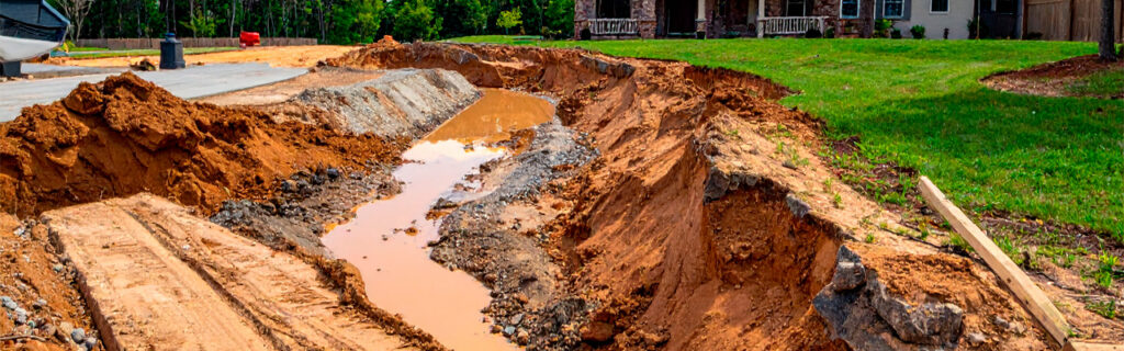
The drainage conditions at any proposed improvement location are most accurately observable during or within twenty-four hours of a significant rain event, which is why the most important property walkthrough timing decision is conducting at least one site evaluation under wet conditions rather than exclusively during the dry conditions that most site visits conveniently occur under. Wet-condition walkthrough observation reveals where water collects, how long it persists, what flow paths it follows across the terrain, whether the site receives significant drainage from surrounding uphill terrain in addition to rain falling directly on the improvement footprint, and whether any seasonal wet areas or potential drainage features exist that dry-condition observation would not reveal. This drainage behavior information is directly consequential for every project category from building foundation design to driveway drainage infrastructure to food plot location selection, and it cannot be substituted by any amount of dry-condition observation that consistently presents the site in its most favorable drainage condition regardless of what wet-season drainage behavior actually occurs.
Equipment Access Routes and Constraints
Every outdoor improvement project requires equipment and vehicles to reach the work area from the public road, and the access route’s dimensional constraints, ground bearing conditions, and seasonal accessibility determine whether the planned equipment can reach the work area safely and at what cost. The property walkthrough that assesses equipment access covers the full route from the road to the work area, measuring gate widths at constraint points, assessing overhead clearance from canopy and utility lines, evaluating ground bearing conditions on soft or wet sections of the route, and confirming that the route’s turning radius allows the specific equipment planned for the project to maneuver through without contacting adjacent improvements or terrain features. Access constraints discovered during a pre-project walkthrough become planning inputs that determine equipment selection, preliminary access preparation requirements, and project scheduling around conditions that would prevent equipment operation in specific seasonal windows. Access constraints discovered on mobilization day become reactive problems that delay project starts, require unplanned preliminary work, and in some cases prevent the project from beginning on the planned schedule until access issues are resolved at unplanned cost and timeline impact.
Soil Conditions and Organic Layer Depth
Physical probing of the soil at proposed excavation, grading, and structural subgrade preparation locations during the property walkthrough provides the soil condition information that cannot be assessed from surface observation alone and that most directly affects earthwork scope, compaction scheduling, and drainage design requirements. On Cherokee County properties, the specific soil conditions most consequential for project planning include the organic topsoil layer depth that determines stripping scope before structural fill can be placed, the current moisture content that affects whether compaction can proceed immediately or must wait for drying to reach the optimum moisture range, and any subsurface conditions including rock indicators, anomalous layers, or evidence of prior fill or buried debris that should be identified before excavation encounters them as reactive project scope additions. A few minutes of hand probing with a metal rod or soil probe at multiple points across the proposed improvement footprint during the walkthrough produces this soil condition context at essentially no cost relative to the project planning improvement it provides.
Vegetation Character and Clearing Requirements
The vegetation conditions at the proposed project site, specifically the density, species composition, stem size distribution, and presence of preservation candidates within the clearing area, determine what clearing method is appropriate, what the clearing scope and cost will be, and what invasive species management program the property will need after clearing to prevent rapid reversion. The property walkthrough that specifically notes the dominant invasive species, estimates the maximum stem sizes present, identifies significant trees and native species that should be preserved, and assesses whether the terrain conditions in the clearing area support the equipment that would be used for clearing all produce information that project scoping requires. Summer vegetation assessment is most productive for species identification because full-leaf summer growth makes invasive species identification most reliable. Winter assessment is most productive for canopy structure evaluation and for seeing the ground-level terrain that summer foliage obscures. A walkthrough that combines both seasonal perspectives for any significant clearing project produces the most complete vegetation assessment available for project planning purposes.
Regulatory Features That May Affect Project Scope
Seasonal streams, drainage features, low-lying areas with potential wetland characteristics, and the total land disturbance area that the proposed project would create all represent regulatory considerations that the property walkthrough should specifically evaluate before project design commits the improvement to positions or scopes that may conflict with applicable requirements. Stream buffer requirements that restrict land-disturbing activities within defined setback distances from regulated watercourses, potential wetland conditions that may require Army Corps of Engineers review before disturbance, and the one-acre land disturbance threshold that triggers Georgia’s Erosion and Sedimentation Act permit requirement are all regulatory factors that a properly conducted property walkthrough, specifically including wet-condition observation that makes seasonal drainage features identifiable, can flag for pre-project compliance evaluation that prevents the mid-project regulatory discovery that creates the stop-work situations significantly more expensive and disruptive than pre-project compliance assessment would have required.
How a Property Walkthrough Changes the Project Design
The specific information produced by a thorough property walkthrough changes outdoor project designs in the ways that most directly prevent the performance failures that projects designed without site-specific information consistently produce. Understanding how walkthrough information changes specific design decisions helps property owners appreciate why the walkthrough investment produces returns that extend well beyond the project planning phase.
Building site selection informed by walkthrough observation of drainage behavior, terrain position, and seasonal moisture conditions produces sites positioned at terrain locations where natural drainage away from the building footprint in multiple directions minimizes foundation drainage infrastructure requirements. Building site selection without this information produces sites selected for convenience or view without reference to the drainage conditions that the chosen position creates for the foundation, which often manifests as the chronic foundation moisture conditions that adequate site-informed selection would have avoided by choosing a position where the terrain naturally assists rather than challenges foundation drainage performance.
Drainage infrastructure design informed by walkthrough identification of natural drainage patterns, contributing area assessment from the uphill terrain surrounding the site, and drainage crossing locations along proposed driveway alignments produces drainage systems sized and positioned for the actual drainage conditions the site presents. Drainage infrastructure design without this site-specific information produces systems sized from generic assumptions about drainage volumes that may significantly underestimate what the specific site’s terrain position, contributing area, and drainage pattern deliver to the improvement location, producing the undersized infrastructure that overtops and fails during the significant rain events that adequate sizing would have conveyed without overtop.
Clearing scope informed by walkthrough identification of significant trees and native species that should be preserved within the clearing area produces clearing boundaries and preservation marking guidance that protects specific valuable features while removing the invasive growth that limits the property’s function. Clearing scope established without this walkthrough information produces clearing that removes what is in the path of clearing equipment without specific evaluation of what each element contributes, potentially eliminating significant mature trees and native species that a preservation-informed clearing boundary would have specifically protected at modest additional planning effort cost relative to the irreversible loss that their inadvertent removal creates.
How a Property Walkthrough Improves Project Budget Accuracy
The most financially consequential function that a thorough property walkthrough performs is producing the site-specific information that allows project budgets to be based on actual site conditions rather than generic planning assumptions that may not match those conditions. Budget accuracy is a direct function of the accuracy of the site condition knowledge that the budget is based on, and the systematic assessment of the conditions that most frequently produce budget surprises during active project execution is the investment that most reliably produces accurate budgets rather than initial estimates that grow substantially when site conditions reveal what assumptions did not anticipate.
Earthwork volume estimates based on walkthrough terrain assessment consistently produce more accurate construction budgets than estimates based on aerial imagery or edge observation that underestimate the ground-level elevation variation across improvement footprints. Organic stripping depth estimates based on walkthrough soil probing consistently produce more accurate subgrade preparation budgets than generic depth assumptions that may not match the specific site’s organic layer depth. Rock contingency allowances based on walkthrough assessment of topographic position and surface rock indicators consistently produce more realistic project contingency than budgets that assume no rock will be encountered because no rock is visible at the surface. Access preparation costs based on walkthrough access route assessment consistently produce more complete project budgets than proposals developed without access evaluation that discover access constraints on mobilization day and require unplanned preliminary work that the budget did not include.
How to Conduct a Productive Property Walkthrough Before a Project
Property owners can conduct a productive pre-project walkthrough that produces genuinely useful project planning information by following the systematic approach described below. This approach does not require professional surveying equipment or technical expertise. It requires physical presence at the site, observation attention directed at the specific categories of conditions that outdoor project planning depends on, and documentation that preserves what is observed for use in contractor conversations, design decisions, and budget development.
Schedule at least one site visit within twenty-four hours of a significant rain event specifically to observe drainage behavior, drainage feature locations, and wet area conditions that dry-condition visits do not reveal. This timing is the single most impactful walkthrough scheduling decision because it provides the drainage information that is most consequential for project design and that is least available from any other observation timing. Take photographs at this wet-condition visit that document where water is collecting, flowing, and persisting so that these drainage conditions can be specifically referenced during contractor conversations and project design discussions that may occur weeks after the visit when memory of specific drainage behaviors may be imprecise.
Walk the full proposed improvement footprint and the full access route from the road to the work area, rather than only the sections most easily reached from convenient observation positions. The conditions most likely to produce project surprises are frequently in the sections least conveniently accessible from normal approach routes, because those sections are the ones that prior casual observation has not reached and assessed. Note every access width constraint, overhead clearance limit, and soft or wet section of the access route that would affect equipment mobilization so that these constraints can be addressed before project execution rather than discovered on mobilization day.
Probe the soil at multiple points across the proposed improvement footprint to assess organic layer depth and note any anomalous conditions including unusual compaction, evidence of prior fill, or soil color indicators of seasonal moisture conditions. This probing can be done with a metal rod or soil probe that most property owners can access, and it produces directly useful soil condition information for earthwork scope estimation and foundation design that no surface observation can substitute for. Document the probing results by noting the approximate organic depth and any anomalies at each probe location with the location’s approximate position within the footprint so that the pattern of soil conditions across the footprint can be understood rather than only the conditions at a single point.
How to Use Walkthrough Findings in Contractor Conversations
The documented findings from a thorough pre-project walkthrough are most valuable when they are shared with contractors before project scope is discussed rather than after proposals have been developed. A contractor who receives the walkthrough documentation including photographs, drainage behavior notes, terrain assessment, access constraint identification, and soil probing results before developing a project proposal can incorporate the specific site conditions into their scope and cost estimates from the beginning rather than developing estimates from generic assumptions and then needing to revise them when the specific site conditions that the walkthrough revealed are subsequently communicated.
Sharing the walkthrough findings also allows contractors to identify conditions in the documentation that warrant additional evaluation or that affect project approach in ways the property owner may not have recognized as significant. An experienced local contractor reviewing walkthrough photographs and drainage behavior notes may identify drainage pattern characteristics that indicate a regulated drainage feature requiring buffer compliance evaluation, or soil color indicators in the probing notes that suggest seasonal high water table conditions affecting foundation system selection, that the property owner’s walkthrough observed but did not specifically recognize as having the regulatory or design implications that the contractor’s regional experience allows them to identify from the same observations. This combination of the property owner’s site-specific walkthrough documentation and the contractor’s regional experience interpretation consistently produces better project planning than either the property owner’s documentation alone or the contractor’s experience applied without the specific documentation gives the detailed site condition basis that accurate project-specific application requires.
Frequently Asked Questions
How long should a thorough pre-project property walkthrough take?
A thorough pre-project walkthrough for a typical Cherokee County residential or rural outdoor improvement project covering terrain, drainage, access, soil, vegetation, and regulatory feature assessment at a single improvement location typically requires one to three hours of deliberate site observation and documentation, depending on the property size, the terrain complexity, and the number of improvement locations being assessed simultaneously. Larger properties with multiple proposed improvement locations, complex interior terrain that requires extended walking to fully assess, or multiple access route options requiring comparative assessment will require proportionally more time. The walkthrough investment is most productively treated as a dedicated evaluation activity rather than as an incidental observation during other property visits, because the systematic attention each evaluation category requires is difficult to maintain when the walkthrough competes with other activities for focus and time.
Should the contractor conduct the property walkthrough or should the property owner do it first?
The most productive approach combines property owner walkthrough documentation followed by contractor site visit with the documentation as context. The property owner’s walkthrough, conducted without the time pressure of a contractor site visit and including the wet-condition observation timing that contractor visits may not specifically schedule, produces the systematic documentation that gives the contractor site visit its highest value. The contractor site visit, conducted with the property owner’s walkthrough documentation in hand, can focus on confirming and extending the documented observations, applying regional experience to the specific conditions documented, and providing professional interpretation of conditions whose significance the property owner observed but may not have fully recognized. This sequence consistently produces better project planning outcomes than either the property owner’s walkthrough documentation alone without contractor input or the contractor’s single site visit without prior systematic documentation of the site conditions that most require specific observation under timing conditions the contractor visit may not coincide with.
What is the most common walkthrough omission that leads to project planning failures on Cherokee County properties?
The most consistent walkthrough omission that leads to project planning failures is the absence of any wet-condition site observation. Most property walkthroughs on Cherokee County properties occur during dry or moderately moist conditions that present the site in its most favorable drainage presentation, concealing the drainage collection points, uphill contributing drainage, seasonal high water table indicators, and potential regulatory drainage features that wet-condition observation reveals clearly. Projects designed without any wet-condition site observation consistently encounter the drainage conditions during execution or post-completion performance that the dry-condition design did not account for, producing the foundation moisture, road drainage failure, and drainage infrastructure inadequacy problems that routinely appear as performance failures in the first wet season following project completion and that adequate wet-condition walkthrough observation before project design would have identified as design requirements rather than performance surprises.
Does a property walkthrough need to be repeated if significant time passes between the walkthrough and the project start?
Yes, and the need for a walkthrough update before project start increases with the time elapsed between the original walkthrough and the project’s execution, particularly when that time spans a full growing season or more. Vegetation conditions change significantly between growing seasons as invasive species advance into previously assessed areas, as preservation-worthy trees develop new conditions that affect their disposition relative to the clearing scope, and as drainage features accumulate debris or vegetation that changes their hydraulic characteristics. Access routes change as vegetation growth reduces corridor width and overhead clearance, and as seasonal moisture conditions produce soft sections in routes that appeared firm during the original walkthrough’s seasonal conditions. Reviewing the original walkthrough documentation before project start, conducting a brief update walkthrough that specifically checks for changes to the most dynamic conditions documented in the original assessment, and identifying any changes that affect the project design or scope before mobilization rather than on the day work begins keeps the project planning current with the site conditions it must address rather than the conditions that may have changed since the assessment that informed the original design.
Ready to Start Your Next Outdoor Project the Right Way?
Every outdoor improvement project on a North Georgia residential or rural property proceeds better when it begins with accurate knowledge of the terrain, drainage, access, soil, vegetation, and regulatory conditions it will encounter. That knowledge does not come from desk research, aerial imagery review, or the brief site visits that confirm a project idea’s general feasibility. It comes from the deliberate, systematic property walkthrough that physically covers the proposed improvement area under the observation conditions that reveal each category of site conditions at its accurate rather than favorable presentation, and that produces the documented findings that project design, contractor conversations, and budget development can be specifically based on rather than generically assumed. The walkthrough investment is the most cost-effective investment available in any outdoor improvement project, because it consistently produces the site-specific information that prevents the reactive corrections, budget overruns, and performance failures that projects designed without it consistently encounter when the conditions the walkthrough would have revealed are discovered during active project execution when addressing them is significantly more expensive and more disruptive than anticipating them in pre-project planning.
Bardin Outdoors works with homeowners and landowners across Ball Ground, Canton, Cherokee County, and North Georgia on outdoor improvement projects that begin with thorough site evaluation and proceed on plans designed for the specific terrain, drainage, soil, and vegetation conditions each property presents. To learn more about how Bardin Outdoors approaches pre-project site evaluation for North Georgia outdoor improvement projects, contact us.