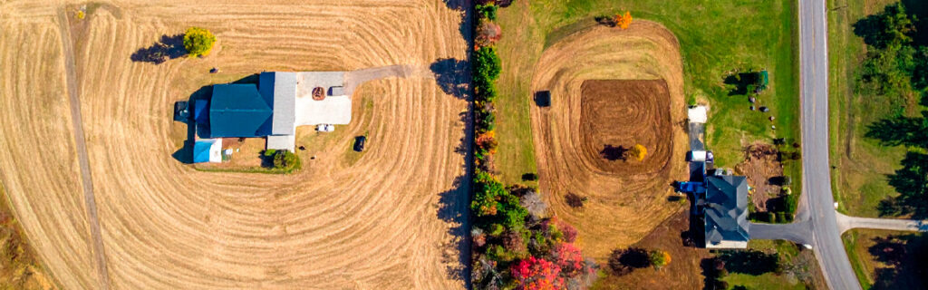
For property owners across Cherokee County, Ball Ground, and Canton who have recently acquired land in this region, who are planning improvements on established properties, or who are evaluating the land’s characteristics before committing to a specific improvement program, understanding specifically what makes Cherokee County properties different from the typical residential lot context that most homeowners have experience with, and what those differences mean for how outdoor improvement projects should be planned, budgeted, and executed, gives the practical foundation for approaching improvement work with appropriate expectations and effective strategies rather than with planning assumptions that the land’s actual characteristics will consistently and expensively contradict.
Property Size and the Management Complexity It Creates
The most fundamental difference between a typical Cherokee County rural or semi-rural property and a conventional residential lot is the acreage involved and the management complexity that larger acreage creates. While a suburban residential lot of a quarter to half acre can be managed largely through the incidental observation of daily activity and the periodic maintenance that visible conditions prompt, a Cherokee County rural property of five to fifty or more acres contains interior sections that are never visible from accessible positions and that accumulate the conditions that deferred management produces without producing any visible signal at the accessible perimeter that anything requires attention.
This observation coverage challenge is not simply a matter of more area requiring more time. It is a qualitative management challenge that requires deliberate inspection routines that physically cover the full property on a scheduled basis, systematic documentation of conditions found during those inspections, and a maintenance program that allocates resources across all the infrastructure categories that larger properties contain based on priority rather than on what happens to be most visible at the time maintenance resources are available. The property owner who manages a five-acre residential lot the same way they managed a half-acre suburban lot, responding to visible conditions as they become apparent rather than systematically inspecting for developing conditions before they become apparent, will consistently discover that their Cherokee County property has accumulated the deferred maintenance consequences that undetected conditions produce when they are not found and addressed before they advance to the scale where reactive correction is significantly more expensive than the preventive management that early detection would have required.
Wooded Acreage and Its Specific Management Requirements
The mature hardwood woodland that covers most of Cherokee County’s rural and semi-rural acreage is the characteristic that most distinguishes these properties from conventional residential lots and that most directly affects the management requirements and improvement planning that the land presents to its owners. Wooded acreage in this region is not passive background to the property’s active use areas. It is a dynamic ecological system with its own management requirements, its own improvement opportunities, and its own degradation pressures that evolve on their own timeline regardless of whether the property owner is paying attention to them.
Invasive Species as a Continuous Management Pressure
Chinese privet, kudzu, wisteria, and multiflora rose are established throughout Cherokee County’s landscape in concentrations that guarantee continuous seed rain and root advance pressure on any managed or cleared area of the property from adjacent woodland and unmanaged sections. Unlike the weed management challenge on a typical residential lawn, which involves relatively manageable herbaceous growth that periodic mowing and spot treatment can address, the invasive species pressure on Cherokee County wooded acreage involves woody plants with deep root energy reserves that regenerate from those reserves after any mechanical treatment that addresses only above-ground expression without depleting the root reserves that produce the next season’s regrowth. Property owners who approach invasive species on their Cherokee County property with the same once-and-done management expectation that annual herbicide application to a suburban lawn weed might satisfy are consistently surprised to find the same invasive populations returning at similar density within one to two growing seasons despite the mechanical clearing that was expected to address them permanently.
Effective invasive species management on Cherokee County wooded acreage requires the combined mechanical and chemical treatment program that depletes root energy reserves progressively over successive seasons rather than the one-time clearing that removes above-ground expression without addressing the biological persistence that root energy reserves provide. This is a multi-season management commitment rather than a single project, and understanding this distinction before beginning a clearing investment produces more realistic expectations about what the investment will accomplish and what follow-up management will be needed to produce lasting improvement rather than temporary clearing followed by full return to pre-clearing density within the first growing season after treatment.
Tree Canopy as an Asset Requiring Periodic Assessment
The mature hardwood canopy on Cherokee County rural properties is simultaneously the feature that makes the land most distinctively appealing and a structural infrastructure element that requires periodic assessment for the conditions that mature trees develop over time. Dead branches in canopy positions over structures and occupied areas, internal decay conditions in large mature trees near buildings and driveways, and root zone disturbance from prior construction activity that affects tree stability are all conditions that the wooded acreage context creates and that periodic tree assessment should specifically evaluate for the trees whose position in a priority fall zone makes their structural condition consequential for safety. The conventional residential lot typically involves a limited number of landscape trees managed within a maintained lawn context. The Cherokee County rural property may involve dozens or hundreds of mature trees in various structural conditions in various relationships to structures, access routes, and occupied areas, creating a tree management challenge that requires a systematic assessment approach rather than the casual observation that a small suburban landscape can be adequately managed with.
Rolling Terrain and Its Drainage, Earthwork, and Access Implications
Cherokee County’s rolling terrain, positioned at the transition between the southern Piedmont and the Appalachian foothills, creates the topographic character that makes properties in this region visually distinctive and that simultaneously creates the drainage complexity, earthwork requirements, and equipment access challenges that outdoor improvement projects must navigate. A conventional residential lot in a developed suburban area typically occupies relatively flat, already-graded land where the drainage system was established as part of the subdivision development and where earthwork for any individual lot improvement is modest. A Cherokee County rural property of five or more acres is almost certainly not flat, almost certainly has not had its drainage systematically managed by prior development, and requires earthwork and drainage design that accounts for the specific terrain and drainage conditions that the property’s location within the regional topography creates.
Drainage as a Universal Project Consideration
On Cherokee County rolling terrain with its red piedmont clay soil, drainage is not simply a drainage project concern. It affects every outdoor improvement project regardless of whether drainage is the project’s primary objective. Building sites receive drainage from the surrounding uphill terrain that the drainage design must manage in addition to the rain falling directly on the building footprint. Driveways cross drainage patterns that create culvert requirements and surface drainage design challenges at each crossing point. Food plots and cleared areas must drain adequately for the plant species being grown and the equipment operations being conducted within them. Access routes must maintain drainage-adequate conditions throughout wet seasons rather than only during the dry conditions that make most routes passable regardless of their drainage design quality. Understanding that drainage is a consideration in every improvement project rather than only in drainage-specific projects is one of the foundational Cherokee County property management insights that conventional residential lot experience does not provide, because the flat, developed suburban context makes drainage essentially invisible in routine property management in ways that rolling, clay-soil rural terrain makes it impossible to ignore.
Earthwork Volumes That Consistently Exceed Visual Estimates
The cut-and-fill earthwork required to create level or gently sloped surfaces from Cherokee County’s rolling terrain is consistently larger than property owners estimate from visual terrain assessment, aerial imagery observation, or edge-position property viewing. The terrain variation that appears modest from the road, from the property boundary, or from aerial photographs is almost always more significant when interior terrain is physically walked with attention to the elevation change that must be overcome to establish level surfaces across building footprint sizes and driveway alignments. The budget consequence of this systematic underestimation, which produces project budget overruns when actual earthwork volumes revealed during active grading significantly exceed what the visual assessment suggested, is among the most common and most preventable project planning failures on Cherokee County rural and semi-rural properties. Pre-project interior terrain walking that specifically estimates the elevation differential between the high and low corners of proposed improvement footprints gives the earthwork volume estimate accuracy that visual assessment alone cannot provide, and that accuracy is the foundation of realistic improvement project budgets that do not encounter this predictable surprise.
Red Piedmont Clay Soil and Its Specific Behavior
The red-orange piedmont clay that defines Cherokee County’s soil character behaves differently from the soils of most other residential and rural land markets that property owners with experience elsewhere may have encountered, and those behavioral differences affect outdoor improvement projects in specific ways that planning must account for rather than discovering through the performance problems that clay’s specific characteristics produce when improvement projects ignore them.
Cherokee County clay’s near-zero permeability when saturated means that essentially all rainfall during wet season conditions becomes surface runoff rather than infiltrating into the soil profile. This total runoff conversion under saturated conditions produces the drainage volumes that drainage infrastructure must be sized for and the bearing capacity losses that schedule wet-season earthwork restriction and compaction timing management. Cherokee County clay’s volume change with moisture cycling, expanding when wet and contracting when dry, creates the mechanical forces on foundations, pavements, and buried infrastructure that adequate perimeter drainage management limits rather than structural over-engineering addresses. And Cherokee County clay’s compaction behavior, which requires that fill be placed and compacted at moisture content near the optimum for compaction rather than at the elevated moisture content that spring wet season and post-rain conditions create, makes excavation and grading scheduling a genuine quality management consideration rather than a simple timeline preference.
Property owners who have primarily owned land on more permeable soils will find Cherokee County clay’s drainage behavior and seasonal moisture cycling more consequential for improvement planning and performance than what their prior experience would suggest as the normal range of soil-related management considerations. This is not a deficiency of Cherokee County land. It is a characteristic of the specific geological and climatic conditions that produced the region’s distinctive landscape, and it is manageable with the planning approach that the clay’s specific behaviors require.
Rural Access Infrastructure and Its Ongoing Maintenance Requirements
Most Cherokee County rural and semi-rural properties are accessed through driveways and interior roads that are not maintained by any public authority and that are entirely the property owner’s responsibility for design, construction, and ongoing maintenance. Unlike the suburban residential lot whose access to the street is provided by publicly maintained pavement that stops at the property boundary, the rural Cherokee County property’s access may involve hundreds of feet to a mile or more of private driveway or road that must perform reliably through North Georgia’s full seasonal range of conditions without any maintenance support from public infrastructure resources.
The ongoing maintenance that Cherokee County rural access infrastructure requires to perform reliably through wet seasons is not complex, but it is consistent. Annual culvert inlet clearing before wet season maintains the drainage capacity that debris accumulation progressively reduces. Periodic crown profile restoration grading every three to five years on heavily used sections restores the drainage design that traffic compaction and surface wear degrade over time. Vegetation management of overhead clearance and corridor width prevents the access limitations that growing season extension growth creates in sections where wooded corridor vegetation continues advancing toward the travel surface between management events. Property owners who approach their private driveway and access road infrastructure with the expectation that it will maintain its performance without systematic maintenance attention are almost always disappointed when their first significant wet season reveals the soft conditions, drainage failures, and surface damage that inadequate maintenance allows to develop in Cherokee County’s clay soil and rolling terrain context.
Subsurface Rock as a Standard Contingency Consideration
The metamorphic and granitic bedrock underlying Cherokee County’s soil profile appears at depths that create a meaningful excavation contingency requirement across much of the county’s area, particularly at ridge and hilltop topographic positions where historical erosion has removed more soil depth over geological time. This subsurface rock probability is a standard feature of excavation project planning in Cherokee County rather than an exceptional risk that project budgets can assume away. Property owners planning excavation projects, particularly foundation excavation, pond construction, and deep drainage installation, should include specific rock contingency in their budgets proportional to the rock probability indicators at the specific excavation location rather than assuming no rock will be encountered because none is visible at the surface.
Rock removal when encountered during excavation requires specialized hydraulic breaking equipment and substantially more machine time per cubic yard than clay excavation, creating cost additions that significantly affect project economics when they occur without prior contingency planning. The reactive discovery of rock during active project execution, after the project budget has been committed based on clay-only assumptions, is among the most consistently reported project planning surprises on Cherokee County excavation projects and one of the most preventable through the site-specific rock probability assessment and appropriate budget contingency that project planning should include before any commitment is made to a budget that assumes no rock will be encountered.
Why Local Contractor Experience Matters More on Cherokee County Properties
The specific characteristics that make Cherokee County properties different from conventional residential lots are the same characteristics that make local contractor experience specifically valuable on projects in this region. A contractor who has worked consistently on Cherokee County rural and semi-rural properties over multiple seasons has accumulated the specific knowledge about how local clay behaves at different seasonal moisture conditions, which topographic positions have elevated rock probability, how invasive species populations respond to different management approaches in this region’s climate, and what drainage design approaches work reliably on the specific combination of soil, slope, and rainfall that Cherokee County properties present. This accumulated regional knowledge is not available from general construction competence without the specific regional background, and it consistently produces better project scoping, more accurate cost estimation, and more effective execution on Cherokee County improvement projects than competent general contractors without the regional experience provide on the same property types.
For property owners new to Cherokee County land ownership or new to rural property management in this region, engaging experienced local contractors for pre-project site assessment conversations before improvement scopes are committed is the most direct way to access the regional knowledge that the specific conditions of this land require to be managed effectively. These conversations consistently produce better project planning than approaches developed from general improvement planning principles without the regional context that local contractor experience specifically provides for Cherokee County’s specific conditions.
Frequently Asked Questions
How should someone new to Cherokee County rural property ownership approach their first improvement projects?
The most consistently productive approach for new Cherokee County rural property owners is to spend at least one full year observing the property under all seasonal conditions before committing to major improvement investments. Walking the property during and after significant rain events, observing where drainage concentrates and where wet conditions persist, walking interior sections that are not visible from the property boundary, and building familiarity with the invasive species present and their current distribution across the property produces the site-specific knowledge that makes subsequent improvement decisions genuinely informed rather than based on the assumptions that first-season observation under favorable conditions suggests. Engaging an experienced local contractor for a site assessment conversation and property walk during this observation period adds the regional professional perspective to the property owner’s direct observations, producing a combined understanding of the property’s specific characteristics and challenges that neither the property owner’s observation alone nor the contractor’s general regional knowledge alone could provide as effectively.
Are Cherokee County properties more expensive to improve than comparable properties in other regions?
Cherokee County properties are not universally more expensive to improve than comparable properties in other regions, but they consistently require more preparation, evaluation, and contingency planning than improvement projects on simpler terrain and more permeable soil to produce equivalent outcomes at equivalent quality. Projects that account for the specific requirements of Cherokee County clay soil, rolling terrain, invasive species management, and subsurface rock probability from the beginning of planning produce outcomes that meet their intended standard at costs that were accurately projected because those conditions were assessed before commitment rather than discovered during execution when they produce reactive cost additions. Projects that proceed on assumptions that do not account for these specific conditions consistently encounter cost overruns when the conditions reveal themselves during active project execution. The cost difference between these two approaches is not inherent to Cherokee County land. It is a function of whether the planning investment that the specific conditions require was made before the project was committed rather than discovered through the execution that commitment-without-assessment produces.
What is the most important single thing to understand about Cherokee County property before starting any outdoor improvement project?
The most important single understanding for any outdoor improvement project on Cherokee County rural or semi-rural property is that the site conditions most consequential for the project’s design, cost, and long-term performance are not fully visible during dry-condition site observation, which is when most pre-project evaluations conveniently occur. The drainage behavior that determines how much drainage infrastructure the project needs, the soil moisture conditions that affect when and how earthwork can proceed, the seasonal high water table conditions that may affect foundation system selection, and the invasive species populations that will require ongoing management after the improvement is established are all conditions that express themselves most clearly during or after wet season conditions rather than during the dry summer and fall periods when site visits are most comfortable and most convenient to schedule. The investment of conducting at least one site evaluation during or immediately following a significant rain event before any project scope is committed produces the site condition understanding that improvement planning requires to be accurate, and avoids the drainage, soil, and vegetation condition surprises that dry-season planning assumptions consistently encounter when the first significant rain event after project completion reveals what adequate wet-condition evaluation would have shown before the project began.
How do Cherokee County’s regulatory requirements differ from typical residential lot regulations?
Cherokee County rural and semi-rural properties encounter several regulatory requirements that conventional residential lots in developed suburban contexts typically do not face with the same frequency or consequence. Georgia’s land disturbance permit requirements under the Erosion and Sedimentation Act apply to projects disturbing one acre or more, a threshold easily reached on rural improvement projects that involve clearing, grading, and access development across meaningful acreage rather than the limited footprint that residential lot improvements typically disturb. Stream buffer requirements that restrict land-disturbing activities within defined setback distances from regulated drainage features apply on rural properties where seasonal streams and drainage corridors cross the property interior in positions that improvement projects may encounter without prior identification and mapping of those features. And potential wetland conditions in low-lying areas of rural properties may require Army Corps of Engineers review before filling or draining that smaller developed lots rarely contain. Confirming applicable regulatory requirements specific to the planned improvement type and property location before project planning is committed is the compliance approach that prevents the disruption and cost of mid-project regulatory discovery that pre-project compliance evaluation would have avoided.
Ready to Make the Most of Your Cherokee County Property?
Cherokee County properties are distinctive, ecologically productive, and genuinely rewarding to own and improve when the management and improvement approach is calibrated to what the land actually presents rather than to what simpler or different property types would require. The wooded acreage, rolling terrain, red clay soil, invasive species pressure, and access infrastructure requirements that characterize this region’s rural and semi-rural properties are the conditions that reward planning and experience calibrated to them and that consistently challenge approaches borrowed from conventional residential lot management without adjustment for the specific differences that the local conditions create. Understanding those differences before they become expensive project surprises is the practical foundation for owning and improving Cherokee County land with the satisfaction and the results that its distinctive character genuinely supports.
Bardin Outdoors works with landowners and homeowners across Ball Ground, Canton, Cherokee County, and North Georgia on outdoor improvement projects planned for the specific terrain, soil, vegetation, and drainage conditions of this distinctive region, bringing the regional experience that Cherokee County rural property improvement consistently rewards to every project from initial site assessment through completed improvement. To learn more about how Bardin Outdoors can help your Cherokee County property reach its full potential, contact us.