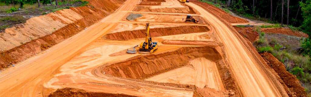
For property owners across Cherokee County, Ball Ground, and Canton planning excavation or grading projects on their residential and rural lots, understanding what a professional site evaluation for these project types specifically covers, why each assessment activity the evaluation includes produces information that scope and cost estimation requires rather than representing optional thoroughness, and how the evaluation’s findings translate into the proposal components that property owners should understand and ask about before committing to any excavation or grading project scope gives the practical framework for participating productively in the site evaluation process rather than waiting passively for a number to appear and then accepting or declining it without understanding what the evaluation found or how those findings determined what was proposed.
What a Professional Site Evaluation Is Trying to Accomplish
Before understanding what a professional site evaluation specifically does, it is useful to understand what it is trying to accomplish, because the specific activities the evaluation includes are all in service of this overarching purpose rather than being assessment activities for their own sake. A professional site evaluation for an excavation or grading project is trying to develop the site-specific knowledge that allows the project to be designed for the actual conditions at the actual location rather than for the assumed conditions that generic planning applies to all projects of the same type regardless of what the specific site presents. This site-specific knowledge includes the terrain conditions that determine earthwork scope and drainage design requirements, the soil conditions that determine stripping depth, compaction approach, and scheduling constraints, the access conditions that determine equipment mobilization approach and preliminary work requirements, and the project objective clarity that determines what the project is trying to achieve and what standard of outcome the property owner expects.
Every assessment activity that a professional site evaluation includes is in service of developing one or more of these knowledge categories. Terrain walking develops the terrain and drainage condition knowledge. Soil probing develops the soil condition knowledge. Access route assessment develops the access condition knowledge. The property owner conversation develops the project objective and outcome standard knowledge. A site evaluation that completes all of these assessment activities has the knowledge base that accurate scope definition, realistic cost estimation, and appropriate scheduling recommendation requires. A site evaluation that omits assessment activities produces a scope and cost proposal with knowledge gaps that the omitted assessment activities would have filled, and those knowledge gaps are where the project planning inaccuracies that produce execution surprises reside.
The Property Owner Conversation That Should Open Every Site Evaluation
A professional site evaluation for an excavation or grading project should begin with a conversation between the contractor and the property owner that establishes the project objective, the intended use of the improved site, the quality standard the property owner expects the project to achieve, the timeline the property owner is working within, and any constraints including budget range, regulatory concerns, or preservation priorities that should influence the project’s scope and design. This conversation provides the project context that directs every subsequent assessment activity toward the specific site conditions relevant to the specific project rather than toward a generic site assessment unconnected to what the project is attempting to accomplish.
Property owners should come to this conversation prepared to describe not only what they want the project to do but why they want it done and what they will use the improved site for after the project is complete. A contractor who understands that the grading project is preparing a building pad for a primary residence whose foundation must perform reliably for decades will design a scope that achieves building foundation subgrade quality standards rather than the more modest surface improvement standard that other site uses might justify. A contractor who understands that the clearing and grading will be followed within twelve months by a barn construction project will design the grading drainage to accommodate the barn’s drainage addition rather than only the current site’s drainage requirement. And a contractor who understands that the property owner has preservation priorities for specific trees or natural features within the project area will design clearing boundaries and equipment routes around those priorities rather than discovering them as scope constraints after the equipment has already operated through the area they were intended to protect.
Terrain Assessment During the Site Walk
After the opening conversation establishes the project context, the site walk begins with the contractor physically entering and traversing the proposed project area to assess the terrain conditions that earthwork scope estimation and drainage design require. This terrain assessment is the activity that most directly determines whether the project’s earthwork cost estimate will be accurate or whether it will be the estimate that active grading revises upward when actual terrain conditions require more earthwork than the assessment estimated.
Elevation Differential Assessment Across the Improvement Footprint
The contractor walks the full extent of the proposed improvement footprint, from its highest to its lowest corners, estimating or measuring the elevation differential that the grading must overcome to achieve the design grade the improvement requires. On Cherokee County properties where wooded terrain consistently presents more ground-level elevation variation than aerial or edge observation suggests, this interior terrain walk is the assessment activity that most frequently produces the largest single correction to the property owner’s prior earthwork scope estimate, because the terrain that seemed level from the road or from the property edge may reveal significant corner-to-corner elevation differential when physically walked at ground level through the full footprint extent. The contractor’s terrain walk should specifically note the slope direction and magnitude at each section of the footprint, identify any abrupt grade changes or terrain irregularities that would create specific grading challenges, and estimate the average cut depth on the high side and the average fill depth on the low side from which cut and fill volumes can be approximated for initial cost estimation.
Drainage Pattern Identification and Contributing Area Assessment
While traversing the project area, the contractor identifies the natural drainage patterns that the terrain creates, noting where surface water flows during rain events, where it concentrates, and what uphill terrain area contributes drainage to the proposed improvement location. This drainage pattern assessment is most accurate when conducted during or immediately after a rain event that reveals the drainage behavior that dry-condition assessment can only estimate, and contractors who conduct site evaluations under dry conditions without any post-rain observation reference are assessing drainage from terrain observation alone rather than from the behavioral evidence that rain events provide. The contributing area assessment that identifies how much uphill watershed delivers drainage to the proposed improvement location is the drainage design input that most directly determines drainage infrastructure sizing adequacy, and undersized drainage infrastructure from underestimated contributing area is the most common single source of post-construction drainage performance failures on Cherokee County improvement projects.
Drainage Crossing Identification Along Proposed Routes
For driveway and access route projects, the terrain assessment specifically identifies the natural drainage features that the proposed route alignment will cross, noting the width, depth, and estimated flow volume at each crossing to inform culvert sizing at each position. The number and character of drainage crossings along a proposed route alignment is a direct determinant of the route’s culvert infrastructure cost, and route alignment alternatives that minimize drainage crossings by following ridgeline or shoulder terrain produce lower infrastructure cost than alternatives that cross multiple drainage channels on the most direct path to the destination. The site evaluation terrain walk that assesses drainage crossing positions for different alignment options gives the property owner the comparative information that allows route alignment decisions to account for infrastructure cost differences as well as directness and grade differences among available alignment options.
Soil Assessment During the Site Evaluation
Soil assessment during the site evaluation addresses the conditions below the ground surface that earthwork scope estimation and design quality require but that surface observation cannot reveal. On Cherokee County properties where clay soil characteristics, organic layer depth, and subsurface rock probability each significantly affect excavation and grading project scope and cost, soil assessment is the evaluation activity that most directly prevents the soil-related scope additions that projects planned without soil assessment consistently encounter during active excavation when actual soil conditions reveal what the surface appearance did not.
Organic Layer Depth Assessment
The contractor should probe the soil at multiple points across the proposed improvement footprint using a metal rod, soil probe, or similar tool to estimate the organic topsoil depth above the mineral subsoil at each probing point. This depth assessment reveals whether the site’s organic layer is within the four to six inch range that previously disturbed or cultivated sites typically present or whether it is in the deeper eight to twenty-four inch range that long-wooded Cherokee County sites frequently present beneath decades of accumulated organic material. The difference between these organic depth ranges represents a substantial stripping scope and cost difference for any improvement requiring structural subgrade preparation, and discovering the actual organic depth during active stripping after the project was budgeted for the shallower assumption is the most common single source of significant earthwork cost overruns on Cherokee County building site and structural improvement projects. Multiple probing points distributed across the full improvement footprint also reveal any organic depth variation within the footprint that a single central probe would not identify, including the common situation where parts of a footprint previously cleared have shallow organic depth while adjacent wooded sections have deep organic depth that the probe pattern reveals and the earthwork budget must account for.
Rock Indicator Assessment
The contractor should assess the proposed project location for rock probability indicators that include surface rock outcrops visible on or adjacent to the property, ridge or hilltop topographic position where historical erosion has removed more soil depth over geological time and shallow rock is correspondingly more probable, and any probe resistance during soil probing that suggests rock at shallow depth rather than the clay resistance that probe refusal in stiff clay can mimic. Rock probability cannot be confirmed without excavation that the site evaluation typically does not include, but indicators can be assessed that support a probabilistic rock contingency allocation proportional to the assessed probability rather than the binary assumption that either no rock will be encountered or that rock presence is certain. On Cherokee County ridge and upper slope positions with visible surface rock outcrops in the area, a specific rock contingency should be explicitly included in the project budget rather than treating rock as an excluded scope item whose price is established only if encountered, because this treatment of rock risk produces the mid-project budget surprise that explicit contingency allocation prevents by acknowledging the probability before commitment rather than after discovery.
Current Moisture Content Assessment
The contractor assesses the current soil moisture content at the proposed improvement location, noting whether the clay is near its optimum moisture range for compaction or whether it is significantly above optimum from recent rainfall or seasonal conditions that would prevent adequate compaction if earthwork proceeded immediately. This moisture content assessment informs the project scheduling recommendation by identifying whether earthwork can proceed at the proposed start date or whether drying time is required before compaction-critical earthwork should begin. For projects requiring structural subgrade compaction, proceeding at clay moisture conditions significantly above compaction optimum produces an apparently completed subgrade that will not perform to structural density specification, which is the preparation quality failure that scheduling around moisture conditions specifically prevents at the cost of a schedule delay that is modest compared to the performance remediation that inadequate compaction under wet conditions consistently generates.
Access Route Assessment During the Site Evaluation
The contractor walks or drives the full access route from the public road to the proposed project area, evaluating the conditions that will affect equipment mobilization, operation, and demobilization for the proposed project. Access route assessment during the site evaluation identifies the preliminary access preparation requirements that must be addressed before primary project equipment can reach the work area, the dimensional constraints that affect equipment selection for the project, and the seasonal access limitations that should inform project scheduling.
Corridor width at the narrowest points along the access route determines whether the equipment proposed for the project can navigate the route without contact with corridor edge obstacles, and whether any preliminary clearing is required to open narrowed sections to the width that project equipment requires. Overhead clearance at overhanging canopy positions determines whether the project equipment’s height can navigate beneath existing canopy without contact that would require preliminary limbing before primary equipment can reach the project area. Ground bearing conditions at soft or wet sections of the route determine whether preliminary surface preparation, temporary matting, or routing around those sections is required before heavy project equipment can navigate without the ground deformation and recovery complications that soft sections create under heavy equipment loading. Each of these access route conditions, if identified during the site evaluation and incorporated into the project scope or scheduling, prevents the mobilization-day surprises that undiscovered access limitations create when primary project equipment arrives at access conditions that prevent the project from starting on the planned schedule without the preliminary work that access assessment would have revealed and scheduled before mobilization.
How Site Evaluation Findings Translate Into the Project Proposal
The findings from the terrain, soil, and access assessment activities of the site evaluation translate into each component of the project proposal that the property owner ultimately reviews and decides on. Understanding how specific evaluation findings determine specific proposal components allows property owners to evaluate whether the proposed scope and cost reflect what the evaluation found about the specific site rather than generic assumptions that regional averages might support but that the specific site’s assessed conditions do not.
Earthwork volume in the proposal should reflect the elevation differential the terrain walk found across the improvement footprint, translated through the cut-and-fill geometry that the proposed design grade creates from the existing terrain. If the terrain walk found a ten-foot corner-to-corner elevation differential across a building pad footprint, the earthwork volume in the proposal should reflect that differential rather than a generic regional average that may assume a different elevation variation. Organic stripping scope in the proposal should reflect the organic depth the probing found at the improvement location, with the deeper organic depth that wooded sites present generating more stripping scope than the shallower depth that previously disturbed sites present. Rock contingency in the proposal should reflect the rock probability indicators the evaluation found, with higher contingency for ridge positions with surface outcrop evidence than for valley positions without outcrop indicators. And preliminary access preparation scope in the proposal should reflect the access route conditions the access walk found, with preliminary clearing or temporary surface stabilization included for the access limitations that the assessment revealed rather than assuming access is adequate when the assessment identified specific inadequacies.
Questions Property Owners Should Ask During the Site Evaluation
Property owners who participate actively in the site evaluation by asking specific questions about what the contractor is finding and why each assessment activity matters produce better site evaluation outcomes than those who observe passively and wait for the proposal. Specific questions that improve site evaluation productivity include asking the contractor to describe what the terrain walk revealed about the elevation differential across the footprint and how that differential translates into earthwork volume and cost, asking what organic depth the probing found and whether that depth affects the stripping scope in the proposal, asking whether any rock probability indicators were observed and how those indicators affect the contingency recommendation, and asking what access route conditions the access walk identified and whether any preliminary access preparation is required before primary project equipment can reach the work area.
The contractor who can answer each of these questions with specific site-referenced details, describing what the evaluation specifically found at the specific site rather than what is generally true of Cherokee County projects of the same type, is conducting a site evaluation that will produce a proposal reflecting the actual site conditions. The contractor who cannot connect the proposed scope and cost to specific site evaluation findings with site-referenced detail may be proposing from regional averages rather than from site-specific assessment, which is the proposal quality difference that asking these questions reveals before the property owner commits to a scope that may or may not reflect what the actual site requires.
Frequently Asked Questions
How long does a professional site evaluation for an excavation or grading project typically take?
A thorough professional site evaluation for a typical Cherokee County residential or rural excavation or grading project covering the opening property owner conversation, terrain walk across the improvement footprint, soil probing at multiple points, access route assessment from the road to the project area, and any regulatory feature identification that the evaluation reveals typically requires one to two hours on site for a single improvement location of modest size. Larger projects, projects with multiple improvement locations, or projects on complex terrain with multiple drainage features requiring specific assessment may require two to four hours or more to cover adequately. Site evaluations that conclude in fifteen to thirty minutes have almost certainly not covered the full terrain, soil, and access assessment that accurate scope development requires, and property owners who receive proposals from evaluations of this brevity should ask specifically what terrain, soil, and access assessment was conducted and what those assessments found before trusting that the proposal reflects the actual site conditions rather than regional assumptions that a brief site visit confirmed rather than specifically assessed.
Should a property owner be present during the site evaluation or is it acceptable to give the contractor access and review the proposal afterward?
Property owner presence during the site evaluation consistently produces better proposal outcomes than absent-owner evaluations because the property owner conversation that should open the evaluation, establishing project objectives, intended use, outcome quality standards, and preservation priorities, cannot occur if the property owner is not present. Without this conversation, the contractor must infer the project context from the site conditions alone, which consistently produces scope recommendations optimized for the most common use pattern for the project type rather than for the specific use that the specific property owner intends. Property owner presence also allows the contractor to ask clarifying questions about ambiguous site conditions that the evaluation reveals, such as whether a specific mature tree within the improvement footprint should be preserved or removed, whether a specific drainage feature should be incorporated into the drainage design or addressed by routing the improvement away from it, and whether a specific soil condition that the probing found affects the intended project timeline in ways that scheduling adjustment should address. These clarifying questions can only be productively answered if the property owner is present to answer them during the evaluation rather than being presented as completed proposals that the property owner then reviews without the context that the evaluation questions would have provided.
What should I do if different contractors’ site evaluations produce very different cost estimates for the same project?
Significantly different cost estimates for the same project from different contractors’ site evaluations typically indicate that the evaluations produced different scope definitions rather than simply different unit pricing for the same scope, because unit pricing differences alone rarely produce the large total estimate differences that property owners sometimes see when comparing multiple proposals for the same project. Comparing the specific scope items in each proposal, specifically looking for differences in earthwork volume, organic stripping depth, rock contingency inclusion, drainage infrastructure specification, and access preparation scope, reveals whether the estimates are different prices for the same work or the same price structure for different work scopes. The lower estimate that omits significant scope items is not a more competitive price for the project. It is a proposal for a different and less complete project that will either require scope additions during execution that bring its final cost closer to the comprehensive proposal or will deliver a lower-quality outcome that the omitted scope items would have improved. Asking each contractor to explain specifically what their evaluation found about terrain, soil, access, and drainage conditions, and how those findings determined the specific scope items in their proposal, is the evaluation of the evaluations that reveals whether each proposal reflects what the site actually requires or what regional averages assume it typically requires.
Is a site evaluation for a grading or excavation project free, or should I expect to pay for it?
Site evaluation practices vary among contractors, with some providing initial site evaluations without charge as part of their business development process and others charging a site evaluation fee that may be credited toward the project cost if the property owner proceeds with the contractor. Neither practice is inherently better or worse from the property owner’s perspective, because the relevant quality criterion is whether the evaluation is thorough enough to produce an accurate proposal rather than whether it was provided without charge. A free evaluation that is brief and produces an inaccurate proposal costs more than a fee-based evaluation that is thorough and produces an accurate proposal when the inaccurate proposal leads to budget overruns that exceed the evaluation fee many times over. Property owners should not allow the presence or absence of an evaluation fee to determine how much evaluation thoroughness they accept, because the evaluation’s value is in the accurate proposal it produces rather than in the dollar value assigned to the evaluation visit itself.
Planning an Excavation or Grading Project on Your North Georgia Property?
A professional site evaluation that covers the terrain, soil, access, and project objective assessment that accurate scope definition and realistic cost estimation require is the starting point that every successful excavation and grading project on a Cherokee County property needs before scope is committed and work is scheduled. The evaluation activities that produce this accurate starting point, terrain walking that reveals actual elevation differentials, soil probing that reveals actual organic depth and rock probability, access route walking that reveals mobilization requirements, and the property owner conversation that establishes what the project is for and what it must achieve, are not optional thoroughness that the most ambitious contractors include and the most efficient ones omit. They are the knowledge-gathering activities whose findings determine whether the project that proceeds from the evaluation is designed for the actual site or for the assumed one, and whether the budget that was committed from the evaluation will be the budget the project requires or the starting point for the additions that actual conditions generate when they differ from the assumptions the proposal was built on.
Bardin Outdoors conducts thorough site evaluations for grading and excavation projects across Ball Ground, Canton, Cherokee County, and North Georgia that cover terrain, soil, drainage, and access assessment with the site-specific thoroughness that accurate Cherokee County project scope and cost estimation requires. To schedule a site evaluation for your excavation or grading project, contact us.