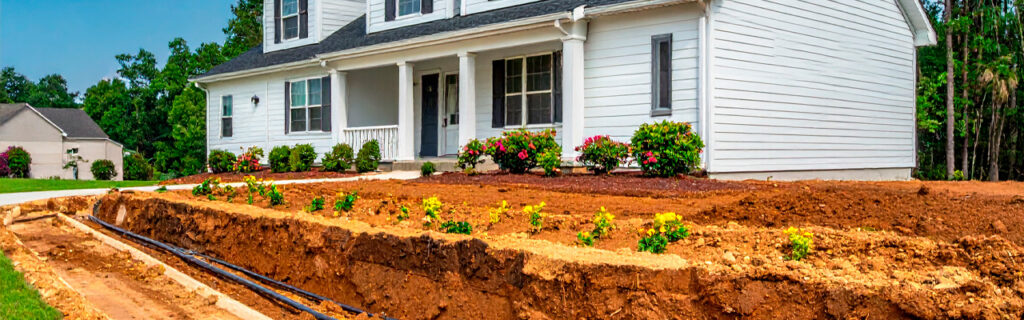
For property owners across Cherokee County, Ball Ground, and Canton planning any development on residential or rural lots, whether that development is an initial homestead build or the addition of structures and improvements to an existing developed property, understanding how utility planning decisions affect the full range of future improvements the property might accommodate gives the practical framework for making utility placement and sizing decisions that serve the property’s long-term development rather than only its immediate construction. The utility infrastructure that is easiest to plan around, that requires the least disruption to access and maintain, and that accommodates the property’s future growth most efficiently is the infrastructure that was planned with the full property vision in mind before any ground was broken rather than the infrastructure that was placed for immediate convenience without reference to what the property would eventually need to accommodate.
Why Utility Planning Should Precede Building Site Selection
Utility planning should ideally precede building site selection rather than follow it, because the utility systems a property requires are not equally installable at all positions on the lot, and building sites that seem ideal for the structure’s orientation, views, and terrain position may turn out to be constrained or compromised by the utility requirements that those positions create. A building site on a large lot that requires the septic drain field to occupy the only area suitable for a future barn eliminates one of the two improvements from the property as a practical matter. A building site that positions the well too close to the proposed drain field violates the minimum separation distances that both systems require, which may not be discoverable without careful joint planning of both systems before either is installed.
The regulatory requirements that govern utility system placement on Cherokee County residential and rural properties create fixed constraints that building site selection and utility planning must both satisfy simultaneously rather than independently. The minimum separation distances between wells and septic systems, between septic systems and property boundaries, between septic systems and drainage features and structures, and between electrical service entrance points and property features all create a spatial planning puzzle that only has viable solutions when all constraints are considered together rather than sequentially with each system positioned without reference to what the other systems require from the same land area.
Septic System Planning and Its Impact on Property Layout
Septic system design and placement on a Cherokee County rural property is the utility planning decision with the greatest impact on the spatial layout of all other improvements because the drain field, which requires more land area than any other utility system component, must be positioned where the soil conditions support adequate effluent treatment and where the required separation distances from wells, structures, drainage features, and property boundaries can all be maintained simultaneously. The drain field’s spatial requirements effectively reserve a significant portion of the available lot area for septic function and exclude that area from competing uses, which makes its placement the land use decision with the most significant effect on what other improvements the remaining lot area can accommodate.
Soil Evaluation for Drain Field Suitability
Drain field suitability depends on soil percolation rates, depth to seasonal high water table, and depth to bedrock at the proposed drain field location, all of which must be evaluated through official soil testing conducted by or under the oversight of the Cherokee County Environmental Health department before a septic permit can be issued. This soil evaluation determines which areas of the lot have soils that can adequately treat septic effluent and which do not, which directly affects where the drain field can legally be placed regardless of where the property owner might prefer it from a layout standpoint. Properties with significant areas of clay soil that has low percolation rates, high water table conditions, or shallow rock depth may have limited suitable drain field area that further constrains the flexibility of lot layout planning.
Identifying the areas of suitable soil for drain field installation before building site selection and future improvement layout planning is finalized allows all subsequent planning to account for the drain field’s land use requirements rather than discovering after other improvements are planned or installed that the drain field’s soil requirements and separation distances conflict with those improvements. The soil evaluation investment before planning decisions are made is minimal relative to the replanning cost that post-planning discovery of soil constraints creates when those constraints require revision of improvements that were designed without knowledge of them.
Reserving Repair Area in Addition to Primary Drain Field
Cherokee County septic permit requirements typically require that a repair area, meaning additional suitable soil area adjacent to the primary drain field that would allow drain field expansion or replacement if the primary field fails, be identified and reserved at the time of original system permitting. This repair area requirement effectively doubles the soil area that septic planning must reserve from competing uses, because the repair area must remain undisturbed and free of improvements that would compromise its future use as replacement drain field area. Improvements placed on the reserved repair area after the septic system is installed technically violate the permit condition, and failing drain fields on lots whose repair areas were subsequently built over create replacement field situations that have no legal site for the replacement system without removing the improvements that were placed on the reserved area.
Planning future improvements with specific knowledge of both the primary drain field location and the reserved repair area location ensures that those improvements are sited on areas of the lot that the septic system’s spatial requirements have not reserved, and that the repair area remains available for its intended purpose throughout the ownership period rather than becoming unavailable through improvements that its reservation was intended to prevent.
Well Placement and Its Long-Term Access and Separation Requirements
Well placement on Cherokee County rural properties creates access requirements for drilling, pump service, and eventual pump or casing replacement that should be accounted for in the landscape and improvement planning around the well location. A well that is installed in a position that will eventually be surrounded by structures, mature landscape plantings, or hardscape improvements that prevent a drill rig or service truck from accessing the well location converts routine well maintenance into an extraordinary effort that the original well placement could have avoided by accounting for the access envelope that the well would eventually need throughout its service life.
Drill Rig and Service Access Clearance
Water well drilling and pump service requires truck-mounted equipment with height clearances that overhead obstacles including trees, power lines, and structure overhangs must not obstruct, and with minimum turning radius requirements that the approach path to the well location must accommodate without the tight maneuvering that damages surrounding improvements. Planning the well location with specific attention to the approach path that service equipment will use, and ensuring that improvements planned around the well do not compromise that approach path with overhead or turning obstructions, is the future-access planning that prevents the service access complications that wells surrounded by mature improvements consistently create for property owners who assumed that routine well maintenance would always be straightforward until it was not.
Separation Distance Compliance and Future Structure Placement
Georgia well construction standards establish minimum separation distances between wells and potential contamination sources including septic systems, fuel storage, and certain other land uses. Future structures on the property that include fuel storage, animal housing, or other land uses that qualify as potential contamination sources must maintain the required separation distances from the well, which affects where those structures can be placed on the property. Knowing the well location and the minimum separation distances its protection requires before planning future structures allows those structures to be sited at compliant distances rather than being planned without reference to the well’s required protection zone and discovered to be non-compliant when the permit process confirms the separation distance violation that proper planning would have avoided.
Electrical Service Planning for Current and Future Loads
Electrical service planning for rural Cherokee County properties involves decisions about service entrance capacity, service panel location, and underground or overhead distribution routing that each affect the property’s ability to accommodate future structures and uses that require electrical supply beyond what the current development needs. Electrical service infrastructure that is planned only for the current development’s load without consideration of future additions creates the service upgrade situations that require returning to the utility provider’s infrastructure and potentially to the meter and service entrance equipment that adequately planned initial installation could have sized for the full future load.
Service Entrance Capacity for Full Future Development
The electrical service entrance capacity installed for a rural property should be sized for the full anticipated load of all structures and systems the property will eventually contain rather than only for the initial structure’s load. A residence with an anticipated future workshop, barn, or outbuilding that requires significant electrical service should have a service entrance capacity that supports the full anticipated load of all these structures simultaneously, because the incremental cost of installing adequate capacity at the initial service entrance installation is substantially less than the upgrade cost of returning to the service entrance and utility provider’s infrastructure to increase capacity that was installed at a lower level than the eventual full load requires.
Even when the future structures requiring electrical service are not yet planned in specific detail, installing service entrance capacity at the generous end of the anticipated range costs marginally more than minimal capacity installation and provides the flexibility to accommodate future load additions without service upgrade. Service entrance upgrades on established properties require not only replacing the meter base and service panel but coordinating with the utility company for the utility’s side of the upgrade, which involves scheduling delays and coordination costs that the initial installation avoided by sizing adequately from the start.
Underground Service Routing and Future Excavation Planning
Underground electrical service from the utility’s point of delivery to the service entrance, and underground distribution lines from the service entrance to outbuildings and accessory structures on the property, must be installed at the depths and in the locations that protect them from future excavation damage while also making them accessible for service and for future extension to additional structures that the property will eventually accommodate. Underground service routing that crosses areas where future improvement excavation will occur creates service protection conflicts that either restrict where future excavation can proceed or require the expense and service interruption of rerouting underground lines that were placed without reference to where future earthwork would need to operate.
Documenting the routing and depth of all underground electrical lines immediately after installation, with measurements from permanent landmarks that allow the lines to be located accurately before any future excavation occurs in the vicinity, is the record-keeping practice that converts utility installation from a completed project with forgotten details into a documented asset whose location can be confirmed before any future ground-disturbing work is planned in areas where the underground lines might be present. This documentation is most reliably created at the time of installation when the route is precisely known and before landscape changes, additional improvements, and fading installation memory make the route reconstruction from inadequate records an uncertain and potentially damage-creating exercise.
How Site Preparation and Clearing Interact With Utility Planning
Site preparation and clearing work including the grading and excavation that prepares building pads and driveways and the land clearing that removes vegetation from improvement areas both interact with utility planning in specific ways that the sequencing of these activities relative to utility system design and installation should account for.
Clearing that reveals the actual terrain and soil conditions across the property, including the soil conditions at proposed drain field locations and the terrain relationships between proposed well, drain field, and building locations, produces the site condition information that utility system design requires for accurate placement decisions. Utility system design conducted before clearing reveals these conditions must rely on soil and terrain estimates from vegetated site observation that the actual cleared conditions may not confirm, producing utility placements that require adjustment after clearing reveals conditions that the pre-clearing design did not account for. Sequencing clearing before utility system design allows the design to be based on the actual cleared site conditions rather than estimated conditions that clearing might significantly revise.
Grading work that establishes finished terrain around and between utility system components should be sequenced after the utility components are installed and their service access requirements are known, so that the grading can establish the terrain that serves both the improvement’s drainage and functional objectives and the utility systems’ access and separation distance requirements simultaneously. Grading completed before utility systems are installed may establish finished terrain that conflicts with the utility systems’ eventual placement or access requirements, requiring grading corrections after utility installation that adequately sequenced initial grading would not have needed.
Planning Utility Corridors for Future Extension
Rural properties where future structures including barns, workshops, guest quarters, and accessory buildings are anticipated but not yet constructed benefit from utility corridor planning that reserves defined route access from the existing utility infrastructure to the anticipated future structure locations. These utility corridors are not improvements themselves at the time they are planned. They are simply defined paths through the property’s landscape and improvements that are kept clear of the permanent plantings, hardscape, and structures that would obstruct utility line installation when the future structures are eventually built and require utility connections.
Installing empty conduit sleeves beneath driveways and other crossings at the time of initial construction, sized for the utility conductors that future connections from service to outbuilding will require, is the most cost-effective utility corridor planning investment available for rural properties with anticipated future structures. The cost of installing empty conduit beneath a driveway during initial construction is modest. The cost of excavating through a finished driveway to install conduit that was not installed during original construction is substantially higher and requires the surface repair that the original installation would have avoided. The conduit sleeve beneath the driveway may sit empty for years before the future outbuilding that needs it is built, but when that outbuilding is ready for utility connection, the conduit makes the connection straightforward and inexpensive rather than requiring the driveway excavation that the lack of conduit would create.
Frequently Asked Questions
At what point in the property development process should utility planning begin?
Utility planning should begin before building site selection is finalized, because the utility systems’ soil, terrain, separation distance, and access requirements are most efficiently incorporated into the layout planning process when they inform the site selection rather than constrain it after the site has been committed. The most productive utility planning sequence starts with the septic soil evaluation that identifies suitable drain field areas, proceeds to the joint septic and well placement planning that satisfies both systems’ requirements simultaneously within the suitable soil areas, and then uses the identified utility system locations as fixed constraints within which building site selection and future improvement layout planning are finalized. This sequence allows every subsequent planning decision to be made with the utility constraints already known and incorporated rather than discovering those constraints progressively as each utility system is designed against a layout that was planned without knowing them.
How much land area does a septic system typically require on a Cherokee County rural property?
The land area required for a Cherokee County septic system depends on the soil percolation rate at the drain field location, the number of bedrooms in the residence the system will serve, and the specific system design that the soil conditions and lot constraints require. Conventional drain field systems on soils with adequate percolation rates require less area per bedroom than systems designed for soils with lower percolation rates, where either larger conventional fields or alternative system designs that distribute effluent more broadly may be required. Including the repair area that Cherokee County permit requirements reserve in addition to the primary field roughly doubles the soil area the system affects. Specific area requirements can only be determined from the official soil evaluation conducted for the specific property, but the planning expectation for rural lots on Cherokee County clay soils should include the possibility that the combined primary field and repair area requirement may occupy a substantial portion of the lot’s suitable soil area, making early soil evaluation a planning priority before layout decisions commit improvements to areas that the septic system may need.
What happens if I want to add a structure to my property after the septic system and well are already installed?
Adding a structure to a property with existing septic and well systems requires confirming that the proposed structure location satisfies the minimum separation distances from both systems and from the reserved drain field repair area, and that the structure’s utilities can be extended from the existing service infrastructure without requiring upgrades that were not planned for in the original installation. If the proposed structure location satisfies all of these requirements, the addition proceeds with normal permit and construction processes. If the proposed location conflicts with existing system separation requirements or repair area reservations, either the structure must be repositioned to a compliant location or the conflicting system must be modified to create a compliant configuration, both of which add cost and complexity that adequate original layout planning with the future structure in mind would have avoided. This is the scenario that utility-aware initial layout planning specifically prevents by accounting for the future structure’s requirements in the original planning when all these considerations can be addressed simultaneously at lower cost than the sequential revision that post-installation conflicts require.
Should utility easements from the power company affect where I plan improvements on my property?
Utility easements from power companies and other utility providers restrict certain improvements and activities within the easement area that the utility company retains access rights to for maintenance, repair, and infrastructure replacement. The specific restrictions vary with the easement terms but typically prohibit permanent structures and significant tree planting within the easement corridor and reserve the utility company’s right to access the easement area with equipment at any time without advance notice. Improvements planned within utility easements without verifying the specific restrictions in the easement documents may be required to be removed at the property owner’s expense when utility company maintenance activity needs the easement area clear of obstructions. Locating utility easements on the property through a title search or survey before planning improvements that would be affected by easement restrictions is the due diligence that prevents improvements from being placed in areas where the utility company’s easement rights effectively prohibit them.
Ready to Plan Utility Access for Your Property’s Future Development?
Utility planning that accounts for the property’s full anticipated development from the beginning of the planning process produces property layouts where every system serves its function without conflicting with the others, where future structures have the utility access they need without requiring infrastructure revisions that adequate original planning would have made unnecessary, and where the maintenance access that each utility system periodically requires can be provided without the extraordinary effort and expense that improvements surrounding utility infrastructure without access planning consistently create. The time investment in utility planning before improvement construction begins is modest relative to the cost savings and complexity avoidance that forward-looking utility planning produces across the full period of property development and ownership.
Bardin Outdoors works with homeowners and landowners across Ball Ground, Canton, Cherokee County, and North Georgia on site preparation projects including clearing, grading, and access development that are coordinated with utility system planning to produce property layouts that serve both the immediate improvement objectives and the long-term utility access and development requirements that the property’s full intended use demands. To learn more about how Bardin Outdoors supports utility-aware property improvement planning, contact us.