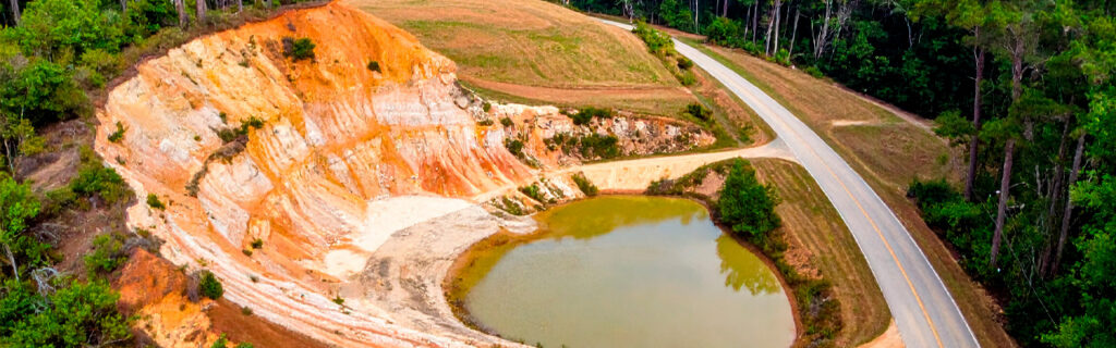
For property owners in Ball Ground and the surrounding Cherokee County area managing rural and semi-rural acreage with improvement objectives that span clearing, grading, drainage, access development, and vegetation management, understanding the specific characteristics of local land that most directly affect improvement project planning, what those characteristics require from project designs that will perform well in local conditions, and what the pre-project knowledge development looks like that reveals the specific conditions at each proposed improvement location before those conditions appear as surprises during active project execution gives the foundational understanding for approaching Ball Ground acreage improvement with the local knowledge that planning accuracy requires rather than with the generic assumptions that local conditions will consistently and expensively challenge.
The Terrain Around Ball Ground and What It Means for Improvement Projects
Ball Ground’s terrain reflects its position at the transition between the Georgia piedmont to the south and the Blue Ridge foothills to the north, producing a landscape that presents more significant and more variable elevation change within individual properties than the piedmont flatlands to the south present, while not reaching the dramatic ridge-to-valley relief that the mountain terrain to the north creates. This in-between terrain character creates the specific improvement planning challenge that Ball Ground properties present most consistently: the elevation changes look manageable from accessible observation positions but reveal substantially more earthwork scope when the interior terrain is physically walked and the actual corner-to-corner elevation differentials across proposed improvement footprints are estimated from ground-level assessment rather than from aerial observation that the canopy makes misleadingly flat.
Properties in the Ball Ground area that include wooded acreage with rolling interior terrain hidden beneath canopy are specifically susceptible to the earthwork volume underestimation that planning from aerial or edge observation consistently produces because the canopy surface that aerial imagery captures is substantially flatter than the ground surface beneath it, and the edge positions that road or boundary observation provides cannot see across the full interior terrain extent that the improvement footprint occupies. A building site footprint that appears to occupy essentially level terrain from the road consistently reveals eight to fifteen feet of corner-to-corner elevation differential when physically walked interior to the wooded terrain where the actual ground surface conditions rather than the canopy surface conditions are what the earthwork must address. This systematic underestimation of interior terrain variation is the single most common and most consequential source of earthwork cost overruns on Ball Ground rural property improvement projects, and physical interior terrain walking of all proposed improvement locations before any scope or budget is committed is the most directly effective prevention available for this consistently recurring planning failure.
Wooded Acreage Characteristics Specific to the Ball Ground Area
The wooded acreage that characterizes most Ball Ground rural properties presents specific vegetative and ecological conditions that improvement planning must account for accurately to produce outcomes that serve the property’s long-term function and character rather than inadvertently eliminating the natural features that make the land worth owning and managing.
Native Hardwood Canopy as the Property’s Primary Natural Asset
Ball Ground’s wooded properties contain mature native hardwood canopy including white oak, red oak, hickory, and tulip poplar at the development stage that reflects the region’s specific combination of climate, soil, and decades of growth since the most recent significant disturbance of each specific wooded section. This mature native canopy is the natural asset that most distinguishes Ball Ground rural property from developed or cleared land of equivalent acreage, and it is the asset that improvement planning most needs to specifically protect because it cannot be replaced within any practical ownership period at any cost once clearing removes it. Improvement projects that route clearing boundaries, building footprints, and equipment corridors around significant mature canopy trees rather than through them produce better long-term property outcomes than those that remove significant canopy for the convenience of simpler treatment boundaries, because the natural character that the preserved canopy defines in the post-improvement property is the character that makes the improved land as satisfying to own as the unimproved land was before improvement compromised it.
Invasive Species Pressure as the Primary Ongoing Management Challenge
Chinese privet is established across essentially every unmanaged wooded section on Ball Ground rural properties at the densities and root energy levels that decades of unmanaged establishment produces. The privet that makes Ball Ground wooded sections impenetrable to both navigation and ecological productivity is not a condition that mechanical clearing alone permanently resolves, because the root systems that decades of establishment developed produce vigorous resprout growth within the first growing season after mechanical clearing at the same density that the clearing addressed, unless herbicide follow-up treatment of that resprout depletes the root energy reserves that the regrowth draws from. Property owners planning clearing projects on Ball Ground acreage who expect one-time clearing to permanently restore the cleared areas to open manageable condition are planning for the outcome that mechanical clearing followed by consistent herbicide treatment produces rather than the outcome that mechanical clearing alone consistently produces, and the difference between realistic expectations and the one-time clearing expectation is the primary determinant of whether Ball Ground clearing investments produce lasting improvement or recurring restoration requirements at equivalent intensity.
Kudzu, wisteria, and multiflora rose are present at meaningful densities on many Ball Ground rural properties in the specific locations where each species’ establishment requirements are met by local terrain, soil moisture, and prior disturbance conditions. Each of these species has the same root energy persistence that makes mechanical clearing alone a temporary rather than permanent improvement, and each warrants the combined mechanical and chemical management approach that specifically depletes root energy reserves progressively across successive treatment seasons rather than simply removing above-ground expression while the root reserves that drive vigorous regrowth remain fully intact beneath the cleared surface.
Organic Soil Depth on Long-Wooded Sites
Ball Ground rural properties that have been continuously wooded for decades present organic topsoil layers of significant depth that must be completely removed from any zone where structural fill will be placed or where foundations will bear before earthwork for building sites, driveway subgrades, or other structural improvements can proceed on adequately prepared subgrade. The organic layer depth on long-wooded Ball Ground properties frequently ranges from eight to twenty-four inches, substantially exceeding the four to six inch generic assumption that improvement projects from other contexts might apply to the same scope. This organic depth difference represents significant additional stripping volume and cost that pre-project soil probing at the proposed improvement location reveals before budget commitment and that generic assumptions miss until active stripping during project execution reveals what the probing would have shown. Probing the soil at multiple points across any proposed structural improvement footprint before the improvement is designed and budgeted is the most reliable prevention for the organic stripping scope surprise that Ball Ground wooded site improvement projects most consistently encounter when planned without this specific pre-commitment site knowledge.
How Limited Access Affects Improvement Projects on Ball Ground Acreage
Many Ball Ground rural properties are accessed through private driveways that are the property owner’s full responsibility for design, construction, and ongoing maintenance, and that connect the property to the public road system through terrain conditions that may include stream crossings, significant grade changes, and vegetation-limited corridor widths that affect both routine property use and the equipment access that improvement projects require. The access conditions that are adequate for the property owner’s personal vehicles during routine daily use may not be adequate for the excavation equipment, forestry mulching machines, material delivery trucks, and construction equipment that improvement projects require to reach work areas throughout the property.
Improvement project planning on Ball Ground acreage should specifically assess the full access route from the public road to each proposed improvement location for the width, overhead clearance, ground bearing, and drainage conditions that each improvement project’s equipment requires, identifying any preliminary access improvements that must be completed before primary project scope can proceed. These preliminary access improvements are not optional additions to the project that add cost without primary scope contribution. They are the prerequisite conditions that primary project scope requires to execute at the quality and efficiency that the primary scope budget assumes when the access conditions that the access assessment reveals are necessary to achieve that quality and efficiency. Projects that discover access limitations during mobilization rather than during pre-project assessment encounter the day-one delays and emergency preliminary work costs that pre-project access assessment would have incorporated into the project schedule and budget at planned rather than emergency timing.
Drainage Crossings on Ball Ground Property Access Routes
The Etowah River watershed terrain that Ball Ground properties occupy creates multiple drainage crossing requirements on most rural property access routes, because the rolling terrain’s drainage patterns intersect with driveway alignments at multiple positions where water crosses beneath or through the driveway corridor from the higher terrain above to the lower terrain below. These drainage crossings require culverts sized for the full contributing watershed above each crossing point rather than only for the visible channel at the crossing location, and undersized culverts at Ball Ground driveway crossings are among the most consistently identified access infrastructure inadequacies on local rural properties because the contributing watershed above many Ball Ground crossings is substantially larger than the visible channel at the crossing position suggests to observers who estimate contributing area from the channel size alone rather than from the watershed topography above it that delivers drainage to the crossing regardless of whether that drainage is yet concentrated in a defined channel at the crossing point.
Soil and Drainage Conditions That Ball Ground Landowners Should Specifically Understand
The red piedmont clay that underlies Ball Ground properties is the soil characteristic that most significantly affects the full range of improvement project types and that most requires site-specific evaluation rather than generic planning assumptions to produce improvement designs that perform adequately in local conditions. Understanding how this specific soil type behaves across the seasonal moisture cycling and rainfall intensity conditions that Ball Ground’s climate delivers is the foundational site knowledge that every Ball Ground improvement project planning conversation should begin with rather than arriving at when project execution encounters the soil conditions that pre-project understanding would have incorporated into accurate designs from the beginning.
Ball Ground clay’s near-zero permeability under saturated conditions converts essentially all rainfall to surface runoff during the wet seasonal conditions that the region’s climate delivers multiple times each growing season, producing drainage volumes at improvement sites that include the full uphill contributing watershed rather than only the direct rainfall on the improvement footprint. A building site that receives drainage from several acres of surrounding higher terrain during wet seasonal conditions must manage drainage volumes many times larger than the footprint’s direct rainfall alone would generate, and drainage infrastructure sized only for direct footprint rainfall will be systematically inadequate for the actual drainage loads that the contributing watershed delivers to the site during the wet seasonal conditions that Ball Ground’s climate produces at regular frequency throughout the year. Post-rain site observation that identifies the contributing watershed above any proposed improvement location before drainage infrastructure is designed is the observation timing that reveals actual drainage behavior rather than the dry-condition appearance that conceals the drainage conditions that wet seasons consistently reveal.
Ball Ground clay’s compaction moisture sensitivity creates the earthwork scheduling considerations that improvement project timelines must specifically account for rather than treating compaction as an activity executable at any seasonal timing without quality consequence. Clay at significantly elevated moisture content from spring rains or significant recent rainfall cannot be adequately compacted regardless of compaction equipment effort because the water filling the soil pore spaces prevents the particle consolidation that creates structural density. Earthwork that requires compacted fill to achieve structural density performance standards should be specifically scheduled for the seasonal moisture conditions that allow compaction to achieve those standards, which in Ball Ground generally means late summer through fall before winter rainfall begins returning the clay toward its peak moisture content rather than spring and early summer when the clay is consistently at its highest moisture content from the winter and spring rainfall that preceded the improvement season.
Regulatory Considerations for Ball Ground Acreage Improvement
Ball Ground’s location within the Etowah River watershed creates specific regulatory considerations for improvement projects that disturb land or affect drainage features within or adjacent to the Etowah and its tributaries that flow through many Ball Ground rural properties. Understanding these regulatory considerations before improvement project scope is committed prevents the mid-project regulatory discoveries that create stop-work requirements, scope revisions, and compliance costs that pre-project regulatory awareness would have incorporated into project designs from the beginning rather than discovering as constraints after scope commitment makes working around them significantly more disruptive and more expensive than designing for them from the outset.
Georgia’s stream buffer requirements establish minimum setback distances from regulated watercourses within which land-disturbing activities are restricted, and Ball Ground’s abundant drainage features including the named and unnamed tributaries of the Etowah River system that cross many rural properties in the area create multiple potential regulated feature positions that improvement project scope must either avoid or address through the appropriate regulatory process before disturbance occurs within the buffer zone. Identifying regulated stream features on or adjacent to proposed improvement locations through post-rain site observation that makes seasonal features visible and active, and confirming the applicable buffer distance for each identified feature through the Cherokee County Environmental Health or Georgia EPD inquiry that provides regulatory confirmation, allows improvement designs to route their scope away from regulated buffer zones rather than discovering regulatory buffer conflicts when active scope execution reaches the regulated feature positions that pre-project observation and inquiry would have identified and avoided.
Georgia’s Erosion and Sedimentation Act land disturbance permit requirement applies to projects disturbing one acre or more of land, a threshold that multi-category Ball Ground improvement programs including clearing, grading, and access development across meaningful acreage easily reach. Projects subject to this requirement must develop and implement erosion and sedimentation control plans before land-disturbing activities begin, adding permit application time, plan development cost, and specific erosion control implementation requirements to the project timeline and budget that pre-project regulatory assessment identifies before those requirements appear as unexpected compliance additions during active project execution.
How to Develop the Site-Specific Knowledge That Ball Ground Improvement Projects Require
Developing the site-specific knowledge that Ball Ground acreage improvement projects require before scope is committed and work is scheduled involves a combination of physical site assessment, observation timing that reveals conditions not apparent under typical site visit conditions, and contractor input that adds the regional professional knowledge that translates observed site conditions into project-specific scope, cost, and scheduling implications with the accuracy that local project experience specifically provides for Ball Ground’s specific conditions.
Physical terrain walking of all proposed improvement locations, conducted specifically to assess the ground-level elevation differential across each proposed improvement footprint, is the most important single site assessment activity for Ball Ground improvement projects because it prevents the earthwork scope underestimation that planning from aerial and edge observation consistently produces on the interior rolling terrain that characterizes most Ball Ground wooded properties. This walking should specifically reach the interior of each proposed footprint rather than assessing from accessible adjacent positions, and it should specifically note the elevation change between the highest and lowest corners of each footprint rather than only confirming that the terrain seems manageable from the observation positions that foot traffic can conveniently reach.
Post-rain site observation conducted within twenty-four hours of a significant rain event specifically reveals the drainage behavior at each proposed improvement location that dry-condition observation conceals, providing the contributing watershed identification, drainage crossing confirmation, and drainage collection pattern information that drainage infrastructure design requires for sizing and positioning accuracy that dry-condition observation cannot provide. Scheduling at least one site visit for immediately following a significant rain event before any improvement scope is committed produces the drainage condition knowledge that Ball Ground improvement project drainage designs most need and most often lack when they are developed from the exclusively dry-condition observation that the most convenient site visit timing consistently produces.
Contractor site assessment with an experienced contractor who has specific recent project history on Ball Ground and Cherokee County rural properties adds the regional professional knowledge that translates the physical site observations into improvement project scope, cost, and scheduling recommendations calibrated to local conditions and contractor experience with how those conditions affect the specific improvement types being planned. This regional professional knowledge is not simply general construction competence applied to the local site conditions. It is the accumulated calibration from multiple prior projects on similar local terrain, soil, and vegetation conditions that allows the contractor to connect the specific site conditions they observe to the specific scope, cost, and scheduling implications that those conditions have produced on comparable prior projects in the same area.
Frequently Asked Questions
How does Ball Ground’s terrain specifically differ from other Cherokee County areas in ways that affect improvement planning?
Ball Ground properties in the northern part of Cherokee County tend to present more significant terrain variation than properties in the southern portions of the county closer to Canton, reflecting Ball Ground’s closer proximity to the Blue Ridge foothills terrain that introduces more elevation change within individual properties than the more gradually rolling piedmont terrain that characterizes the county’s southern portions. This terrain difference means that earthwork scope and cost for equivalent improvement footprint sizes is generally higher on Ball Ground properties with foothills terrain influence than on comparable footprint improvements at equivalent Cherokee County properties with less dramatic terrain variation. The drainage pattern complexity that steeper terrain creates is also generally higher on Ball Ground properties than on flatter county properties, producing more drainage crossings per linear foot of access route alignment and more contributing watershed complexity for building and improvement site drainage design than the more gently rolling terrain of other county areas with equivalent acreage presents. These terrain-specific differences between Ball Ground and flatter Cherokee County areas are the primary reason that improvement project scope and cost estimates developed from other county area experience should be specifically calibrated to the Ball Ground terrain context rather than transferred directly without the terrain assessment that Ball Ground’s more variable topography specifically requires.
Are there specific invasive species in the Ball Ground area that require different management approaches than other North Georgia locations?
Chinese privet is the dominant invasive species management challenge on Ball Ground properties as it is across Cherokee County, and the combined mechanical and chemical management approach that effectively depletes privet root energy reserves is the same approach that produces the best management results across the full county area rather than requiring Ball Ground-specific modification. Kudzu populations are present on Ball Ground properties in the specific locations where terrain, soil moisture, and prior disturbance created the establishment conditions that kudzu’s vigorous growth exploits, and the combined mechanical and chemical management program that addresses kudzu root energy reserves is equally applicable to Ball Ground kudzu populations as to kudzu elsewhere in the region. The terrain variation specific to Ball Ground creates one management consideration that flatter properties less frequently encounter: erosion risk from clearing on steeper slopes that requires specific erosion control measures during the transition between mechanical clearing and vegetative cover reestablishment, because Ball Ground’s steeper terrain slopes produce the rainfall energy concentration and surface flow velocities that initiate erosion on unprotected clay slopes more rapidly than equivalent rainfall on gentler terrain produces on the less erodible slope positions that gentler terrain creates.
What is the best time of year to begin improvement projects on Ball Ground acreage?
The most productive improvement season on Ball Ground acreage is the late summer through early winter period from August through January for the combination of improvement types that most Ball Ground rural property owners pursue. Late summer through fall provides the best compaction conditions for earthwork requiring structural fill density on Cherokee County clay as the soil has dried from its spring peak moisture toward the optimum compaction range. Fall dormancy through early winter provides the most efficient forestry mulching and clearing conditions as dormant vegetation presents lower biomass per acre than growing-season treatment, allowing more acreage to be treated per equipment operating hour at lower per-acre cost than summer clearing of the same vegetation at peak biomass. Fall dormancy also provides the clearest canopy visibility for selective clearing that must identify preservation targets within the treatment area, as leafless deciduous conditions allow canopy trees to be seen through the understory that summer foliage would conceal them within. Scheduling pre-project site assessment in late summer, before the optimal improvement season begins, allows contractor scheduling and any necessary regulatory applications to be completed before the fall improvement season opens rather than during it, capturing the full fall and early winter improvement window rather than losing the first weeks of it to the preparation that late-summer assessment would have completed before the season began.
How should Ball Ground property owners approach improvement planning differently than owners of suburban residential lots?
Ball Ground acreage improvement planning differs from suburban residential lot improvement planning in three fundamental ways that each require the rural acreage planning approach to be specifically developed for the rural context rather than transferred from suburban residential experience. First, the site knowledge development that adequate rural acreage improvement planning requires is substantially more extensive than suburban residential lot planning requires, because rural acreage presents terrain, drainage, soil, and vegetation conditions across larger and more variable areas that cannot be adequately assessed from the accessible perimeter positions that suburban residential lot assessment can cover comprehensively from street and yard observation. Second, the dependency relationships among improvements that rural acreage’s multi-phase improvement programs create require the coordinated phasing and sequencing planning that suburban residential improvements rarely need at the same scale, because rural acreage improvements span multiple improvement categories over multiple seasons rather than the simpler single-category improvements that suburban residential lots typically present. And third, the invasive vegetation management commitment that rural acreage requires as an ongoing multi-season program rather than a single-event clearing project has no direct suburban residential analog, making the expectation setting about post-clearing management requirements specifically important for Ball Ground acreage owners approaching their first significant rural land clearing investment.
Ready to Improve Your Ball Ground Acreage the Right Way?
Ball Ground acreage improvement that is planned from accurate site-specific knowledge of the local terrain, soil, drainage, vegetation, and regulatory conditions produces outcomes that satisfy their owners across the full ownership period because the improvements are designed for what the land actually presents rather than for generic assumptions that the land’s actual conditions contradict during execution. The specific knowledge that Ball Ground acreage improvement requires, including the interior terrain walking that reveals actual elevation differentials, the post-rain site observation that reveals actual drainage behavior, the soil probing that reveals actual organic depth and rock indicators, and the contractor input that translates all of these observations into project-specific scope and cost implications with the accuracy that local project experience provides, is the investment in preparation before commitment that most consistently prevents the planning failures that Ball Ground’s distinctive local conditions produce when improvement projects encounter them without adequate advance preparation. Properties whose improvements were planned from this local knowledge consistently deliver the function, character, and long-term satisfaction that make Ball Ground rural land ownership as rewarding as the land’s natural setting and improvement potential promise.
Bardin Outdoors works with property owners in Ball Ground, Canton, Cherokee County, and throughout North Georgia on clearing, forestry mulching, and grading and excavation projects planned from site-specific knowledge of the local terrain, soil, drainage, and vegetation conditions that Ball Ground acreage specifically presents, bringing the regional experience that translates those conditions into accurate project designs and realistic cost estimates. To learn more about how Bardin Outdoors can help improve your Ball Ground acreage, contact us.