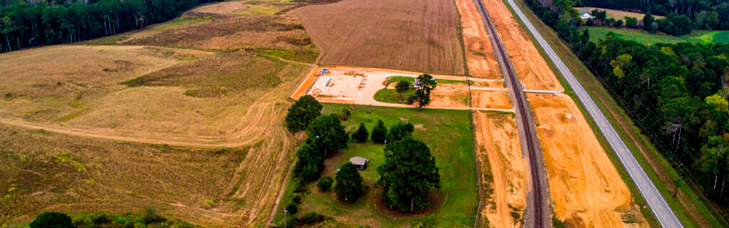
For property owners across Cherokee County, Ball Ground, and Canton managing rural acreage with remote sections that have become difficult or unreliable to reach, understanding the practical approaches available for improving remote area access without requiring major construction projects or significant infrastructure investment gives the realistic options for converting theoretical ownership of distant acreage into actual use of land that is genuinely within reach. Improved access to remote property sections is not always a large project. It is often a series of modest, targeted improvements that together eliminate the specific barriers preventing consistent access rather than a comprehensive infrastructure development program.
Why Remote Property Sections Become Inaccessible Over Time
Remote property sections that were once accessible do not typically become inaccessible through a single dramatic event. They become inaccessible through the accumulation of small changes that each marginally increase the difficulty of reaching them until the cumulative difficulty exceeds what most property owners are willing to accept for routine access. A trail that was cleared adequately several seasons ago has been progressively narrowed by vegetation encroachment from both sides until its effective width no longer accommodates the equipment or vehicles that need to use it. A soft creek crossing that was manageable in dry weather became impassable after a wet season raised the water table enough to keep the crossing soft year-round without the improvement that would have made it reliable. A road section that once had adequate surface and drainage accumulated ruts from a wet-season equipment use event that was never properly repaired, creating a section that damages vehicles and discourages use.
Each of these changes accumulated while the remote section was being used less than it previously had been, which is the self-reinforcing dynamic of deteriorating remote access. Less use means less maintenance attention. Less maintenance attention allows more deterioration. More deterioration produces less use. By the time a property owner consciously recognizes that a remote section has become difficult to access, the conditions producing that difficulty have typically been accumulating for multiple seasons without the incremental maintenance that would have kept them from becoming significant access barriers. Reversing this dynamic requires identifying the specific conditions that reduced access from adequate to inadequate and addressing those specific conditions rather than assuming that the entire access route requires comprehensive reconstruction.
Step One: Walking the Full Access Route to Identify Specific Barriers
Before any access improvement work is planned or scheduled, the full route from the primary driveway to the remote section should be walked deliberately with specific attention to identifying every discrete condition that makes the route difficult or unreliable. This walk should occur during or within twenty-four hours of a significant rain event to reveal the moisture-related access limitations that dry conditions conceal and that are often the primary determinants of seasonal access reliability. The conditions identified during this evaluation walk, documented with photographs and location notes, become the access improvement work list from which specific improvements can be prioritized and planned.
Most access routes to remote property sections have one to three specific barrier points that are responsible for most of the access difficulty, rather than uniform deterioration across the full length of the route. A vegetation-narrowed corridor section, a single chronically soft crossing, and an overhead clearance constraint from a fallen tree that was never removed may be the three specific conditions on an otherwise adequate route that collectively make reaching the remote section impractical for most of the year. Identifying these specific barriers rather than characterizing the entire route as generally inadequate focuses improvement planning on the interventions that will produce the most access improvement for the least investment rather than treating the entire route as requiring uniform improvement.
Restoring Overgrown Trail and Road Corridors
Vegetation encroachment into trail and road corridors is the most common single cause of deteriorating remote access on Cherokee County rural properties, and it is typically the most straightforward barrier to address because it requires only clearing equipment and access to the corridor rather than earthwork or drainage infrastructure installation. The approach appropriate for restoring an overgrown corridor depends on the current vegetation density and stem size and on the intended use of the restored corridor.
Forestry mulching is the most effective restoration approach for corridors that have been reclaimed by woody invasive species including privet, wisteria, and volunteer trees to stem sizes and densities that exceed what standard brush mowing equipment can effectively process. The mulching machine processes the full vegetation density in a single continuous pass, deposits the processed material as a ground-level mulch that immediately improves the corridor surface compared to the bare disturbed soil that alternative clearing methods would leave, and allows the operator to navigate precisely along the corridor to be restored while avoiding significant trees that should be preserved rather than removed. When the machine completes its work over a corridor, the corridor is immediately passable at foot and ATV width, and with slightly wider machine passes, at vehicle width appropriate for the equipment and vehicles the property owner needs to accommodate.
For corridors where vegetation has been reclaimed primarily by herbaceous and light woody growth that has not yet exceeded standard brush mowing equipment capacity, a tractor-mounted brush mower pass along the corridor centerline followed by lateral passes to the intended corridor width restores adequate foot and ATV access at lower cost than professional equipment mobilization would require. This owner-operated approach is appropriate for corridors where the vegetation density and stem size are within the mowing equipment’s capacity and where the corridor does not require the precision navigation around preserved trees that professional forestry mulching equipment provides more effectively.
Addressing Soft and Wet Crossing Points
Soft or wet crossing points along access routes are the barriers that most consistently limit seasonal access reliability on North Georgia rural properties because they create impassable conditions specifically during the wet weather periods when Cherokee County clay loses bearing capacity and when reaching the remote section is most likely to matter for hunting, wildlife management, or post-storm property inspection. A crossing that is firm and passable most of the year but that becomes soft and vehicle-damaging or impassable for several weeks after significant rain events creates an access reliability gap precisely at the times when reliable access is most valuable.
Fill and Crown Profile Improvement at Low-Lying Crossings
Low-lying sections of access routes that collect water from surrounding terrain and remain soft after rain events can often be made reliably passable through fill placement that raises the crossing surface above the seasonal wet zone’s influence, combined with crown profile grading that sheds water off the raised surface rather than allowing it to pond on the fill. The fill volume required for this improvement at any specific crossing depends on how much elevation above the surrounding wet zone is needed to provide adequate separation from the seasonal high water influence, and a contractor assessment of the specific crossing conditions is the most reliable basis for determining appropriate fill depth and lateral extent before the improvement is planned and budgeted.
Culvert Installation at Drainage Channel Crossings
Access routes that cross natural drainage channels, seasonal streams, or concentrated flow paths need culvert infrastructure to allow the water to pass beneath the road surface rather than overtop it during storm events. Low or wet crossing points that occur specifically at drainage channel positions are typically addressable through culvert installation in a fill section that raises the crossing above the drainage channel’s influence while providing adequate hydraulic capacity for the flow volumes the channel carries. Culvert sizing for these crossings should be based on the contributing drainage area above the crossing and the channel’s flow characteristics rather than on the smallest culvert that fits in the available fill height, because undersized culverts create the overtop flooding that the crossing improvement was intended to prevent.
Aggregate Surface Treatment for Soft Sections
Access route sections that are soft and bearing-capacity-limited at seasonal moisture levels but that are not in a drainage channel position or actively receiving drainage from surrounding terrain may be addressable through aggregate surface treatment rather than fill and culvert infrastructure. Crushed stone or gravel placed over a geotextile fabric base on an adequately crowned and drained subgrade distributes vehicle and equipment loads across the aggregate layer and through the geotextile to the underlying soil, providing bearing capacity support that the native clay subgrade alone cannot sustain during wet conditions. This surface treatment approach is most appropriate for sections where the softness is a function of the native clay’s moisture-sensitive bearing capacity rather than a function of water accumulation from drainage that must be intercepted and managed before the surface treatment can perform.
Clearing Overhead and Lateral Obstructions
Overhead and lateral obstructions along access routes including fallen or leaning trees spanning the corridor, branches that have grown into the clearance envelope required for vehicles and equipment, and shrub growth that has reduced effective lateral clearance below the width needed for reliable passage each create specific access barriers that targeted removal addresses efficiently without requiring the full corridor restoration that more comprehensive vegetation encroachment demands. Identifying these discrete obstructions during the access route evaluation walk allows them to be addressed individually through land clearing work or targeted tree removal rather than requiring treatment of the full corridor length.
Fallen trees spanning the corridor that have been lying across it since a prior storm event and that have never been removed are among the most common discrete obstructions on neglected interior access routes, and their removal is typically straightforward once access to them is established. The challenge is often reaching the fallen tree on routes where other encroachment conditions have made approaching the obstruction difficult, which is why the access route evaluation walk that identifies all barriers collectively allows them to be addressed in the sequence that most efficiently restores access by clearing the outermost barriers first, then progressing toward the interior barriers that become accessible once the outer barriers have been removed.
Establishing New Corridor Connections to Previously Unreachable Sections
Some remote property sections have not simply deteriorated from a formerly accessible condition but have never had adequate access established in the first place, existing as nominally owned acreage that the current owner has never been able to reach through the wooded terrain separating it from the accessible portions of the property. Establishing new trail or road corridors through this terrain to connect the remote section to the existing access network converts nominally owned acreage into genuinely usable land in ways that can be accomplished without large-scale land development through targeted corridor clearing that establishes the connection at appropriate width for the intended use.
New corridor establishment through wooded terrain requires route selection that accounts for terrain, vegetation, drainage features, and regulatory requirements in addition to the straight-line connection between the accessible network and the remote section. A route that follows natural terrain contours, avoids significant mature trees that would need to be removed for the corridor and that provide valuable canopy character, crosses drainage features at locations where culvert installation is feasible, and maintains adequate distance from any regulated stream buffers or wetland areas is a better route than the most direct line between the connection points regardless of how much more linear footage the terrain-following route requires. Route selection that accounts for these considerations before corridor clearing begins produces a corridor that can be established with appropriate equipment and that will remain functional across multiple seasons without drainage problems, erosion, or regulatory compliance issues that poor route selection would generate.
How to Maintain Restored Access Over Successive Seasons
Access improvements to remote property sections that are not followed by maintenance appropriate to the specific improvement type consistently deteriorate toward their pre-improvement condition within one to three growing seasons, requiring restoration at full cost again rather than the lighter maintenance that consistent management between restoration events would have required. Understanding the maintenance requirements of each type of access improvement before the improvement is made allows maintenance planning and commitment to be part of the improvement decision rather than an afterthought discovered after deterioration is already underway.
Trail and road corridors cleared through forestry mulching require vegetation management at intervals appropriate to the invasive species pressure in the specific corridor to prevent return to mowing-resistant density. Annual or biennial professional mulching treatment combined with owner-operated brush mowing between professional cycles is the maintenance pattern that most effectively keeps cleared corridors in accessible condition while progressively depleting the invasive root energy that produces resprout growth. Targeted herbicide treatment of resprout growth at six to twelve inches of height following each mechanical clearing cycle depletes root energy reserves that mechanical treatment alone does not reach, progressively extending the interval between required mechanical treatments as resprout vigor declines across successive combined treatment seasons.
Fill and culvert crossings require annual inspection of culvert inlets for debris accumulation and clearing of any blockage before wet season, inspection of fill surface drainage condition and repair of any crown profile deterioration that vehicle use has produced, and monitoring of fill settlement that may reduce the effective crossing elevation over time as the fill consolidates under traffic loading. Aggregate surface sections require periodic resurfacing as traffic displaces aggregate material from the surface, crown profile maintenance to restore drainage that traffic compaction reduces over time, and replacement of geotextile fabric sections that have been damaged by concentrated drainage or vehicle loading.
Sequencing Access Improvements for Maximum Efficiency
When multiple access barriers on a single route to a remote property section require improvement, the sequence in which those improvements are addressed determines how efficiently the work proceeds and how quickly the remote section becomes consistently accessible. Addressing barriers from the primary driveway outward toward the remote section, rather than beginning with the barrier closest to the remote section and working back toward the accessible network, ensures that each successive improvement is reachable through the infrastructure that prior improvements in the sequence have already established.
Beginning with the barrier furthest from the primary driveway creates a situation where the work needed to address that barrier must be staged and executed from the primary driveway without the access improvement that addressing the nearer barriers first would have established. Working from the accessible end outward produces a progressively extending reach of reliable access that makes each successive barrier addressable with the full range of equipment and staging options that the already-improved section of the route provides, rather than requiring improvised approaches to reach barriers that are currently beyond the reliable access boundary.
Frequently Asked Questions
How wide should a trail corridor be to provide reliable ATV and foot access to remote property sections?
A corridor cleared to eight to ten feet wide provides adequate lateral clearance for most ATV widths while allowing comfortable foot access alongside the vehicle track without contact with the corridor edge vegetation. This width also allows the corridor to accommodate side-to-side variation in trail alignment without the edges being so close that normal trail use produces contact with remaining vegetation at every deviation from the centerline. For corridors intended to serve both ATV use and occasional light truck or UTV access, twelve to fourteen feet of cleared width provides comfortable clearance for wider vehicles without requiring the full road width that heavy equipment access would need. For foot-access-only corridors where ATV or vehicle use is not planned, six feet of cleared width provides comfortable single-person navigation with adequate shoulder clearance for carrying equipment or pulling a game cart without contact with corridor edge vegetation.
How do I determine whether a soft crossing requires a culvert or simply fill and surface aggregate to become reliably passable?
The distinction between crossings that need culvert infrastructure and those addressable through fill and aggregate surface treatment is whether the softness results from an active drainage flow that needs a conveyance path beneath the road surface or from the native clay soil’s moisture-sensitive bearing capacity in an area without significant drainage flow. If the crossing is soft because a drainage channel, seasonal stream, or concentrated drainage flow path crosses the access route at that point, a culvert provides the flow conveyance that prevents the water from saturating the fill and creating the softness that the crossing experiences without it. If the crossing is soft because the native clay in a low-lying area retains moisture from surrounding soil drainage without a discrete surface flow crossing the route, fill that raises the crossing above the moisture influence zone combined with adequate crown drainage may be sufficient without a culvert. A site assessment by an experienced local contractor during or following a rain event provides the most reliable determination of which condition is present at any specific soft crossing point.
Is it possible to improve remote area access without using professional equipment for every improvement?
Yes. Property owners with access to a tractor-mounted brush mower, a chainsaw, and basic hand tools can address many access barrier types without professional equipment mobilization, particularly for corridors where vegetation encroachment is primarily herbaceous or light woody growth within mowing equipment capacity, for fallen tree obstructions where chainsaw work can clear the obstruction once the fallen material is accessible, and for overhead clearance issues where individual branches rather than full tree removal is needed. Professional equipment becomes necessary when woody stem sizes and densities in the corridor exceed what standard brush mowing equipment can effectively process, when earthwork for fill or grading corrections is needed at soft crossings, and when new corridor establishment through densely vegetated terrain requires the processing capacity and precision navigation that forestry mulching equipment provides. A mixed approach that addresses the barriers within owner capability through owner-operated equipment and engages professional equipment specifically for the barriers that exceed owner capability is consistently more cost-effective than treating all access improvement work as requiring professional equipment regardless of the specific nature of each barrier.
How should I decide whether improving access to a remote section is worth the investment relative to how that section will actually be used?
The access improvement investment decision should be evaluated against the value that consistent reliable access to the remote section would produce across the seasons following the improvement rather than only against the immediate cost of the improvement itself. A remote food plot that could be consistently maintained and managed with reliable access, producing better wildlife habitat and hunting outcomes each season, represents a compounding return on the access investment that accumulates across every subsequent season of use. A remote timber section that could be periodically inspected and assessed with reliable access allows the timber’s health and condition to be actively monitored, preventing the undetected hazard tree accumulation that sections without monitoring consistently develop. A remote boundary section that could be walked after storm events allows fence infrastructure inspection and prompt repair that prevents the damage accumulation that inaccessible sections experience between rare access events. Evaluating these compounding seasonal returns rather than only the one-time improvement cost typically reveals that access improvements to genuinely valuable remote sections have favorable returns when the full period of ownership benefit is included in the analysis.
Ready to Improve Access to Your Property’s Remote Areas?
The remote sections of large North Georgia rural properties are not inaccessible because improving access to them is inherently expensive or complicated. They are inaccessible because the specific barriers that have accumulated along their access routes have not been systematically identified and addressed. Walking the full access route to each remote section under wet conditions, documenting every discrete barrier encountered, and developing a targeted improvement plan that addresses those specific barriers from the primary driveway outward converts the task of improving remote access from an overwhelming general project into a specific, prioritized list of targeted interventions that each produce measurable improvement in access reliability. The result is land that the property owner actually uses rather than land they own but cannot reach.
Bardin Outdoors works with property owners across Ball Ground, Canton, Cherokee County, and North Georgia on access improvement projects including trail corridor clearing, soft crossing treatment, and new access route establishment that convert remote acreage from theoretical ownership into genuinely accessible and usable property sections. To learn more about how Bardin Outdoors can help your property improve access to its remote areas, contact us.