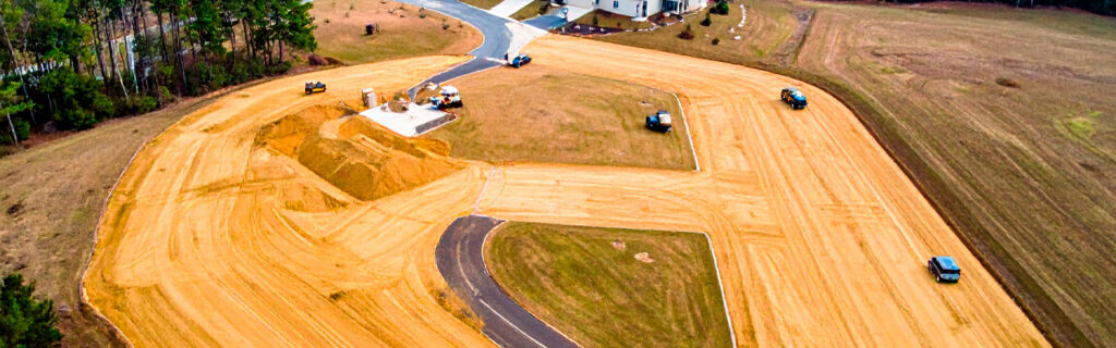
For property owners across Cherokee County, Ball Ground, and Canton planning any outdoor improvement from a building foundation to a driveway to a recreational area development, understanding specifically how elevation changes affect each category of project planning gives the context for approaching improvement decisions with the terrain awareness that North Georgia’s topography requires. The rolling hills that make this region’s residential and rural properties visually distinctive and appealing are the same terrain features that shape every drainage relationship, every earthwork requirement, and every access infrastructure design on the properties they define. Understanding elevation’s role in those relationships is not technical expertise that only engineers possess. It is practical knowledge that every property owner making outdoor improvement decisions on North Georgia’s terrain needs.
How Elevation Change Drives Water Movement and Drainage Outcomes
Water moves downhill. This is the simplest and most consequential terrain principle for outdoor project planning on North Georgia properties, because the direction and concentration of water movement across a site determines where drainage infrastructure must be positioned, how it must be sized, and what the consequences will be if improvement projects create surfaces or conditions that redirect water toward places it should not go. Elevation change is the mechanism that drives every drainage relationship on a property, and understanding the elevation relationships between a proposed improvement site and the terrain surrounding it is the essential first step in any drainage design for that improvement.
Uphill Contributing Areas and Their Drainage Volumes
Any improvement site that is topographically lower than the terrain surrounding it on one or more sides will receive drainage from those uphill areas in addition to the rainfall falling directly on the improvement’s own footprint. The volume of this uphill drainage contribution is determined by the size of the contributing area and the soil’s permeability under the moisture conditions present during rain events. Cherokee County’s red piedmont clay has near-zero permeability when saturated, converting essentially all rainfall to surface runoff during the wet conditions that the region’s frequent rain events produce. This means that a building site at the base of a slope receives not only the rain falling on its footprint but the full rainfall-equivalent runoff from all the uphill area draining toward it during saturated soil conditions.
Improvement projects designed without accounting for uphill contributing area drainage consistently produce drainage outcomes that work adequately during light rain but fail during the more significant events that the local terrain and rainfall pattern generate. A foundation drainage system designed for the rain falling on the building footprint, without accounting for the additional runoff from the slope above the building, will be overwhelmed by the uphill contribution during significant rain events that the system was never designed to handle. A driveway culvert sized for the rain falling on the driveway corridor without accounting for the drainage channel crossing it carries during storms will produce the overtop flooding and washout that adequate culvert sizing for the full contributing area would have prevented. These drainage failures are terrain failures before they are design failures, resulting from incomplete understanding of what the elevation relationships at the project site mean for the drainage volumes the project must manage.
Drainage Concentration at Low Points and Concavities
Terrain concavities, low points between ridges, and any site position where multiple drainage flow paths converge create drainage concentration conditions that produce larger drainage volumes at specific locations than the contributing area calculation for any single flow path would suggest. These concentration points are typically where the most significant drainage management challenges occur on North Georgia rural properties, because the concentrated flow that arrives at them carries both the volume and the velocity that erosion and infrastructure damage require. Identifying the drainage concentration points at and near any proposed improvement site before the project is designed allows the drainage infrastructure to be positioned and sized for the concentrated flow that will arrive at those points rather than for the distributed lower-velocity flow that characterizes the areas between concentration points.
How Small Elevation Differences Create Large Drainage Consequences
Elevation differences that seem insignificant from a visual or practical standpoint can create significant drainage consequences for adjacent improvements because drainage is determined by relative elevation between adjacent surfaces rather than by absolute elevation differences that feel meaningful to a person standing on the terrain. A building pad that is graded two inches lower than the surrounding lawn on one side will collect water from that direction during rain events because water flows toward and accumulates at the lowest available point regardless of how small the elevation differential that creates that low point is. A driveway section that has lost its crown profile to the point of being essentially flat will collect and hold water rather than shedding it because the drainage mechanism that crowning provides is not a function of the absolute amount of crown but of the directional slope that any crown creates relative to the surface edge.
This sensitivity of drainage outcomes to small elevation differences is the practical reason that finished grading for drainage-sensitive applications must achieve precision that rough terrain observation cannot verify. The five percent outward slope standard for foundation perimeter drainage, which corresponds to six inches of drop over ten horizontal feet, is specific precisely because the drainage consequence of failing to achieve that slope is significant even though the physical difference between a correctly sloped surface and a flat surface at that scale is not visually obvious to someone walking across it. Grading and excavation work that achieves these drainage grades accurately and verifiably produces the drainage outcomes that the design intended. Work that approximates these grades without verification produces outcomes that may or may not achieve the intended drainage performance depending on whether the approximation happened to be adequate.
How Elevation Change Affects Earthwork Scope and Cost
Creating the level or gently sloped surfaces that improvements including building pads, driveways, recreational areas, and work platforms require from the rolling terrain of Cherokee County properties involves cut-and-fill earthwork whose volume is directly proportional to the elevation change that must be overcome across the improvement footprint. Understanding the relationship between terrain elevation change and earthwork volume is essential for accurate improvement project cost estimation, because earthwork volume is the primary driver of excavation and grading project cost on North Georgia properties and because visual terrain assessment consistently underestimates actual elevation change at the scales that produce significant earthwork volume differences in project budgets.
Why Visual Terrain Assessment Underestimates Elevation Change
Human visual terrain assessment from standing positions or from property edges consistently underestimates the elevation change present across interior terrain features on wooded and partially vegetated properties for several reasons that are inherent to how human vision processes terrain information rather than how skilled the observer is at terrain reading. Aerial imagery compounds the problem by showing canopy surfaces rather than ground surfaces on wooded properties, presenting an apparently flatter surface than the ground terrain beneath the canopy actually has. And residential property lots that appear to have gentle, manageable slopes from casual visual assessment often reveal considerably more elevation change when interior terrain is physically walked with specific attention to noting where the high corners and low corners of proposed improvement footprints actually are.
The budget consequence of this underestimation compounds across the relationship between elevation change and earthwork volume. A building pad footprint of one hundred by one hundred feet with an actual corner-to-corner elevation difference of four feet requires substantially more earthwork than the same footprint with an assumed two-foot elevation difference, and the cost difference between these two earthwork volumes at current Cherokee County contractor rates is large enough to affect project financial decisions. Property owners who commit project budgets based on visually assessed terrain elevation and discover actual elevation during excavation that exceeds the visual estimate face the choice between accepting a budget overrun and modifying the project scope, neither of which would have been necessary if physical interior terrain evaluation had produced an accurate elevation picture before the budget was committed.
Cut-Fill Balance and Its Effect on Project Economics
The relationship between the volume of material that must be cut from the high areas of a project footprint and the volume of material needed to fill the low areas determines whether the earthwork is self-contained within the project footprint or whether excess material must be exported from the site or additional fill material must be imported to achieve design elevation. A balanced cut-fill project where the cut volume closely matches the fill volume is the most economical earthwork scenario because it avoids the trucking cost of exporting excess cut material or importing deficient fill material. Terrain evaluation that accurately identifies the project footprint’s elevation profile before earthwork design allows the project to be designed for cut-fill balance where terrain conditions allow it, and to account for the import or export cost where terrain conditions make balance impossible.
On sloped sites where a level pad is being established, the cut-fill balance depends on where within the slope the pad is positioned. A pad positioned at mid-slope with equal amounts of cut above and fill below the natural grade will be more balanced than the same pad positioned at the bottom of the slope where most of the earthwork is fill rather than cut, or at the top of the slope where most is cut rather than fill. Understanding this relationship allows site selection decisions to favor positions with better cut-fill balance when the intended improvement is compatible with different positions within the available terrain, reducing earthwork cost through position selection rather than accepting the higher cost of an imbalanced earthwork scenario at a less favorably positioned site.
How Elevation Change Affects Building Site Selection and Foundation Design
Building site selection on North Georgia residential and rural properties involves terrain evaluation that goes beyond identifying a site that appears large enough for the planned structure and accessible from the existing driveway. The elevation relationships at the proposed site determine the drainage conditions that the foundation will experience across its service life, the earthwork scope required to establish the building pad, and the foundation system type that is appropriate for the site’s specific elevation and drainage characteristics.
Terrain Position and Long-Term Foundation Drainage
The terrain position of a building site within the property’s overall topographic context determines the drainage conditions that the foundation will be exposed to across its service life. Sites on elevated terrain positions including ridge crests, shoulder positions, and upper slopes have natural positive drainage away from the building footprint in multiple directions, reducing or eliminating the need for drainage infrastructure to protect the foundation from chronic moisture exposure. Sites at lower terrain positions including valley bottoms, toe-of-slope positions, and terrain concavities receive drainage from surrounding terrain that the foundation drainage system must capture and redirect away from the building continuously. The drainage infrastructure required to protect a foundation at a lower terrain position is more extensive than what an elevated terrain position requires, and that infrastructure cost difference is a legitimate building site selection consideration that the site’s topographic position determines.
Elevation and Foundation System Compatibility
The elevation of the proposed foundation relative to the seasonal high water table at the site determines which foundation system types are appropriate for the location. Sites where the seasonal high water table rises close to the proposed foundation elevation require either a foundation system that positions the building floor above the seasonal water level, through raised pier foundations or elevated slab construction, or drainage infrastructure that intercepts and removes groundwater before it reaches the foundation elevation. These additional requirements represent real project cost that the terrain and elevation conditions at the site create and that site evaluation during wet seasonal conditions reveals before foundation commitment rather than after construction when the seasonal high water expression in the foundation confirms that the site’s elevation and drainage characteristics required more design attention than they received.
How Elevation Change Affects Driveway Design and Performance
Driveways on sloped North Georgia terrain must manage the elevation change they traverse in ways that provide safe vehicle operation, maintain structural integrity of the road surface through the full seasonal range of moisture conditions, and convey drainage off the road surface and through drainage crossings without the overtop flooding and surface damage that inadequate drainage design produces. Each of these requirements is directly determined by the specific elevation changes along the driveway alignment, and driveway design that does not accurately account for those elevation changes produces driveways whose performance in actual conditions does not match the performance their design intended.
Grade and Vehicle Operation Safety
Driveway grade, which is the ratio of elevation change to horizontal distance, determines whether the driveway is safely navigable by the vehicles that regularly use it under the full range of seasonal conditions those vehicles encounter. Grades that are manageable for passenger vehicles in dry conditions may become unsafe for loaded trucks or trailers in wet conditions when braking distance increases and traction reduces on saturated gravel surfaces. Grades that are navigable in the forward direction may be problematic for backing maneuvers that the property’s turnaround and delivery access require. Understanding the specific grades present at all sections of a proposed driveway alignment before design is finalized allows grade-limiting alignments to be identified and alternative routings evaluated before committing to an alignment whose grade creates operational limitations that would have been discovered after construction.
Grade and Surface Drainage Design
Driveway surface drainage design depends on both the longitudinal grade of the driveway and the cross slope that crown profile creates. On low-grade sections where the driveway is nearly level longitudinally, cross drainage through crown profile and side ditches is the primary drainage mechanism, and maintaining adequate crown profile on these sections is the primary surface drainage maintenance priority. On steep-grade sections where the driveway drops significantly over short horizontal distances, longitudinal surface flow along the driveway becomes the primary drainage concern, and periodic cross drainage features including drainage dips and water bars that intercept and divert longitudinal flow off the driveway surface before it accumulates velocity and volume sufficient to displace gravel are the design elements that protect the driveway surface from the erosion that unmanaged longitudinal flow produces.
How Elevation Change Affects Recreational and Use Area Development
Recreational areas, outdoor living spaces, equipment work platforms, and other use areas that require level or gently sloped surfaces must be established from the terrain that exists at their proposed location, and the elevation change at that terrain determines both the earthwork required to create the level surface and the drainage design required to keep that surface functional across all seasonal conditions. Understanding how elevation change at candidate locations affects both of these requirements allows use area placement decisions to favor terrain positions that reduce earthwork and drainage infrastructure requirements while achieving the functional goal the use area is intended to serve.
A food plot location on a gently sloping section that requires modest earthwork to establish a reasonably level planting surface and that has natural positive drainage away from the plot in the downhill direction is a more favorable terrain position than a food plot location in a terrain concavity where significant earthwork is required to manage the elevation change across the plot footprint and where the concave terrain collects drainage from surrounding areas that makes the plot chronically wet during the wet season. Both locations may provide adequate sunlight and soil conditions for productive food plot planting, but the terrain position differences create enough difference in earthwork and drainage management requirements to make the slope position substantially more cost-effective to develop and maintain over successive seasons of use.
How to Evaluate Elevation Change Before Planning Outdoor Projects
Accurate elevation evaluation for outdoor project planning requires physical presence at the proposed improvement site and deliberate attention to the terrain features that determine the elevation relationships most consequential for the planned project. Several practical evaluation approaches provide the elevation information that project planning requires without the formal surveying equipment that engineering applications demand.
Walking the proposed improvement footprint specifically to identify the high corner and the low corner of the footprint and estimating the elevation difference between them, by observing how many consistent steps of terrain drop occur between the two points and estimating the elevation change per step from the slope angle, provides the rough elevation differential that allows earthwork volume to be estimated before engaging a contractor for detailed scope development. This walking assessment consistently produces more accurate elevation estimates than visual observation from any external position because it requires physical navigation of the terrain rather than visual estimation of its character from a distance.
Observing water movement across the site within twenty-four hours of a significant rain event reveals the drainage relationships that the terrain’s elevation pattern creates under the actual conditions that the site experiences during rain events. Where water flows, where it collects, and how long it persists after rain stops are all drainage behaviors that the terrain’s elevation pattern drives, and observing those behaviors directly is the most reliable method for understanding them rather than inferring them from terrain description alone. This post-rain observation investment is particularly valuable for drainage-sensitive project types including building site selection, driveway alignment, and any improvement where the drainage relationship between the site and surrounding terrain significantly affects how the project should be designed.
Frequently Asked Questions
How much elevation change across a building pad footprint is considered manageable versus requiring significant earthwork investment?
There is no universal threshold that separates manageable from significant earthwork because the earthwork volume required for any specific elevation difference depends on both the elevation differential and the footprint area across which that differential must be overcome. A two-foot elevation change across a twenty-by-twenty-foot pad is a modest earthwork scope. The same two-foot elevation change across a sixty-by-sixty-foot pad is significantly more material to move. As a practical reference point, building pad sites on Cherokee County residential properties with corner-to-corner elevation differences of two feet or less typically produce earthwork scopes that can be completed in one to two machine days with modest material volumes. Sites with four to six feet of elevation change across the building footprint, which are common on the rolling terrain of the region, require substantially more machine time and fill material, and sites with elevation differences exceeding six feet across the footprint move into the range where earthwork cost becomes a significant project line item warranting specific evaluation and accurate scoping before the project budget is committed.
Can Google Earth or satellite imagery provide adequate elevation information for outdoor project planning?
Satellite imagery and the elevation profiles available through mapping tools including Google Earth provide useful general context about the broad topographic character of a property but consistently understate the ground-level elevation variation that project planning requires for accurate earthwork and drainage design, particularly on wooded properties where the canopy surface shown in aerial imagery is substantially flatter than the ground terrain beneath it. The resolution of publicly available elevation data is also typically too coarse to reveal the site-specific elevation variations at the scale of a building footprint or a driveway alignment that are most consequential for project planning. These tools are useful for understanding the broad drainage watershed context of a property position and the general regional slope character, but they should not be used as a substitute for physical site evaluation that reveals ground-level elevation variation at the specific improvement locations where that variation drives project scope and cost.
Does the direction a slope faces affect how elevation change influences outdoor project planning beyond just the drainage considerations?
Yes. Slope aspect, which is the compass direction a slope faces, affects the soil moisture conditions the slope experiences through the seasonal cycle and the sunlight availability for vegetation growing on the slope, both of which influence outdoor project planning in specific ways. North-facing slopes receive less direct solar radiation than south-facing slopes and retain moisture longer after rain events because reduced evapotranspiration from reduced solar exposure keeps soil wetter for extended periods. This means that excavation and grading work on north-facing slopes encounters wetter clay conditions more persistently than equivalent work on south-facing slopes, requiring more weather contingency in project scheduling. North-facing slopes also support different native vegetation communities than south-facing slopes, which affects clearing project scope and the invasive species likely to be present. South-facing slopes dry more quickly after rain events and support sun-demanding vegetation including the warm-season grasses and forbs that food plots and pastures require, making them generally more favorable terrain positions for these applications than the moister, shadier north-facing positions of equivalent gradient.
How does understanding elevation change help avoid drainage problems that are expensive to correct after construction?
Understanding elevation change before construction allows drainage infrastructure to be positioned and sized for the actual drainage volumes and flow paths that the terrain’s elevation pattern creates rather than for assumed drainage conditions that the actual terrain may not produce. The drainage problems most expensive to correct after construction are almost always the result of drainage infrastructure being positioned or sized based on inadequate terrain evaluation that did not account for the uphill contributing area that the site’s terrain position brings to the improvement site, or the concentrated flow that terrain concavities direct toward specific points rather than distributing evenly across a broad front. Both of these drainage design shortcomings are addressable through pre-construction terrain and elevation evaluation that accurately characterizes the site’s drainage context. Addressing them after construction requires either retrofitting drainage infrastructure into a completed landscape where disruption and coordination costs are significantly higher than pre-construction installation would have been, or accepting chronic drainage conditions that limit the improvement’s performance and eventually damage its structural elements through the chronic moisture exposure that adequate pre-construction drainage design would have prevented.
Planning an Outdoor Project on Your North Georgia Property?
Every outdoor improvement on a North Georgia residential or rural property is shaped by the elevation changes at its site. Those elevation changes determine where water goes and where it collects, how much earthwork bringing the site to the designed surface requires, what drainage infrastructure the project must include to perform correctly across all seasonal conditions, and what foundation and structural design is appropriate for the site’s specific terrain position. Understanding these relationships before project planning is finalized is not technical complexity that requires professional expertise to navigate. It is practical terrain awareness that physical site evaluation provides to any property owner who walks their improvement sites with specific attention to the elevation relationships that will drive their projects’ drainage behavior, earthwork requirements, and long-term performance.
Bardin Outdoors works with homeowners, landowners, and builders across Ball Ground, Canton, Cherokee County, and North Georgia on grading, excavation, and site preparation projects that account accurately for the elevation changes and drainage relationships at each project site, producing improvements designed for the terrain they occupy rather than for assumed terrain conditions that the actual site may not match. To learn more about how Bardin Outdoors approaches terrain and elevation evaluation in outdoor project planning, contact us.