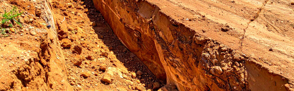
For property owners across Cherokee County, Ball Ground, and Canton managing residential and rural lots where the rolling terrain, clay soil, and seasonal rainfall that characterize the region produce uneven ground conditions across many properties regardless of their improvement history, understanding how specific types of uneven ground specifically limit property use, what grading corrections address each type of uneven ground condition, and how to evaluate whether grading investment in a specific uneven area would produce functional improvements worth the investment gives the practical foundation for approaching uneven ground as the addressable functional limitation it usually is rather than the permanent property characteristic it sometimes appears to be from the accessible observation positions that make topographic challenges look more intractable than targeted grading can actually make them.
How Different Types of Uneven Ground Create Specific Use Limitations
Uneven ground on Cherokee County properties takes several distinct forms that each create different types of use limitations and that each require different grading approaches to correct. Understanding the specific limitation that each uneven ground type creates helps property owners identify the connection between the ground condition they observe and the use limitation they experience, which is the connection that motivates grading investment as a functional improvement rather than simply a cosmetic change to the landscape’s appearance.
Excessive Slopes and Equipment Operation Limitations
Slopes that exceed the safe operating gradient for the equipment or vehicles that a property owner needs to operate across a specific area limit the management and development activities that slope section can support without regrading that reduces the slope to the gradient safe operation allows. A slope that exceeds the safe operating gradient for a tractor-mounted brush mower prevents the mowing passes that food plot and open area vegetation management requires, limiting those management activities to the areas of the property where gradients are within safe mowing equipment operation limits. A slope that exceeds the stable operating gradient for a skid steer or mini excavator prevents the equipment from positioning safely for the excavation work that site preparation in that area requires, limiting building site development and drainage correction to positions where safe equipment operation is achievable without regrading the approach terrain.
Grading that reduces excessive slopes to gradients within safe equipment operation limits converts the equipment-inaccessible steep sections into areas where the management activities the property owner intends can actually be executed without the gradient limitation that prevented them. The specific gradient reduction that safe equipment operation requires varies with the equipment type, and matching the grading correction to the specific equipment that the corrected area will support gives the grading its appropriate design standard rather than an arbitrary slope reduction that may or may not achieve the specific safe operating gradient that the intended equipment requires.
Low Areas and Drainage Collection Limitations
Low areas that collect surface drainage from surrounding higher terrain, holding standing water for extended periods after rain events, limit the uses that water-sensitive applications require the ground to be dry for: planting establishment that cannot tolerate prolonged saturation at the root zone, building site development that requires dry subgrade conditions for adequate compaction, equipment operation that requires firm ground bearing through wet seasonal conditions, and recreational use that requires the area to be accessible and comfortable after rain events rather than covered by standing water that persists for days. The fundamental problem with low areas is that they occupy the terrain position that water naturally flows toward, and water that flows to a low area from surrounding higher terrain will continue doing so regardless of how many times the standing water that results is managed after the fact rather than the drainage pattern that delivers it to the low area being corrected at its source.
Grading that addresses low area drainage limitations does so either by raising the low area’s grade to eliminate the topographic depression that collects drainage from surrounding terrain, or by improving the drainage outlet from the low area so that collected drainage flows out at the rate it arrives rather than accumulating to standing water depth. Raising the grade requires fill material placement and compaction that creates a new ground surface above the existing low area, changing the topographic position from drainage collection to drainage shedding at the new grade. Improving the drainage outlet requires establishing or improving the path that drainage follows from the low area to the nearest lower terrain position where it can flow away, which may involve grading a drainage swale, installing a culvert through a natural berm that is blocking the outlet, or creating a drainage channel that provides the flow path the low area’s drainage needs to exit rather than accumulate.
Irregular Surface Conditions and Equipment Efficiency Limitations
Irregular surface conditions including ruts, erosion channels, hummocks from organic material decomposition, and the uneven ground that root removal from prior clearing creates limit equipment operating efficiency and in some cases create equipment damage risks that make operation across irregular surfaces less cost-effective than it would be across the uniformly graded surfaces that grading correction can produce. Hay mowing equipment that must navigate ruts and surface irregularities to complete passes across a field operates less efficiently per hour and experiences more blade and equipment contact with the irregular surface features than the same equipment operating across a uniformly graded surface, increasing both the time required to complete the mowing and the equipment wear and damage risk from surface contact that uniform grading eliminates. Food plot maintenance equipment, tractor-mounted spreaders, and other implements that are effective across uniform surfaces become less efficient and sometimes inoperative across surfaces with irregularities significant enough to cause implement bounce, inconsistent soil contact, and equipment stability concerns that uniform grading would have prevented.
Grading that addresses irregular surface conditions by smoothing the surface to a uniform grade eliminates these equipment efficiency limitations by providing the consistent operating surface that equipment is designed for rather than the irregular surface that prior organic material, erosion, or rut development created. Surface uniformity grading is typically less extensive and less costly than the major terrain reshaping that slope reduction or low area elevation require, because it addresses surface irregularities at the existing approximate grade rather than changing the overall terrain configuration that major grading corrections accomplish.
Settlement and Subsidence Conditions Near Infrastructure
Settlement and subsidence that drops surface elevation below the surrounding grade at specific locations, particularly near structures, paved surfaces, and drainage infrastructure, creates the drainage collection and moisture accumulation at those locations that the surrounding improved infrastructure was specifically designed to prevent. A building foundation perimeter section that has settled below the surrounding grade collects the water that the foundation drainage system was designed to shed away from the foundation, creating the chronic moisture accumulation at the settled section that foundation drainage design assumes does not occur at any foundation perimeter position. A driveway section that has subsided below the surrounding grade from organic material decomposition beneath it creates the standing water collection that the driveway’s crown profile was designed to shed to the ditch lines, compromising both the surface drainage and the subgrade bearing capacity beneath the ponded section.
Grading that addresses settlement and subsidence conditions restores the surface elevation at the settled location to the grade that the surrounding drainage design assumed, re-establishing the positive drainage away from the settled area that the original grade provided and that the settlement converted to the drainage collection condition the remediation is correcting. Settlement grading corrections near structures and paved surfaces must account for the settled area’s proximity to those existing improvements, using hand tools and compact equipment where heavy grading equipment cannot safely operate close to the foundation or pavement without damage risk to the improvements it is repairing drainage for.
How Cherokee County’s Specific Conditions Create Uneven Ground Challenges
Cherokee County’s specific combination of rolling piedmont terrain, red clay soil, and high-intensity seasonal rainfall creates uneven ground conditions at higher frequency and with more significant functional consequences than the same acreage in flatter, more permeable, or lower-rainfall regions would experience. Understanding the local conditions that produce uneven ground most commonly helps property owners recognize the conditions creating the functional limitations they observe and anticipate the grading corrections that will most effectively address those conditions in the local context.
Cherokee County’s rolling terrain produces natural slope variation that makes essentially every rural property and many residential lots present multiple gradient levels across their area, with steeper sections limiting equipment operation, gentler sections supporting more intensive use, and the terrain transitions between steep and gentle creating the cut-and-fill relationships that grading must address to establish usable level or gentle surfaces from the existing rolling condition. The rolling terrain’s contribution to uneven ground functional limitations is the most fundamental and the most consistently encountered because it reflects the regional topographic character that individual property conditions express rather than the property-specific events that create other uneven ground conditions on a more variable basis.
Cherokee County clay’s near-zero permeability under saturated conditions converts almost all rainfall to surface runoff during the wet seasonal conditions that the region’s climate delivers multiple times each year, concentrating drainage flows at low areas and drainage collection positions that hold standing water far longer than more permeable soil would allow the same rainfall to produce. The clay’s impermeability amplifies the functional limitation that low area topography creates by producing standing water that persists days rather than hours after the rain event that created it, extending the period during which the low area is unusable for the water-sensitive uses its terrain position otherwise supports.
How to Evaluate Whether Grading Investment in a Specific Uneven Area Is Worthwhile
Not every uneven area on a rural property warrants grading investment to correct its functional limitations, and evaluating the specific factors that determine whether grading investment in any particular uneven area produces functional improvements worth the investment helps property owners focus grading expenditure on corrections that produce the highest functional improvement return rather than grading every uneven area regardless of the magnitude and practical significance of the functional improvement each correction would produce.
The most important evaluation factor is the magnitude of the functional limitation the uneven area creates relative to the property’s intended use of that specific area. An excessive slope in a section of the property that has no intended use requiring equipment operation across it creates a functional limitation that does not significantly affect the property’s intended use program, making grading investment in that section a lower priority than grading investment in areas where functional limitations directly constrain activities the property owner intends to conduct. The same excessive slope in a section where food plot mowing, building site development, or agricultural equipment operation is specifically planned creates a functional limitation that directly prevents the intended use, making grading investment in that section a higher priority than in the section where no intended use is constrained by the slope condition.
The second evaluation factor is the earthwork scope and cost that correcting the specific uneven condition at the specific location requires, which on Cherokee County’s rolling terrain can vary substantially among candidate locations for the same improvement based on the actual elevation differential that physical terrain assessment reveals and that aerial or edge observation consistently underestimates. Physical terrain walking that estimates the elevation differential across the proposed grading correction footprint produces the earthwork scope context that allows the grading investment to be sized against the functional improvement it will produce rather than being committed without the specific cost information that makes the investment decision genuinely informed.
What Grading Corrections Require to Perform Well Over Time
Grading corrections that address uneven ground functional limitations perform well over time when they are executed with the preparation quality that the specific correction type and the local soil conditions require, rather than at the reduced preparation quality that saves immediate cost while compromising the correction’s long-term performance. Understanding what each grading correction type requires for long-term performance helps property owners evaluate whether proposed grading scopes are adequate for the performance the correction is intended to produce or whether they are abbreviated in ways that will compromise the correction’s durability and require remediation within a few seasons.
Fill placement corrections that raise low areas or eliminate surface depressions require organic material removal from the fill footprint before fill is placed, compaction of each fill lift at appropriate moisture content to achieve the structural density that prevents the settlement that uncompacted fill consistently produces, and drainage design that conveys water away from the corrected area rather than allowing the original drainage collection condition to reconstitute at the new grade from inadequate outlet drainage. Fill corrections that omit organic removal create the settling condition above the decomposing organics that the correction was intended to address in another form. Fill corrections that omit adequate compaction produce the progressive settlement that reproduces the surface depression condition the fill was intended to eliminate. And fill corrections that omit drainage design for the new grade produce the drainage collection condition at the new grade’s low points that adequate drainage design would have prevented.
Slope reduction corrections that convert excessive slopes to gradients within safe equipment operation limits require erosion control on the created cut and fill slopes that the grade change establishes, because the bare soil exposed by the grading operation on Cherokee County clay is vulnerable to the significant erosion that high-intensity summer and fall rainfall produces on unprotected disturbed clay surfaces before revegetation or erosion control mat installation can establish the vegetative protection that prevents continued erosion. Slope reduction corrections that achieve the target gradient without the erosion control that the bare disturbed slopes require during the establishment period produce the erosion and grade loss that compromises the correction before revegetation can establish the protective coverage that prevents further erosion progression.
Frequently Asked Questions
How do I determine whether a low area on my property needs grading correction or drainage infrastructure correction?
The distinction between low areas that need grading to raise their elevation and low areas that need drainage infrastructure to improve their outlet depends primarily on whether the low area’s drainage problem is caused by its topographic position collecting drainage with no adequate outlet, or by inadequate outlet drainage that causes water to back up in an area that has an outlet but one that cannot convey drainage fast enough to prevent accumulation. A low area that sits in a topographic basin with no lower-elevation outlet within practical drainage distance needs grading that raises the area’s elevation to create positive drainage in a direction where an outlet exists. A low area that has a potential outlet to lower terrain but that is separated from it by a berm or higher ground section that blocks the flow path needs drainage infrastructure, typically a culvert or drainage channel, that provides a flow path through or around the blocking terrain to the outlet that already exists at lower elevation. Observing where drainage flows and where it is blocked during a post-rain site visit reveals which condition is creating the standing water problem, directing the correction toward the grading or infrastructure response that the specific blocking mechanism requires.
Can grading corrections on Cherokee County clay be done in wet season conditions or do they need to wait for dry conditions?
Grading corrections on Cherokee County clay that involve fill placement and compaction should generally wait for conditions when the clay is at or near optimum moisture content for compaction rather than proceeding at the elevated moisture content that spring wet season and significant post-rain conditions create in local clay soils. Compacting Cherokee County clay at moisture content significantly above the compaction optimum cannot achieve adequate structural density regardless of compaction effort because the water filling the soil pore spaces prevents the particle consolidation that creates structural density, producing an apparently completed fill surface that will settle progressively as it dries and the soil particles consolidate to the density that wet-condition compaction could not achieve. Surface grading corrections that do not require fill compaction to achieve structural density, including surface smoothing, drainage swale establishment, and erosion channel repair, can typically proceed in a wider range of moisture conditions than fill compaction corrections because they are not attempting to achieve compaction density that moisture content specifically controls. The seasonal window of late summer through early fall, when Cherokee County clay has dried from its spring and early summer peak moisture content toward the range where compaction is most achievable, is generally the most productive period for grading corrections that include fill placement and compaction on local clay soils.
How do I know if the settling near my driveway or foundation needs grading correction or indicates a more serious underlying problem?
Settling near driveways and foundations that is limited to the surface grade and that does not involve cracking of the adjacent pavement or foundation structure typically indicates surface settlement from organic material decomposition, inadequate original compaction in the settled area, or erosion that has removed surface material, each of which grading correction can address by restoring the surface grade without requiring structural remediation of the adjacent infrastructure. Settling that involves progressive cracking of adjacent pavement, progressive tilting or cracking of foundation walls, or that is occurring at multiple locations simultaneously rather than at isolated surface depressions may indicate structural conditions including significant buried organic material decomposition, major compaction deficiency in the fill beneath the infrastructure, or drainage conditions that are actively compromising the subgrade bearing capacity, each of which warrants professional assessment before grading correction to confirm that surface grade restoration is the appropriate response rather than the preliminary step in a structural remediation sequence that the surface condition’s underlying cause requires. Surface settling without adjacent structural distress is typically addressable through grading correction. Surface settling with adjacent structural distress warrants the professional assessment that identifies whether the structural distress and the surface settling share a common cause that grading alone cannot address.
What vegetation reestablishment is typically needed after grading corrections on Cherokee County properties?
Vegetation reestablishment after grading corrections on Cherokee County properties is required on every exposed soil surface that the grading creates or disturbs, because the bare clay exposed by grading operations is highly vulnerable to the erosion that the region’s high-intensity rainfall produces on unprotected clay surfaces during the period between grading completion and vegetative cover establishment. For graded surfaces intended for turf or lawn establishment, seeding with an appropriate grass species for the specific sun, moisture, and traffic conditions at the corrected site, combined with erosion control measures during the establishment period such as straw mulch or erosion control blanket that protect the seed and the soil surface from direct rainfall impact during germination, produces the vegetative establishment that prevents erosion while the grass develops the root system that protects the soil without the supplemental erosion control materials. For graded slopes where erosion control blanket is the most reliable protection measure, biodegradable erosion control matting that holds seeded grass against the slope surface while the grass establishes is the standard erosion control approach that Cherokee County’s rainfall intensity and clay erodibility specifically require on graded slopes above approximately five to eight percent gradient where the rainfall energy on bare clay produces erosion faster than seed germination and early establishment can protect against it without the matting supplement.
Ready to Address Uneven Ground on Your North Georgia Property?
Uneven ground on Cherokee County residential and rural properties is among the most consistently addressable functional limitations that property owners encounter, because the specific terrain conditions that create use limitations on local properties are the conditions that grading and drainage design have specifically developed techniques and equipment to correct effectively. The excessive slope that prevents equipment operation, the low area that collects standing water, the irregular surface that limits equipment efficiency, and the settlement near infrastructure that compromises drainage performance are each addressable through the grading correction that changes the specific ground condition creating the specific use limitation, converting the functionally limited area into the functionally useful area that the property owner’s intended use requires. Evaluating each uneven area against the specific use it is limiting and the specific correction that would eliminate that limitation, with the earthwork scope and cost assessment that physical terrain evaluation provides, produces the grading investment decisions that produce the most significant functional improvement return relative to the investment each correction requires.
Bardin Outdoors works with homeowners, landowners, and builders across Ball Ground, Canton, Cherokee County, and North Georgia on grading and excavation projects that address the specific uneven ground conditions limiting property use at each improvement location, with the earthwork scope, fill compaction quality, and drainage design that produces functional improvements durable enough to justify the investment across the improvement’s full service life. To learn more about how Bardin Outdoors can help address uneven ground conditions on your property, contact us.