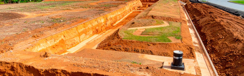
For property owners across Cherokee County, Ball Ground, and Canton planning improvements on residential and rural properties where the rolling terrain, clay soil, and seasonal rainfall that characterize the region make ground elevation’s drainage, access, and usability implications more consequential than equivalent elevation conditions in simpler terrain contexts, understanding specifically how ground elevation changes affect drainage patterns and infrastructure requirements, functional usability for specific improvement types, access route performance, and the earthwork scope that changing elevation to create the conditions improvements require involves gives the practical foundation for approaching every improvement location and design decision as the grade-informed choice that the terrain’s physical conditions specifically require rather than the grade-uninformed choice that treating terrain as a visual backdrop to the improvement rather than the physical constraint and determinant that it is consistently produces as the foundation for improvements that the terrain then reveals as inadequately planned for the grade conditions that pre-improvement assessment would have characterized before commitment allowed the inadequate planning to be embedded in the committed improvement design.
How Ground Elevation Determines Drainage Patterns and Where Water Goes
The most fundamental and most consequential effect of ground elevation on North Georgia property usability is its determination of where water flows across every surface during every rain event and where water accumulates when it cannot flow further or when drainage infrastructure cannot convey the drainage load that the contributing watershed above each lower elevation position delivers. Understanding this drainage-determination relationship between elevation and water movement is the foundational knowledge that every improvement location decision on a Cherokee County property specifically requires, because every improvement is positioned at a specific elevation relative to the surrounding terrain, and that relative elevation determines the drainage behavior that the improvement must manage rather than the drainage behavior that the improvement design could choose regardless of the terrain.
High Elevation Positions and Their Drainage Advantages
Improvements positioned at higher elevations relative to the surrounding terrain, specifically at ridge shoulders, hilltop positions, and upper slope areas where the terrain slopes away from the improvement location in most or all directions, experience the drainage advantages that high elevation positions naturally provide through their positive terrain relationship with every surrounding lower position that drainage flows toward rather than away from high positions. A structure, access route, or productive area at an elevated position receives only the direct rainfall on its own footprint as the drainage load that its drainage design must manage, because the surrounding terrain slopes away from the elevated position rather than toward it and therefore delivers no contributing watershed drainage to the elevated position in addition to its direct footprint rainfall. The grading design at elevated positions works with the terrain’s natural drainage direction, requiring only the precision drainage grades that adequate surface management demands without the watershed-based infrastructure that lower-position improvements require to manage the additional drainage load their terrain position receives from the surrounding higher terrain that slopes toward them.
These drainage advantages make elevated positions specifically favorable for improvements whose drainage performance most significantly affects their functional longevity and structural integrity, specifically building foundations that rely on stable moisture conditions at the foundation zone, access routes that rely on subgrade moisture remaining below bearing capacity reduction thresholds through wet seasonal conditions, and productive areas that rely on soil moisture remaining below the saturation levels that root health and planting establishment require. Selecting elevated positions for these drainage-sensitive improvement types when available candidate positions include both elevated and lower alternatives produces the improvement placements that work with the terrain’s drainage characteristics rather than against them, reducing the drainage infrastructure investment required to achieve adequate drainage performance and increasing the durability of the drainage performance the improvement achieves through the full seasonal moisture range that Cherokee County’s climate delivers.
Low Elevation Positions and Their Drainage Challenges
Improvements positioned at lower elevations relative to the surrounding terrain, specifically at slope bases, terrain concavities, and valley bottom areas where the terrain slopes toward the improvement location from one or more surrounding higher terrain positions, experience the drainage challenges that low elevation positions create through their position as the recipient of the contributing watershed drainage that the surrounding higher terrain slopes toward rather than away from them. On Cherokee County’s clay soil that becomes effectively impermeable when saturated, converting essentially all rainfall across the contributing watershed to surface runoff during significant rain events, the drainage load that lower-position improvements receive from their contributing watershed during storm events can represent multiples of the direct footprint rainfall that the improvement’s drainage design must manage at the watershed-accurate sizing rather than the footprint-only sizing that failing to account for the contributing watershed’s contribution produces as the systematic drainage infrastructure undersize that lower-position improvements at Cherokee County’s clay watershed context consistently reveals as inadequate when the first significant storm delivers the watershed-based drainage load that the footprint-only infrastructure cannot convey without the overtop and accumulation that watershed-accurate infrastructure would specifically have managed within its designed capacity.
The contributing watershed size that each lower-position improvement receives drainage from is determined by the elevation relationships between the improvement location and the surrounding terrain, specifically the area of terrain above the improvement that slopes toward it rather than away from it. Identifying this contributing watershed before improvement design is committed requires the post-rain site observation that reveals actual drainage flow paths toward each candidate location during and after significant rain events, specifically observing where surface water flows across the surrounding terrain during rain events and confirming whether any of that surface flow is directed toward the proposed improvement location rather than away from it. This post-rain observation is the assessment activity that most accurately characterizes the contributing watershed that each lower-position improvement location receives drainage from, and it is the activity that dry-condition terrain assessment without post-rain confirmation cannot replicate at equivalent accuracy because the dry-condition terrain observation infers drainage direction from terrain shape rather than observing actual water movement that the rain event directly reveals.
How Elevation Changes Affect Where Improvements Can Be Practically Located
Ground elevation changes across a property determine not only where water flows but where specific improvement types can be practically located given their functional requirements for level or gently sloped surfaces, adequate drainage conditions, and access route performance that the existing elevation presents differently at different property positions.
Building Sites and Level Pad Requirements
Building sites require level pads that the structure’s foundation demands for the structural integrity and functional performance that any building requires from its foundation across its service life. The elevation differential across any proposed building footprint directly determines the earthwork volume that creating the required level pad from the existing elevation involves, making the existing grade at proposed building sites the primary determinant of the building site preparation earthwork scope and cost that the foundation requirement creates from whatever elevation change the terrain presents across the building footprint. Small elevation differentials across the building footprint require small earthwork volumes to achieve the level pad the foundation requires. Large elevation differentials require large earthwork volumes. And the elevation differentials that Cherokee County’s rolling terrain presents across typical building footprints are consistently larger than accessible observation from adjacent positions suggests, because the terrain variation beneath wooded areas is systematically underestimated from external observation positions relative to the actual ground-level differential that physically walking the proposed footprint from its highest to its lowest corner specifically reveals at the accuracy that building site earthwork estimation requires.
This means that building site selection on Cherokee County residential and rural lots is most accurately made after the interior terrain walk that reveals the actual elevation differential at each candidate site rather than from the accessible observation assessment that consistently underestimates those differentials. The candidate site that appears level from the road may reveal eight to twelve feet of corner-to-corner elevation differential when the interior is physically walked, requiring the earthwork that an equivalent-footprint site with two feet of differential would not require at the same scale. Comparing the actual walking-revealed differentials across multiple candidate building sites allows the earthwork scope and cost implications of each candidate to be incorporated into the site selection decision before commitment rather than after commitment reveals the earthwork that the selected site actually requires from the conditions that pre-commitment walking would have revealed in time to make the comparison that more favorably-graded alternatives might have justified selecting over the committed site.
Food Plots and Productive Areas
Food plots and other productive areas require the soil moisture conditions that the intended planting and production use demands from the site, which means the existing elevation and its drainage implications specifically determine whether any proposed food plot location will have the soil moisture conditions the productive use requires or the waterlogged or excessively dry conditions that inadequate or excessive drainage creates as the persistent functional limitation of food plot locations selected without the elevation-informed drainage assessment that confirms the drainage conditions the productive use requires before the food plot establishment investment is made at the location that the elevation may make specifically inadequate for the intended use. Lower-elevation food plot candidates in terrain concavities that receive concentrated drainage from surrounding higher terrain during rain events may remain wet for extended periods after rain events, creating the waterlogged soil conditions that restrict planting establishment and root development even for moisture-tolerant food plot species, while elevated food plot candidates that shed all rainfall away from the productive area without any contributing watershed addition may develop the excessive dry-season moisture deficits that irrigation cannot practically supplement on large rural food plots without the infrastructure investment that smaller food plot areas or more moderate drainage positions would not require at the same frequency.
How Elevation Changes Affect Access Route Performance
Access routes on Cherokee County residential and rural properties must navigate the elevation changes between the public road and the property’s interior destinations while maintaining the safe operating grades, adequate drainage design, and year-round bearing capacity that practical access requires through the seasonal moisture range that Cherokee County’s climate delivers to routes that inadequate drainage design allows to compromise during wet conditions.
Grade and Safe Operation
The elevation changes between an access route’s starting point and its destinations determine the sustained grade magnitudes that the route must navigate, and sustained grade magnitudes that exceed the safe operating threshold for the vehicles and equipment that regularly use the route create the traction challenges, braking difficulties, and stability concerns during wet and icy conditions that route grade management specifically prevents by designing the route alignment to navigate the elevation changes within the safe grade range rather than at the direct-line grades that elevation changes create for routes that follow the most direct path between their starting points and destinations without the alignment adjustment that grade management requires to keep the route within safe operating grades across the terrain’s elevation changes. Route alignments that traverse elevation changes through switchbacks, contour-following routes, and ridge-following alignments that reduce sustained grades below the direct-line grade magnitudes require longer route lengths than the shortest direct alignments, but produce the grade management that safe route operation through the full seasonal moisture range that Cherokee County clay’s reduced wet-condition traction makes specifically consequential for route safety during the wet seasons that inadequate grade management allows to compromise route safety at grades that dry-condition traction may have accommodated without the safety concern that wet-condition traction reduction creates at equivalent grades on Cherokee County clay surfaces.
Drainage Crossings and Culvert Requirements
The number of drainage channels that a proposed access route alignment must cross is determined by the elevation changes the route traverses, because each time a route crosses from one drainage watershed to another by traversing the ridge or high point separating them, the route necessarily crosses the drainage channel at the watershed boundary that drainage from both sides of the watershed boundary flows toward. Routes that navigate complex elevation changes by traversing multiple drainage watershed boundaries require culverts at each watershed crossing to maintain the drainage channel’s continuity beneath the route embankment that filling across the channel without culvert infrastructure would block. Each culvert must be sized for the contributing watershed above the crossing point, which the elevation relationships between the crossing and the surrounding terrain determine by defining the drainage area that slopes toward the crossing position from above. Routes that traverse more complex elevation changes therefore require more extensive culvert infrastructure at more crossing positions, each sized for the contributing watershed that the elevation relationship above each crossing determines, making the route alignment’s elevation change complexity a direct driver of the culvert infrastructure scope and cost that the route development requires beyond the primary surface grading that creates the travelable surface the route provides for vehicles and equipment navigating between the public road and the interior property destinations the route serves.
Why Understanding Existing Grade Is the Important First Step
Understanding the existing grade before any improvement planning is committed to locations, designs, and scopes that the existing grade should inform is specifically the first step because every subsequent planning decision is either made with accurate grade knowledge that the assessment provides or made without it and therefore at risk of the grade-related planning errors that accurate grade knowledge would have prevented from being embedded in the committed improvement plan before execution reveals them as the drainage failures, earthwork surprises, and functional limitations that the committed plan did not account for because the grade assessment that would have informed those plans was not conducted before commitment.
The grade assessment activities that provide the existing grade understanding that improvement planning requires are not complex professional surveys with expensive equipment, though professional survey-grade accuracy may sometimes be warranted for specific improvement types. They are the physically active site assessment activities that the property owner can conduct without professional equipment: physically walking proposed improvement footprints from highest to lowest corner to reveal actual elevation differentials, conducting post-rain site observation to reveal actual drainage behavior at proposed locations, walking proposed access route alignments to assess sustained grade magnitudes and identify drainage crossings, and probing soil at multiple points across proposed structural improvement footprints to characterize the organic depth variation that slope creates between upper and lower footprint positions on sloped Cherokee County sites. These activities together produce the existing grade understanding that improvement planning requires to be accurate, and their omission before improvement commitment produces the grade knowledge gap that execution consistently fills by revealing what assessment would have found in time to incorporate rather than after commitment when the planning cannot be revised without the cost and disruption that mid-commitment revision creates relative to the cost-free planning revision that pre-commitment assessment revelation allows before any costs have been committed to the improvement design that the revealed grade conditions would have changed.
How Changing Ground Elevation Creates Usability That Did Not Previously Exist
Understanding existing grade is the first step not only because it informs location and design decisions for improvements at existing grade conditions but because it reveals where changing the grade through grading and earthwork would create usability that the existing grade does not provide at the positions where grade change most cost-effectively produces the usable conditions that the property’s intended use requires. Grade change through professional grading and excavation is the intervention that converts the existing grade’s limitations into the graded conditions that improvements require for their functional performance, and the value that grade change creates at each position where it converts unusable conditions to usable ones is directly proportional to the functional improvement the grade change produces at that position for the intended use the grade change enables.
A chronically wet low area that cannot support productive use at its existing grade becomes productively usable when grade change through filling, drainage correction, or outlet development converts the existing drainage-accumulation conditions to the adequate drainage conditions that productive use requires. A sloped area that cannot support a building pad at its existing grade becomes buildable when grade change through cut-and-fill earthwork converts the sloped surface to the level pad that the foundation requires. An access route position where the existing grade creates a drainage crossing that flooding during storm events makes temporarily impassable becomes year-round reliable when grade change through culvert installation and embankment development converts the flooding crossing to the drained crossing that year-round access requires. In each of these cases, understanding the existing grade is specifically the assessment that reveals where grade change would create the most significant usability improvement from the existing grade condition and what the grade change required to create that usability involves in scope and cost, which together constitute the information that grade-change investment decisions require to be made with the accuracy that grade-uninformed decisions cannot achieve before the investment is committed to the site conditions that pre-investment assessment would have characterized at the accuracy adequate investment decision-making requires.
Frequently Asked Questions
How do small elevation changes, specifically less than one foot, affect drainage and improvement performance on Cherokee County properties?
Small elevation changes below one foot are among the most consequential grade conditions on Cherokee County residential properties because the graded surfaces adjacent to foundations and improvements are specifically designed to achieve minimum positive drainage slopes in the two to five percent range, which represents two to five inches of elevation change per ten feet of horizontal distance. At this design grade range, the difference between a surface that is graded correctly to positive drainage away from the foundation at two percent and a surface that has settled to neutral or negative drainage toward the foundation at the same location is a difference of only two to four inches of elevation change across ten feet of surface, which is a sub-foot difference that appears visually imperceptible from casual observation but that functionally represents the difference between drainage flowing away from the foundation at every rain event versus drainage accumulating at the foundation perimeter at every rain event. Small elevation changes within the sub-one-foot range also determine which positions on a graded surface collect the drainage that adjacent impervious surfaces shed rather than shedding that drainage toward their own outlets, creating the wet low points within otherwise graded areas that drainage design inadequately addressed at the one to two inch accuracy that adequate positive drainage maintenance requires from the construction that creates those surfaces rather than the inch-level settlement variation that earthwork without precision grading allows to create the drainage-collecting low points within otherwise positively drained surfaces.
Can I assess the existing grade on my property adequately without professional survey equipment?
Property owners can assess the existing grade adequately for most improvement planning decisions without professional survey equipment by using the physically active assessment methods that produce the grade understanding that planning accuracy requires at the accuracy that professional equipment improves upon without being necessary for the improvement planning decisions that property owner assessment specifically informs. The interior terrain walk that reveals the actual elevation differential across proposed improvement footprints by walking from the highest to the lowest corner and estimating the elevation change at each step of the walk produces the approximate differential that earthwork scope estimation requires for the accuracy level that improvement planning decisions use, which is the order-of-magnitude and cost range accuracy that approximate differentials provide rather than the inch-level accuracy that professional survey would provide for engineering design purposes. The post-rain drainage observation that reveals actual drainage flow directions and accumulation positions at proposed improvement locations produces the drainage behavior understanding that improvement drainage design requires at the accuracy that the observation directly provides without the terrain survey that infers drainage direction from measured elevation rather than observing it from actual water movement during rain events. These owner-conducted assessment methods produce adequate grade understanding for improvement planning decisions in most Cherokee County property improvement contexts, with professional survey accuracy warranted for specific improvement types where engineering design precision rather than planning scope estimation accuracy is specifically required from the grade assessment, specifically including foundation drainage design for structures and drainage infrastructure sizing for culverts at defined contributing watershed positions where hydraulic engineering accuracy rather than planning estimation accuracy specifically applies.
How does existing grade assessment specifically help with prioritizing improvements across a large property with multiple improvement needs?
Existing grade assessment across a large property with multiple improvement needs helps prioritization by revealing which candidate improvement locations present grade conditions that most favorably support the functional performance the improvement requires versus which locations require the most extensive grade change to achieve adequate functional conditions, which directly affects both the improvement investment required at each location and the durability of the performance the improvement achieves at each location relative to the alternative locations that more favorable grade conditions would provide at lower infrastructure investment for equivalent performance. Improvement locations with grade conditions that naturally support the improvement’s drainage, level surface, and access requirements without extensive grade change deserve higher priority as investments that achieve better functional performance at lower total project cost than the locations requiring extensive grade change for equivalent performance. Improvement locations where small targeted grade changes convert specific limiting grade conditions, specifically the small elevation adjustments that convert negative perimeter drainage to positive perimeter drainage, the culvert installation at a specific drainage crossing that converts flooding-limited seasonal access to year-round reliable access, or the fill correction at a specific low point that converts chronic wet conditions to adequate drainage, deserve high priority as investments whose small scope relative to their functional performance improvement represents the highest improvement-value-per-investment efficiency available among the full property’s improvement candidates. Existing grade assessment that specifically characterizes the grade conditions at each improvement candidate location against the grade conditions that adequate functional performance requires produces the grade-informed prioritization that this efficiency assessment requires rather than the grade-uninformed prioritization that ranks improvements by visible urgency without the grade assessment that reveals the improvement investment required and the functional performance achievable at each candidate location.
How does the existing grade at a proposed improvement location affect the post-improvement maintenance that the improvement will require?
The existing grade at a proposed improvement location affects the post-improvement maintenance the improvement will require primarily through the drainage conditions that the grade creates at the improvement location and the contribution that those drainage conditions make to the deterioration rate of the improvement’s infrastructure components. Improvements at lower elevation positions that receive contributing watershed drainage from surrounding higher terrain will experience higher drainage loads on their drainage infrastructure than equivalent improvements at elevated positions receiving only direct footprint rainfall, and the higher drainage loads at lower positions produce faster deterioration of drainage infrastructure components, specifically culvert silting from the higher sediment loads that higher-velocity watershed drainage carries, ditch sedimentation from the same higher drainage velocity and sediment load, and surface deterioration from the higher runoff volumes and velocities that watershed drainage loads create on the improvement’s surface infrastructure. Improvements at adequately elevated positions that naturally shed drainage away without significant contributing watershed additions experience lower drainage loads that produce slower infrastructure deterioration and lower maintenance frequency requirements at the equivalent maintenance standard, creating a lower post-improvement maintenance cost trajectory at elevated positions than at lower positions receiving equivalent improvements but significantly higher contributing watershed drainage loads that accelerate the infrastructure deterioration that maintenance must address at the frequency that the higher drainage load’s faster deterioration rate specifically creates relative to the lower maintenance frequency that lower drainage loads at elevated positions produce from equivalent infrastructure at equivalent initial quality.
Ready to Understand Your Property’s Grade Before Planning Your Next Improvement?
Ground elevation on North Georgia residential and rural properties is not the passive terrain background that improvement planning happens in front of. It is the active physical condition that determines where water flows during every rain event, which improvement locations naturally support adequate drainage or require drainage infrastructure to achieve it, what earthwork scope creating level surfaces from existing terrain involves at every candidate improvement location, and how access routes must navigate elevation changes to achieve the safe grades and adequate drainage that year-round reliable performance requires. Understanding the existing grade before improvement planning is committed to locations, designs, and earthwork scopes that the existing grade should have specifically informed is the assessment investment that produces the planning accuracy that prevents the drainage failures, earthwork surprises, and functional limitations that grade-uninformed planning consistently produces when improvements encounter the actual grade conditions that pre-commitment assessment would have revealed in time for the planning to account for them rather than after commitment when the planning is fixed and the grade conditions must be managed reactively as the limitations that adequate assessment before commitment would have specifically prevented from being embedded in the committed improvement plan that the assessment findings would have revised before commitment rather than after it.
Bardin Outdoors works with homeowners, landowners, and builders across Ball Ground, Canton, Cherokee County, and North Georgia on grading and excavation projects whose locations, designs, and earthwork scopes are determined from thorough assessment of the existing ground elevation conditions that each project site presents, producing the grade-informed improvement planning that accurately reflects what the terrain requires rather than what accessible observation assumes without the interior terrain walking, post-rain drainage observation, and contributing watershed assessment that the existing grade’s actual conditions specifically require to be characterized at the accuracy that improvement planning decisions need. To learn more about how Bardin Outdoors approaches grade-informed improvement planning for North Georgia properties, contact us.