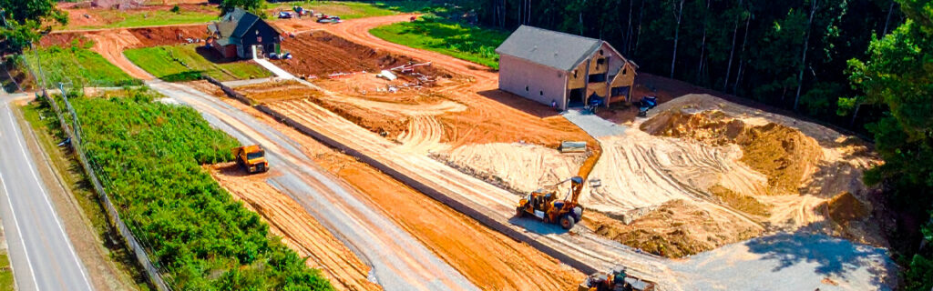
For property owners across Cherokee County, Ball Ground, and Canton managing residential and rural lots where the rolling piedmont terrain, clay soil, and seasonal rainfall that characterize the region produce the uneven ground conditions that limit property usefulness across significant portions of otherwise well-located and well-sized properties, understanding how grading specifically converts the most common types of uneven ground from limiting conditions into functional ones, what each grading correction type requires to perform well over time on Cherokee County clay, and how to evaluate whether specific uneven areas on a specific property warrant the grading investment that would address them gives the practical framework for approaching grading as the targeted functional improvement it can be rather than either the universal solution to every terrain challenge or the blunt earthwork intervention that property owners without the site-specific planning background sometimes associate with the broad category of grading work.
What Proper Grading Actually Does to Uneven Ground
Grading reshapes the existing terrain surface by moving soil from positions where it exists above the desired design grade to positions where it is needed below the desired design grade, establishing the surface configuration that the intended use requires rather than the configuration that natural terrain formation, erosion, settlement, or prior land use has produced at the existing ground surface. The design grade that grading establishes is the terrain configuration that specific uses require, which varies among use types in ways that make the appropriate grading design for each situation specific to the use and site rather than universally applicable regardless of what the graded area will support and what site conditions the existing terrain and soil present.
Proper grading, as distinguished from grading that simply moves soil to create a level appearance without addressing the drainage design, organic material removal, and compaction requirements that durable grading performance demands, achieves the terrain reconfiguration that the intended use requires while simultaneously establishing the drainage conditions that prevent moisture from accumulating in the graded area, the organic-free subgrade that prevents settlement in areas where structural loads will be applied, and the surface profile that sheds water away from structures and improvements rather than directing it toward them. This comprehensive approach to grading design, accounting for drainage behavior and structural performance rather than only terrain configuration, is what distinguishes grading that improves property function durably from grading that changes the terrain’s appearance temporarily while creating the drainage problems and settlement conditions that inadequate grading design consistently generates when drainage and organic removal are not specifically addressed alongside the terrain reconfiguration that the grading equipment accomplishes.
Converting Steep Slopes Into Usable Terrain
Slopes that exceed the gradient limits of the intended use create functional limitations that grading can address by redistributing the terrain’s elevation differential into a configuration that brings the slopes within the gradient range the intended use requires. Understanding what gradient limits apply to each intended use helps property owners identify which slopes on their property are actually limiting the uses they intend versus which are simply sloped without being problematic for what the specific slope section will support.
Slopes That Limit Equipment Operation
Tractor-mounted mowing equipment that food plot and open area maintenance requires has maximum safe operating gradient limits that the specific equipment’s stability characteristics and Cherokee County clay’s slippery wet condition behavior together determine as the threshold above which operating the equipment creates tipping and traction loss risks that safe equipment operation must avoid. Slopes exceeding this threshold in sections where equipment-dependent maintenance is intended cannot be safely maintained with that equipment without grading that reduces the slope to within the safe operating range. The food plot that cannot be maintained with the mowing equipment the property owner operates, the access trail that cannot be navigated safely with the ATV that interior access requires, and the managed open area that cannot receive the equipment passes that its maintenance demands are all examples of slopes that specifically limit the equipment-dependent uses that the slope sections were intended to support, and that grading to within those equipment’s safe operating gradient would convert from functionally limited to functionally capable of the intended use.
Grading that addresses equipment-limiting slopes does not necessarily require creating completely level surfaces where the existing terrain is significantly sloped. It requires reducing the slope to the gradient that safe equipment operation allows, which may still be a gently sloped surface rather than a level one, with the cut from the steeper upper slope sections redistributed as fill to the lower slope sections to produce the more gradual slope profile that equipment can safely navigate and operate on. This slope-reduction grading requires less earthwork volume than grading to a fully level surface where existing slopes are significant, and it achieves the functional outcome that equipment operation requires at lower earthwork cost than the more extensive level-pad creation that building or heavy structural use would demand from the same slope.
Slopes That Create Building and Structural Pad Requirements
Building sites, barn pads, equipment storage areas, and other improvements that require level or very gently sloped surfaces for structural and functional adequacy need grading that creates these level surfaces from the existing sloped terrain, with the elevation differential across the proposed improvement footprint determining the cut volume on the uphill side and the fill volume on the downhill side that the level pad creation requires. The earthwork volume that building pad grading on Cherokee County sloped terrain requires is the most consistently underestimated site preparation cost on local improvement projects because the elevation differential across proposed building footprints is systematically underestimated from accessible observation positions relative to the actual differential that physically walking the interior terrain reveals, and the earthwork volume is directly proportional to this elevation differential regardless of how efficiently the grading is executed.
Properly graded building pads on sloped Cherokee County terrain require not only the level surface that the structure above demands but the positive perimeter drainage grades that shed water away from the foundation in all directions, the organic material removal from the fill zone that prevents settlement from organic decomposition beneath the placed fill, and the compaction of placed fill to structural density standards that supports the building loads without progressive settlement that inadequate compaction consistently produces. Each of these requirements is specific to the building pad grading application rather than to slope-reduction grading for equipment access, and the grading design that serves building pad applications must account for all of these requirements simultaneously rather than addressing only the terrain reconfiguration that creating a level surface from sloped terrain requires.
Converting Low Areas Into Functional Ground
Low areas that collect drainage from surrounding higher terrain and hold standing water for extended periods after rain events represent some of the most consequential uneven ground conditions on Cherokee County properties because they actively limit the widest range of intended uses and because Cherokee County clay’s near-zero permeability under saturated conditions extends the standing water duration at low area positions far beyond what more permeable soil types would produce from equivalent rainfall and drainage collection. A low area that drains within hours on sandy loam soil may hold standing water for two to five days on Cherokee County clay under equivalent drainage collection conditions, making the functional limitation that the low area creates substantially longer in duration on local clay than the same terrain position would create on more permeable regional soil types.
Raising Grade to Eliminate Drainage Collection
Low areas where the terrain depression that creates drainage collection is the primary limitation, and where adequate drainage outlet exists at lower terrain positions that the fill can be graded to drain toward, can be addressed by fill placement that raises the low area’s grade above the surrounding terrain level to create positive drainage away from the area rather than toward it. Fill placed to raise the low area’s grade must be placed over the organic material that is stripped from the low area before fill placement, compacted in lifts to prevent the settlement that uncompacted fill consistently produces, and graded to the drainage profile that directs runoff away from the raised area toward the drainage outlet rather than allowing the fill’s settling and natural drainage pattern formation to develop the drainage behavior independently of the design intent that the grading should specifically establish.
Fill material for low area grade raising on Cherokee County properties should be clean mineral soil or approved structural fill rather than organic material or debris that would decompose beneath the fill and create the settlement that organic decomposition produces in fill sections where organic material was not specifically excluded. The fill material source is an important grading design consideration for low area grade raising because the cut material from adjacent slope sections may or may not be suitable fill depending on its organic content, rock inclusion, and moisture condition at the time of placement, and fill that does not meet the appropriate structural fill standard for the intended use above it creates the performance deficiencies that inadequate fill material selection generates regardless of how well the placement and compaction are executed.
Improving Drainage Outlets to Reduce Standing Water Duration
Low areas where the drainage collection problem results from an inadequate or blocked outlet rather than from a terrain depression without any lower-elevation outlet can be addressed by establishing or improving the drainage outlet that allows accumulated water to exit the low area at adequate rate rather than raising the low area’s grade to eliminate the collection altogether. Drainage outlet improvements may involve grading a drainage swale that provides a defined flow path from the low area to the nearest lower terrain position where water can flow away, installing a culvert through a natural berm or road fill that is blocking the existing drainage outlet from the low area, or removing the debris and vegetation accumulation from an existing outlet channel that has been restricted by the natural material accumulation that unmanaged drainage channels collect. The drainage outlet improvement approach is appropriate for low areas where the terrain configuration can drain effectively once the outlet restriction is removed and where raising the area’s grade is not required or not feasible given the surrounding terrain configuration that fill placement would need to work with to achieve positive drainage away from the raised area.
Converting Irregular Surfaces Into Efficient Operating Ground
Irregular surface conditions on otherwise usable terrain, including ruts from prior equipment operation, surface depressions from root decomposition, erosion channels that have incised the surface, and the humped and hollowed surface that results from inconsistent soil conditions creating differential settlement, limit the efficiency and safety of equipment operation and the comfort and safety of recreational use without necessarily creating the significant elevation differential or drainage collection that slope and low area conditions involve. These irregular surface conditions are often addressable through surface grading that redistributes the existing soil without the major cut-and-fill operations that slope reduction and low area grade raising require, making surface smoothing grading a lower-scope and lower-cost intervention than the major terrain reconfiguration that more significant uneven ground conditions demand.
Equipment operation on irregular surfaces experiences the operational efficiency reduction and maintenance challenge that irregular terrain creates through blade bounce on mowing equipment, uneven product distribution on spreading equipment, inconsistent soil contact on tillage equipment, and the equipment damage risk from the impacts and stresses that irregular surface navigation creates at the irregular terrain features that smooth surface operation avoids. Agricultural and recreational equipment operating across smooth, uniformly graded surfaces covers its intended area more efficiently per operating hour, distributes products more uniformly across the operating width, and experiences lower equipment stress from the consistent surface contact that smooth terrain provides relative to the irregular surface contact that uneven terrain creates at every terrain irregularity. Surface smoothing grading that removes these efficiency-reducing irregularities from production and management areas converts the reduced-efficiency operating conditions that irregular surfaces create into the full-efficiency operating conditions that smooth, uniformly graded surfaces provide for every equipment pass across the graded area through the grading’s full service life.
How Grading Improves Access Across Previously Difficult Terrain
Access route grading that establishes the grades, drainage profiles, and surface conditions that year-round reliable vehicle and equipment access requires converts the conditionally accessible terrain that many Cherokee County rural properties currently navigate through into the reliably accessible infrastructure that property management and improvement development depend on operating through the full seasonal range rather than only during the favorable conditions that poorly drained and steeply graded routes can support before wet conditions reduce or eliminate their usability.
Access route grading that establishes the crowned surface profile that sheds surface water to both sides rather than allowing it to penetrate the subgrade, the side ditch grades that carry shed water away from the route corridor, and the approach and departure grades at drainage crossings that allow culvert installation at the hydraulic continuity elevations that drainage crossings require produces the drainage design that maintains subgrade bearing capacity through Cherokee County clay’s wet seasons rather than allowing the subgrade moisture to reach the saturation level that bearing capacity failure and route surface deformation produce when drainage design is absent or inadequate. This drainage-adequate access route grading is not simply a cosmetic improvement to the route’s appearance. It is the functional infrastructure investment that makes management activities accessible year-round rather than only during dry conditions that poorly drained routes can support before the next significant rain event converts them to the muddy, impassable conditions that inadequate drainage consistently produces on Cherokee County clay at the elevated moisture content that poor drainage allows to develop.
What Proper Grading Requires to Perform Well on Cherokee County Properties
Grading that performs well over its service life on Cherokee County properties requires the preparation quality and design attention that the specific combination of clay soil, seasonal rainfall, and terrain variation demands from earthwork that will be tested by the local climate conditions rather than performing to the lower standards that more forgiving soil types and less demanding climates would tolerate without the failures that Cherokee County conditions produce when grading quality falls below what local conditions specifically require.
Organic material removal from fill zones before fill is placed is the grading preparation requirement most consistently associated with long-term grading performance failure when it is inadequately addressed. Fill placed over organic material that was not stripped produces the settlement that organic decomposition creates as the organic material converts to the void space that the original organic volume occupied, creating the surface depression progression that appears in the graded area months to years after the grading was completed as the organic material beneath the fill decomposes at the rate that burial conditions allow. Stripping the organic material to the full depth it occupies before fill placement, rather than stripping to a nominal depth that falls short of the actual organic layer’s full thickness on long-wooded Cherokee County sites, eliminates this settlement source before fill placement rather than managing the surface depressions that inadequate organic removal creates after the grading is complete and the fill is in place above the decomposing material that adequate preparation would have removed.
Compaction of placed fill in lifts at appropriate moisture content is the grading quality requirement most consistently associated with fill settlement performance. Cherokee County clay placed and compacted at moisture content within the optimum range for compaction achieves the structural density that prevents the progressive consolidation under load that uncompacted or poorly compacted fill produces over its service life as each load application and wetting-drying cycle advances the fill toward the density that adequate compaction at the time of placement would have established before the fill was carrying the loads that inadequate compaction allows it to consolidate under progressively. Scheduling fill placement and compaction during the dry seasonal conditions when Cherokee County clay is most likely to be within its optimum moisture range, rather than during the wet spring conditions when clay moisture is consistently above optimum and adequate compaction density cannot be achieved regardless of compaction effort, is the scheduling decision that most directly affects the compaction quality that the grading’s long-term performance depends on.
Evaluating Which Uneven Areas Warrant Grading Investment
Not every uneven area on a rural or residential property warrants the grading investment that correcting it would require, and evaluating which uneven areas produce sufficient functional improvement from grading to justify the investment helps property owners focus grading expenditure on the corrections that produce the most significant and most practically consequential functional improvement relative to the earthwork cost they require.
The evaluation framework that most reliably identifies grading investments worth making asks two questions for each candidate uneven area: how significantly does the current terrain condition limit the specific use the area is intended for, and how much earthwork does the grading correction require relative to the functional improvement it produces? Terrain conditions that severely limit high-priority uses requiring frequent access, regular equipment operation, or structural development warrant grading investment at earthwork scopes that conditions limiting lower-priority occasional uses may not justify at the same earthwork scope. A low area that prevents food plot establishment in a section the property owner has identified as the highest-priority food plot location warrants higher grading investment than a similarly sized low area in a section where the food plot priority is lower and alternative locations without drainage problems exist within the property. Evaluating each candidate grading investment against these two questions produces the investment priority ranking that directs grading expenditure toward the corrections producing the most significant functional improvement for the highest-priority intended uses rather than distributing grading investment across all uneven areas regardless of the functional improvement priority that each correction represents.
Frequently Asked Questions
How do I determine whether a slope on my property is steep enough to warrant grading or whether it is within the manageable range for my intended use?
The determination of whether a specific slope warrants grading for the intended use requires comparing the slope’s actual gradient to the gradient limit that the specific intended use establishes as the threshold for adequate function. For tractor-mounted brush mowing on Cherokee County clay, slopes above approximately fifteen to twenty percent are typically within the range where traction loss and stability concerns on wet clay make operation unsafe for most equipment configurations, and slopes within this range that the property owner intends to maintain with mowing equipment warrant gradient assessment against the specific equipment’s safe operating specification. For building pad development, the slope across the proposed footprint determines the earthwork volume required rather than a specific gradient limit that makes building impossible, and virtually any slope can have a level building pad created from it if the earthwork investment is justified by the building’s intended use. For hay production and agricultural equipment operation, slopes above approximately eight to twelve percent approach the range where erosion risk and equipment stability become limiting for productive use. Physically walking the slope and estimating the rise-to-run ratio, which is the elevation change per horizontal distance traveled, gives the gradient percentage that can be compared to the specific use’s gradient limit without requiring survey instruments that produce more precise gradient measurements than the preliminary assessment that grading investment evaluation requires before the contractor site assessment that confirms specific grading scope and cost.
What causes low areas to develop on Cherokee County properties that did not have them when the property was originally cleared?
Low areas that develop on Cherokee County properties after initial clearing and grading most commonly result from root system decomposition that creates void space beneath the cleared surface as the root mass that the clearing left in place decomposes over the years following clearing, producing the surface depression above the decomposing root mass that the void space development progressively deepens as decomposition continues. This is the most common cause of new low areas developing in food plots, cleared pastures, and open areas that were initially relatively flat after clearing but that develop surface depressions in patterns that correspond to the positions of the root systems that clearing left in place rather than removed. Erosion from rain events on the cleared surface before vegetative cover establishes can also create channel incision and surface lowering in the concentrated flow paths that drainage patterns follow across the cleared surface, developing the erosion-driven low areas that concentrate drainage and deepen progressively with each subsequent storm event. Settlement of fill material that was placed during initial grading without adequate compaction can also develop apparent low areas as the incompletely compacted fill consolidates under the load of the material above it and the wetting and drying cycles that seasonal moisture variation applies, with the most incompletely compacted fill sections settling most and creating the relative low areas that the more adequately compacted fill sections do not exhibit to the same degree.
Can property owners do any grading work themselves or does all grading require professional equipment?
The scope of grading that property owners can accomplish with owner-operated equipment depends on the terrain change scale the grading requires and the equipment the property owner has available. Surface smoothing of modest irregularities including light ruts, small erosion channels, and surface unevenness within a range of a few inches of relief can often be accomplished with a tractor-mounted box blade or landscape rake that property owners with tractors can operate to smooth the surface to within the tolerance that most intended uses require without professional equipment involvement. Drainage outlet improvements including clearing debris and vegetation from drainage channels, shaping light swale profiles, and improving culvert inlet conditions can often be accomplished with hand tools and owner-operated tractor equipment for the scale of improvement that modest drainage corrections involve. Major terrain reconfiguration including slope reduction, significant low area grade raising, building pad creation from significantly sloped terrain, and access route grading with culvert installation requires the excavator, bulldozer, and motor grader equipment that professional grading contractors operate because the earthwork volumes and precision requirements that these applications involve exceed what owner-operated tractor equipment can efficiently accomplish at the quality the applications require for durable performance.
How long after grading is completed should I wait before expecting the graded area to be fully functional for the intended use?
The time between grading completion and full functional readiness for the intended use varies with the intended use’s specific requirements and the grading correction type that the completion represents. Access routes graded with appropriate drainage and surface preparation can typically support vehicle use within days to a few weeks of completion depending on the weather conditions following grading and the surface material applied. Building pads graded to structural density standards with verified compaction can support foundation installation as soon as the compaction verification confirms adequate density, without a waiting period for additional settling that adequate compaction makes unnecessary. Agricultural and recreational open areas graded and seeded for vegetative cover establishment need the establishment period for the seeded species to germinate, establish root systems, and achieve the coverage level that protects the graded surface from the erosion and surface disruption that unseeded bare clay experiences during rain events, typically four to eight weeks for warm-season grass species planted during appropriate growing season conditions and six to twelve weeks for cool-season species planted during fall establishment conditions. Food plots graded and seeded for the same establishment period as agricultural areas are similarly not fully productive until the establishment period produces the vegetative cover that both protects the graded surface and supports the wildlife attraction value that the food plot’s productive planting creates.
Ready to Make More of Your North Georgia Property Usable?
Uneven ground on Cherokee County residential and rural properties is not a permanent limitation that property owners must accept as the fixed condition of the land they own. It is an addressable functional limitation that proper grading corrects by reshaping the terrain toward the grades, drainage conditions, and surface uniformity that the intended uses require, converting the acres that current terrain conditions limit or prevent from productive use into the functional, accessible, manageable property sections that the grading investment specifically creates. The grading that performs this conversion durably on Cherokee County clay requires the organic removal, compaction quality, and drainage design that local soil and climate conditions demand rather than the minimal preparation that less demanding soil types might tolerate, and the planning that identifies the specific uneven conditions and intended uses that justify the grading investment produces the targeted earthwork that addresses the functional limitations worth correcting rather than grading everything regardless of the functional improvement priority each correction represents.
Bardin Outdoors works with homeowners, landowners, and builders across Ball Ground, Canton, Cherokee County, and North Georgia on grading and excavation projects that address the specific uneven ground conditions limiting each property’s use with the earthwork scope, drainage design, and preparation quality that Cherokee County conditions require for durable functional improvement rather than temporary terrain change. To learn more about how Bardin Outdoors can help make more of your property usable through proper grading, contact us.