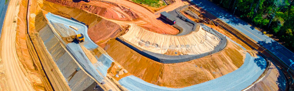
For property owners across Cherokee County, Ball Ground, and Canton planning grading projects for building sites, access routes, food plots, drainage corrections, and the range of other improvements that grading serves on residential and rural North Georgia properties, understanding specifically how the existing elevation changes at each proposed improvement location affect the grading project’s scope, drainage design requirements, and earthwork volume gives the practical foundation for connecting the terrain that the property presents to the grading decisions that the terrain’s specific elevation change pattern most specifically influences, and for evaluating whether proposed grading scopes accurately reflect what the terrain’s actual elevation changes require rather than what regional average assumptions suggest without the site-specific elevation assessment that the actual terrain requires for accurate grading scope development.
How Elevation Changes Determine Drainage Patterns and Infrastructure Requirements
The drainage pattern across any property is determined by its elevation changes, because water on any surface flows from higher elevations toward lower elevations at the rate that the slope’s steepness and the surface’s roughness together produce, concentrating at the lowest available drainage positions and accumulating at positions where natural drainage paths are blocked or where the surrounding terrain delivers more drainage than the local drainage outlet can convey. Every improvement on a Cherokee County property is positioned at a specific elevation relative to the surrounding terrain, and that relative elevation determines whether the improvement occupies a drainage-shedding position that naturally directs water away from it or a drainage-receiving position that receives water from the surrounding higher terrain in addition to the direct rainfall that the improvement footprint itself generates.
Topographic Position and Its Drainage Consequence
A building site, food plot, or access route positioned at an elevated terrain position, specifically at a ridge shoulder, hilltop, or upper slope where the terrain slopes away in most or all directions from the improvement footprint, occupies a drainage-shedding position that naturally directs rainfall away from the improvement without requiring drainage infrastructure to redirect it. The grading design at these elevated positions works with the terrain’s natural drainage direction, establishing the perimeter drainage grades that encourage the natural drainage direction while maintaining the minimum drainage slopes that adequate performance requires without the watershed-based drainage loads that lower terrain positions receive from the surrounding higher terrain.
A building site, food plot, or access route positioned at a lower terrain position, specifically at a slope base, valley bottom, or terrain concavity where the surrounding terrain slopes toward the improvement footprint from multiple directions, occupies a drainage-receiving position that receives the accumulated rainfall from the full contributing watershed above it in addition to the direct rainfall on the improvement footprint. The drainage load that this contributing watershed delivers to the lower-position improvement during significant storm events can substantially exceed the direct footprint rainfall that the improvement footprint alone generates, and drainage infrastructure designed only for the direct footprint rainfall at these positions will be systematically inadequate for the actual watershed-based drainage load that significant storms deliver. On Cherokee County properties where the clay soil’s near-zero permeability at saturation converts essentially all rainfall across the contributing watershed to surface runoff rather than the partial infiltration that more permeable soils would retain, the watershed-based drainage contribution to lower-position improvements during significant rain events can represent multiples of the direct footprint rainfall that drainage design focused only on the footprint would account for without the watershed assessment that accurately characterizes the total drainage load the infrastructure must manage.
How to Identify Contributing Watershed Before Grading Commitment
Identifying the contributing watershed that delivers drainage to a proposed improvement location before grading design is committed requires the post-rain site observation that reveals actual drainage flow paths during and after significant rain events rather than the dry-condition assessment that conceals where water flows and where it accumulates. Walking the proposed improvement location and the surrounding terrain within twenty-four hours of a significant rain event specifically to observe which uphill terrain areas are delivering surface flow toward the proposed location, how that flow concentrates and moves through the terrain between the contributing uphill area and the proposed location, and whether the existing drainage outlets from the proposed location appear adequate for the combined direct rainfall and watershed contribution the observation reveals as the actual drainage load reveals the watershed-based drainage design requirement that dry-condition assessment cannot characterize with equivalent accuracy. This post-rain observation is the single most informative site assessment activity available for drainage design accuracy on Cherokee County properties where the clay soil makes watershed-based drainage loads substantially more consequential than the same watershed size on more permeable soil would produce, and it is the assessment activity most commonly omitted from pre-grading site evaluation because the convenient site visit under dry conditions cannot reveal what post-rain observation specifically provides.
How Elevation Changes Determine Earthwork Volume
The elevation change across any proposed improvement footprint is the primary determinant of the earthwork volume that creating the design grade the improvement requires involves, because the volume of soil that must be cut from the high side and placed as fill on the low side to create the level or gently sloped surface the improvement requires is directly proportional to the elevation differential that the existing terrain presents across the footprint from its highest to its lowest corner.
The Systematic Underestimation of Elevation Differentials on Cherokee County Properties
The elevation differential across proposed improvement footprints on Cherokee County wooded properties is the most consistently and most significantly underestimated grading scope factor in the region because the observation positions that accessible assessment uses, specifically aerial imagery, road-edge observation, and property boundary perimeter positions, provide a systematically flatter representation of the terrain than the actual ground-level differential presents at the interior footprint positions where the grading must create the design grade. Trees of varying heights growing on rolling terrain produce a canopy surface that the aerial imagery captures as substantially flatter than the ground surface beneath it, because the taller trees in lower terrain positions and the shorter trees in higher terrain positions partially cancel the visual expression of the ground-level terrain variation that the canopy above them creates a flatter composite surface over. The result is that a building pad footprint whose interior terrain walk from the highest to the lowest corner reveals ten to fifteen feet of actual ground-level elevation differential may appear from aerial imagery and road-edge observation to occupy terrain with two to four feet of apparent elevation differential, and the earthwork volume that the actual ten to fifteen foot differential requires is proportionally greater than the earthwork volume the apparent two to four foot differential would require, producing the earthwork cost overrun that planning from the apparent rather than actual differential creates when active grading reveals what interior terrain walking would have revealed before commitment.
Why Interior Terrain Walking Is the Only Accurate Elevation Assessment Method
The only assessment method that reveals the actual ground-level elevation differential across a proposed improvement footprint with the accuracy that grading scope estimation requires is physically walking the footprint’s full extent from its highest corner to its lowest corner at the ground surface level where the grading must create the design grade. This walking requires entering the interior of the proposed footprint rather than observing from accessible adjacent positions that provide the underestimated peripheral view rather than the accurate ground-level cross-section the footprint walk provides. The walking specifically should proceed from the highest ground-surface point within the footprint to the lowest ground-surface point, noting the slope direction and estimating the elevation change at each section of the walk, to produce the corner-to-corner elevation differential estimate that grading scope calculation requires rather than the general impression of how the terrain seems to vary that observation without systematic footprint walking produces. This terrain walk produces the primary input for accurate grading scope estimation, and the accuracy difference between walking-revealed and observation-estimated differentials on Cherokee County wooded properties is consistently significant enough to substantially change the earthwork scope and cost that the project requires when the actual terrain is encountered during grading versus what the observation estimate suggested would be required.
How Elevation Changes Affect Cut-Fill Balance
The elevation change pattern across a proposed grading footprint, specifically how the existing terrain slopes relative to the design grade the improvement requires, determines the cut-fill balance that the grading project produces between the volume of material cut from positions above the design grade and the volume required as fill at positions below the design grade. This cut-fill balance affects the total project cost through the material management requirements that imbalance creates beyond the primary cut-and-fill earthwork the grading itself involves.
Excess Cut and Its Material Management Implications
Grading projects where the existing terrain’s elevation change produces more cut volume from the uphill terrain reduction than the fill volume the downhill area requires to reach design grade are projects with excess cut that must be managed on-site or removed off-site at cost beyond the primary grading operations. On-site management of excess cut material requires identifying suitable locations to place the additional material without creating the drainage problems, structural hazards, or property use limitations that unplanned fill deposit creates when excess material is placed at positions not specifically designed to receive it. Off-site removal through hauling requires the transportation cost per load removed that the excess material volume and the haul distance together determine, adding material management cost to the grading scope that a cut-fill balanced design at the same location would not have required. Terrain walking that estimates the approximate cut-fill balance for the proposed improvement at a specific location allows the grading design to identify whether significant excess cut or fill deficit is likely before the design is committed, allowing design adjustments that reduce the imbalance to be considered before commitment rather than after grading reveals the actual imbalance that the design did not account for.
Fill Deficit and Its Material Import Implications
Grading projects where the existing terrain’s elevation change produces less cut volume from the uphill terrain reduction than the fill volume the downhill area requires to reach design grade are projects with fill deficit that must be supplemented with imported material at the fill delivery cost per load that the deficit volume and material source distance determine. On Cherokee County properties where building pad grading may require substantial fill placement to raise the downhill portion of a sloped footprint to the level pad grade that the structure requires, and where the cut from the uphill portion of the same footprint may not produce adequate volume to provide all the required fill without significant excess soil profile stripping, fill deficit is a more commonly encountered cut-fill condition than excess cut for many building site grading projects. Pre-project terrain walking that estimates the elevation differential and approximate cross-section geometry of each candidate building site allows the approximate cut-fill balance to be compared across candidates, allowing sites where the natural terrain geometry more closely approximates cut-fill balance to be identified and preferred over sites where significant fill deficit requires substantial material import cost before the building foundation can be established on the level pad that structural requirements demand.
How Elevation Changes Affect Access Route Grading
Elevation changes along proposed access route alignments affect the grading requirements for those routes through the grade management that keeps route grades within the safe operating limits of the vehicles and equipment that will navigate the route, the drainage crossing frequency that terrain elevation changes create where drainage channels cross the route at the terrain positions where water flows from higher terrain to lower, and the cut and fill earthwork that establishing the route at the grade that safe operation and adequate drainage require from the existing terrain’s profile involves.
Maximum Grade Constraints and Alignment Implications
Access routes on Cherokee County rolling terrain must navigate the elevation changes the terrain presents while maintaining the maximum sustained grade that the vehicles and equipment using the route can safely operate on without the traction loss, stability concerns, and braking difficulty that grades exceeding the safe operating threshold create for the equipment configurations that access routes must serve. On Cherokee County clay that becomes slippery under wet conditions, the maximum safe grade for equipment operation is more restrictive than equivalent grades on more permeable or more stable soil types where traction remains more reliable under wet conditions that Cherokee County clay does not maintain at the same grades. Route alignments that follow ridgeline positions where the terrain’s grade along the ridge may be gentler than the cross-slope grades that routes traversing the hillside must manage can minimize the sustained grade challenges that the elevation changes create, but may require longer route lengths to reach the same destinations that shorter direct alignments through steeper cross-slope terrain would reach with higher sustained grades that safe equipment operation constrains. Evaluating the grade implications of alternative route alignments by walking each candidate alignment and assessing the sustained grade magnitudes at each section of the walk produces the grade management assessment that route alignment selection requires for access routes on elevation-variable terrain.
Drainage Crossing Frequency and Culvert Infrastructure Cost
The number of drainage crossings that a proposed access route alignment must cross is directly determined by the elevation changes between the route’s starting point and its destination, because each crossing of a drainage channel that flows from higher terrain to lower terrain across the route alignment requires culvert installation to maintain the drainage channel’s continuity beneath the route embankment. Route alignments that traverse elevation changes by crossing from one drainage watershed to another must cross the drainage channels that define the watershed boundaries, with each channel crossing requiring the culvert infrastructure that drainage continuity beneath the route requires. The culvert infrastructure cost at each crossing depends on the contributing watershed size above the crossing point, which determines the culvert diameter needed to convey the maximum probable storm flow without the backwater and embankment saturation that undersized culverts create when the storm flow exceeds the culvert’s conveyance capacity. Walking proposed route alignments specifically to identify each drainage crossing position and estimate the contributing watershed above each crossing before route alignment is committed allows the culvert infrastructure cost contribution of each candidate alignment to be incorporated into the alignment selection rather than discovering the culvert infrastructure requirements after alignment commitment when the infrastructure costs that the alignment’s crossing positions generate are established rather than variable through the alignment selection decision that specific assessment before commitment would have informed.
How Modest Elevation Changes Create Significant Grading Implications
The grading implications of elevation changes are not proportional to the apparent significance of those changes from accessible observation positions, because even modest elevation changes that seem minor from the road or from the property boundary create substantial grading implications when those changes occur across the full extent of a proposed improvement footprint or along the full length of a proposed access route.
A two percent slope across a five-thousand square foot building pad footprint, which appears as very gentle terrain variation from any observation position, represents a corner-to-corner elevation differential of approximately two feet between the footprint’s high and low corners, which translates into the specific cut and fill volumes that creating a level pad from this modest slope requires across the full footprint extent rather than at a single point. Multiplying a modest differential by the footprint area produces the earthwork volume that the modest slope imposes across the full footprint, and when the actual slope is not two percent but ten or fifteen percent as the interior terrain walk of many Cherokee County wooded improvement footprints reveals rather than the apparent two or three percent that accessible observation suggests, the earthwork volume that the modest apparent slope implied at the footprint area becomes the substantially larger earthwork volume that the actual steeper slope requires at the same footprint area, producing the scope and cost difference that pre-commitment terrain walking prevents from being a commitment-time surprise by revealing the actual slope before the commitment rather than after it.
Frequently Asked Questions
How do I know whether the elevation changes at a proposed improvement location are within a manageable grading scope or whether they indicate I should consider alternative locations?
Evaluating whether the elevation changes at a proposed improvement location create manageable grading scope or indicate that alternative locations should be considered requires comparing the earthwork volume that the terrain walk reveals the elevation differential requires against the earthwork cost that volume represents relative to the improvement’s total budget and against the earthwork cost that alternative candidate locations with different elevation differentials would require for equivalent improvement. An elevation differential that creates earthwork volume within the grading budget that the property owner is working with at the specific location is manageable at that location even if it is more earthwork than a flatter alternative location would require, because the property owner’s specific constraints include the budget available for the improvement rather than exclusively the minimum earthwork volume that any available candidate location could provide. An elevation differential that creates earthwork volume exceeding the improvement’s total budget at the specific location indicates that the specific location may not be feasible at the available budget without either accepting a smaller improvement footprint that reduces the earthwork to budget-feasible volume or identifying an alternative location with a smaller elevation differential that produces budget-feasible earthwork volume for the full intended footprint. The terrain walk that reveals the elevation differential at each candidate location is the assessment that makes this comparison possible before commitment rather than after grading begins revealing what the terrain walk would have shown before the commitment established the improvement at the location rather than an alternative candidate with more favorable earthwork scope implications.
Do topographic maps provide adequate elevation information for grading scope estimation without physical site assessment?
Topographic maps provide valuable supplementary context for understanding the general terrain pattern and watershed relationships at a proposed improvement location, but they do not provide the ground-level accuracy that grading scope estimation requires as a substitute for physical terrain walking of the specific improvement footprint. Most readily available topographic maps have contour intervals of five or ten feet, which means that terrain variation smaller than the contour interval is not depicted at all in the map representation, and that the map may suggest a relatively flat area where the actual ground-level terrain variation is several feet in a direction that the contour interval masks rather than depicts. For grading scope estimation purposes, topographic maps help identify the general topographic position, approximate watershed boundaries, and major drainage features at the general improvement area, but the specific corner-to-corner elevation differential across the specific improvement footprint that earthwork volume calculation requires can only be accurately determined by the terrain walk that physically reaches the footprint interior at ground level. Using topographic maps as supplementary context while conducting the terrain walk as the primary elevation assessment produces the most complete elevation information for grading scope estimation, with the map’s watershed context complementing the walk’s footprint-specific differential measurement rather than either substituting for the other in the elevation assessment that grading scope accuracy requires.
How do elevation changes affect the timing and scheduling of grading projects on Cherokee County properties?
Elevation changes affect grading project timing primarily through the fill placement and compaction scheduling constraints that the cut-and-fill operations the elevation changes require create in combination with Cherokee County clay’s moisture sensitivity to compaction quality. Fill placed to achieve the design grade from lower positions below the design grade must be compacted to structural density specifications before the improvements above it can proceed on an adequately prepared subgrade, and Cherokee County clay compaction to specification density requires the clay to be at or near optimum moisture content at placement, which during Cherokee County’s wet spring seasons is typically above the optimum range that adequate compaction requires. Elevation changes that require substantial fill placement to raise lower terrain positions to the design grade produce the most timing-sensitive scheduling challenges because the fill placement and compaction scope is largest for the most significant elevation changes, requiring the most careful scheduling around the seasonal moisture conditions that compaction quality depends on rather than the project schedule convenience that ignores moisture conditions and accepts below-specification compaction as an unavoidable consequence of wet-season grading. Late summer through early fall is generally the most favorable timing for substantial fill placement and compaction on Cherokee County clay because the soil has dried from its spring and early summer moisture peak toward the optimum range where compaction can achieve specification density, making this seasonal window the period when grading projects with significant fill placement scope should be scheduled to capture the compaction quality that the dry-season moisture conditions specifically enable.
Should elevation changes at proposed improvement locations influence whether improvements are phased or executed in a single project?
Yes, and the most common phasing scenario that elevation changes specifically motivate is the clearing-before-grading sequence that improvements on wooded Cherokee County properties should generally follow because clearing reveals the actual ground-level elevation differential that grading design requires to be informed by rather than estimated from pre-clearing accessible observation that the canopy conceals from the accuracy that grading design needs. The elevation differential that accessible observation suggests before clearing may be substantially smaller than the differential that clearing reveals at the ground level, and grading design committed to the pre-clearing estimate may be significantly inaccurate for the post-clearing revealed terrain that the grading must actually address. Phasing the clearing as the first project that reveals the terrain before the grading is designed and committed as the second project captures the terrain revelation that clearing provides as the accurate grading design input that post-clearing grading planning requires rather than the inaccurate pre-clearing terrain assumption that pre-clearing grading commitment must rely on without the ground-level terrain knowledge that only clearing’s removal of the canopy and understory that concealed the ground-level terrain variation from accessible observation specifically provides. This clearing-first phasing is the most practically important elevation-change-motivated phasing decision on Cherokee County wooded improvement projects, and it is the one most commonly omitted when grading is committed before clearing because the clearing-then-grading sequence requires accepting that the grading scope and cost cannot be accurately committed until after the clearing reveals the terrain that the grading scope depends on.
Planning a Grading Project on Your North Georgia Property?
The elevation changes that existing terrain presents at proposed improvement locations on Cherokee County residential and rural properties are the primary determinants of the grading project’s drainage design requirements, earthwork volume, cut-fill balance, access route grade and crossing infrastructure, and scheduling constraints, making them the most important site characteristics to specifically assess before grading project scope is committed to the estimates that accessible observation rather than physical terrain walking would otherwise produce at the systematically lower accuracy that the canopy and terrain complexity of Cherokee County wooded properties consistently demonstrates when earthwork scope from accessible observation is compared to earthwork scope from interior terrain walking. The interior terrain walk that reveals the actual ground-level elevation differential, the post-rain drainage observation that reveals the actual watershed-based drainage load, and the contributing watershed identification that informs drainage infrastructure sizing together produce the elevation-change-specific grading scope accuracy that planning accurate enough to prevent the earthwork cost overruns, drainage infrastructure inadequacies, and cut-fill imbalance surprises that planning from accessible observation alone regularly produces on Cherokee County properties specifically requires.
Bardin Outdoors works with homeowners, landowners, and builders across Ball Ground, Canton, Cherokee County, and North Georgia on grading and excavation projects whose scope is determined from thorough site-specific assessment of the elevation changes, watershed drainage loads, and cut-fill balance that each project at each specific site requires, producing accurate scope and cost estimates that reflect what the terrain’s actual elevation changes require rather than what accessible observation assumes they present. To learn more about how Bardin Outdoors approaches elevation-informed grading project planning for North Georgia properties, contact us.