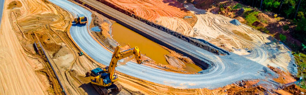
For property owners across Cherokee County, Ball Ground, and Canton planning clearing, grading, or excavation projects on their residential and rural properties, understanding what access planning for these project types specifically covers, why certain access conditions create more consequential project complications than they appear to when evaluated from the comfortable observation positions of a dry-day site visit, and how to evaluate and address access conditions before project scope is committed gives the practical framework for approaching access as the essential project planning component that it is rather than the logistical detail that can be handled when the equipment arrives and the access conditions are first encountered at operational reality rather than planning theory.
What Access Planning for Clearing and Excavation Projects Specifically Covers
Access planning for clearing and excavation projects covers four specific assessment categories that together determine whether the project’s required equipment can reach the work area, operate within it, and exit from it safely and efficiently. Each category reveals access conditions that affect a different aspect of equipment operation, and missing any category in the access assessment leaves a gap in the access understanding that the missing category’s conditions will fill at the project’s operational reality when those conditions are encountered without the prior assessment that would have identified them.
Route Width and Equipment Dimensional Clearance
The width of the access route from the public road to the work area determines whether the equipment required for the project can physically navigate to the work area without contact with the route’s lateral boundaries. Forestry mulching equipment, excavators on transport trailers, bulldozers, and dump trucks each have specific operational widths that the access route must exceed at every point along its full length, including at gate openings, vegetation-narrowed sections, and any terrain features that the route passes in close proximity to. A route that is wide enough at its widest point but that narrows to below the equipment’s operational width at any single constraint point is a route that cannot deliver the equipment to the work area without either addressing the constraint point or selecting different equipment that fits the constraint. Evaluating route width at the narrowest point rather than the average or widest point is the access width assessment that identifies the binding constraint rather than confirming the adequacy of the sections that do not limit the equipment.
Gate openings on rural properties are among the most commonly identified dimensional constraints on equipment access routes because farm gates and property access gates are frequently sized for standard farm vehicles rather than the wider transport trailers that carry excavation and grading equipment to project sites. A gate opening that is twelve feet wide accommodates a pickup truck and a standard farm trailer but may not accommodate the eighteen-foot-wide transport trailer that carries an excavator to the site, requiring either temporary gate removal, alternative access route identification, or equipment size selection that fits the constraint rather than the project’s optimal equipment. Identifying gate dimension constraints during pre-project access assessment allows the constraint to be addressed by the most efficient means available before mobilization day rather than being discovered when the transport trailer arrives at the gate opening that the equipment cannot pass through.
Overhead Clearance Along the Access Route
Overhead clearance along the access route from the public road to the work area determines whether the equipment’s height when transported or operating can navigate beneath the overhead obstacles that canopy, utility lines, and any overhead structures create above the route. Equipment transport trailers with excavators, bulldozers, or other large equipment on their decks can reach heights of fourteen to sixteen feet or more above the road surface, which is higher than the overhead canopy at many points along wooded rural access routes where branches have extended across the route at heights that passenger vehicles navigate comfortably but that tall equipment transport loads contact. Utility lines that cross the access route at their minimum mid-span clearance height create the most consequential overhead clearance constraints because contact with utility lines creates not only the equipment damage and project delay that canopy contact creates but the electrical hazard and utility disruption that utility line contact specifically adds. Walking the full access route with specific upward attention to the lowest overhead obstacle at each point along the route, rather than assessing the route from within a standard vehicle where overhead clearance constraints above the vehicle’s roof are not apparent from the driver’s normal observation position, identifies the overhead constraints that equipment transport height will encounter.
Ground Bearing Conditions Along the Access Route
Ground bearing conditions along the access route determine whether the soil surface can support the weight of the project equipment without deformation that bogs the equipment or damages the route surface and the infrastructure beneath it. Cherokee County clay’s bearing capacity is highly moisture-dependent, and access routes that are firm and navigable under the dry conditions that most pre-project site visits occur under may be soft and impassable under the wet seasonal conditions that the project mobilization date encounters. A route section that has adequate bearing capacity during a dry August site visit may have inadequate bearing capacity during a wet November mobilization if the clay at that section has absorbed sufficient moisture to approach saturation, which on Cherokee County clay routes without adequate drainage design can occur from a single significant rain event in the days preceding mobilization.
Identifying sections of the access route where clay moisture conditions, poor drainage, or previous equipment damage has produced soft bearing conditions before the project mobilization date allows the most efficient response to be selected for each soft section: temporary surface improvement through gravel or geotextile mat installation, route deviation that avoids the soft section through an alternative path with adequate bearing, or schedule adjustment to allow the soft section to dry adequately before equipment attempts to navigate through it. Each of these responses is more effectively planned and more efficiently executed before mobilization than after the transport trailer is already at the soft section that the equipment cannot navigate without the response that the pre-project access assessment would have identified and implemented before that moment.
Turning Radius and Equipment Maneuverability at the Work Area
The turning radius and maneuverability space available at the work area and at the approach to the work area determines whether the equipment can position for effective operation within the work area and whether the transport that delivered the equipment can turn around for exit rather than requiring the extended and potentially difficult backing operation that insufficient turning space forces. Large excavators require significant swing radius clearance for safe bucket operation, forestry mulching machines require turning space at the ends of treatment passes, and delivery and dump trucks require adequate turning space to maneuver within the project site without the difficult multi-point turns that insufficient turning space in constrained site conditions produces at significant time and operational complication cost. Identifying the turning space constraints at the work area approach and within the work area during pre-project access assessment allows turning space improvements, including clearing of vegetation that would otherwise limit turning radius, to be scheduled as preliminary work before the project’s primary scope begins rather than discovered as operational limitations when equipment arrives expecting adequate turning space that the preliminary clearing assessment would have provided.
Why Access Conditions Look Better During Assessment Than at Mobilization
The most common reason that access conditions produce mobilization-day surprises despite having been assessed during pre-project site visits is that the assessment and the mobilization occur under different seasonal conditions that the access route performs very differently under, specifically the dry favorable conditions that most pre-project site visits conveniently occur under and the wet unfavorable conditions that mobilization-day weather may deliver regardless of what the site visit’s conditions suggested about access route adequacy.
Cherokee County clay routes that appear firm, accessible, and negotiable under dry site visit conditions are the same routes that become soft, rutting, and potentially impassable under the wet conditions that significant rain events produce at elevated clay moisture content, which is the moisture condition that the clay has no mechanism for shedding rapidly because its near-zero permeability prevents the drainage that would reduce moisture content at the rate that more permeable soils achieve. A site visit in August that observes a clay access route in its driest annual condition provides the least accurate picture of the wet-season access conditions that a November mobilization will encounter, because the August condition represents the clay at its lowest annual moisture content and its highest annual bearing capacity while the November condition may represent the clay at or approaching saturation from fall rainfall.
The vegetation condition at access route assessment also differs from the vegetation condition at project mobilization when the seasons are different, specifically when assessment occurs in fall or winter dormancy and mobilization occurs during the growing season, or when assessment occurs in early spring before the growing season has produced the lateral encroachment and overhead extension that summer growth adds to every wooded access route. A corridor that was assessed as adequately wide during November dormancy may have been narrowed by eight to twelve inches of lateral vegetation extension from each side by the July mobilization that follows it, reducing the assessed adequate width by sixteen to twenty-four inches of combined extension growth that the dormant-season assessment could not have observed but that the growing-season mobilization will encounter as the constraint that the assessment’s adequacy judgment did not anticipate.
How Access Conditions Affect Project Scope and Cost When Discovered at Mobilization
Access limitations discovered at project mobilization rather than during pre-project access assessment affect project scope and cost through the emergency response mechanisms that reactive problem-solving requires, each of which is consistently more expensive and more schedule-disruptive than the planned equivalent response that pre-project access assessment would have initiated at planned timing and cost rather than emergency timing and premium cost.
Equipment that cannot reach the work area on mobilization day because of an undiscovered access constraint may require the contractor to return equipment to the yard and reschedule the mobilization after the access constraint is resolved, creating both the additional mobilization cost for the return trip and the schedule gap between the original mobilization date and the rescheduled date that the access constraint resolution requires. This gap may extend days or weeks depending on the contractor’s schedule availability at the rescheduled date, affecting not only the primary project timeline but any permits, contractor sequences, or property owner plans that depended on the primary project proceeding on the original schedule.
Soft access route sections that prevent equipment navigation on mobilization day require emergency surface stabilization through gravel delivery, geotextile mat installation, or temporary corduroy road construction that the project budget did not include because the pre-project access assessment that would have identified the soft section and incorporated the stabilization cost into the project budget was not conducted or was conducted under conditions that did not reveal the soft section’s wet-condition behavior. The emergency stabilization cost that mobilization-day soft section discovery requires exceeds the planned stabilization cost that pre-project access assessment would have incorporated into the project budget, because emergency response pricing for material delivery and installation at short notice on a specific project-critical timeline is consistently higher than the planned equivalent scope executed on a normal procurement and scheduling timeline that adequate advance notice supports.
How to Conduct a Practical Pre-Project Access Assessment
A practical pre-project access assessment that produces the access condition knowledge clearing and excavation projects require does not need survey instruments or technical expertise. It needs systematic physical walking of the full access route from the public road to the work area with the specific assessment attention directed at each of the four access condition categories that determine whether project equipment can navigate to the work area safely and effectively.
Walk the full access route from the public road to the work area, physically entering the route rather than observing it from the road connection point or from any single position that provides only partial route coverage. At every gate, measure or estimate the opening width and note whether the opening dimensions accommodate the widest equipment that the project requires to pass through it. At every overhead obstacle including low canopy, utility lines, and any overhead structures, estimate the clearance height and compare it to the expected transport and operating height of the project’s equipment. At every section where soft soil, drainage problems, or previous equipment rutting suggests bearing capacity concerns, specifically note the condition and estimate whether the project’s equipment weight would produce deformation at that section under the moisture conditions the mobilization date may present. And at the work area approach and within the work area, specifically assess whether adequate turning and staging space exists for the primary project equipment to maneuver effectively without contact with adjacent obstacles or the need for difficult multi-point turns in confined space.
Document each constraint identified during the assessment walk with a photograph and a location note that allows the constraint to be specifically communicated to the contractor during project planning discussions rather than requiring the contractor to identify the constraint from a general description without the specific location and photographic documentation that allows remote assessment of the constraint’s practical significance for the specific equipment the project requires. The constraint documentation produced by the assessment walk is the communication tool that allows contractor and property owner to plan the preliminary access improvements that each constraint requires before project mobilization rather than discovering the constraint when the equipment encounters it at operational reality on mobilization day.
Common Preliminary Access Improvements and How to Plan Them
The preliminary access improvements that pre-project access assessment most commonly identifies as needed before clearing and excavation project mobilization fall into predictable categories that each have practical, achievable solutions when they are identified before mobilization day rather than at it.
Corridor width constraints from vegetation encroachment are the most commonly identified preliminary access improvement need on Cherokee County rural properties because wooded access routes consistently narrow from growing season vegetation extension that has not been specifically managed for equipment access adequacy. Corridor width improvements through brush cutting, hand saw work on low-hanging branches, or owner-operated mowing equipment passes along the access route can address vegetation-limited corridor width at modest cost and with relatively short lead time, allowing the property owner to complete the preliminary corridor width improvement between the pre-project assessment that identifies the constraint and the project mobilization date that requires the corrected width without the constraint that the original assessment identified. Professional forestry mulching treatment may be required for corridor width constraints where the vegetation exceeding the required corridor width has developed stem sizes that exceed standard owner-operated equipment capacity, which the constraint assessment should specifically note to allow professional preliminary corridor treatment scheduling before the primary project mobilization date.
Overhead clearance constraints from low canopy and utility lines require different preliminary improvement approaches depending on the specific constraint type. Low canopy that can be addressed through limbing by the property owner with standard hand tools or a pole saw can be cleared before project mobilization without professional contractor involvement. Low canopy that requires climbing or aerial equipment for safe removal requires professional tree service scheduling before project mobilization. Utility line clearance constraints require contact with the utility company for the clearance work that utility lines require before project equipment can operate beneath them, which may involve a utility company scheduling process with lead time that pre-project access assessment initiates well before mobilization day but that mobilization-day discovery cannot accommodate within any practical timeframe without delaying the project.
Frequently Asked Questions
How far in advance of project mobilization should the access assessment be conducted?
Access assessment for clearing and excavation projects should be conducted far enough before project mobilization to allow the full preliminary access improvement cycle, including assessment, improvement planning, improvement execution, and any utility company coordination that clearance constraints require, to complete before the mobilization date that the primary project scope requires. For projects with only vegetation-related access constraints that owner-operated equipment can address, two to four weeks before mobilization may provide adequate lead time for assessment and improvement. For projects with utility line clearance constraints that require utility company coordination, six to eight weeks or more may be necessary to accommodate the utility company’s scheduling process before clearance work occurs. And for projects with complex access constraints including multiple constraint types at multiple route positions that each require different preliminary improvement approaches, the assessment should occur early enough that the longest-lead constraint type’s preliminary improvement can complete before the mobilization date rather than having the longest-lead constraint determine the project’s actual start date after the mobilization has been scheduled without accounting for that constraint’s resolution lead time.
Should the contractor or the property owner conduct the pre-project access assessment?
The most productive approach combines property owner assessment that physically covers the full access route with its documentation of specific constraints, followed by contractor review of the assessment documentation to identify the project-specific equipment access implications of each documented constraint. Property owner assessment produces the most comprehensive route coverage because the property owner can schedule a dedicated assessment walk at the timing and under the conditions that best reveal each constraint category, including the post-rain visit that reveals wet-season bearing capacity conditions and the overhead clearance walk that requires specific upward observation attention that a standard site visit does not provide. Contractor review of the assessment documentation adds the project-specific equipment access implications that the contractor’s knowledge of the specific equipment dimensions, weights, and turning requirements allows them to identify from the property owner’s constraint documentation, producing the specific preliminary improvement recommendations that each constraint’s impact on each piece of required project equipment warrants. This combined approach is more productive than either the property owner assessment without contractor review that may identify constraints without connecting them to specific preliminary improvement requirements, or the contractor-only assessment that provides excellent equipment-specific access evaluation but that may occur under favorable conditions that do not reveal the wet-season bearing capacity and growing-season vegetation conditions that a property owner assessment conducted under specifically revealing conditions would produce.
What access conditions most commonly create the largest project delays when discovered at mobilization rather than at pre-project assessment?
Utility line clearance constraints discovered at mobilization consistently create the largest project delays because the utility company coordination required for clearance work typically operates on multi-week scheduling timelines that mobilization-day discovery cannot compress to the same-day or next-day resolution that the stopped project mobilization needs. A utility line that requires the utility company to raise or relocate for equipment clearance may require a four to eight week scheduling process that completely stalls the primary project scope during the full resolution period, creating a project delay that pre-project identification and utility company contact initiated eight weeks before mobilization would have resolved before the mobilization date rather than creating the full delay during the active project schedule. Soft access route sections requiring significant surface stabilization are the second most delay-creating access constraint discovered at mobilization because stabilization material delivery and installation require the procurement and scheduling lead time that emergency ordering commands at premium cost and with variable availability that pre-project procurement at normal timeline does not face. Pre-project identification of both these constraint types, utility line clearance needs and soft section stabilization needs, should be treated with the greatest advance notice priority of any access constraint type because their resolution lead times are the longest and their delay consequences are the most schedule-disruptive of the commonly encountered access constraint categories.
Does access planning change depending on whether the project is clearing, grading, or excavation?
Access planning for clearing, grading, and excavation projects addresses the same four constraint categories for each project type but applies different dimensional and weight standards for each constraint category based on the specific equipment each project type requires. Forestry mulching projects for clearing work typically involve equipment of moderate width and weight that has lower route dimensional and bearing capacity requirements than the heavy excavation equipment that pond construction, building site development, and major drainage correction require. The transport trailer that delivers an excavator is typically wider and heavier than the transport that delivers forestry mulching equipment, creating more stringent access route width and bearing capacity requirements for excavation projects than for clearing projects at the same location. Grading projects using bulldozers and motor graders have their own specific dimensional and weight requirements that fall between forestry mulching and excavation equipment on most access route constraint dimensions. When planning access for projects that include multiple equipment types across sequential project phases, the access standard should be sized for the most demanding equipment any phase requires rather than for the immediate phase’s equipment, ensuring that the access improvements made before the first phase also accommodate the equipment that subsequent phases will require to navigate the same route without additional access improvement at each subsequent phase mobilization.
Planning a Clearing or Excavation Project on Your North Georgia Property?
Access planning before clearing and excavation project commitment prevents the mobilization-day surprises that discovering access constraints at operational reality consistently produces at premium emergency response cost and disruptive schedule delay. The four access condition categories that pre-project assessment covers, route width and dimensional clearance, overhead clearance, ground bearing conditions, and turning and maneuverability space, each require specific assessment attention that systematic route walking provides and that general site visit observation without this specific focus consistently misses until the project encounters those conditions at mobilization. Conducting the access assessment under the seasonal conditions that most reveal each constraint category, specifically including wet-condition bearing assessment and growing-season vegetation extension assessment alongside the dry-condition dimensional and overhead clearance assessment that most site visits provide, produces the most complete access condition understanding available before commitment and the most reliable prevention for the access surprises that incomplete assessment under favorable conditions allows to appear at the mobilization timing when prevention is no longer available at planned cost and schedule.
Bardin Outdoors works with homeowners, landowners, and builders across Ball Ground, Canton, Cherokee County, and North Georgia on clearing, forestry mulching, and grading and excavation projects that include pre-project access assessment as a standard component of project planning, ensuring that each project’s equipment can reach the work area on mobilization day without the access-related delays and costs that inadequate pre-project access assessment consistently produces. To learn more about how Bardin Outdoors approaches access planning for North Georgia improvement projects, contact us.