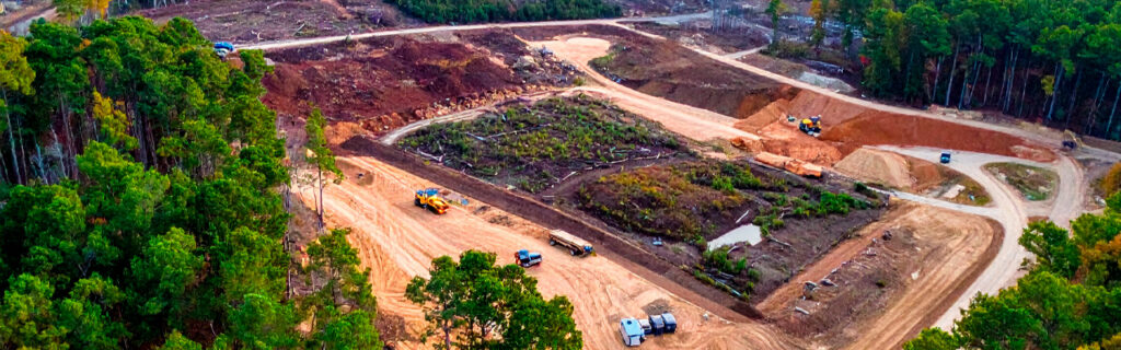
For property owners across Ball Ground, Canton, Cherokee County, and North Georgia planning land clearing improvements on residential and rural properties where the desire to create usable open space at specific locations coexists with the equally genuine desire to preserve the natural wooded character that the property’s wooded sections provide as the aesthetic, ecological, and intrinsic value that the property holds for the owner who chose wooded acreage for the natural character it maintains rather than the open acreage that uniform clearing would produce from it, understanding how to plan clearing in zones that distinguishes the areas where clearing creates the needed open space from the areas where preservation maintains the natural character, what the zone-differentiated planning approach involves in specific practical terms, and how the preservation zones and clearing zones that the planning produces work together to create the improved property that has the open space where it is specifically needed and the natural character where it is specifically valued gives the complete guide for approaching zone-based clearing planning as the improvement approach that most specifically serves the property owner who wants both outcomes from the same property rather than either outcome at the expense of the other.
Thinking About the Property in Zones Rather Than as One Project
Thinking about clearing in zones rather than as a single property-wide project requires the prior step of evaluating each portion of the property for the specific function it should serve in the improved property’s overall use pattern rather than evaluating each portion for whether it has vegetation that could be cleared without the function-based question of whether the clearing would improve the portion’s contribution to the improved property or diminish it by removing the natural character that the portion’s wooded condition provides as its contribution to the improved property’s overall character.
The zone-based evaluation that produces the clearing and preservation zone distinction begins with mapping the intended uses for the improved property that the owner’s improvement goals define as the functional outcomes the improvement program should produce. Building sites, parking areas, food plots, outdoor living areas, and access routes are the use types that require the cleared or open conditions that clearing specifically creates. Woodland habitat, natural buffers, scenic wooded backdrop, native plant communities, and the ecological functions that wooded sections provide are the use types that require the preserved wooded conditions that preservation specifically maintains. Mapping the intended uses onto the property’s terrain reveals which portions the improvement program requires to be cleared for the open-condition uses and which portions the improvement program requires to remain natural for the wooded-condition uses, producing the zone map that distinguishes the clearing zones from the preservation zones before the clearing that the map directs to the clearing zones and withholds from the preservation zones.
The terrain assessment that informs the zone map’s accuracy requires the interior terrain walks, post-rain drainage observations, and vegetation assessments that characterize each portion’s actual conditions rather than the accessible perimeter observations that characterize the apparent conditions without the interior accuracy the mapping decisions require for placement accuracy. The building site zone that the map places at the terrain position with the most favorable earthwork scope, drainage orientation, and soil conditions produces a more improvement-efficient zone assignment than the building site zone placed at the visually prominent terrain position without the terrain assessment that would have revealed the more favorable position’s lower earthwork requirement. The preservation zone that the map places at the terrain position with the most mature native canopy, the most ecologically diverse understory, and the most natural character produces a more valuable preservation outcome than the preservation zone placed at the invasive-dominated section without the vegetation assessment that would have revealed the native-character position as the more preservation-worthy zone.
Defining the Clearing Zones: Where Open Space Is Needed
The clearing zones that the zone map identifies as the property portions where open space creation specifically serves the improvement objectives should be defined by the functional requirements that each intended use creates for the cleared condition rather than by the extent of the available vegetation that could theoretically be cleared without an upper limit that the functional requirement establishes as the appropriate clearing scope boundary.
Building Site and Development Clearing Zones
Building site clearing zones should be specifically defined by the building footprint, the construction operating zone that equipment must maneuver within during construction, the access corridor that construction traffic must navigate, and the utility corridor that utility connections must traverse between the road connection and the building site. These four functional components together define the building site clearing zone at the minimum extent that the building development specifically requires rather than the maximum extent that clearing beyond the functional components would produce from the development mobilization that the property owner might be tempted to expand beyond the functional requirement without the functional boundary that the zone-based planning specifically establishes as the clearing scope limit. The preservation zone begins at the clearing zone’s boundary rather than at the distance from the improvement that the comprehensive clearing approach would continue clearing to without the zone boundary that zone-based planning specifically maintains between the clearing that the functional requirement defines and the preservation that the zone boundary protects from the clearing that the functional requirement does not need to extend into the preservation zone to accomplish the building development objectives the clearing zone was defined to serve.
Food Plot and Agricultural Clearing Zones
Food plot clearing zones should be specifically defined by the productive area dimensions that the food plot management program requires from the cleared and open surface that full sunlight access across the full productive area demands, plus the margin that extends the clearing beyond the intended productive boundary at the additional distance that gives the food plot the full sunlight access without the canopy edge shading that clearing only to the intended productive boundary would allow to reduce the productive area’s effective sunlight access from the canopy’s shade contribution at the clearing edge. This sunlight-access-defined clearing zone produces the food plot productive area that the intended planting establishment and management program requires from the cleared zone without the additional clearing beyond the sunlight-access requirement that extending the food plot clearing to a larger extent than the sunlight access demands would impose on the adjacent preservation zone that the sunlight-access-defined clearing boundary specifically protects from the clearing that the productive area’s sunlight access requirement does not extend into the preservation zone to achieve.
Access Corridor Clearing Zones
Access corridor clearing zones should be specifically defined by the corridor width that the most demanding equipment or traffic type the corridor serves requires for the safe and comfortable navigation that the corridor’s functional purpose demands from the cleared width, plus the overhead clearance height that the tallest vehicle or equipment the corridor serves requires the clearing to provide above the corridor’s travel surface. This functional-requirement-defined corridor clearing zone produces the access corridor that serves the intended traffic at the adequate width and clearance without the beyond-corridor clearing that widening the corridor beyond the traffic’s functional requirement would impose on the preservation zone on both sides of the corridor that the functional-requirement-defined corridor width specifically protects from the clearing that the traffic requirement does not need beyond the corridor width the requirement specifically defines. The preserved wooded character on both sides of the functional-requirement-defined corridor is what creates the woodland trail experience that walking or riding through the cleared corridor provides when the woods that the corridor connects are visible and accessible from within the corridor that the functional clearing defined as the passage through the preservation zone rather than the clearcut through it that comprehensive clearing beyond the corridor’s functional requirement would substitute for the woodland corridor experience.
Defining the Preservation Zones: Where Natural Character Should Be Maintained
The preservation zones that the zone map identifies as the property portions where the natural wooded character should be maintained rather than cleared should be defined by the natural character value that each portion provides as the contribution to the improved property’s overall character rather than by the absence of a specific clearing requirement that would default the portion to preservation without the positive assessment of its natural character value that zone-based planning specifically requires from the preservation zone designation.
Native Canopy Preservation Zones
The wooded sections where the mature native canopy that decades of growth have developed above the forest floor contributes the most irreplaceable natural character to the property’s overall setting are the highest-priority preservation zones that the zone-based planning should specifically protect from the clearing that would permanently eliminate the mature canopy that cannot be replaced within any timeframe that the property owner’s occupancy includes. The mature oak and hickory woodland that provides the summer shade, the overhead canopy structure, the natural nesting habitat, and the aesthetic character that distinguishes the wooded residential property from the cleared residential lot is the natural character contribution that makes the native canopy section the highest-priority preservation zone that the zone-based planning specifically protects by placing the clearing zones at the portions where the functional improvement objectives are achievable without the native canopy’s elimination and placing the preservation zone at the native canopy sections where the natural character contribution the canopy provides cannot be achieved from the cleared condition that elimination would substitute for the canopy character that decades of growth have developed and that zone-based planning specifically preserves by directing the clearing to the clearing zones that serve the functional objectives without the native canopy sections that the preservation zone specifically protects.
Transition and Buffer Preservation Zones
The wooded transition sections between the clearing zones and the interior preservation zones that the zone-based planning maintains as the buffer between the cleared areas and the preserved interior contribute the visual screening, the ecological connectivity, and the gradual open-to-wooded transition that abrupt clearing edge to wooded interior without the transition buffer would replace with the stark edge between the cleared condition and the wooded interior that the transition buffer’s graduated character specifically softens into the natural open-to-wooded transition that many property owners specifically value as the aesthetic quality that the gradual rather than abrupt edge transition provides for the improved property’s overall character. The transition buffer zone’s selective management that addresses the invasive species within the transition while preserving the native understory and the canopy that the transition contains creates the accessible, ecologically diverse transition character that the buffer preservation zone maintains between the cleared areas and the preserved interior without the comprehensive clearing that eliminating the transition buffer’s vegetation would substitute for the transition character it provides.
Riparian and Drainage Feature Preservation Zones
The wooded sections adjacent to drainage features, drainage channels, and low-lying drainage accumulation areas that the zone-based planning preserves as the riparian and drainage function zones contribute the bank stabilization, the water quality protection, the drainage velocity reduction, and the ecological function that wooded riparian zones provide alongside drainage features that the clearing would eliminate by removing the vegetation that performs those functions adjacent to the drainage features that the vegetation specifically protects through the riparian functions that the zone-based planning preserves by designating those sections as the preservation zones that the clearing directs away from rather than through the drainage feature sections that the clearing would be required to treat as clearing zones without the zone-based planning that specifically designates the riparian and drainage sections as the preservation zones that the drainage functions and any applicable regulatory buffers that stream buffer protection requirements may establish at those drainage features require to remain as the wooded protective zones that zone-based planning specifically maintains.
How Selective Forestry Mulching Serves the Zone-Based Clearing Approach
Selective forestry mulching within the clearing zones that the zone-based planning has defined as the clearing scope serves the zone-based approach by addressing the invasive vegetation within those zones while specifically preserving the native canopy trees, native understory species, and natural features that the clearing zones contain at the preservation-worthy positions the selective approach navigates around rather than processes with the surrounding invasive vegetation that the mulching is specifically intended to address. The food plot clearing zone that contains the mature native oak at the food plot’s edge and the native serviceberry in suppressed condition beneath the invasive privet that the food plot clearing is intended to address can be served by the selective forestry mulching that removes the invasive privet throughout the food plot zone while specifically preserving the native oak and the native serviceberry as the food plot’s retained natural character elements rather than the comprehensive clearing that would eliminate the native oak and serviceberry along with the invasive privet the food plot clearing was intended to address without the collateral native species loss that the selective approach specifically prevents by navigating around the preservation-marked native elements within the food plot clearing zone.
The pre-clearing preservation walk that physically enters each clearing zone before the clearing equipment arrives, identifies each native canopy tree, native understory species, and natural feature within the zone that the selective treatment should preserve, and marks each preservation target with bright flagging tape at approximately five to six feet of height at each marked target’s specific position within the clearing zone produces the field-present preservation guidance that the clearing operator’s equipment navigation requires at each marked target’s position during active processing. This preservation walk and marking within the clearing zones is the activity that translates the zone-based planning’s intention to preserve the natural character elements within the clearing zones into the field instructions the clearing execution requires for the preservation accuracy that the zone-based planning approach specifically intends to achieve from the selective clearing that addresses the invasive vegetation within the clearing zones without the native character elimination that the clearing zones’ preservation-worthy elements specifically warrant the selective approach to avoid.
Communicating the Zone-Based Plan to the Clearing Contractor
Communicating the zone-based clearing plan to the clearing contractor before any clearing equipment arrives requires the specific zone map, the zone boundary marking, and the preservation target marking within the clearing zones that together translate the zone-based planning’s clearing and preservation distinctions into the field-present instructions that the clearing execution needs to implement the zone-based plan rather than the property-wide comprehensive clearing that the execution without zone-specific instructions would apply without the zone boundaries that the zone-based plan establishes as the clearing scope limits.
The zone map that shows the clearing zones and preservation zones as the distinct areas that the clearing should treat differently communicates the zone-based plan’s structure to the contractor before the site visit that the contractor conducts to verify the zone boundaries in the field and confirm the operational approach that clearing the clearing zones without entering the preservation zones requires from the equipment navigation that the zone boundaries establish as the limits that the clearing respects throughout the treatment. The zone boundary marking that physically establishes each zone boundary in the field with flagging tape, marking paint, or stakes at the boundary positions where the clearing equipment must stop and the preservation zone begins provides the field-present boundary indication that the operator’s navigation requires to implement the zone boundary as the clearing scope limit rather than the impression-assumed boundary that the operator’s judgment at active processing speed would maintain without the physical marking that the zone-based planning specifically requires the field marking to provide as the unambiguous zone boundary the clearing execution can follow during the active treatment that implements the zone-based plan the contractor and property owner have specifically agreed to before the clearing begins.
Frequently Asked Questions
How do I determine the appropriate size of the clearing zones relative to the preservation zones on my property?
Determining the appropriate size of the clearing zones relative to the preservation zones requires applying the functional requirement criterion to each clearing zone and the natural character value criterion to each preservation zone rather than applying a fixed ratio of cleared to preserved acreage that would ignore the property-specific functional requirements and natural character values that the appropriate zone sizes should reflect. Each clearing zone’s appropriate size is specifically defined by the functional requirement that the zone must serve, with the building site clearing zone sized to the building footprint, construction operating zone, and utility corridor that the development requires, the food plot clearing zone sized to the productive area and sunlight margin the food plot management requires, and the access corridor clearing zone sized to the corridor width and overhead clearance the traffic requires. Each preservation zone’s appropriate size is the remaining acreage after the functionally-defined clearing zones have been specifically placed at the positions where the functional requirements locate them, with the preservation zone encompassing the acreage that the functional requirements do not specifically place clearing at. This functional-requirement-first sizing approach produces the clearing zones at the sizes the functional requirements specifically need and the preservation zones at the sizes the remaining acreage provides after the functional requirements have been specifically satisfied at the clearing zone sizes the requirements define rather than the artificially balanced clearing-to-preservation ratio that would either over-clear at the expense of preservation or under-clear at the expense of functional requirement satisfaction.
Can zone-based clearing be implemented in phases over multiple seasons rather than all at once?
Zone-based clearing is particularly well-suited to phased implementation over multiple seasons because the zone-based approach’s structure naturally provides the phasing logic that sequences the clearing zone implementation from the highest-priority zones whose functional improvements the improvement program most urgently needs toward the lower-priority zones whose functional improvements the improvement program can productively defer to subsequent seasons without the urgency that the higher-priority zones create. The building site clearing zone that the construction development program requires to be cleared before the site preparation and construction can proceed is the first-phase clearing that the phased zone-based approach prioritizes for the current season’s clearing implementation. The food plot clearing zones that the hunting program requires for the approaching hunting season are the second-phase clearing that the phased approach prioritizes for the current or immediately subsequent season. The access corridor clearing zones that extend the property’s interior access network toward the remoter destinations are the third-phase clearing that the phased approach implements in subsequent seasons as the access network extension advances the full intended interior connectivity from the current accessibility through the sequential corridor additions that each season’s corridor clearing contributes to the network that the zone-based plan established as the full intended extent at the outset before the phased implementation began delivering the clearing zones in the sequence the phasing logic determines from the zone-based plan’s full intended scope.
How do I manage the invasive vegetation pressure in the preservation zones without clearing them?
Managing invasive vegetation pressure in the preservation zones without clearing them requires the targeted management approach that specifically addresses the invasive species within the preservation zones while preserving the native canopy, native understory, and natural character that the preservation zones are maintained to protect rather than the comprehensive clearing that would eliminate the invasive pressure by eliminating the preservation zone vegetation that the management is specifically trying to maintain. Targeted herbicide treatment of invasive seedlings and resprout at the manageable heights that the preservation zone’s invasive populations present before they advance to the established density that selective forestry mulching would need to address at the professional clearing stage specifically addresses the invasive pressure at the early stages where owner-operated management can intercept the invasive advance without the professional clearing that the preservation zone’s intact native character the early-stage management preserves would require at the established stage. The annual growing-season inspection walk through the preservation zones that specifically identifies the invasive seedlings, early establishment populations, and advancing invasive fronts from the clearing zones into the preservation zones at the early stages where the owner-operated herbicide treatment can address the invasive pressure most cost-efficiently maintains the preservation zones at the naturally dominated condition that the zone-based planning designated them for rather than allowing the invasive pressure that the adjacent clearing zones’ management program disrupts into the adjacent preservation zones to advance unchecked toward the established density that would eventually require the selective forestry mulching that the preservation zone maintenance specifically prevents from becoming necessary through the early-stage invasive management that intercepts the advance before the established stage.
What should I do if I realize after clearing that I cleared too much or that the clearing zone was larger than the functional requirement needed?
If the clearing zone’s implementation reveals that the cleared area is larger than the functional requirement specifically needed, the most productive response is the native species replanting or native seed establishment that begins the ecological restoration of the over-cleared area toward the woodland character that the over-clearing removed from the area beyond the functional requirement rather than accepting the over-cleared condition as the permanent outcome of the clearing that proceeded beyond the functional requirement’s appropriate limit. Native species appropriate to the regional ecology including native oaks from acorn planting, native understory species from container-grown transplants, and native ground covers from seed mixes specifically suited to Cherokee County’s soil and light conditions can be established in the over-cleared area to begin the transition from the cleared condition back toward the woodland character that the over-clearing removed at the positions beyond the functional requirement that the zone-based planning would have specifically maintained as preservation zone had the clearing zone been accurately limited to the functional requirement rather than extended beyond it. The replanting and establishment investment that restoring the over-cleared area requires is the learning cost that the over-clearing produced from the clearing that exceeded the zone-based planning’s intended scope, and the zone-based planning approach that is specifically designed to prevent the over-clearing by defining the clearing zone at the functional requirement rather than the available vegetation extent is the improvement planning practice that prevents the over-clearing that the replanting investment would otherwise need to correct from the cleared condition that the functional-requirement-limited zone boundary would have specifically prevented from developing through the zone-based planning that the over-clearing outcome demonstrates the value of applying before the clearing that proceeds from the zone-based plan rather than beyond the zone boundaries it establishes as the clearing scope limits.
Ready to Plan Zone-Based Clearing on Your North Georgia Property?
The zone-based clearing plan that distinguishes the clearing zones where open space creation specifically serves the improvement objectives from the preservation zones where the natural wooded character should be maintained produces the improved property that has the open space where it is specifically needed and the natural character where it is specifically valued without the uniform comprehensive clearing that sacrifices the natural character throughout the full property to create the open space that only the clearing zones require. The functional-requirement-defined clearing zones that serve the building development, food plot management, and access corridor objectives at the extents those objectives specifically require, the natural-character-value-defined preservation zones that maintain the native canopy woodland, the ecological transition buffers, and the riparian character at the portions where those character contributions are most specifically worth preserving, and the selective forestry mulching within the clearing zones that addresses the invasive vegetation without eliminating the native character elements those zones contain are the zone-based clearing planning components that together produce the improved property that works with what the property’s natural character provides rather than against it at the natural character elimination cost that comprehensive clearing without the zone-based distinction imposes on the property’s long-term character and value.
Bardin Outdoors works with property owners across Ball Ground, Canton, Cherokee County, and North Georgia on zone-based land clearing and forestry mulching projects that implement the clearing and preservation zone distinctions the improvement program’s functional requirements and natural character values specifically define, applying the regional experience that translates zone-based clearing plans into the field-marked zone boundaries, selective preservation markings, and clearing approach selections that the zone-based plan’s clearing and preservation outcomes require from the clearing execution that the zone-based plan specifically guides. To learn more about how Bardin Outdoors can help plan zone-based clearing on your North Georgia property, contact us.