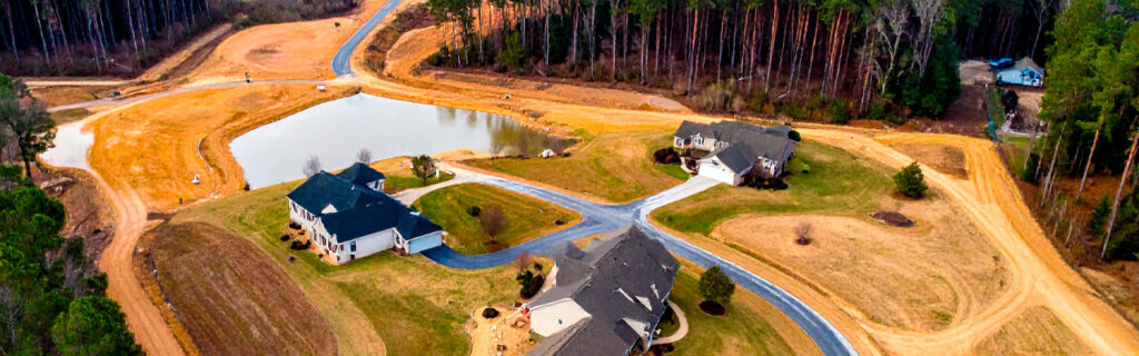
For landowners across Cherokee County, Ball Ground, and Canton who own or are considering purchasing rural acreage in North Georgia, understanding what makes this land specifically different from rural land in other regions, what those differences mean for improvement planning and ongoing management, and what the most important things are to know before making any significant investment in land improvement gives the practical foundation for approaching North Georgia property ownership with realistic expectations and effective strategies rather than with assumptions borrowed from simpler or fundamentally different improvement environments. The landowners who are most satisfied with their North Georgia rural properties are almost always those who understood what they were working with before they began investing in improving it.
Rolling Terrain That Creates Both Character and Complexity
North Georgia’s position at the transition between the southern Piedmont and the Appalachian foothills produces the rolling terrain that gives the region’s rural properties their distinctive visual character and three-dimensional feel that flat land cannot replicate. Ridge crests, mid-slope transitions, and the stream corridors and low-lying areas that define the valley bottoms between ridges create the topographic variety that makes a North Georgia rural property feel like land rather than simply a large flat lot. This terrain character is genuinely appealing and is a primary reason that most buyers choose to pay the premiums that rural North Georgia acreage commands over comparably sized flat rural land in other parts of Georgia.
The same terrain that creates this appealing character also creates the drainage complexity, earthwork volume requirements, and equipment access challenges that make outdoor improvement projects on North Georgia rural properties more involved than equivalent projects on flat land. Every outdoor improvement on rolling terrain must account for the drainage relationships that slope creates between uphill contributing areas and the improvement site, the cut-and-fill earthwork volumes that establishing level surfaces from sloped terrain requires, and the equipment access conditions that slope imposes on the approach routes and work areas that improvement projects use. Understanding that this terrain complexity is inherent to the land rather than a project management failure that could have been avoided with better planning is the first step toward building accurate improvement project expectations.
Drainage as a Universal Improvement Consideration
On rolling North Georgia terrain, drainage is not simply a drainage project concern. It is a factor in every outdoor improvement project regardless of whether the project’s primary purpose is clearing, building, road development, or vegetation management. Every improvement site on sloped terrain receives drainage from the uphill terrain surrounding it in addition to the rainfall falling directly on the improvement’s footprint, and the volume of that uphill drainage contribution on Cherokee County’s clay-dominant soil is substantial because the soil’s low permeability converts most rainfall to surface runoff rather than absorbing it into the soil profile. Improvement projects planned without accounting for this uphill contributing drainage consistently produce drainage problems in the finished improvement that site evaluation accounting for the terrain would have identified and designed for before work began.
Earthwork That Exceeds Flat-Land Expectations
The cut-and-fill earthwork required to establish level building pads, functional driveways, and cleared work areas from rolling North Georgia terrain is consistently larger than landowners estimate from visual terrain assessment or from aerial imagery observation. Aerial imagery shows the canopy surface of wooded properties rather than the ground terrain beneath it, and even direct visual assessment from property edges understates the slope variation that interior terrain walking reveals. Earthwork volume estimates for improvement projects on North Georgia rural properties should be developed from direct interior terrain evaluation by experienced local contractors who can accurately read the slopes and elevation changes from physical site walking rather than from the visual impression of exterior observation.
Red Piedmont Clay Soil That Defines Excavation and Drainage Behavior
The red-orange piedmont clay that characterizes North Georgia’s subsoil profile is one of the most distinctive and most consequential characteristics of rural property in the region. This clay is the product of millions of years of chemical weathering of the metamorphic and granitic bedrock that underlies the region, and its physical properties differ from the sandier soils of Georgia’s coastal plain, the loamier soils of the mountain regions further north, and the mixed soils of many other rural land markets in ways that directly affect how outdoor improvement projects should be designed and executed.
Low Permeability and Surface Runoff Dominance
Cherokee County clay soil has very low permeability when saturated, approaching zero infiltration capacity during extended wet periods. This means that rainfall on saturated clay soil becomes almost entirely surface runoff, generating the flow volumes and velocities on slopes that produce the region’s characteristic erosion patterns and that challenge drainage infrastructure designed for soil conditions with more infiltration capacity. Every drainage system on a North Georgia rural property must be designed for essentially all rainfall becoming surface runoff during the wet season conditions that the region’s climate regularly produces, which produces drainage infrastructure requirements that are more extensive than what the same project would require on more permeable soil types.
Seasonal Volume Change and Structural Implications
Cherokee County clay expands significantly when it absorbs moisture and contracts when it dries, producing volume changes with seasonal moisture cycling that create mechanical forces on foundations, pavements, drainage pipes, and fence posts embedded in or resting on the clay. The foundation cracking, pavement heaving, and drainage pipe displacement that are common on North Georgia residential properties are typically expressions of this clay volume change behavior rather than construction defects in the affected structures. Understanding that this behavior is a property of the soil rather than a construction quality issue means designing around it through adequate drainage that limits moisture cycling amplitude, rather than simply building more robust structures and expecting them to withstand the clay’s movement without drainage management that moderates the movement itself.
Compaction Requirements and Moisture Sensitivity
Cherokee County clay can only be compacted to adequate structural density within a specific moisture content range near its optimum for compaction. Clay significantly above this optimum moisture content, which the region’s spring wet season regularly produces, cannot achieve adequate compaction density regardless of the effort applied because the water in the soil pore spaces prevents the particle consolidation that creates structural density. This moisture sensitivity means that excavation and grading projects requiring structural compaction, including building pad preparation and driveway base construction, must be scheduled for seasonal windows when clay moisture conditions support quality compaction work rather than for the spring wet season when the clay’s moisture content is most likely to be above the compaction-optimum range.
Dense Tree Cover That Creates Clearing Complexity and Opportunity
North Georgia rural properties are predominantly wooded, and the mature hardwood forest that covers most of the region’s rural acreage is one of the characteristics that most directly attracts buyers to this land. The oaks, hickories, tulip poplars, and other hardwoods that have been growing on typical Cherokee County rural properties for decades provide the canopy character, wildlife habitat, timber value, and visual setting that make this land distinctive. This wooded character is an asset to be managed and preserved rather than a barrier to be eliminated, and the most successful improvements on North Georgia rural properties are those that work selectively with the existing tree cover rather than simply removing all vegetation to create open land from wooded acreage.
Concealed Conditions Beneath Wooded Cover
The wooded canopy that makes North Georgia rural properties appealing also conceals the ground-level terrain, drainage features, soil conditions, and regulatory features beneath it in ways that require deliberate interior site evaluation before any significant improvement project is planned. A wooded property that appears relatively uniform from the road or from aerial imagery may contain substantial terrain variation at ground level, intermittent streams with regulatory buffer requirements, low-lying wet areas that would affect building site selection, and invasive species populations whose density and extent are invisible from any external observation position. Walking the interior of any wooded property under consideration for improvement projects, and doing that walk under multiple seasonal conditions that reveal drainage behavior as well as terrain and vegetation character, produces the site understanding that improvement planning requires and that aerial observation or edge assessment cannot adequately substitute for.
Selective Clearing as the Most Effective Management Approach
Forestry mulching that removes invasive understory species while preserving the mature canopy above it is the clearing approach that produces the most characteristically North Georgia result from wooded property improvement: open, navigable woodland with clear sight lines at ground level and the mature canopy character intact above. This selective clearing approach converts impenetrable wooded sections into productive hunting habitat, accessible recreational land, and navigable property sections without the fundamental character change that full clearing would create. Understanding selective clearing as a viable and often superior alternative to full clearing is foundational knowledge for landowners managing wooded North Georgia properties because it opens management options that the full-clearing-or-no-clearing framework most commonly applied to wooded properties misses entirely.
Invasive Species Pressure That Requires Active Ongoing Management
Cherokee County’s growing conditions, including the warm temperatures, generous rainfall, and long growing season that make the region’s natural vegetation so lush, are the same conditions that make its invasive species particularly aggressive and particularly challenging to manage. Chinese privet, kudzu, wisteria, multiflora rose, and autumn olive are all present throughout the region’s landscape in established populations that continuously produce seed, advance their root systems into adjacent managed areas, and regrow from established root reserves after any mechanical treatment that addresses only their above-ground expression.
Managing these invasive species populations effectively requires understanding that mechanical clearing alone does not address the root systems that will reproduce the same above-ground growth within one to two growing seasons after clearing. The most effective invasive management programs on North Georgia rural properties combine mechanical clearing to address the current above-ground expression with targeted herbicide treatment of resprout growth in the weeks following clearing, when the active transport of the herbicide through the plant’s vascular system into the root reserves produces root energy depletion that progressively reduces resprout vigor over successive treatment seasons. Landowners who expect one-time mechanical clearing to produce lasting results consistently find themselves clearing the same areas at the same intensity every few years without the progressive improvement that combined mechanical and chemical treatment produces over the same period.
Subsurface Rock That Creates Excavation Contingency Requirements
The geological character of North Georgia’s southern Piedmont produces subsurface rock at depths and frequencies that make rock encounter a standard budget contingency item on excavation projects in the region rather than an exceptional discovery that no planning allowance is needed for. The metamorphic and granitic bedrock of the Piedmont underlies the clay soil profile at depths that vary with topographic position, with ridge and hilltop positions having shallower rock depth from historical erosion and valley positions having deeper soil profiles from material accumulation at lower elevations. Properties on or near ridgelines and those with visible surface rock outcrops have elevated rock probability that experienced local contractors recognize and budget for appropriately, while properties with no surface indicators still have meaningful rock probability that warrants contingency allowance on excavation projects requiring significant depth.
Rock removal from excavation projects requires specialized hydraulic breaking equipment and substantially more time per cubic yard than clay excavation, creating cost additions that significantly affect project economics when they occur without prior contingency planning. Landowners who approach North Georgia excavation projects with the assumption that rock will not be encountered because they have not seen surface expressions of it are consistently the ones who experience the budget disruption that unplanned rock removal creates. Treating subsurface rock as a standard regional characteristic that warrants specific budget contingency rather than as an exceptional risk that needs no allowance is the approach that experienced local contractors consistently recommend for any excavation project on North Georgia rural properties.
Regulatory Features That Require Evaluation Before Development
North Georgia rural properties frequently contain regulatory features that restrict where improvements can be placed and what activities can occur in specific zones, and these features require identification and confirmation before any significant improvement project is planned rather than after work has already begun in areas that turn out to be subject to regulatory constraints. The most common regulatory features on Cherokee County rural properties include stream buffers that establish minimum setback distances from regulated watercourses within which land-disturbing activities are restricted, potential wetland areas subject to federal jurisdiction where Army Corps of Engineers review may be required before any disturbance, and the land disturbance permit threshold of one acre under Georgia’s Erosion and Sedimentation Act that triggers a permit requirement for projects exceeding that area.
The stream and drainage features that create buffer requirements on North Georgia rural properties are not always obviously identifiable from property edge observation or aerial imagery because they can flow through wooded land without surface expression that distinguishes them from the general wooded landscape. Walking the property interior under wet conditions when seasonal streams are active is the most reliable identification method for these features, and doing this evaluation before planning any clearing, grading, or development work in potentially affected areas is the approach that prevents the compliance complications that regulatory feature discovery during active construction creates. Landowners who invest in this pre-development regulatory evaluation consistently find it less expensive and less disruptive than the stop-work situations that undiscovered regulatory features create when they are found during active project execution.
Seasonal Conditions That Shape the Management Calendar
North Georgia’s climate delivers over fifty inches of annual rainfall in seasonal patterns that create specific optimal and suboptimal windows for different types of property improvement and management work. Understanding this seasonal pattern and planning improvement projects for the windows when local conditions support quality work rather than for calendar convenience is one of the most practically valuable things a landowner can know about managing North Georgia rural property effectively.
Spring wet season from March through May creates the most challenging conditions for equipment-intensive work because persistent rainfall keeps Cherokee County clay saturated for extended periods, limiting bearing capacity for equipment movement, preventing adequate compaction for structural fill work, and creating the equipment tracking conditions that damage subgrade surfaces in ways that reduce finished work quality. Late summer through fall provides the most consistent conditions for structural excavation, grading, and building pad preparation as soil moisture declines from its spring peak and working days with adequate clay conditions become more reliably available. Late fall and winter is the most productive window for vegetation clearing and forestry mulching because dormant vegetation has lower biomass, leafless trees allow better preservation target identification, and the seasonal absence of ground-nesting wildlife reduces habitat disturbance concerns during clearing operations.
The Value of Local Contractor Experience on North Georgia Properties
The characteristics that make North Georgia rural properties distinctive, including the rolling terrain, red clay soil, wooded character, invasive vegetation pressure, subsurface rock probability, and seasonal moisture patterns, are characteristics that experienced local contractors have navigated on project after project on similar land in the region. This accumulated regional experience is practical project quality knowledge that cannot be fully replicated by general construction competence without the specific regional background. A contractor who has worked on hundreds of Cherokee County rural property projects knows how local clay behaves at different seasonal moisture levels, which topographic positions in the area typically produce rock, how local invasive species populations respond to mechanical clearing, and what drainage approaches work reliably on the region’s typical slope and soil combinations. This knowledge affects project outcomes in every phase from initial scope estimation to execution quality to long-term performance of the finished improvements.
For landowners evaluating contractors for improvement projects on North Georgia rural properties, regional experience on comparable terrain is a practical project quality consideration rather than simply a credential. The most expensive excavation surprises, drainage failures, and improvement rework on North Georgia rural properties are disproportionately found on projects executed by contractors without regional experience applying approaches developed for simpler or different improvement environments to conditions that those approaches were not designed for. Involving experienced local contractors in project planning before scope decisions are made is the approach that consistently produces the most accurate initial estimates and the most effective project execution on land with North Georgia’s specific characteristics.
Frequently Asked Questions
How does owning rural property in North Georgia compare to rural land ownership in other parts of Georgia?
North Georgia rural properties differ from coastal plain and central Georgia rural properties in terrain, soil, vegetation, and geological characteristics that each affect improvement planning and management in specific ways. The rolling terrain of North Georgia’s Piedmont-to-foothills transition creates drainage complexity and earthwork requirements that flat coastal plain properties do not present at the same scale. The red piedmont clay soil has lower permeability and higher volume change behavior than the sandier soils of south Georgia, creating drainage infrastructure requirements and foundation movement considerations that are less prevalent on more permeable soil types. The mature hardwood forest that defines North Georgia’s rural landscape requires the selective management approaches that open-field rural properties in other regions do not need. And the subsurface rock probability from the Piedmont’s bedrock geology creates excavation contingency requirements that are absent on the deep sedimentary soils of south Georgia. Each of these differences requires adjustment from management approaches developed for other Georgia rural property types rather than direct transfer of practices that work well in those environments.
What is the most important single thing to know before purchasing rural land in North Georgia?
Walking the full interior of any property being considered for purchase, specifically including at least one visit during or immediately following a significant rain event, is the most important single evaluation practice before purchasing North Georgia rural land. This interior wet-condition walk reveals the drainage behavior, terrain variation, seasonal stream presence, wet area locations, regulatory feature positions, and vegetation density at ground level that no external observation or aerial imagery assessment can adequately substitute for. Properties that appear ideal from the road or from aerial imagery often reveal significant conditions on an interior wet-condition walk that change the evaluation substantially, and properties that appear problematic from the outside sometimes reveal better interior conditions than their edge presentation suggests. The landowners who have been most satisfied with their North Georgia rural property purchases are consistently those who evaluated the property from inside it under the conditions that reveal its actual characteristics rather than those who purchased based on external observation and aerial imagery that presented the property’s most favorable possible view.
How should a new North Georgia rural landowner approach the first several years of property management?
The most productive approach to the first several years of North Georgia rural property management is to observe and understand before committing to major improvement investments. Walking the property in multiple seasonal conditions, documenting what is present and how it behaves across the full year’s weather cycle, identifying the invasive species populations and their current trajectories, and understanding the drainage patterns and terrain relationships across the full property provides the site knowledge foundation that makes subsequent improvement decisions genuinely informed. Engaging an experienced local contractor for a site assessment walk and planning conversation in the first season of ownership produces the regional knowledge input that supplements the property owner’s direct observation with the professional perspective that prior regional project experience provides. The improvements that follow this initial observation and planning phase are consistently more effective and more appropriate for the specific property’s conditions than improvements made from enthusiasm in the first season before the property’s actual characteristics are fully understood.
Are there specific improvement mistakes that are most common among new North Georgia rural landowners?
Three mistakes appear consistently enough among new North Georgia rural landowners to deserve specific mention. The first is underestimating earthwork requirements for building sites and driveways based on visual terrain assessment that does not capture the ground-level slope variation beneath the wooded canopy, leading to budget surprises during project execution. The second is expecting one-time mechanical clearing to produce lasting invasive species management results without the follow-up herbicide treatment of resprout growth that produces the root energy depletion necessary for progressive improvement, leading to frustration when cleared areas return to their pre-treatment density within two growing seasons. The third is developing improvement plans without prior wet-condition site evaluation, leading to drainage problems in the finished improvements that post-rain observation before planning would have identified and designed for rather than discovered after the improvements are in place and the drainage conditions they created are already expressing themselves as problems.
Ready to Make the Most of Your North Georgia Rural Property?
North Georgia rural property is some of the most distinctive and most rewarding land to own in the Southeast, with a combination of terrain character, natural ecology, and development potential that its specific geological and climatic position uniquely produces. The rolling hills, mature hardwoods, red clay soil, and seasonal patterns that define this land are also the conditions that reward the landowner who takes the time to understand them before investing in improving the property they produce. The most successful North Georgia rural landowners are not those with the largest improvement budgets but those with the clearest understanding of what makes their land specifically what it is and what that means for how it should be managed, developed, and maintained across the seasons of their ownership.
Bardin Outdoors works with landowners across Ball Ground, Canton, Cherokee County, and North Georgia on property improvement projects designed for the specific terrain, soil, vegetation, and drainage conditions of this distinctive region, bringing the regional experience that North Georgia rural property management consistently rewards to every project from initial site assessment through completed improvement. To learn more about how Bardin Outdoors can help your North Georgia property reach its full potential, contact us.