Soil testing before significant excavation projects is not universally required for every outdoor improvement project on Cherokee County properties. Routine driveway gravel maintenance, light clearing work, and vegetation management projects proceed appropriately without formal soil testing. But for projects where subgrade bearing capacity determines structural performance, where soil type affects drainage design requirements, or where site-specific soil characteristics would change the excavation method, the material handling approach, or the foundation system selection if they were known before work began rather than discovered during execution, the information that soil evaluation provides before project commitment changes project planning in ways that produce better outcomes and more accurate cost estimation than proceeding without it.
What Soil Testing and Evaluation Actually Tells Project Planners
Soil testing and evaluation for excavation project planning covers a range of assessment approaches from simple field observation and probing to laboratory analysis of soil samples, and the appropriate level of assessment depends on the application’s sensitivity to soil variability and the consequences of discovering unfavorable conditions after work has begun rather than before it was planned. Understanding what different levels of soil assessment reveal helps property owners evaluate when each level is appropriate for a planned project and what the information from each level actually means for project design and cost.
Basic field assessment including visual observation of soil color, texture, and moisture at the surface and at shallow depth from hand augering or probing provides information about organic content, moisture conditions, and basic soil type that has direct implications for excavation method selection, compaction requirements, and drainage design. This level of assessment is accessible to property owners and contractors without laboratory support and produces the most practically useful soil information for the majority of residential and rural excavation projects in Cherokee County. Laboratory testing of soil samples provides more precise information about soil composition, Atterberg limits that define the clay’s plasticity and compaction behavior, and bearing capacity characteristics, and is warranted for projects where precise bearing capacity knowledge affects structural engineering decisions or where the consequences of bearing capacity assumptions being incorrect are severe.
How Cherokee County Clay Soil Characteristics Affect Excavation Planning
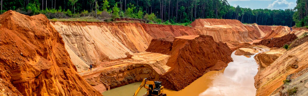
Cherokee County’s dominant soil type is a red piedmont clay derived from the weathering of the region’s metamorphic and granitic parent rock. This clay has specific physical characteristics that create excavation planning requirements that differ from what more permeable or more granular soil types require, and understanding these clay characteristics before planning any significant excavation project provides the context for making appropriate decisions about excavation timing, compaction approach, drainage design, and structural foundation selection.
Low Permeability and Drainage Implications
Cherokee County clay has very low permeability when saturated, meaning that rainfall arriving on a saturated clay surface has essentially no infiltration path and becomes surface runoff. This characteristic has direct implications for drainage design around any excavated and improved site because the natural soil cannot provide drainage relief that more permeable soils would contribute as a component of overall site drainage. Every drainage objective on a Cherokee County excavation site must be achieved through surface drainage grades and drainage infrastructure rather than through any combination of surface drainage and natural soil infiltration. Projects designed with drainage standards that account for soil infiltration as a contributing factor when the soil type provides none will consistently produce drainage outcomes that fall short of their intended performance.
Volume Change With Moisture Content
Cherokee County clay expands when it absorbs moisture and contracts when it dries, producing volumetric changes with seasonal moisture cycling that create ongoing mechanical forces on any structure, infrastructure, or pavement element embedded in or resting on the clay. This volume change behavior produces the foundation cracking, pavement heaving, and drainage pipe displacement that are common on Cherokee County residential properties where foundation drainage was inadequate to limit the clay’s moisture cycling amplitude. Understanding the volume change behavior of the specific clay at the project site before design decisions are finalized allows foundation system selection, drainage design, and pavement base design to account for the clay’s movement rather than discovering the consequences of that movement after the structural elements are in place and the clay’s seasonal cycling has begun expressing itself through movement and cracking.
Moisture-Dependent Bearing Capacity
The bearing capacity of Cherokee County clay is highly sensitive to moisture content. Clay at or below its optimum moisture content for compaction provides adequate bearing capacity for most residential structural loads. Clay significantly above optimum moisture content, which Cherokee County clay regularly reaches during the spring wet season and following significant rain events, loses bearing capacity dramatically, deforming under equipment and structural loads rather than providing the stable support that dry clay delivers. This moisture sensitivity means that both excavation execution quality and long-term structural performance depend on managing the moisture conditions at the bearing surface rather than assuming that clay bearing capacity is consistent across all moisture conditions. Excavation projects that assess the clay’s current moisture condition before beginning structural preparation work can make appropriate decisions about timing, drainage, and preparation approach. Projects that proceed regardless of moisture condition risk producing bearing surfaces that appear adequate but that will not perform as designed under the load they receive.
How Soil Variability Across a Single Property Affects Project Planning
A significant characteristic of North Georgia rural properties that soil assessment reveals is the variability in soil conditions across a single property at scales that surface observation does not capture. Adjacent areas of the same lot can have substantially different soil profiles based on topographic position, prior land use, vegetation history, and proximity to drainage features, and these differences affect excavation method, drainage design, and structural performance in ways that assuming uniform soil conditions across the property consistently fails to anticipate.
Ridge and hilltop positions on a property typically have shallower soil depth over bedrock because erosion has historically removed more soil from these elevated positions than has accumulated at lower positions, while valley and lower slope positions have deeper soil profiles from the accumulation of material that eroded from higher positions. This topographic control on soil depth means that an excavation project moving from a ridge position to a lower slope position may transition from shallow rock conditions that require specialized breaking equipment to adequate clay soil conditions that do not, within the same project footprint. Soil assessment that identifies these spatial patterns before project execution allows the project scope and cost to account for rock breaking requirements in the appropriate zones rather than treating rock as either uniformly present or uniformly absent across the full footprint based on conditions at a single assessment point.
Prior land use also creates soil variability that surface observation cannot identify. Fill areas from prior construction activity, buried organic material from prior clearing events, and disturbed soil profiles from prior agricultural or logging activity can all be present at depth without surface indicators that distinguish these zones from undisturbed native soil. Soil assessment that probes for these conditions at multiple points across the planned excavation footprint rather than assuming uniform conditions from a single assessment location provides the information needed to identify the spatial distribution of these anomalies before they are encountered during active excavation when their presence requires reactive scope and cost adjustments.
How Organic Content Depth Affects Foundation and Subgrade Requirements
The depth of the organic topsoil layer present at a proposed excavation site is among the most practically consequential soil characteristics for project cost and scope, and it is one of the most frequently underestimated on wooded and vegetated Cherokee County properties where the organic layer develops from decades of leaf litter, root turnover, and surface debris accumulation without the periodic cultivation that agricultural sites receive. Soil probing that measures organic layer depth at multiple points across the planned excavation footprint provides the stripping volume estimate that is needed for accurate project budgeting before work begins.
The organic topsoil layer must be stripped from any area where structural fill will be placed or where foundation systems will bear because organic material continues decomposing after burial and creates the settlement voids that produce surface depression, structural movement, and drainage pattern changes in the improvements placed above it. A wooded site that has been accumulating organic material for many decades can have an organic layer of twelve to twenty-four inches or more, which represents substantially more stripping volume than a previously cultivated or graded site with four to six inches of organic topsoil. The difference in stripping volume between these two conditions at building pad scale is significant in the project budget, and identifying that difference through pre-project soil assessment rather than discovering it during active stripping allows the project to be accurately budgeted before commitment rather than revised upward when the actual stripping scope is revealed during excavation.
How Soil Assessment Informs Compaction Planning and Scheduling
The compaction characteristics of Cherokee County clay, specifically the relationship between moisture content and the density achievable through compaction effort, determine both the approach used for structural fill compaction and the scheduling of compaction work relative to precipitation events. Soil assessment that identifies the clay’s current moisture condition and its relationship to the optimum moisture for compaction provides the information needed to determine whether compaction can proceed immediately or whether the soil needs to dry before compaction will produce the density specification requires.
Clay that is significantly above optimum moisture content, which Cherokee County clay regularly reaches during spring wet season and for days to weeks following significant rain events, cannot be compacted to the density that structural applications require regardless of how much compaction effort is applied. The water in the soil pore spaces during this saturated condition prevents the particle consolidation that creates structural density, and attempting compaction on soil in this condition produces a surface that appears compacted but does not achieve the density that the application requires. Soil moisture assessment before scheduling compaction work allows the project timeline to account for the drying time that may be needed before compaction can produce adequate results, rather than scheduling compaction immediately following excavation and discovering during or after the work that the clay conditions were not suitable for achieving the required density.
How Soil Conditions Affect Foundation System Selection
The foundation system appropriate for a structure is determined in part by the soil conditions at the bearing depth, and those conditions vary enough across Cherokee County properties to make site-specific soil assessment a relevant input to foundation system selection rather than a detail that can be standardized from regional averages. Soil conditions that affect foundation system selection include the bearing capacity at the proposed foundation depth, the seasonal high water table position relative to the proposed foundation elevation, the volume change characteristics of the clay at foundation level, and the depth to any rock or anomalous material that would affect the proposed foundation system’s installation.
A slab-on-grade foundation is appropriate for sites where the bearing subgrade is adequate for the structural load at a depth achievable through standard topsoil stripping, where drainage conditions keep the slab grade consistently dry, and where the clay’s volume change behavior can be managed through adequate perimeter drainage rather than through design features that accommodate movement. Sites with seasonal high water table conditions that bring groundwater near the slab grade, sites where bearing conditions are inadequate at achievable stripping depth and require deeper foundations or engineered fill, and sites where the clay’s volume change potential at the bearing depth is severe enough to produce unacceptable movement in a slab-on-grade system may require foundation system alternatives including pier foundations, grade beams, or engineered fill systems that each require knowledge of the soil conditions to design and execute correctly.
How Soil Assessment Changes Excavation Method Selection
The excavation method appropriate for any specific site depends on the soil conditions the excavation will encounter, and selecting the wrong method for the actual soil conditions produces either inefficient excavation that costs more per cubic yard than the correct method would have, or structural and quality problems in the finished subgrade that the correct method would have avoided. Soil assessment that identifies the specific conditions the excavation will encounter allows the appropriate method to be selected before equipment is mobilized rather than discovering during active excavation that the planned method is inadequate for the actual conditions.
Standard excavation equipment including hydraulic excavators is appropriate and efficient for Cherokee County clay soil at moisture conditions that allow clean cutting and predictable bucket loading. When clay is at or above its plastic limit from elevated moisture, the same equipment requires substantially more cycle time per cubic yard because clay adhesion to bucket surfaces reduces effective bucket volume and requires more frequent clearing of adhered material. Rock encountered during excavation that exceeds the hydraulic excavator’s ripping capacity requires hydraulic hammer breaking equipment that must be separately mobilized if it was not anticipated and included in the initial equipment plan. Each of these method selection situations benefits from pre-project soil assessment that identifies the conditions requiring specific equipment rather than discovering those conditions during active excavation when the project’s timeline and budget are already committed and equipment substitutions create additional mobilization cost and schedule disruption.
When Soil Assessment Is Most Valuable for North Georgia Excavation Projects
Soil assessment before excavation projects produces the most significant value in specific project categories where the soil conditions most directly affect project design, cost, and outcome, and where discovering unfavorable conditions during active excavation rather than before project commitment creates the most expensive and most disruptive scope changes. Understanding these high-value assessment categories helps property owners recognize when pre-project soil assessment is genuinely warranted versus when the project’s sensitivity to soil variability is low enough that standard regional soil knowledge provides adequate basis for project planning.
- Building foundation preparation: The soil conditions at foundation bearing depth determine the structural performance of the foundation system for the building’s entire service life. Assessment that confirms adequate bearing, identifies any anomalous conditions requiring remediation, and determines the organic layer depth for stripping scope estimation provides information that prevents the two most common foundation preparation failures: placing structural elements on inadequate bearing and underestimating stripping scope in the project budget.
- Projects at topographic positions with elevated rock probability: Ridge and hilltop positions in Cherokee County have elevated probability of subsurface rock at depths that would affect excavation scope and cost. Soil assessment including targeted test pit excavation at the proposed excavation location provides direct information about rock depth that probability assessment from surface indicators cannot confirm. For projects where rock removal would substantially affect project economics, this direct investigation is warranted before budget commitment.
- Sites with prior land use history suggesting subsurface anomalies: Properties with prior agricultural, logging, or construction history may contain buried organic material, old fill material with variable compaction, and buried debris that affect excavation scope and subgrade quality. Soil assessment that investigates the subsurface at the planned excavation footprint identifies these conditions before active excavation encounters them as unplanned scope changes.
- Drainage-sensitive improvements in low-lying positions: Sites in low-lying topographic positions or adjacent to drainage features may have seasonal high water table conditions or impeded drainage conditions that affect both the foundation system appropriate for the site and the drainage infrastructure required around it. Soil assessment during wet seasonal conditions provides direct evidence of these conditions that dry-season assessment cannot reveal.
How Soil Assessment Fits Into the Pre-Project Site Evaluation
Soil assessment is most efficiently conducted as a component of the broader pre-project site evaluation that precedes any significant excavation project rather than as a separate phase with its own scheduling and mobilization. A contractor conducting a pre-project site walk for a foundation excavation project can assess soil conditions at the proposed excavation location through hand probing and visual observation as part of the site evaluation without requiring a separate formal testing program for most residential and rural applications. This integrated assessment approach produces the most practically useful soil information for project planning at the lowest incremental cost above what the site evaluation visit requires regardless of whether soil assessment is included in its scope.
A contractor with consistent experience on Cherokee County excavation projects interprets the soil conditions they observe during site evaluation through the lens of regional knowledge about how those conditions typically behave during excavation, compaction, and in long-term structural performance, which is the interpretation context that makes soil observations actionable for project planning rather than simply interesting observations about site characteristics. This regional knowledge component of soil assessment is what distinguishes an experienced local contractor’s site evaluation from a purely technical soil testing program that may produce more precise measurements without the regional context that makes those measurements directly applicable to the specific project planning decisions they should inform.
Frequently Asked Questions
Does every excavation project in Cherokee County require formal soil testing before work begins?
No. The appropriate level of soil assessment before any excavation project depends on the project’s sensitivity to soil variability and the consequences of discovering unfavorable conditions after project commitment rather than before. Routine driveway grading, light site preparation for non-structural uses, and most clearing and vegetation management projects do not require formal soil testing and can proceed appropriately based on the contractor’s regional experience and visual site assessment. Foundation preparation for structures, excavation at topographic positions with elevated rock probability, and projects at sites with prior land use history suggesting subsurface anomalies benefit most from pre-project soil assessment and are the project categories where the investment in assessment produces the most significant return through better project planning and more accurate cost estimation.
What is the difference between soil assessment for agricultural purposes and soil assessment for excavation planning purposes?
Agricultural soil testing evaluates nutrient content, pH, organic matter, and other characteristics that determine the soil’s productivity for plant growth and that guide fertilization and amendment decisions for crops, food plots, and pasture. Excavation planning soil assessment evaluates bearing capacity, moisture content relative to compaction optimum, organic layer depth, plasticity and volume change characteristics, and the presence of rock or anomalous subsurface conditions that determine how the excavation should proceed, what the subgrade preparation requires, and how the improvements placed on the prepared subgrade will perform structurally. These are fundamentally different assessments serving different purposes, and the results of agricultural soil testing provide essentially no useful information for excavation planning decisions, while excavation-focused soil assessment provides no information relevant to agricultural management decisions.
How does seasonal timing affect soil assessment accuracy for excavation project planning?
Soil assessment conducted during different seasons reveals different aspects of the site’s soil conditions and provides different types of useful information for excavation project planning. Assessment during dry late summer and fall conditions reveals the bearing capacity characteristics of clay at lower moisture content, the depth to rock or indurated material that limits excavation by standard equipment, and the organic layer depth at conditions where the organic and mineral soil layers are most distinctly differentiated. Assessment during or following wet season conditions reveals the soil’s moisture response characteristics, any seasonal high water table conditions that affect foundation depth and drainage design, and the bearing capacity behavior under the saturated conditions that the excavation will encounter during spring work. The most complete soil assessment picture for projects sensitive to moisture effects combines observations from both seasonal conditions rather than relying on observations from a single season that may not represent the site’s full range of conditions that the excavation and the placed improvements will experience.
How does soil assessment on a sloped North Georgia property differ from assessment on a flat site?
Soil assessment on sloped North Georgia properties must account for the systematic variation in soil depth and characteristics that topographic position creates across the slope profile. Ridge and hilltop positions at the top of the slope have shallower soil depth over rock and typically drier conditions with better drainage than the same soil type at valley positions where depth is greater and seasonal moisture is higher from uphill drainage contributions. Cut areas that the excavation will create in uphill slope sections expose different soil conditions than fill areas on the downhill section that must be constructed from the cut material, and the characteristics of the cut material determine whether it is suitable for reuse as structural fill or requires import of different material to achieve the required fill performance. Assessing soil conditions at multiple positions across the slope, specifically at both the cut area and the fill area locations within the planned excavation footprint, provides a complete picture of the conditions the excavation and structural preparation will encounter rather than a point assessment that may not represent the full range of conditions across the sloped project area.
Planning an Excavation Project on Your North Georgia Property?
Soil conditions below the surface determine how excavation projects proceed and how the improvements placed on excavated and prepared subgrade perform across their service lives. Understanding those conditions before project planning is finalized, through pre-project soil assessment integrated into the site evaluation that should precede any significant excavation project, produces more accurate project scope and cost estimation, better-matched excavation methods and foundation system selection, and more durable long-term performance in the improvements that the excavation prepares the site for. On Cherokee County’s clay-dominant, geologically variable properties, this pre-project knowledge of site-specific soil conditions is consistently more valuable than regional averages that may not reflect what the specific excavation location will actually present when the work begins.
Bardin Outdoors works with homeowners, landowners, and builders across Ball Ground, Canton, Cherokee County, and North Georgia on excavation and site preparation projects that begin with thorough site and soil evaluation and proceed on plans designed for the specific conditions each project location presents. To learn more about how Bardin Outdoors approaches pre-project site and soil evaluation for North Georgia excavation projects, contact us.