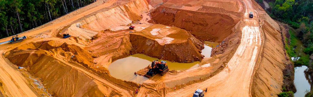
For property owners across Cherokee County, Ball Ground, and Canton planning foundation excavation, pond construction, drainage work, or any other ground-disturbing improvement project, understanding what a thorough site evaluation covers, why each element of that evaluation affects excavation approach decisions, and how the information it produces changes the project scope and cost picture gives the practical foundation for treating site evaluation as the investment that prevents expensive surprises rather than as a preliminary step that can be abbreviated or skipped when the desire to begin work is strong and the project feels straightforward enough to proceed without it.
What Site Evaluation Actually Accomplishes Before Excavation Begins
A thorough site evaluation accomplishes several distinct outcomes that each affect how an excavation project should be designed, budgeted, and executed. These outcomes are not duplicated by any amount of desk research, aerial imagery analysis, or general regional knowledge. They require physical presence on the specific site being evaluated, under conditions that reveal the specific characteristics of that site rather than the general characteristics of sites in the region.
Terrain assessment that only physical site walking can produce accurately reveals the slope conditions, elevation relationships, and topographic features that determine how much earthwork the project requires and where drainage infrastructure must be positioned to function correctly with the actual terrain rather than with estimated terrain. Soil condition assessment that only direct probing and observation at the excavation location can provide reveals the organic topsoil depth, clay characteristics at proposed excavation depths, and any anomalies including organic inclusions, prior fill material, or unusual moisture conditions that should affect the excavation and compaction approach. Rock probability assessment informed by regional geological knowledge and site-specific indicators including topographic position, visible surface outcrops, and any available prior construction history gives the project an informed contingency estimate rather than an uninformed assumption that rock is either certain or impossible. And drainage pattern observation, most accurately possible during or after significant rain events, reveals where water moves on the site and what drainage features the excavation project must account for in its design.
How Terrain Assessment Shapes the Excavation Approach
The terrain at a proposed excavation site determines the volume of earthwork the project requires, the slope and drainage relationships that the finished excavated site must manage, the equipment access conditions that affect which equipment can safely operate on the site, and the structural requirements of any fill work needed to establish the grades and elevations the improvement project needs.
Slope and Elevation Relationships
Cherokee County’s rolling terrain means that most excavation sites have meaningful elevation change across their area, and the specific slope conditions at each site determine how much cut and fill earthwork creating a level building pad, road base, or cleared work area requires. A site that appears relatively flat from a distance or from aerial imagery often has ground-level slope variation that translates into substantial earthwork volumes when a level surface must be established across the full project footprint. Site evaluation that physically walks the terrain at proposed building pad and work area locations, estimating or measuring the elevation change across the footprint from high corner to low corner, allows earthwork volumes to be estimated before project budgets are committed rather than discovered during excavation when the actual terrain reveals the scope that the earlier estimate did not account for.
Slope also creates drainage relationships between uphill and downhill areas of the site that affect how the finished excavated area must be designed to manage both the water that falls on it and the water that the uphill terrain delivers to it after every rain event. An excavated building pad at the base of a slope receives not only rainfall on its own footprint but the runoff from the slope above it that Cherokee County clay soil generates in substantial volumes after every rain event on the low-permeability subsoil conditions characteristic of the region. Site evaluation that identifies and estimates the uphill contributing area delivering drainage to the proposed excavation site allows drainage infrastructure to be designed for the actual runoff volume rather than only for the rain falling on the immediate project footprint.
Equipment Access and Operation Conditions
Terrain also determines where excavation equipment can safely operate on the site and what access route it must use to reach the work area from the nearest road. Steep slopes, soft low-lying areas, and narrow passages between existing features can each prevent specific equipment from accessing the work area safely or at all, requiring either different equipment selection or preliminary access preparation before the primary excavation equipment can be mobilized. Site evaluation that walks the full approach route and work area terrain allows these access conditions to be identified before equipment is scheduled rather than on the day of mobilization when discovering that the planned equipment cannot safely access the work area produces delays, equipment substitution, and additional costs that pre-project evaluation would have prevented.
How Soil Condition Assessment Changes Excavation Planning
The soil conditions at the excavation site determine how the excavation proceeds, what the bearing capacity of the finished subgrade will be, what compaction standards can be achieved and at what moisture content, and whether any unexpected conditions at depth will require scope adjustments when they are encountered during the excavation work. These soil condition factors cannot be assessed without direct physical investigation at the specific excavation location, which is the practical justification for treating soil assessment as an integral component of site evaluation rather than as a project phase that can proceed based on regional soil type generalizations.
Organic Topsoil Depth
The organic topsoil layer must be stripped from any area where structural fill will be placed or where foundations will bear before that work proceeds, because organic material continues decomposing after burial and creates settlement voids that produce surface depression and structural movement in the improvements placed above it. The depth of the organic topsoil layer varies significantly across Cherokee County properties depending on vegetation history, prior land use, and site-specific conditions, and that depth determines the volume of stripping excavation required before structural work can begin.
A wooded site that has accumulated leaf litter and organic material over decades may have an organic topsoil layer of twelve to eighteen inches or more, while a previously cultivated site or a previously graded site may have only four to six inches of organic material above the mineral subsoil. The difference in stripping volume between these two conditions is significant at building pad scale, and the project budget that assumes the shallower condition and encounters the deeper condition during excavation will have an unplanned scope addition that site evaluation would have identified before the budget was committed.
Clay Condition and Moisture Assessment
Cherokee County’s red piedmont clay soil behaves very differently under excavation equipment and compaction equipment depending on its moisture content at the time of work. Clay at or near its optimum moisture content for compaction can be worked efficiently, compacts well in controlled lifts, and provides the stable working surface that precision grading and foundation work require. Clay significantly above optimum moisture content deforms under equipment loads rather than being cut cleanly, cannot be compacted to adequate structural density regardless of effort applied, and creates the equipment tracking and site damage conditions that make wet-weather excavation problematic for project quality as well as site protection. Site evaluation conducted under multiple seasonal conditions, or at minimum during both a dry period and a post-rain period, gives the contractor an accurate picture of the moisture range the site presents and allows scheduling decisions to account for the seasonal windows when clay conditions will support the quality of work the project requires.
Subsurface Anomalies and Prior Land Use Conditions
Sites with prior agricultural, construction, or logging history may contain buried debris, old drainage infrastructure, prior fill material with inconsistent compaction, and buried organic material from prior vegetation that each affect how excavation proceeds at depth. Surface observation does not reveal these subsurface conditions, which is why site history research including conversation with prior owners, review of any available construction or survey records for the property, and physical probing at proposed excavation locations provides the most complete pre-excavation picture available. Identifying likely subsurface anomalies before excavation allows appropriate contingency to be included in the project scope and budget rather than discovering them during excavation when they require reactive scope additions at full cost without prior allowance.
How Rock Assessment Prevents the Most Common Excavation Budget Surprise
Subsurface rock is the single most common source of significant unplanned cost on Cherokee County excavation projects. Its removal requires specialized hydraulic breaking equipment and substantially more machine time per cubic yard than clay excavation, creating cost additions that are large relative to the clay excavation they supplement and that have no adequate contingency if the project was planned without any rock probability assessment. A site evaluation that honestly assesses rock probability based on the indicators available for the specific site and builds appropriate contingency into the project budget for that probability level is the most practical risk management available for this consistent Cherokee County project risk.
Rock probability indicators that site evaluation can assess include topographic position relative to the surrounding terrain, with ridge and hilltop positions having higher probability from shallower soil depth over bedrock; visible surface rock outcrops on the property or on adjacent properties that confirm the presence of rock at shallow depth in the area; any available information from prior well drilling, septic system installation, or construction on the property that indicates actual rock depths encountered at specific locations; and the contractor’s accumulated experience with rock encounter frequency on similar topographic positions in the immediate vicinity from prior projects in the area.
For projects where rock removal cost would substantially affect project economics, targeted test pit excavation at the planned excavation location before the project is contracted and budgeted provides direct subsurface information about actual rock depth that probability assessment cannot. The cost of a test pit excavation is modest relative to the cost difference between a project budgeted with appropriate rock contingency and one that encounters significant rock without prior allowance, making it a worthwhile pre-project investment on sites where the rock probability indicators suggest meaningful risk and where the project scale would make unplanned rock removal a significant budget disruption.
How Drainage Pattern Observation Informs Excavation Design
The drainage patterns across a proposed excavation site determine where water will go after the excavation is complete and how the drainage infrastructure designed into the excavated area must be configured to manage that water effectively. These drainage patterns are most accurately observable during or immediately after significant rain events when they are actively expressing themselves, which is why drainage evaluation conducted only during dry site visits consistently misses the drainage behavior that the excavation’s drainage design must account for.
Site evaluation that includes at least one post-rain observation of the proposed excavation site reveals where surface water collects, how long it persists, whether any subsurface drainage is producing surface saturation in specific areas, and what the natural drainage outlets and drainage pathways are that the excavation’s drainage design should connect to rather than conflict with. Building pad drainage design developed from a dry-site evaluation that did not observe the actual drainage behavior of the site commonly positions drainage features in locations that the actual drainage patterns reveal to be incorrect during the first wet season after construction, requiring costly drainage corrections that post-rain site evaluation during the planning phase would have prevented.
How Regulatory Feature Identification Protects Against Compliance Problems
Excavation projects on Cherokee County properties must comply with Georgia’s land disturbance permit requirements for projects disturbing one acre or more, stream buffer protection requirements that restrict disturbance within defined setback distances from regulated drainage features, and any applicable wetland protection requirements for sites where wetland conditions may be present in or adjacent to the proposed excavation area. Site evaluation that specifically assesses whether any of these regulatory conditions apply to the proposed excavation location before the project is designed or scheduled allows the project to be planned in compliance with applicable requirements from the beginning rather than discovering regulatory constraints after excavation has already begun in areas that turn out to require review or permits that were not obtained.
Stream channels and drainage corridors that may qualify for buffer protection on Cherokee County properties are not always obviously identifiable as regulated features from surface observation, particularly on vegetated sites where the drainage feature may be obscured by vegetation growing across it. Post-rain site evaluation is the most reliable way to identify drainage features that carry intermittent or seasonal flow, as the water movement that makes these features observable is only present during or after rain events rather than during the dry-condition site visits that most property owners find more convenient to schedule. Discovering a regulated drainage feature within the proposed excavation area during evaluation rather than during active excavation is the outcome that project compliance depends on, which is why evaluation timing that includes post-rain observation is genuinely consequential for regulatory compliance rather than simply a scheduling preference.
How Site Evaluation Changes Project Scope, Cost, and Timeline Accuracy
The practical return on thorough site evaluation is measured in how much more accurately the project scope, cost, and timeline can be estimated after evaluation than before it. Projects estimated before site evaluation are based on assumptions about terrain, soil, drainage, and regulatory conditions that may or may not match the actual conditions the project will encounter. Projects estimated after site evaluation are based on direct observation of those conditions, producing estimates that reflect what the project will actually require rather than what generic planning assumptions would suggest for a property in the general region.
The difference in estimate accuracy between pre-evaluation and post-evaluation project scopes on Cherokee County excavation projects is consistently large enough to affect project decision-making. A project that appears feasible within a specific budget based on pre-evaluation assumptions may not be feasible at that budget level when evaluation reveals the actual terrain, soil, and access conditions the project must address. Understanding this before committing to the project budget allows the scope to be adjusted, phased, or delayed to align with realistic cost rather than discovering the budget gap during active construction when scope reductions and deferrals are more expensive and more disruptive than they would have been during the planning phase.
What a Good Site Evaluation Conversation With a Contractor Should Cover
A site evaluation conversation with an experienced Cherokee County contractor should cover all of the evaluation categories described in this article, with the contractor contributing their regional knowledge about how the conditions they observe on the specific site are likely to affect the project relative to how similar conditions have behaved on prior projects in the area. The property owner contributes knowledge of the site’s history, the intended improvement, and any prior construction or installation work on the property whose subsurface remnants might affect the excavation. Together, this site-specific and regionally informed evaluation produces the project planning picture that neither party could develop independently.
The contractor’s site visit should cover the full terrain context including terrain above and below the project footprint that affects drainage design, the proposed excavation location’s specific soil conditions through direct probing and visual assessment, the access route from the road to the work area including all relevant dimensional and load-bearing constraints, any visible rock probability indicators and the contractor’s regional experience with rock encounter frequency at similar topographic positions, and any drainage or regulatory features that the property owner’s knowledge of the site and the contractor’s evaluation observation together can identify before the project design is finalized. This comprehensive evaluation produces the most accurate project scope and cost estimate available before excavation work begins.
Frequently Asked Questions
How long does a thorough site evaluation for an excavation project typically take?
A thorough site evaluation for a residential or rural excavation project in Cherokee County typically requires a half day to a full day for the physical site visit, depending on the property size, the access difficulty through any vegetated sections, and the number of proposed improvement locations that need to be assessed. The post-visit time for the contractor to develop the scope and cost estimate based on the evaluation findings adds additional time before the property owner receives a complete project picture. Total elapsed time from scheduling the site visit to receiving a complete post-evaluation scope and estimate is typically one to two weeks, which is a modest investment relative to the improved project planning accuracy and reduced risk of mid-project surprises that thorough evaluation produces compared to estimates developed without site evaluation.
Should site evaluation be done in a specific season to produce the most useful information for excavation planning?
The most complete site evaluation includes observations from multiple seasonal conditions when possible, because dry-season and wet-season observations each reveal different aspects of the site’s conditions. Dry-season evaluation provides the most accessible terrain observation, the most stable soil surface for walking and probing, and the best conditions for assessing rock indicator features including surface outcrops and topographic position. Post-rain evaluation provides the drainage behavior observation that is most consequential for drainage design accuracy and most important for regulatory feature identification. For projects that cannot accommodate multiple-season evaluation, a site visit scheduled within twenty-four hours of a significant rain event provides both the drainage behavior information that post-rain observation produces and the terrain and soil access that a rain event followed by a day of drying typically allows, combining the most important elements of both observation conditions in a single visit.
Can satellite or aerial imagery substitute for physical site evaluation on projects where access to the site is difficult?
Satellite and aerial imagery provides useful supplemental context including canopy cover patterns, general terrain configuration, and property layout but cannot substitute for physical site evaluation for any of the conditions that most significantly affect excavation project accuracy. Aerial imagery shows the canopy surface rather than the ground terrain beneath it, which on wooded sites consistently understates actual ground-level slope variation. It cannot show soil conditions, drainage behavior during rain events, access route dimensional constraints, rock probability indicators at ground level, or potential regulatory feature locations beneath vegetated cover. Difficult site access that makes physical evaluation challenging is a condition that needs to be resolved through preliminary access clearing or trail establishment rather than by substituting less accurate aerial observation for direct physical assessment. The conditions that difficult access conceals from evaluation are typically the same conditions that will create the most significant project complications during excavation, which makes physical evaluation on difficult-access sites more important rather than less important than on easily accessible sites.
What should I prepare before a contractor comes for a site evaluation visit?
Useful preparation for a contractor site evaluation visit includes gathering any available site history information including prior construction records, well drilling logs, septic system installation records, and any information from prior owners about conditions encountered during prior work on the property. Marking the approximate boundaries of the proposed improvement area on the ground before the visit, even with temporary stakes or flagging, helps focus the evaluation on the specific area being considered rather than requiring the contractor to determine the project scope from a general description while walking unknown terrain. Photographs taken during prior post-rain visits to the proposed improvement area, if available, provide drainage behavior information that supplements what the contractor can observe during the evaluation visit if that visit happens to occur during dry conditions. And preparing specific questions about the conditions of concern, including any prior improvement attempts that produced unexpected results or any site features that the property owner has questions about, ensures that the evaluation conversation addresses the specific uncertainties that the property owner most needs resolved to make confident project decisions.
How does site evaluation change the contractor selection decision for an excavation project?
Site evaluation conducted with multiple contractors seeking competitive bids reveals which contractors are approaching the project with genuine site-specific assessment and which are estimating from generic assumptions without substantive evaluation of the specific conditions. Contractors who conduct thorough site evaluation and produce estimates that account for the site’s specific terrain, soil, access, and rock probability conditions typically produce higher initial estimates than those who estimate from regional averages without site-specific assessment. These higher estimates are more accurate rather than less competitive, because they reflect what the project will actually cost given the site’s conditions rather than what a simpler project on a more favorable site would cost. Selecting the lowest estimate without evaluating whether it is based on comparable site assessment quality risks selecting an estimate that will grow toward the more thorough evaluation’s estimate during project execution as conditions the lower estimate assumed away are actually encountered.
Planning an Excavation Project on Your North Georgia Property?
Every excavation project on a North Georgia rural or residential property begins on a site with unique terrain, soil, drainage, and geological conditions that determine how the project should be designed, what it will cost, and what approach will produce the intended outcome rather than a series of reactive responses to conditions that evaluation would have anticipated. The investment in thorough site evaluation before any project scope is committed to is the investment that makes every subsequent project decision more accurate, every cost estimate more reliable, and every outcome more consistent with what the project was planned to deliver. It is the step that turns a generic excavation plan into a project designed for the specific site it will be executed on, which is the difference between a project that proceeds predictably toward a planned outcome and one that improvises toward an uncertain result.
Bardin Outdoors works with homeowners, landowners, and builders across Ball Ground, Canton, Cherokee County, and North Georgia on excavation and grading projects that begin with thorough site evaluation and proceed on plans designed for the specific terrain, soil, drainage, and geological conditions each property presents. To learn more about how Bardin Outdoors approaches site evaluation and excavation planning for North Georgia properties, contact us.