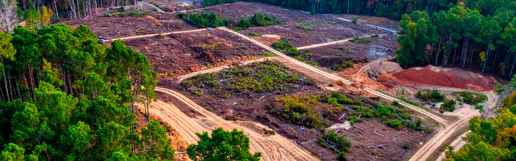
For property owners across Cherokee County, Ball Ground, and Canton whose residential and rural properties include overgrown sections that were once accessible but have accumulated the invasive density that management gaps allowed to develop, or that were acquired without prior management with the overgrown condition that the prior owner’s management gaps had already produced, understanding how land clearing specifically enables the new purposes that overgrown property sections can serve when clearing removes the accumulated overgrowth that has been preventing those purposes from being pursued, what clearing reveals about the property’s actual potential that the overgrowth has been concealing, and how to connect the clearing that removes the accumulated overgrowth to the specific new purpose it is enabling rather than treating clearing as an improvement in itself rather than the enabling first step for the improvements that the new purpose requires gives the complete practical guide for approaching overgrown property clearing as the purposeful reclamation that specific new use goals make it rather than the reactive restoration that the overgrowth’s visual severity triggers without the new use goal that gives the clearing its specific direction and its specific requirements.
Why Clearing Is an Important First Step Rather Than a Complete Improvement
Clearing as an important first step toward a new property purpose is specifically more than clearing as an improvement in itself because the condition that clearing creates, the accessible open ground from which subsequent improvements can proceed, is specifically the condition from which subsequent improvements begin rather than the condition that is itself the new purpose the clearing was intended to enable. Treating clearing as a complete improvement rather than as the first step toward the new purpose produces the post-clearing condition that the property owner has no specific plan to develop further, which is the condition that the next season’s resprout from intact invasive root systems progressively reclaims toward the overgrown condition that the clearing addressed if the clearing is not followed by the management program and subsequent improvements that the new purpose requires from the cleared condition that clearing creates as the starting point rather than the ending point of the reclamation.
Understanding clearing as the important first step rather than the complete improvement shifts the planning focus from the clearing itself to the new purpose that the clearing is enabling, which is the planning focus that produces the clearing design, clearing approach, and post-clearing management program that the new purpose specifically requires rather than the generic clearing that adequate design for a new purpose would have required to be specifically different from. The clearing that enables recreational use as its new purpose is designed around the trail network, open area locations, and native canopy preservation that recreational use requires. The clearing that enables construction as its new purpose is designed around the building site identification, access route development, and organic material management that construction requires. The clearing that enables agricultural production as its new purpose is designed around the stump-free surface, drainage correction, and soil preparation that agricultural production requires. Each new purpose produces the specific clearing design that serves it rather than the generic clearing that serves any purpose without serving any purpose specifically.
How Clearing Enables Recreational Use as a New Purpose
Recreational use as the new purpose for overgrown Cherokee County property sections encompasses the hunting, wildlife management, ATV riding, walking, birdwatching, and nature appreciation uses that the accessible open condition that clearing creates from the impenetrable overgrowth specifically enables for the sections where recreational use is the intended new purpose rather than construction, agriculture, or other uses that clearing enables differently.
Hunting and Wildlife Habitat Development
Overgrown sections on Cherokee County hunting properties where the invasive understory has accumulated to the density that makes the section impenetrable and sight lines limited to the ten or twelve feet that dense privet allows are sections that hunting land clearing specifically enables as the new purpose that creates the open native woodland habitat type from the cleared invasive understory beneath the preserved native canopy that hunting effectiveness and wildlife management specifically require. The hunting land clearing that enables this specific new purpose is the selective clearing that removes the invasive understory while specifically preserving the native canopy above it, producing the open woodland floor beneath the preserved canopy that the hunting habitat requires rather than the cleared field that comprehensive clearing of the same wooded section would produce by removing the native canopy along with the invasive understory that the selective approach was designed to address without sacrificing the canopy that defines the habitat type. Hunting land clearing that enables recreational use as its new purpose must therefore be specifically designed for the selective clearing approach that creates the hunting habitat condition rather than the comprehensive clearing approach that would eliminate the canopy asset along with the invasive understory problem, making the new purpose definition that specifically identifies hunting habitat as the intended use the planning input that distinguishes the appropriate clearing approach from the inappropriate one that generic clearing without use-specific design would apply.
Trail and Access Network Development
Recreational trail and access networks through overgrown sections are enabled by clearing as the first step that creates the navigable corridors from the accessible starting points to the interior destinations that the trail network is intended to connect. Trail network clearing that enables recreational use as its new purpose is designed from the full intended trail network that maps all destinations the trails should connect before any clearing begins, allowing the clearing to establish the complete connected network in a coordinated design rather than the piecemeal corridors that clearing without network planning establishes as isolated access to individual destinations without the network connectivity that allows the full intended recreational use of the property’s interior. The cleared trail corridors that the network clearing creates provide the immediate recreational access that walking, ATV riding, and wildlife observation within the property’s interior specifically require from the navigable connections that the corridor clearing provides between the accessible starting points and the interior destinations that the overgrowth was preventing from being reached.
How Clearing Enables Construction as a New Purpose
Construction as the new purpose for overgrown Cherokee County property sections requires clearing that specifically prepares the identified building site for the site preparation that construction requires rather than the recreational clearing that selectively addresses invasive vegetation while preserving native elements that construction site preparation must address comprehensively for the structural subgrade that building performance demands.
Building Site Identification Through Pre-Clearing Assessment
The building site that construction as the new purpose requires to be specifically identified before clearing is committed to the boundaries and scope that the building site’s location should orient, because the clearing boundaries, the access route development, the utility corridor planning, and the drainage infrastructure design are all specifically connected to the building site’s location in ways that require the building site to be identified before these other clearing and development decisions are committed to the designs and locations that the building site’s position should specifically inform. The interior terrain walk that physically enters the overgrown section to evaluate candidate building site positions for the actual elevation differential, drainage orientation, and soil conditions that building site selection requires reveals the actual site characteristics that accessible observation of the overgrown section cannot characterize at the accuracy that building site selection for construction requires from the ground-level site assessment that the interior terrain walk provides before the clearing that would reveal the same terrain for post-clearing assessment.
Construction-Enabling Clearing Scope and Approach
Construction site clearing that enables construction as its new purpose requires the comprehensive clearing with organic material removal and stump grinding that structural subgrade preparation demands rather than the selective forestry mulching that recreational use clearing appropriately applies when the new purpose does not require organic-free structural subgrade. The organic material in the building footprint’s fill zone, including the root systems of all trees cleared from within the building pad footprint, must be completely removed from the structural zone before structural fill is placed, because the root systems and organic material left in the structural zone decompose after fill placement and create the settlement voids that building foundation performance requires to be absent from the structural zone. Construction-enabling clearing must therefore specifically include the comprehensive clearing with stump grinding and root raking in the building pad footprint that structural subgrade preparation requires rather than the selective approach that preserves organic material in place and that construction site preparation specifically cannot use for the building pad area where structural subgrade quality requires organic-free conditions that selective preservation of organic material specifically prevents.
How Clearing Enables Access Development as a New Purpose
Access development as the new purpose for overgrown property sections specifically enables the equipment access, management access, and improvement project access that the cleared corridors and prepared routes provide to the interior sections that overgrowth was preventing from being reached at the efficiency and scheduling flexibility that adequate access creates from the inaccessible condition that the clearing addresses as the first step toward the functional access network that subsequent access route development creates from the cleared corridor condition as its starting point.
Access development clearing is specifically designed from the full access network that the property’s management and improvement program requires rather than from the individual access improvement that any single management activity’s immediate access need suggests without the full network context that makes the clearing provide access for the full management program rather than only the specific access need that immediate management pressure prompted the clearing to address. Clearing that establishes the connected access network from the full network design enables every subsequent management activity that the network serves rather than only the management activity that the immediate need prompted, producing the cumulative enabling value that access network clearing creates across the full management program rather than the single enabling value that an isolated access improvement for one management activity provides without the network connectivity that extends the enabling value to every subsequent activity the network serves.
What Clearing Reveals About Property Potential That Overgrowth Conceals
Beyond the specific new purpose that clearing enables, the clearing process reveals the actual property conditions and natural assets that the overgrowth was concealing from observation and assessment, providing the post-clearing assessment opportunity that accurately characterizes what the property actually contains rather than what the accessible-position observation of the overgrown section could estimate from the perimeter without the interior access that clearing provides for the first time since the overgrowth grew tall enough to prevent it.
The terrain that clearing exposes for the first time may reveal the significant elevation changes, natural drainage features, rock outcrops, and terrain characteristics that the accessible perimeter observation could not accurately characterize from outside the overgrowth that was concealing the ground-level terrain from the observation positions that the overgrowth prevented from reaching the interior. Building site suitability that the accessible perimeter could only estimate from the canopy surface appearance rather than the actual ground-level terrain that building site selection requires is revealed by the clearing that removes the canopy and understory that were concealing the terrain from the ground-level assessment that accurate building site selection requires. Native trees and ecological features that the overgrowth was concealing are revealed as the natural assets that selective clearing specifically preserves and that comprehensive clearing of the same section would have eliminated along with the overgrowth if the pre-clearing preservation walk had not identified and marked them before the clearing that would have processed them without the marking that the revealing walk informed as the preservation instruction that the clearing operator needed at each preservation target’s position.
The post-clearing assessment walk that specifically evaluates what the clearing has revealed should be planned as an explicit step between clearing completion and subsequent improvement commitment, because the revealed conditions that the clearing has made accessible for the first time should inform the subsequent improvements’ designs and locations rather than the subsequent improvements being committed to designs and locations that were developed without the condition information that only clearing’s terrain revelation could provide at the accuracy that post-clearing assessment makes available. The building site grading design that is committed after the post-clearing terrain assessment incorporates the actual elevation differential that the clearing revealed into the earthwork scope rather than the accessible-perimeter estimate that pre-clearing assessment produced without the ground-level terrain access that clearing specifically created for the post-clearing assessment that informs the earthwork design more accurately than the pre-clearing estimate.
Connecting Clearing to the New Purpose It Enables
The connection between the clearing that addresses the overgrowth and the new purpose that the clearing enables requires the planning discipline that identifies the new purpose before the clearing design is committed, designs the clearing to produce the specific conditions the new purpose requires, and plans the post-clearing management and subsequent improvements that the new purpose requires from the cleared condition as the continuation of the reclamation program that clearing initiates rather than completes.
New purpose definition before clearing design provides the clearing approach specification that ensures the clearing creates the specific conditions the new purpose requires rather than the generic cleared condition that any clearing approach would create without the use-specific design that new purpose definition provides as the clearing’s specific requirements. Recreational use definition specifies selective clearing that preserves native canopy and creates open woodland floor. Construction use definition specifies comprehensive clearing with organic removal that creates structural subgrade conditions. Agricultural use definition specifies comprehensive clearing with stump grinding that creates stump-free productive surface. Each new purpose produces the clearing design that serves it specifically, and new purpose definition before clearing design commitment ensures that the clearing design serves the intended new purpose rather than the generic clearing that any approach would produce without the specific design that the new purpose requires.
Post-clearing management and subsequent improvement planning that the new purpose requires from the cleared condition ensures that the clearing investment produces the lasting improvement program rather than the temporary clearance that clearing without subsequent management and improvements consistently produces when the resprout from intact invasive root systems returns the cleared condition toward the overgrown density that clearing addressed without the management program that prevents the return. The herbicide follow-up treatment of invasive resprout that root energy depletion requires, the food plot establishment that recreational hunting use requires from the cleared and prepared plot area, the building site grading that construction use requires from the cleared and organically stripped site, and the access route development that management access use requires from the cleared corridor are each the post-clearing developments that the new purpose requires from the cleared condition as the continuation of the reclamation program that clearing begins rather than completes.
Frequently Asked Questions
How do I evaluate which new purpose is most suitable for a specific overgrown section of my property?
Evaluating which new purpose is most suitable for a specific overgrown section requires comparing the section’s terrain, soil, drainage, and ecological characteristics against the requirements that each candidate new purpose imposes on the site conditions the section presents. Recreational hunting use is most suitable for sections with significant native canopy above the invasive understory that selective clearing would preserve and reveal as the open woodland habitat that hunting effectiveness requires, with terrain that supports stand installation and food plot development in positions that the hunting program’s intended use would make most productive. Construction use is most suitable for sections with building-capable terrain at positions that the terrain walk’s elevation differential assessment identifies as requiring manageable earthwork scope, drainage orientation that makes foundation drainage infrastructure achievable at reasonable cost, and access route characteristics that construction traffic navigation can reach without the extraordinary access development that highly constrained access would require. Agricultural use is most suitable for sections with terrain that the earthwork for productive drainage correction can convert to the soil moisture conditions productive planting requires, without the stump-free surface challenges that the section’s vegetation would create as the clearing scope that comprehensive clearing with stump grinding must address before agricultural equipment can operate across the cleared surface without the equipment contact risk that remaining stumps at soil surface height create. The interior terrain walk, post-rain drainage observation, and vegetation assessment that physically enters the overgrown section provide the section-specific information that new purpose suitability evaluation requires to match the section’s actual characteristics to the new purpose whose requirements those characteristics most favorably support.
Can the same overgrown section serve multiple new purposes after a single clearing treatment?
A single overgrown section can serve multiple new purposes after clearing when the clearing design specifically accommodates the combination of purposes the section will serve rather than designing for a single purpose that might exclude the design features that additional purposes require. A section intended for both hunting land use and food plot establishment can be cleared with the selective understory clearing approach that preserves the native canopy for hunting habitat while including the food plot area development that comprehensive clearing of specific open plot areas within the section provides as the food plot establishment surfaces that the hunting land’s food plot program requires adjacent to the selectively cleared wooded hunting habitat. The combined use design for the single section requires the clearing plan that identifies which areas within the section receive selective clearing for hunting habitat and which receive comprehensive clearing for food plot establishment, establishing the clearing approach-to-area assignment that the contractor executes with the different approaches at the different designated areas rather than the single uniform approach that treating the full section identically would apply without the area-specific design that the combined use purposes require. Communicating the combined use intention and the area-specific approach assignments to the clearing contractor before clearing begins, with the area boundaries physically marked in the field, produces the combined-use clearing outcome that specifically serves both new purposes rather than the single-use clearing that undifferentiated design without new purpose specificity would produce.
What is the most important post-clearing action to take immediately after the clearing to ensure the new purpose develops successfully?
The most important post-clearing action immediately after the clearing is the post-clearing assessment walk that specifically evaluates what the clearing has revealed about the section’s terrain, drainage, ecological features, and infrastructure conditions for the first time since the overgrowth grew tall enough to prevent the close-proximity ground-level observation that the clearing has now restored. This post-clearing assessment walk serves the new purpose’s development by providing the site information that subsequent improvement design requires at the ground-level accuracy that only the post-clearing access to the cleared section’s interior specifically provides rather than the pre-clearing accessible perimeter estimates that the subsequent improvements would otherwise be designed from without the accuracy improvement that the post-clearing assessment provides. The building site grading design that follows post-clearing terrain assessment incorporates actual revealed differentials. The food plot location selection that follows post-clearing terrain and drainage assessment places the plot at the position the assessment reveals as most suitable rather than the pre-clearing estimate. The preservation marking that the post-clearing walk conducts for the native understory species that competitive release has revealed to be present in the cleared section informs the subsequent vegetation management that avoids processing the revealed native species along with the invasive resprout it targets. And the herbicide treatment scheduling that the post-clearing resprout management requires is most productively initiated immediately after the clearing rather than after the resprout has appeared, because scheduling herbicide treatment before the resprout’s appearance captures the optimal treatment timing at the six to twelve inch resprout height rather than the reactive scheduling after appearance that the pre-scheduling initiates at the timing the resprout’s appearance prompts rather than the timing the most effective treatment specifically requires.
How does the size of an overgrown section affect whether clearing the full section at once or phasing the clearing over multiple seasons is more practical?
The decision between clearing the full overgrown section at once versus phasing the clearing across multiple seasons depends on the section’s total acreage relative to the single-season clearing budget, the new purpose’s urgency and the specific areas within the section that the new purpose most immediately requires to be cleared for the highest-priority uses, and the access network development that the phased clearing requires to proceed logically from the accessible starting points toward the most remote destinations through the corridor establishment that each phase creates as the starting point from which the subsequent phase can extend. Sections where the full acreage is within the available single-season clearing budget and where the new purpose benefits from having the full section available from the beginning rather than the partial section that phased clearing would create across multiple seasons are appropriately cleared in a single season rather than phased without the budget or sequencing reason that would justify the phased approach. Sections where the full acreage exceeds the single-season clearing budget or where the new purpose most immediately requires specific areas within the section that phased clearing can prioritize are more appropriately phased from the highest-priority areas through the sequential seasons that the phased program requires to address the full section’s extent. Phased clearing that is specifically sequenced from the most immediately valuable areas toward the progressively lower-priority areas produces the cumulative clearing investment that advances the new purpose most effectively with each season’s allocation rather than the arbitrary phasing that does not prioritize the areas whose clearing creates the most immediate new purpose value from the clearing investment allocated to each season’s scope.
Ready to Prepare Your Overgrown Property for a New Purpose?
The overgrown sections of Cherokee County residential and rural properties that invasive species accumulation has converted from accessible, useful land to impenetrable, unused acreage contain the terrain, soil, and ecological potential that the new purposes those sections can serve when clearing removes the accumulated overgrowth that has been preventing those purposes from being pursued. Clearing as the important first step toward a new purpose produces the accessible, open starting condition from which any intended new purpose can begin its development, revealing the actual property characteristics that the overgrowth was concealing, creating the management and improvement access that the new purpose requires, and initiating the post-clearing management and improvement program that the new purpose’s lasting development from the cleared condition requires as the continuation of the reclamation that clearing begins. The new purpose that the clearing enables is the planning context that gives the clearing its specific design, approach, and post-clearing program rather than the generic clearing that any approach produces without the specific design that the new purpose requires to be achieved rather than approximated from the unguided clearing that direction-less treatment produces.
Bardin Outdoors works with property owners across Ball Ground, Canton, Cherokee County, and North Georgia on land clearing and forestry mulching projects planned from the specific new purpose that each overgrown section’s clearing is intended to enable, applying the regional experience that translates new purpose requirements into the clearing designs, clearing approaches, and post-clearing management programs that produce the specific condition the new purpose requires from the clearing investment that enables it. To learn more about how Bardin Outdoors can help prepare your overgrown North Georgia property for a new purpose, contact us.