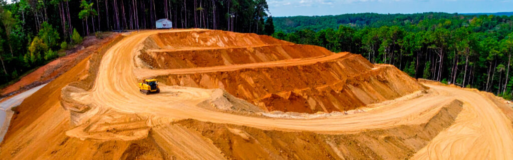
For property owners across Cherokee County, Ball Ground, and Canton planning any grading work from a building pad to a driveway alignment to a drainage correction, understanding how contractors evaluate existing slopes before developing grading plans, what slope characteristics most significantly affect grading design and cost, and why accurate slope assessment before planning produces better outcomes than the generic planning assumptions that inadequate slope assessment substitutes for gives the practical foundation for approaching grading projects with appropriate expectations about what the existing terrain will require the grading to accomplish and what that requirement will cost to execute correctly on a North Georgia property’s specific conditions.
How Contractors Evaluate Existing Slopes Before Grading
The evaluation of existing slopes before grading is not a single activity but a combination of assessment methods that together produce the slope characterization that grading design requires. Understanding these methods and what each contributes to the slope assessment gives property owners the basis for evaluating whether a pre-project assessment has produced the slope information that grading design actually needs or whether the assessment has been abbreviated in ways that leave consequential slope-related unknowns that will emerge during project execution as reactive scope additions and budget surprises.
Physical Terrain Walking to Assess Ground-Level Elevation Change
Walking the specific terrain of the proposed grading area with attention to the direction and estimated magnitude of elevation change across each section of the proposed improvement footprint is the foundational slope assessment activity that no amount of remote observation from aerial imagery or property edge positions can substitute for. Cherokee County’s rolling terrain consistently presents more ground-level elevation variation than aerial observation suggests, particularly on wooded sites where the canopy surface captured by aerial imagery is substantially flatter than the ground surface beneath the canopy. A contractor who walks the interior terrain of a proposed building pad location on a wooded Cherokee County site and estimates the elevation differential between the high and low corners of the proposed footprint will develop a dramatically more accurate earthwork volume estimate than one who assesses the same site from the property edge or from aerial imagery and applies the slope that those views suggest. Physical terrain walking is not a substitute for instrumental survey on projects where precise elevation data is essential for drainage design accuracy, but it is the minimum slope assessment that any grading project on Cherokee County’s terrain requires to produce earthwork estimates that will not be drastically revised when active grading reveals what the terrain actually contains.
Topographic Map Review for Watershed and Drainage Context
Topographic maps showing contour lines at ten-foot intervals for the property and its immediate surroundings provide the watershed and drainage context that physical terrain walking within the project footprint alone cannot provide. The contour pattern around the proposed grading site reveals what uphill terrain area will deliver drainage toward the graded site after its terrain configuration changes the drainage patterns that currently exist, which is the contributing area information that drainage infrastructure sizing requires rather than only the slope information that earthwork volume estimation requires. A building pad graded into a hillside position may intercept and redirect drainage that currently flows across the hillside without concentrating at the pad location, and the contour pattern above the proposed pad location shows how much uphill watershed area produces drainage that the pad’s drainage design will need to manage. This drainage watershed context is available from topographic maps without physical terrain walking across the entire contributing area, making topographic map review a productive complement to the physical walking assessment that characterizes the terrain at the immediate project footprint.
Post-Rain Drainage Observation for Flow Pattern Confirmation
Walking the proposed grading site and its surrounding terrain during or within twenty-four hours of a significant rain event confirms the drainage flow patterns that topographic maps represent theoretically and that post-grading drainage design must manage practically. Rain event observation reveals where water actually concentrates on the existing terrain, where it flows toward the proposed improvement location from uphill positions, and whether any terrain features concentrate flow more than the topographic contour representation suggests. This post-rain observation is particularly valuable for identifying terrain concavities that concentrate drainage without producing the incised channel that would be apparent during dry conditions, and for confirming whether the topographic map’s representation of drainage patterns matches the actual drainage behavior at the specific site during the conditions the post-grading drainage infrastructure will manage. The post-rain site observation that confirms or revises the topographic map’s drainage pattern representation is the slope assessment activity that most directly improves drainage infrastructure design accuracy for grading projects on Cherokee County’s complex rolling terrain.
Cut-and-Fill Balance Assessment for Earthwork Volume Estimation
After physical terrain walking has characterized the slope across the proposed grading footprint, the contractor’s assessment translates that slope characterization into a cut-and-fill balance evaluation that determines how much material must be moved from high areas to low areas to achieve the design grade, and whether the site’s cut volume and fill volume are approximately balanced or whether one significantly exceeds the other in ways that affect both project cost and the approach to managing the excess or deficit material. A site where cut and fill volumes are approximately balanced requires only on-site earthwork to achieve design grade. A site where cut significantly exceeds fill requires either hauling excess cut material off site at disposal cost or incorporating it into additional fills elsewhere on the property that the design can accommodate. A site where fill significantly exceeds cut requires importing fill material from off site at material and delivery cost. Each of these cut-fill balance situations has different cost implications that the slope assessment makes apparent before project commitment rather than during execution when the actual cut and fill volumes reveal the balance situation the design must address.
How Slope Steepness Affects Grading Design Decisions
The steepness of the existing slope at the proposed grading location is the single most direct determinant of the earthwork volume, the cut and fill slope geometry, and the erosion management requirements that the grading design must address. Understanding how different slope steepness ranges affect specific grading design decisions gives property owners the context for evaluating why grading projects on steeply sloping terrain require different design approaches and different construction methods than projects on gentle terrain, rather than treating steep-slope grading as simply more expensive without understanding the specific design differences that slope steepness requires.
Gentle Slopes and Their Grading Characteristics
Building sites and improved areas on slopes below approximately ten percent gradient, meaning less than ten feet of elevation change per one hundred feet of horizontal distance, typically require modest earthwork to achieve level or gently sloped design grades because the existing terrain is already relatively close to the design grade that the improvement requires. Cut and fill volumes are typically modest and approximately balanced on gentle slopes, drainage grades can be established without significant terrain modification, and cut and fill slopes created at the project margins are relatively shallow and stable without requiring extensive slope stabilization measures. Gentle-slope grading on Cherokee County properties is where the straightforward earthwork assumptions that work for flat terrain come closest to applying accurately, though the region’s clay soil compaction requirements and drainage design complexity still distinguish gentle-slope grading in Cherokee County from equivalent gradient grading on more permeable or more stable soil types.
Moderate Slopes and Their Grading Characteristics
Slopes between approximately ten and twenty-five percent gradient are where grading complexity begins to increase substantially on Cherokee County properties. Earthwork volumes at these gradients are significant and may not balance without design adjustments that specifically consider where to place excess cut material or how to minimize fill requirements by adjusting the design grade to better match the existing terrain. The cut and fill slopes created at the improvement margins begin to require specific slope geometry design and stabilization measures because the height of cut and fill at the margin increases with slope steepness, and taller cut and fill slopes in Cherokee County clay require specific attention to slope stability and erosion control that flat or gentle terrain does not need at the same level of specificity. Grading and excavation on moderate slopes also typically requires more careful drainage design because the increased gradient produces faster surface flow velocities on the graded surfaces, requiring drainage infrastructure that can handle those velocities without erosion of the graded surfaces it is meant to protect.
Steep Slopes and Their Grading Characteristics
Slopes above approximately twenty-five percent gradient present grading challenges that require specific design attention across every aspect of the grading project, from earthwork volume and cut-fill balance to slope stability and erosion management. Earthwork volumes on steep slopes are large, typically significantly unbalanced between cut and fill unless the design specifically incorporates elements that use the cut material productively within the project, and the cut and fill slopes created at the improvement margins are tall enough to require engineered slope stability analysis in some cases and to require ongoing erosion management investment that is directly proportional to the height and steepness of the created slopes. Steep slope grading projects in Cherokee County also face the equipment stability considerations that operating grading equipment on steep, clay terrain creates, particularly during or after rainfall when the clay’s reduced bearing capacity on wet slopes creates equipment stability risks that schedule appropriate equipment operation to avoid. Property owners planning improvement projects on steep terrain should approach slope stability, cut-fill balance, and erosion management as primary design concerns rather than secondary considerations, because on steep Cherokee County terrain these concerns often drive more of the total project cost than the earthwork itself.
How Slope Direction Affects Drainage Design and Building Orientation
The direction the existing slope faces relative to the proposed improvement, specifically whether the slope runs toward, away from, or across the improvement location, affects drainage design requirements and building orientation opportunities in ways that are as consequential for grading design as the slope’s steepness. Slope direction assessment is the complement to slope steepness assessment that together with steepness characterizes the slope fully enough for grading design to proceed from accurate site understanding.
A slope that runs toward the proposed building pad from the uphill side delivers drainage to the pad perimeter from the uphill direction, requiring drainage interception at the uphill perimeter before that drainage can reach the foundation. This upslope drainage condition is the most consequential slope direction for foundation drainage design because it creates a drainage load on the uphill foundation perimeter that would not exist if the slope ran away from the building in all directions, and the drainage infrastructure designed to manage it must be sized for the full uphill contributing area rather than only for rainfall on the pad footprint itself.
A slope that runs away from the proposed building pad on all sides, with the pad at the highest point in its immediate vicinity, creates the most favorable drainage condition for foundation performance because water naturally flows away from the pad in all directions without drainage infrastructure having to redirect it away from the foundation. The grading challenge on such a site is achieving adequate grade away from the foundation in all directions while maintaining the pad level, which is a grading design objective that the favorable slope direction specifically enables by providing the natural terrain gradient that positive drainage away from the foundation requires.
A cross-slope condition where the terrain slopes from one side of the proposed improvement to the other requires the grading to create a level surface across a grade that runs perpendicular to the proposed improvement’s longer axis, producing cut on the uphill side and fill on the downhill side that together create the level grade the improvement requires. Cross-slope conditions are among the most common building site conditions on Cherokee County’s rolling terrain, and the cut and fill balance they produce depends on the cross-slope gradient and the improvement’s dimensions, with steeper cross-slope gradients and wider improvements producing larger cut-fill volumes than gentler gradients and narrower improvements on equivalent cross-slope terrain.
How Slope Affects Cut and Fill Slope Stability on Cherokee County Clay
The cut slopes and fill slopes created at the margins of grading projects are themselves slopes that must remain stable through the seasonal moisture cycling and rainfall intensities that Cherokee County properties experience, and their stability depends on the slope geometry, the soil conditions, and the moisture management applied to them after the grading creates them. Cherokee County clay’s specific stability characteristics under different moisture conditions are the regional soil factors that most directly affect cut and fill slope design on local grading projects.
Cherokee County clay in its natural, undisturbed condition has adequate stability for cut slopes at moderate gradients when the clay is at normal moisture content, because the natural soil structure and the root systems of existing vegetation on undisturbed cut slopes provide the cohesion and anchoring that resist shallow slope failure. Freshly cut slopes in Cherokee County clay at steeper gradients, or cut slopes that experience saturation from extended rainfall or from uphill drainage intercepted by the cut, are more susceptible to shallow failure along the clay’s natural structure planes that become failure surfaces when the soil’s internal friction angle is exceeded under the saturated moisture conditions that the region’s rainfall pattern periodically delivers to exposed clay slopes without vegetation protection.
Fill slopes constructed from Cherokee County clay must be compacted to adequate density to resist both internal shear failure and the erosion that uncompacted fill surfaces experience under direct rainfall impact and surface flow. Compacted fill slopes at appropriate gradients in Cherokee County clay are stable under normal moisture conditions but require rapid vegetative establishment or erosion control mat installation to prevent the surface erosion that exposed compacted clay experiences during the interval between grading completion and vegetative cover establishment, particularly if the grading is completed before or during the high-intensity rainfall events of summer and fall that produce the highest erosion rates on exposed clay surfaces.
How Slope Evaluation Informs Driveway Alignment and Grade Design
Driveway alignment and grade design on Cherokee County rolling terrain requires slope evaluation not only of the proposed driveway alignment’s slope conditions but of the surrounding terrain that delivers drainage to the alignment from both sides and that determines where culverts and drainage outlets must be positioned to convey that drainage away from the driveway surface. The slope assessment that produces adequate driveway design covers the alignment’s longitudinal grade, the cross-slope conditions that determine where cut and fill will be required along the alignment, and the uphill drainage patterns that will deliver drainage to the alignment from both sides between drainage outlets.
Driveway longitudinal grade, which is the slope of the driveway surface along its length, must be within safe operating limits for the vehicles that will use the driveway while also being sufficient to drain the driveway surface rather than allowing water to pond on sections that are too flat to drain effectively. Cherokee County’s terrain frequently presents alignment options with varying longitudinal grades that different route choices produce, and the slope evaluation that identifies which alignment options maintain acceptable longitudinal grades throughout their length while minimizing drainage crossings and cut-fill volumes gives the design the comparative terrain information that alignment selection requires. An alignment that maintains safe longitudinal grades throughout its length with minimal steep sections and minimal drainage crossings is almost always the preferred alignment on rolling terrain, even if it is somewhat longer than a more direct alignment that produces steeper grades and more drainage crossings by following the most direct terrain path rather than the most grade-efficient one.
Why Slope Assessment Before Grading Prevents the Most Common Project Surprises
The most common and most expensive project surprises on Cherokee County grading projects are those that result from slope conditions that the project was designed around assumptions for rather than actual assessment of. Understanding which specific slope-related surprises most commonly produce budget overruns and schedule disruptions on local grading projects helps property owners recognize the warning signs that a project is being planned without adequate slope assessment and the specific consequences that inadequate slope assessment typically produces.
Earthwork volume that significantly exceeds the project budget estimate is the most consistent consequence of inadequate slope assessment on Cherokee County grading projects, because the terrain elevation variation that physical slope walking would have revealed is systematically underestimated by aerial observation and edge-position assessment. When active grading reveals that the elevation differential between the building pad corners or driveway endpoints is substantially larger than the project budget assumed, the additional earthwork required to achieve design grade from the actual terrain becomes a reactive scope addition that the budget did not include and that neither the property owner nor the contractor specifically planned for. This earthwork volume surprise is the single most frequently reported grading project budget problem on Cherokee County rural properties and the one most directly preventable through adequate pre-project terrain assessment.
Drainage infrastructure inadequacy revealed by the first significant rain event after project completion is the second most common slope-assessment-related project problem, because drainage designs developed without accurate slope and watershed assessment produce infrastructure sized for assumed contributing areas and drainage velocities that the actual post-grading terrain conditions exceed. The culvert that overtops, the driveway section that erodes, and the building pad that collects water at one corner rather than draining uniformly are all consequences of drainage design that did not have the slope assessment information it needed to produce infrastructure adequate for the site’s actual drainage conditions.
Frequently Asked Questions
How do contractors estimate earthwork volume from slope assessment on Cherokee County properties?
Earthwork volume estimation from slope assessment on Cherokee County properties combines the elevation differential across the proposed improvement footprint, estimated from physical terrain walking or instrumental measurement, with the footprint’s dimensions and the cut-fill geometry that the design grade requires from the existing slope. For a building pad on a cross-slope site, the average cut depth on the uphill side and the average fill depth on the downhill side, both estimated from the slope assessment and the proposed design grade, multiplied by the pad’s footprint area produce the approximate cut and fill volumes that the grading must accomplish. Experienced local contractors who have executed multiple projects on similar terrain develop the slope-reading calibration from that project history that allows them to estimate earthwork volumes from physical terrain assessment at accuracy levels adequate for project budgeting without instrumental survey on most residential-scale grading projects, while recognizing the site-specific conditions that suggest survey investment before budgeting would produce more reliable cost estimates than slope-reading assessment alone.
At what slope steepness does a building site on Cherokee County terrain require retaining structures rather than simple cut and fill grading?
The slope steepness at which a building site requires retaining structures rather than simple cut and fill grading depends on the site’s specific dimensions, the soil conditions at the cut and fill locations, and the available space for cut and fill slopes to transition from design grade to natural terrain. Simple cut and fill grading without retaining structures requires space for cut and fill slopes to transition to natural terrain at stable gradients, which on Cherokee County clay typically means cut slopes no steeper than approximately two feet horizontal for every one foot vertical and fill slopes no steeper than approximately three horizontal for every one vertical. When the available space between the design grade edge and the property line or adjacent improvement is insufficient for these stable slope geometries at the cut and fill heights the grading requires, retaining walls or other slope stabilization structures become necessary to contain the cut or fill within the available space. This space constraint is the most common trigger for retaining structure requirements on Cherokee County residential grading projects, and it occurs most frequently on smaller lots with steeply sloping terrain where the available space between the building footprint and the property line cannot accommodate the slope transition length that stable cut or fill gradients require at the cut and fill heights the terrain creates.
How does the existing slope affect the timing of grading work on Cherokee County clay soil?
Existing slope steepness affects grading timing on Cherokee County clay soil through its influence on the moisture conditions at the grading site and on the equipment stability considerations that steeper slopes create under wet clay conditions. Steeper slopes concentrate surface drainage more rapidly than flat terrain, keeping clay at elevated moisture content longer after rain events than equivalent terrain at shallower gradients, which means steeper sites may require longer drying intervals after rain events before clay moisture content returns to the range where compaction can achieve adequate density. Steeper slopes also present greater equipment stability concerns during and immediately after rain events when the clay’s reduced bearing capacity on wet slopes increases the risk of equipment sliding or tipping during cutting and filling operations. Grading contractors experienced with Cherokee County terrain schedule steep-slope work during dry seasonal windows that minimize both the compaction timing problems and the equipment stability concerns that steep slope grading under wet clay conditions creates, which may shift the optimal project timing for steep-slope grading toward late summer and fall when the region’s seasonal moisture pattern produces the driest clay conditions most consistently.
Should I have my property professionally surveyed before planning a grading project on steep terrain?
Professional survey before planning a grading project on steep terrain is worthwhile when the project’s drainage design requires precise elevation data to design infrastructure that will work correctly rather than approximately, when the earthwork volume uncertainty from terrain assessment without survey would produce a budget range too wide to commit to without the precision that survey provides, or when the cut and fill slope stability design requires specific elevation data at the slope boundaries to produce the slope geometry analysis that determines whether the graded slopes will be stable at the proposed geometry. For smaller residential grading projects on moderately steep terrain, experienced local contractors whose slope-reading calibration from similar project history allows adequate volume estimation from physical terrain assessment may not require survey investment to produce project budgets of adequate accuracy. For larger projects, projects on very steep terrain, or projects where drainage design precision significantly affects the infrastructure sizing and positioning that determines whether the project’s drainage will perform adequately, professional survey investment before design provides the elevation accuracy that design from slope assessment alone may not achieve at the precision the project requires.
Planning a Grading Project on Your North Georgia Property?
The existing slopes on a Cherokee County property are the fundamental physical conditions that every grading project must reckon with before design, before budgeting, and before any soil is moved. Slope steepness determines earthwork volume and cost. Slope direction determines drainage design requirements and foundation moisture conditions. Cut and fill slope geometry and stability determine erosion management requirements and the space needed to transition from design grade to natural terrain. And the drainage patterns that existing slopes create determine what the post-grading site will need to manage and whether the drainage infrastructure designed for it will be adequate for the contributing areas and flow velocities that the actual terrain produces rather than the assumed conditions that design without adequate slope assessment substitutes for. The slope assessment that characterizes these conditions accurately before grading design is the investment that produces grading designs matched to the actual site rather than to assumptions about it, and actual-conditions designs consistently produce projects that execute at projected cost and perform at designed quality in ways that assumption-based designs regularly fail to achieve when active grading reveals what adequate slope assessment would have shown before commitment.
Bardin Outdoors works with homeowners, landowners, and builders across Ball Ground, Canton, Cherokee County, and North Georgia on grading and excavation projects that begin with thorough slope and drainage assessment of the specific site conditions at each proposed improvement location, producing designs and cost estimates based on what the terrain actually requires rather than what generic assumptions might suggest. To learn more about how Bardin Outdoors approaches slope-informed grading design for North Georgia properties, contact us.